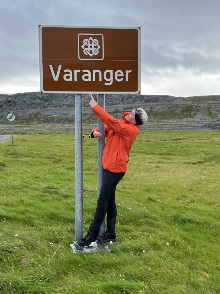
In Norway’s farthest northeastern corner, where hard rock meets the Barents Sea – lies Varanger. Proximity to Russia, Finnish immigration and Sami traditions provide the area with exciting cultural diversity.
The scenic route runs through birch woods, marshland and a rugged cliff landscape. The light is exceptional, and the birdlife and wildlife are unique. Species of birds you won’t find anywhere else in the world are relatively easily accessible.
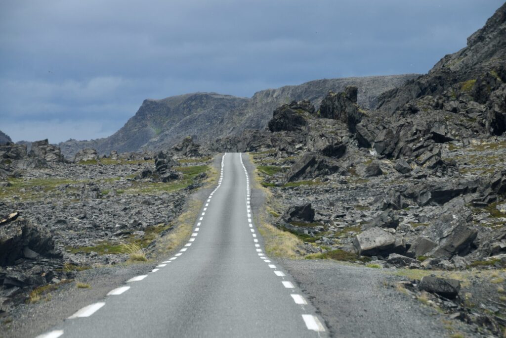
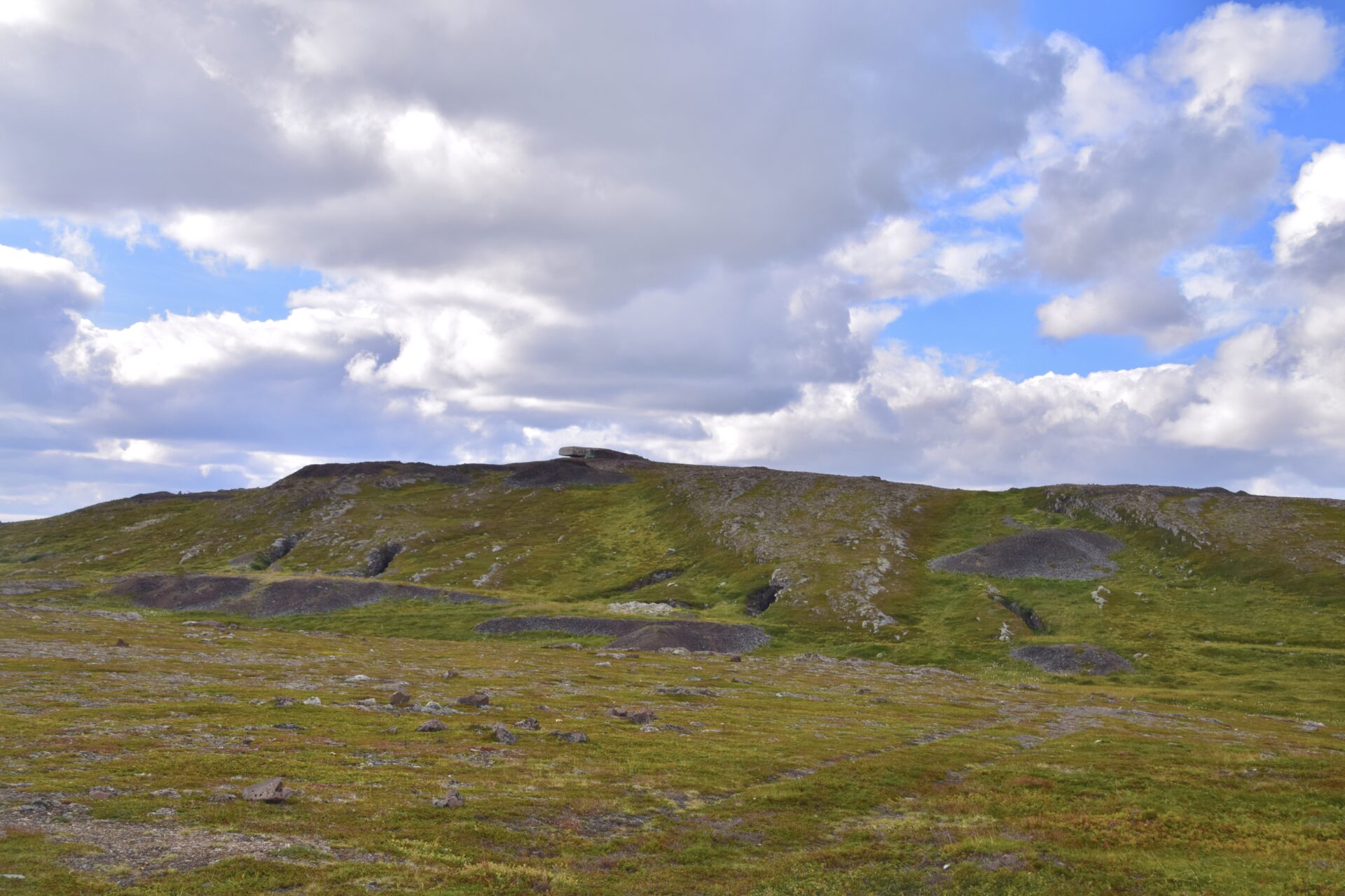
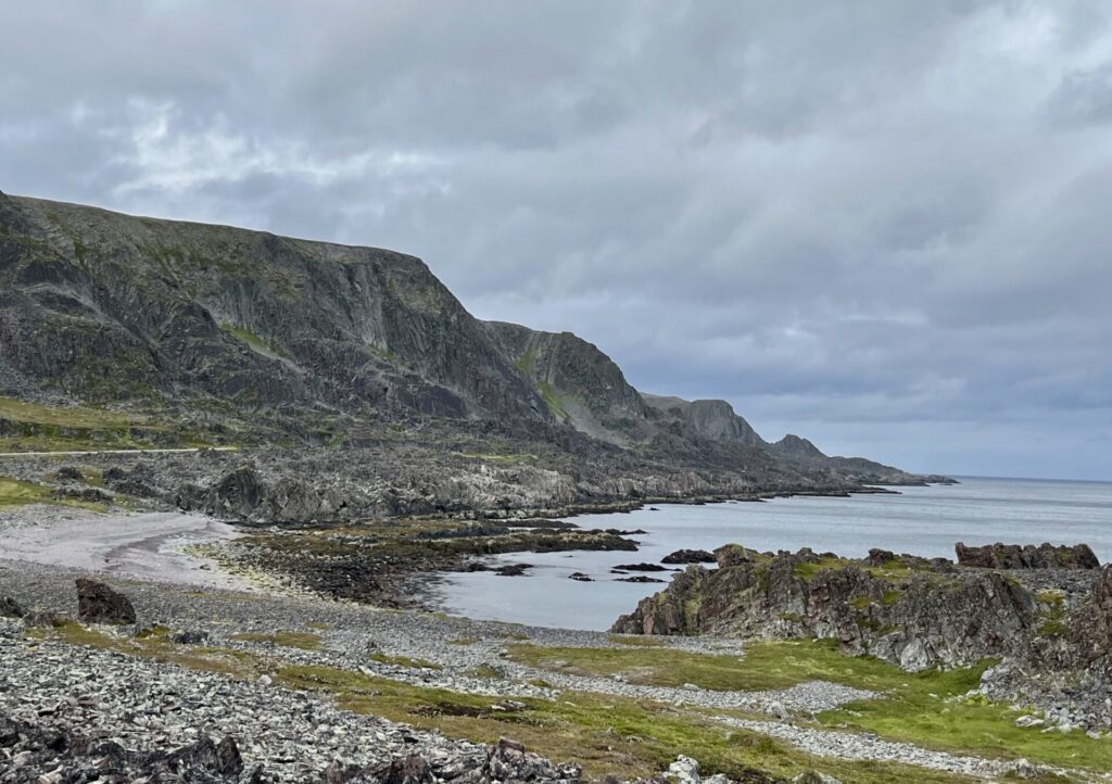
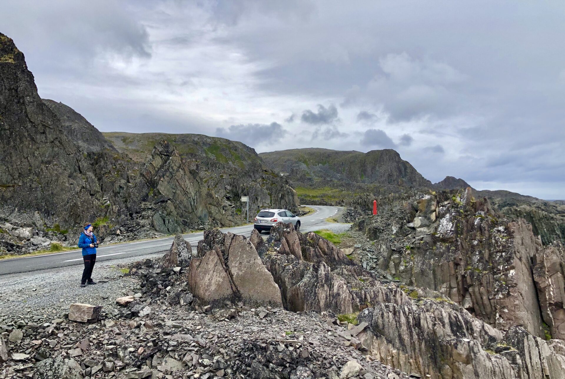
The lunar landscape out towards Hamningberg was maybe the most fascinating part of the route. The drive makes you feel like a journey to the end of the world.
After driving the Varanger Scenic Route – I have completed all 18 scenic routes in Norway.
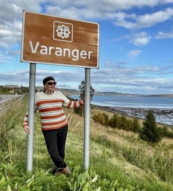
VARANGER SCENIC ROUTE

The route runs from Varangerbotn along E75 – to Vardø and Fv8100 to Hamningberg. I will include these rest areas/viewpoints/attractions ( those in bold are included in the Norwegian Scenic Route) :
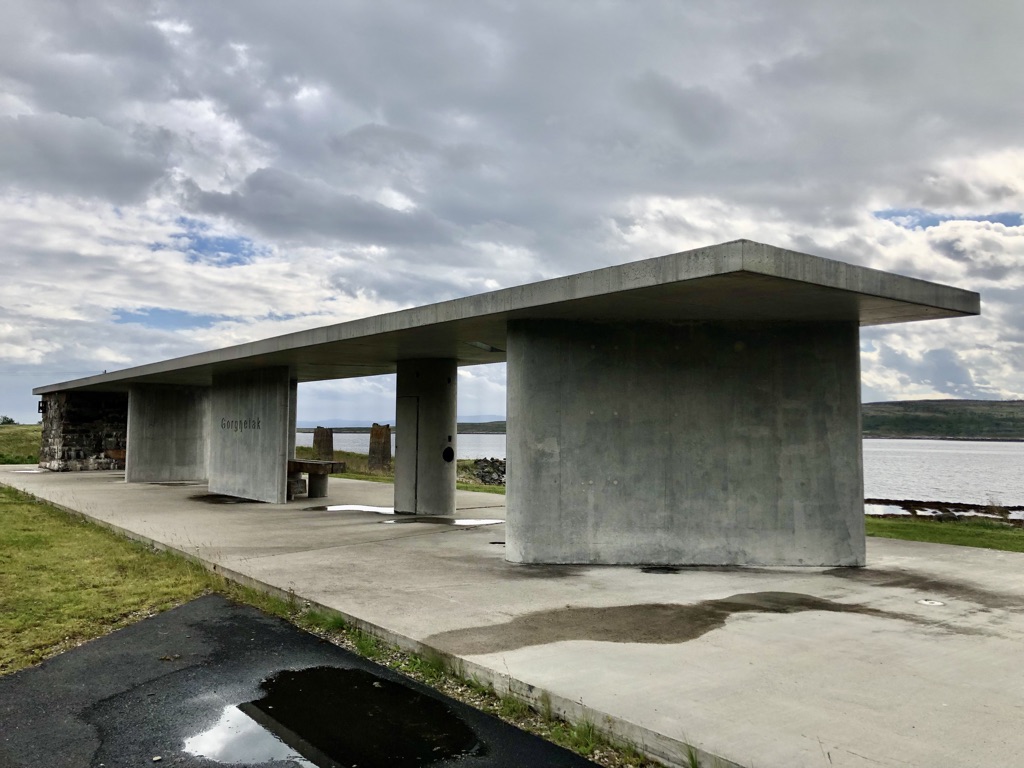
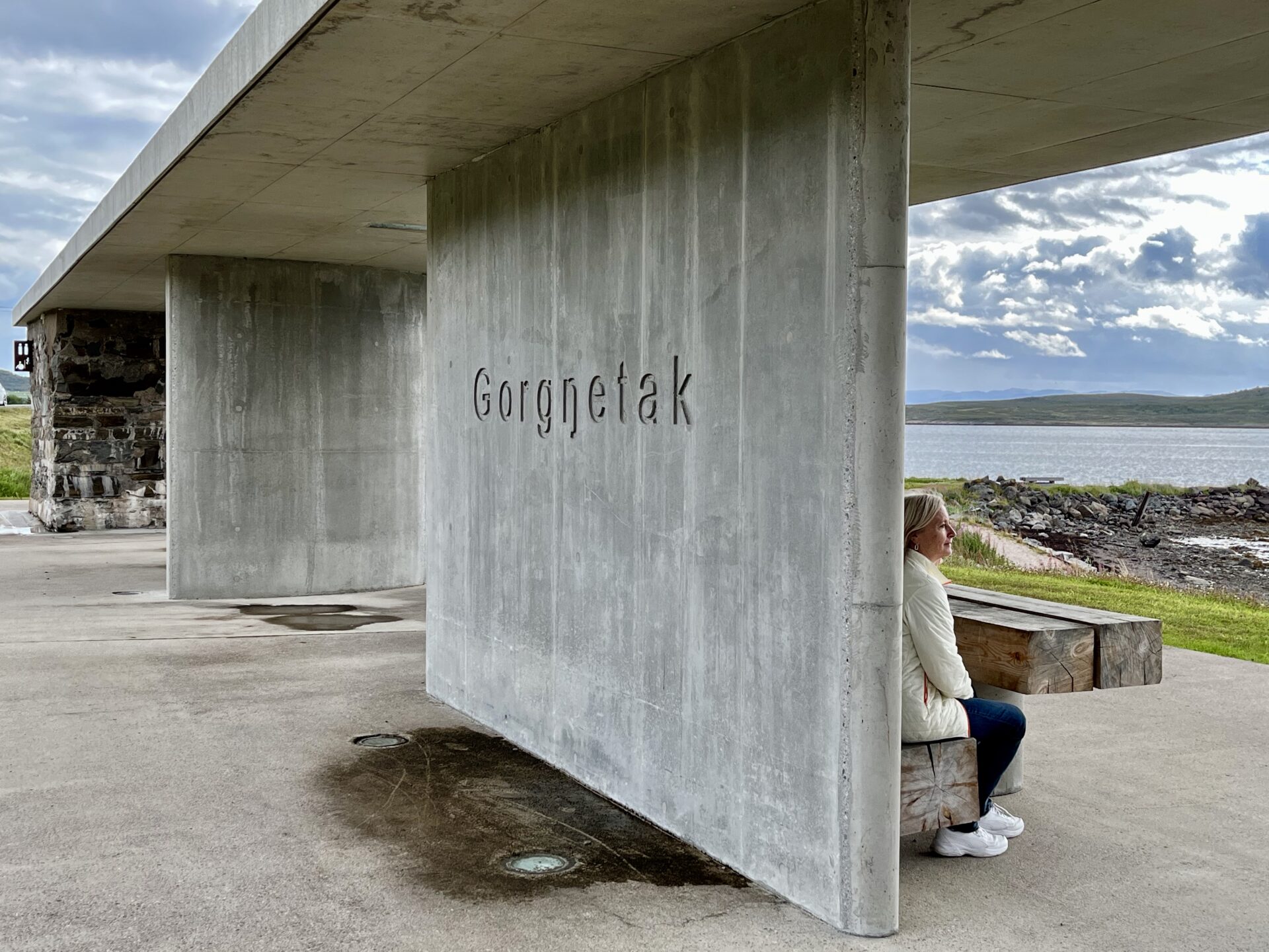
Gornitak
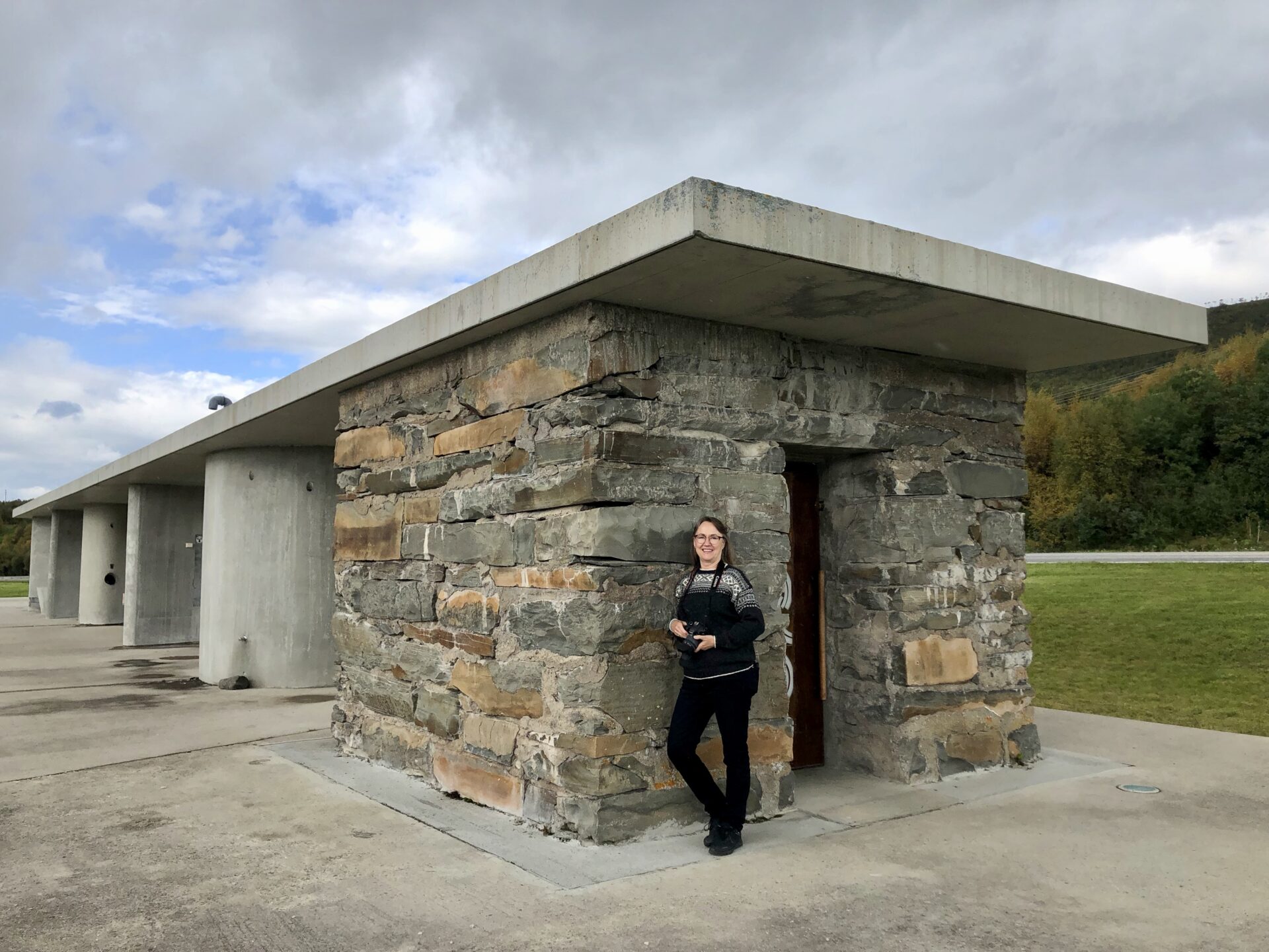
Gornitak marks the start of the Varanger Scenic route. Gorgŋetak is Sami and means”ascent”; we come ashore and begin our ascent into the mountains. This rest area lies on the Varangerfjord close to a mountainside under a high sky and with a view to the sea in the east.
The area has traces of ancient settlements, including Stone Age Sites.
The service facilities are housed in an old, restored stone building that served as an ammunition store during the Second World War.
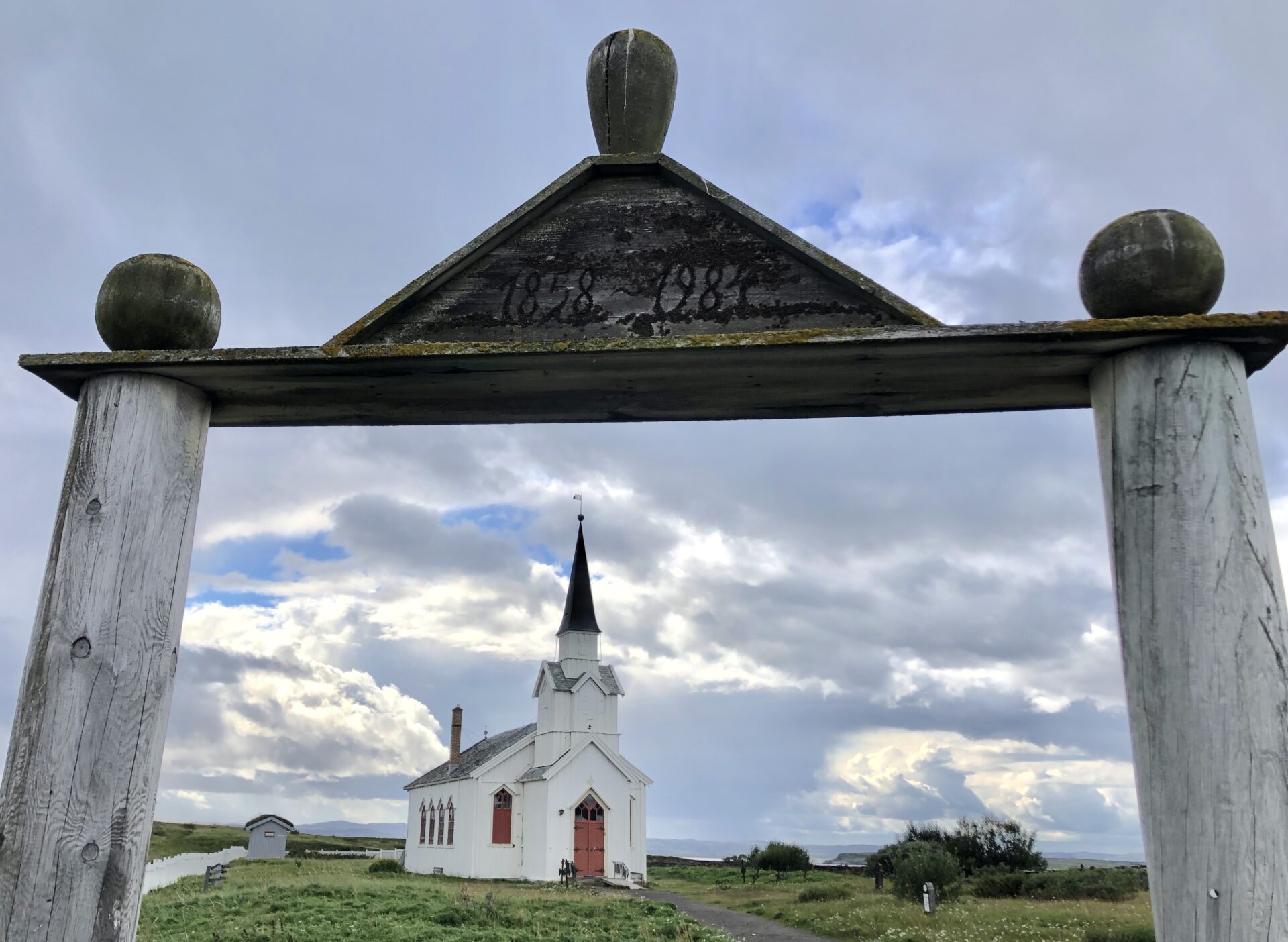
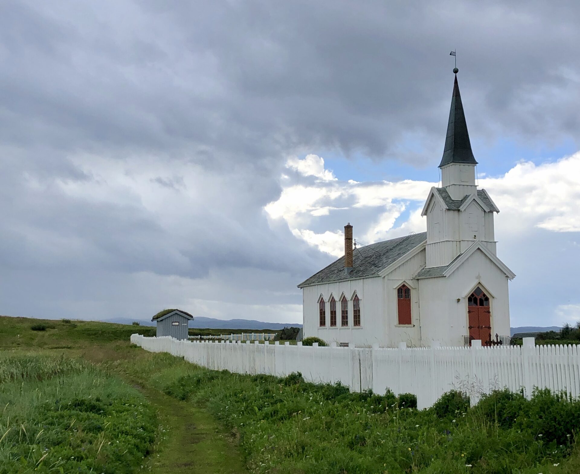
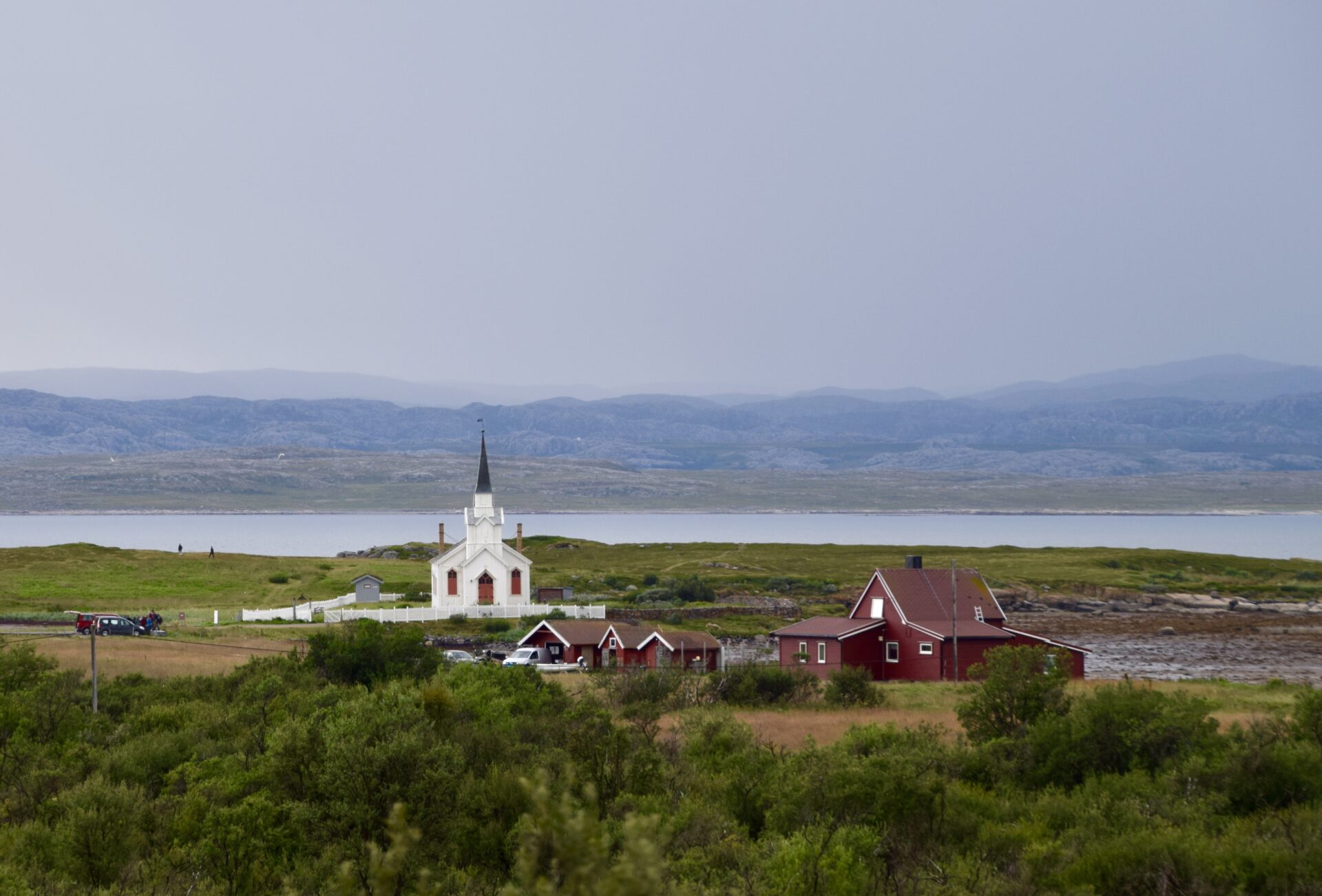
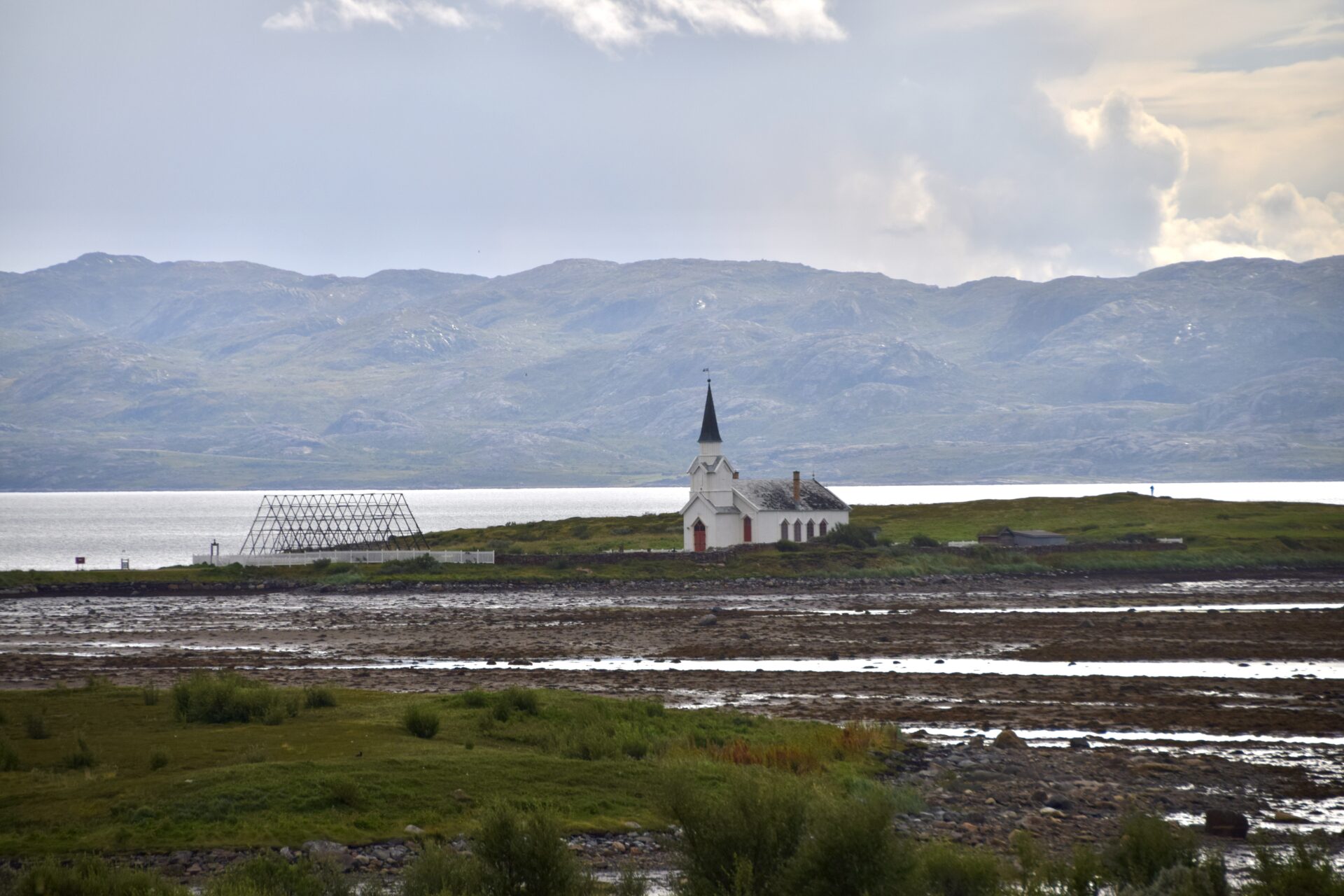
Nesseby Church
Nesseby Church overlooks the Varangerfjorden, a short walk from the village of Nesseby.
The church is one of the few old buildings left in Finnmark (the retreating German army burned most at the end of World War II.
This wooden church was built in 1858 and has a baroque altarpiece dating from around 1720.
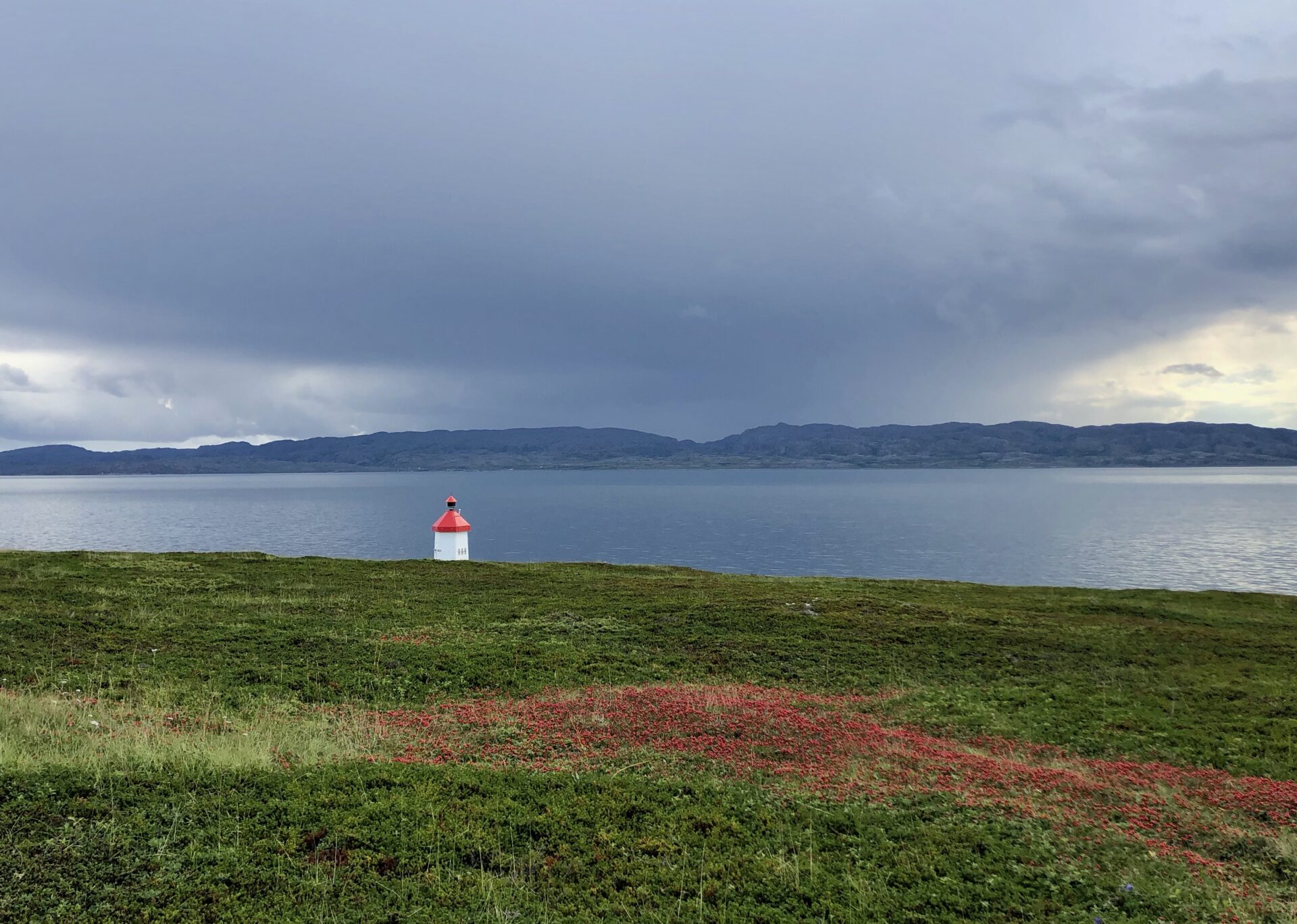
Ceavccageaðge/Mortensnes – Cultural Heritage Site
Just 8 km east of Nesseby Church, you will find Mortensnes Cultural heritage site, one of the richest and most characteristic cultural heritage sites in Scandinavia.
The museum building contains an exhibition about Sami faith and mythology – and the cultural trail begins at the information hall, which leads to a unique selection of cultural sites; House grounds from various periods, a large number of Sammi pre-Christian graves and several sacrificial sites.
Constructed trails with informative signposts lead to the monuments, which show continuous settlements from more than 10,000 years ago until recent times. The youngest archaeological sites are closest to the sea, while the older ones are higher. This is owing to the elevation of the land masses after the Ice Age. There are traces of Stone Age settlements, Sami sacrificial sites and graves.
Guiding must be booked in advance at the Varjjat Varanger Sami Musea.
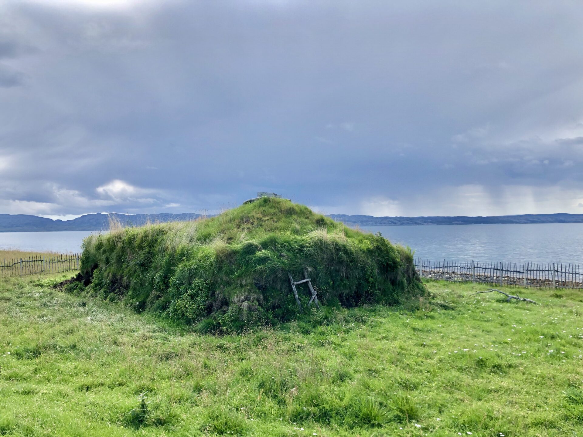
By the seashore – a coastal Saami turf house
I
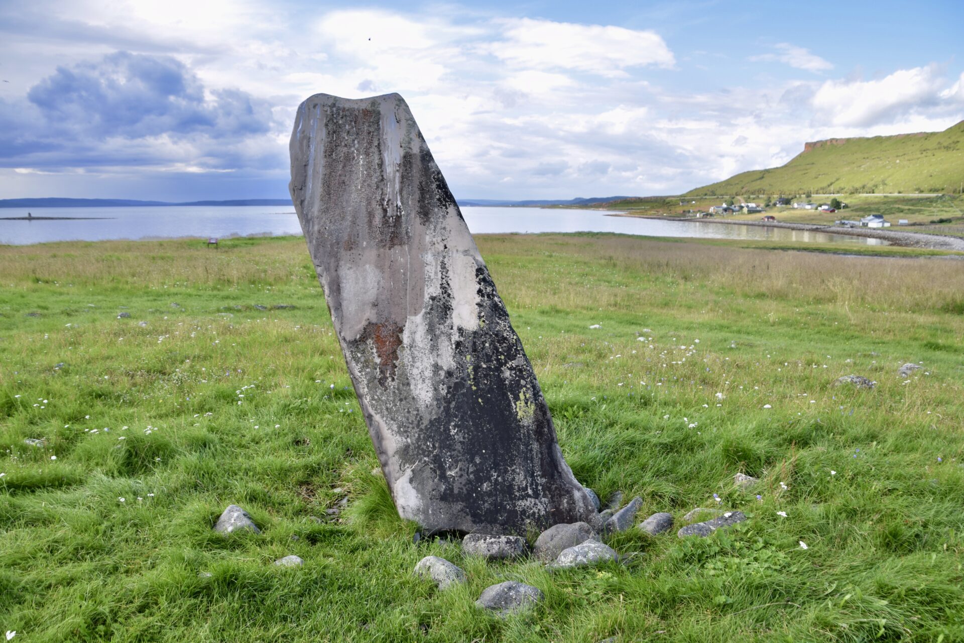
“Fish Oil Ston” – an offering stone where fish oil was offered. The Stone is a monumental standing stone surrounded by several large stones that may have formed a labyrinth.
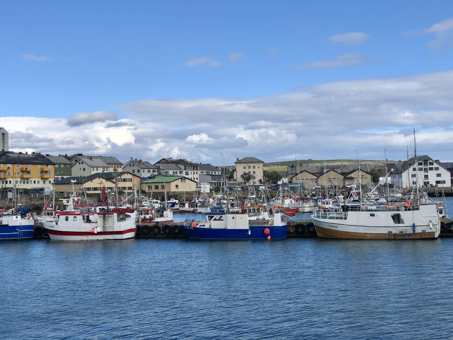
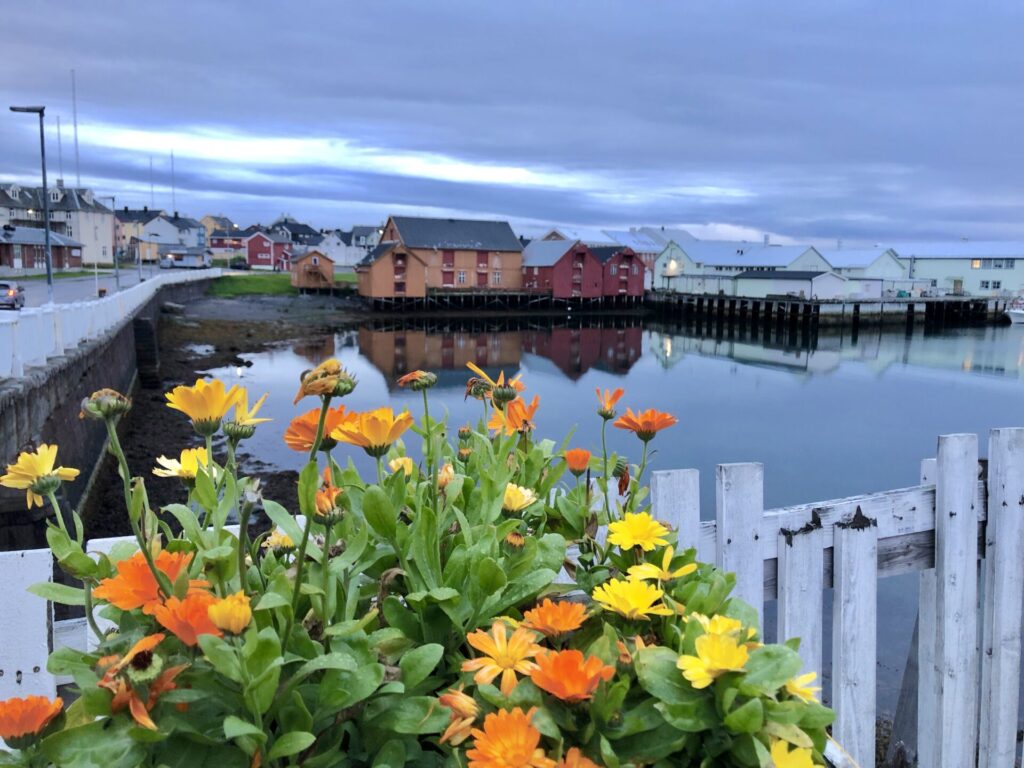
VADSØ
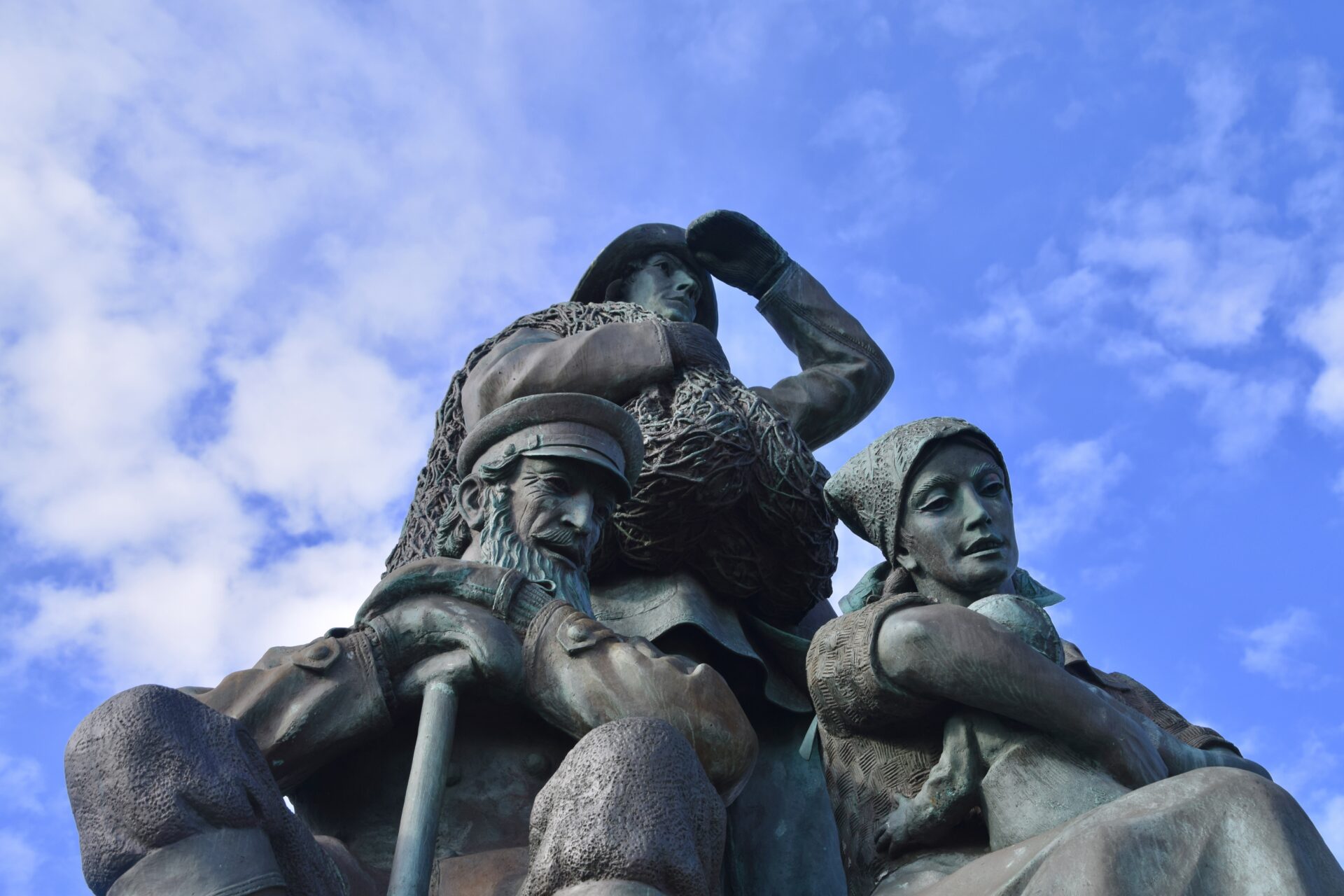
Vadsø is known as «Kvenbyen» («the Kvennish tow’’) and had a Finnish-speaking majority in the 1860s. The Kvens are a Norwegian ethnic minority, descended from Finnish farmers and fishermen who emigrated from northern areas of Finland to Sweden and Norway in the 18th and 19th centuries.
In 1833 Vadsø was awarded the status of a market town, with its citizens having a monopoly on trade in the area, and the town’s population grew. In the autumn of 1944, large parts of central Vadsø were bombed and burnt, and half of its buildings were destroyed. Today Vadsø is the administrative centre of Finnmark. The municipality has a total population of 6 000, with 5 000 people living in the town and around 1 000 in the surrounding communities.
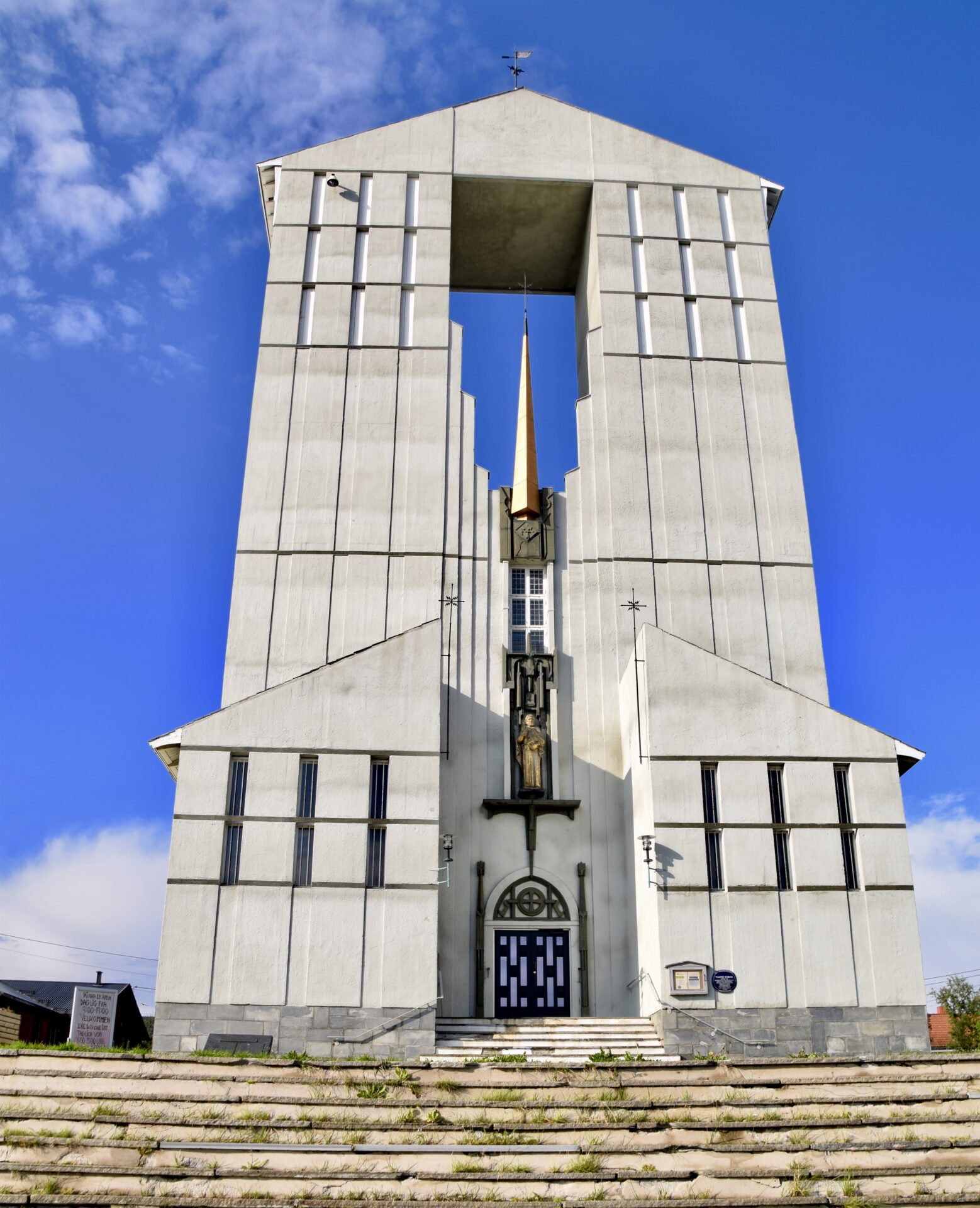
Vadsø built a new church in 1958, which is rich in symbolism. The twin peaks recall an iceberg,
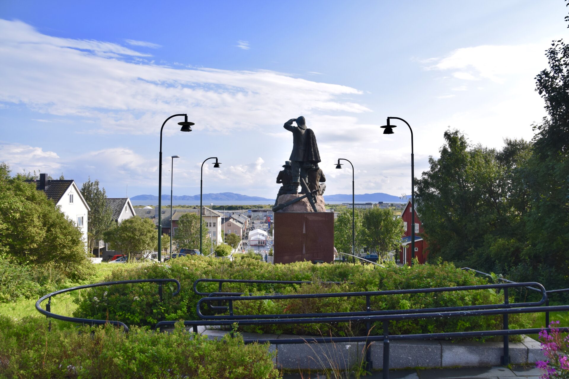
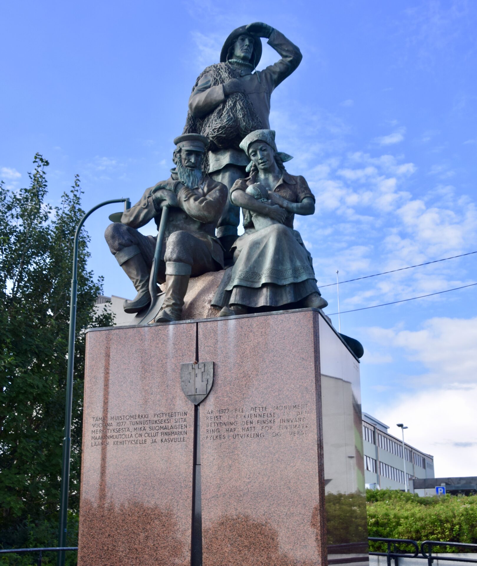
The Monument to the Immigrants, just below the church, testifies to the multi-ethnic origin of the people of Vadsø.
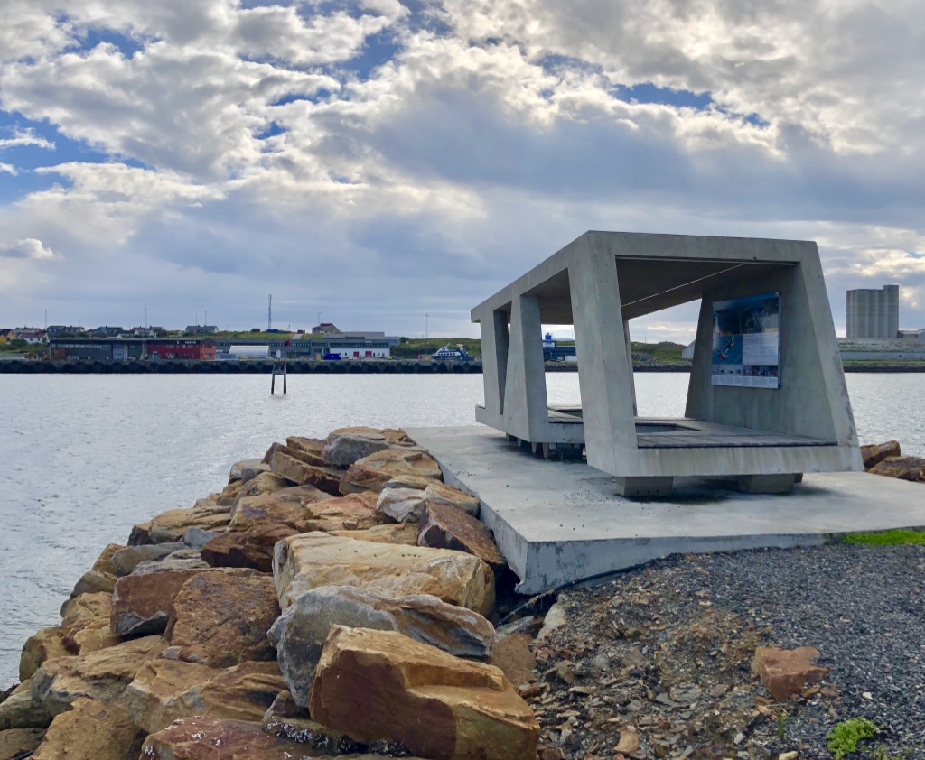
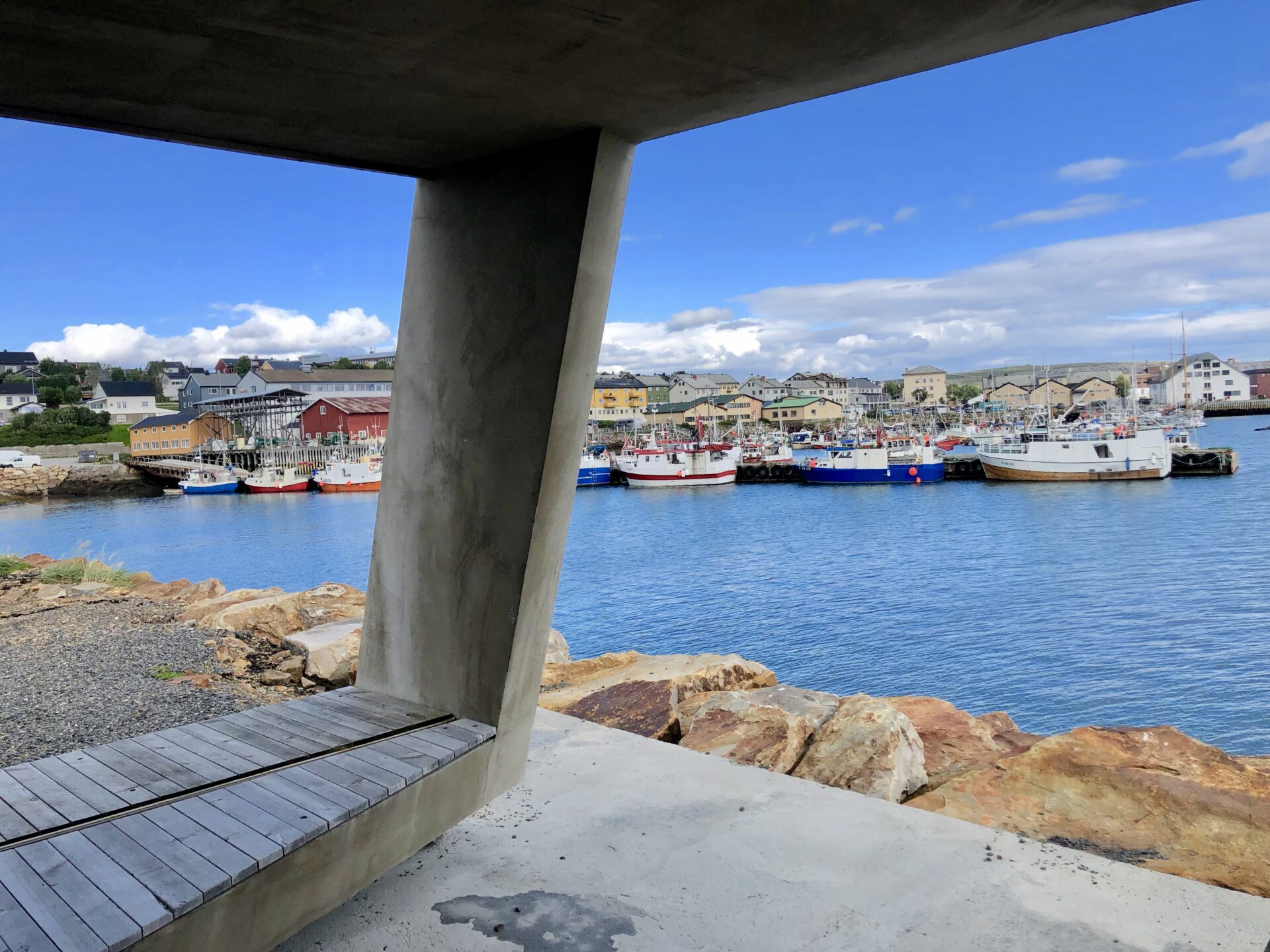
Birding Varanger – Vadsø
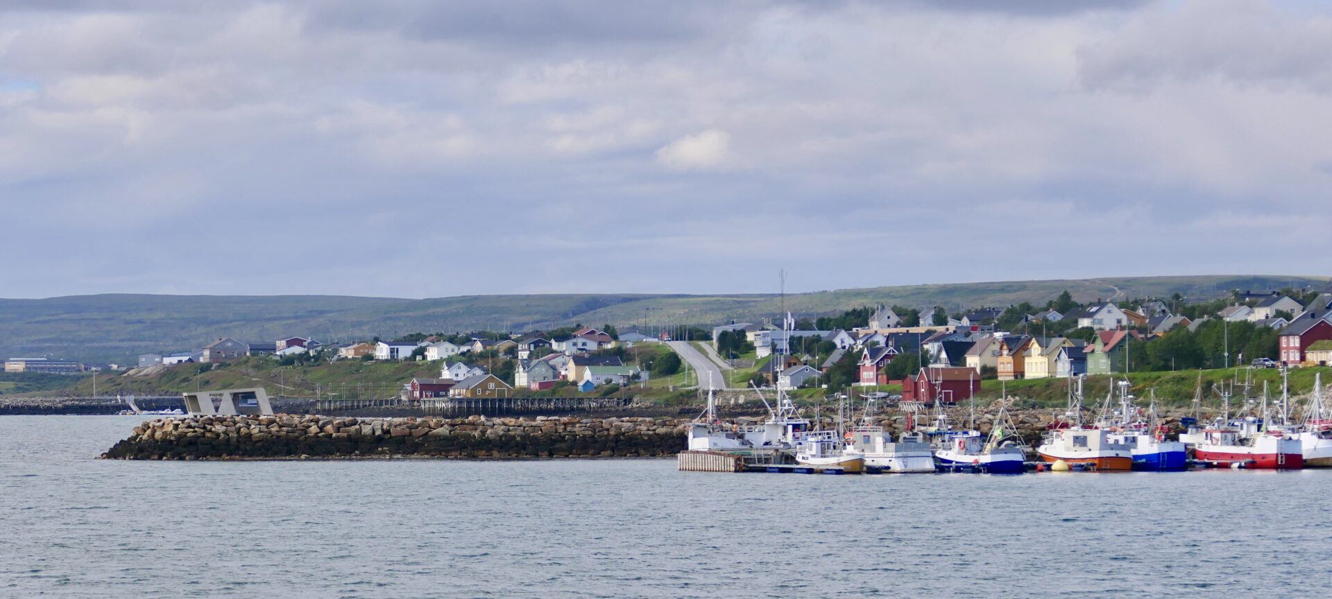
Varanger has a fantastic rich birdlife, and you can experience a wide variety of unique bird species in this area. The selection of incredible bird species combined with easy access makes it one of the top birding destinations in the world.
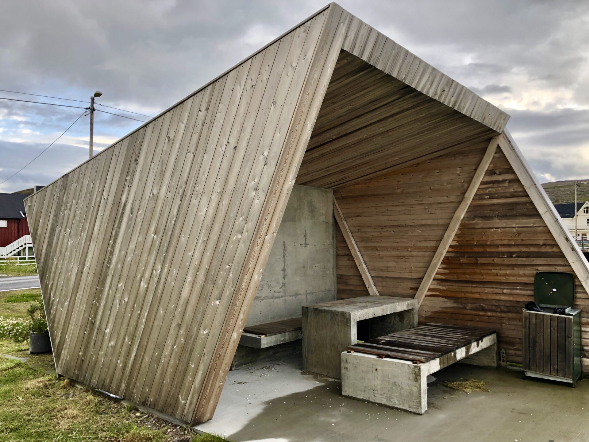
Biotope is the world’s first and only architectural firm specializing in developing and designing architecture to enhance the experience of natural surroundings, including bird-watching hides. Often, these are small but strategically situated hides for bird-watching and photography, and in Varanger, these hides and wind shelters form a unitary whole.
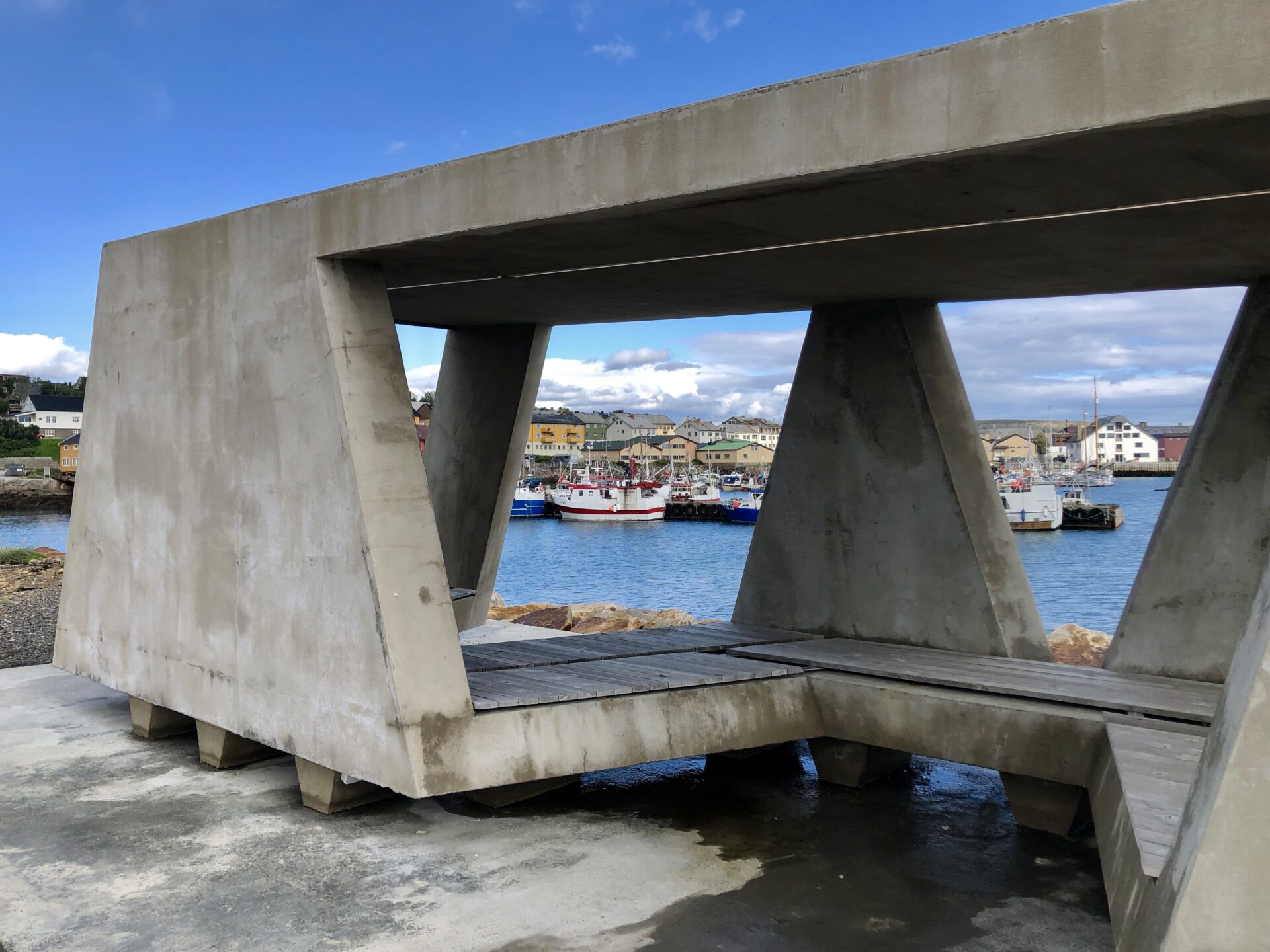
The bird hide in Vadsø harbour is one of those made of Biotope. It is situated at the end of a breakwater and is designed to give shelter from prevailing winds. This hide is a concrete construction completed in 2017.
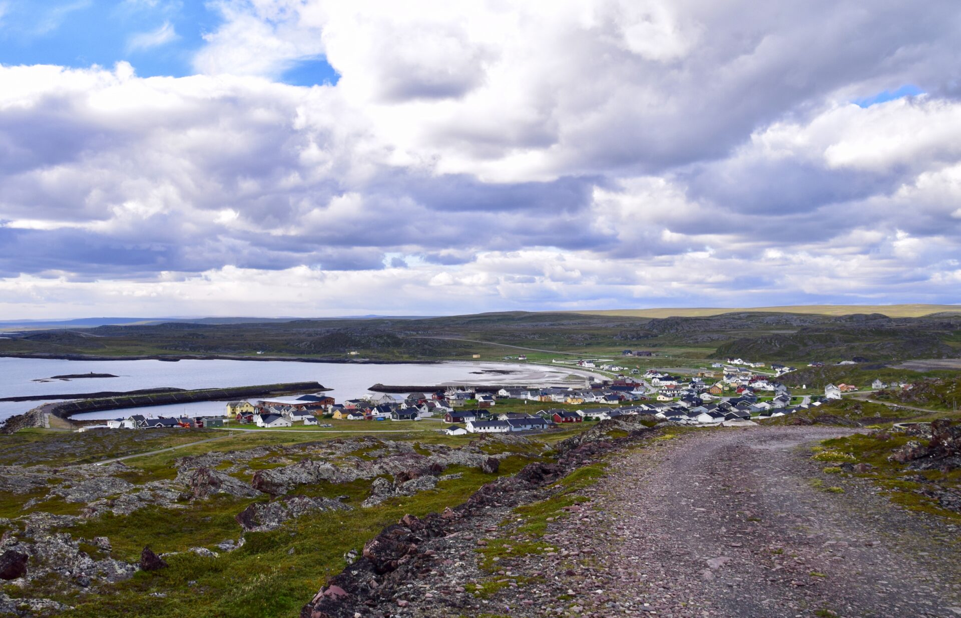
EKKERØY
Ekkerøy is one of the oldest fishing villages in Finnmark. Previously a typical old Sami settlement along the Varangerfjord, Ekkerøy became one of the new «Norwegian» villages. It is located about 15 km east of Vadsø.

We visited these attractions for which it is known:
- a bird reserve with the famous bird cliff Flåget
- a bird hide by the beach
- Kjeldsenbruket – a former fish factory from 1911
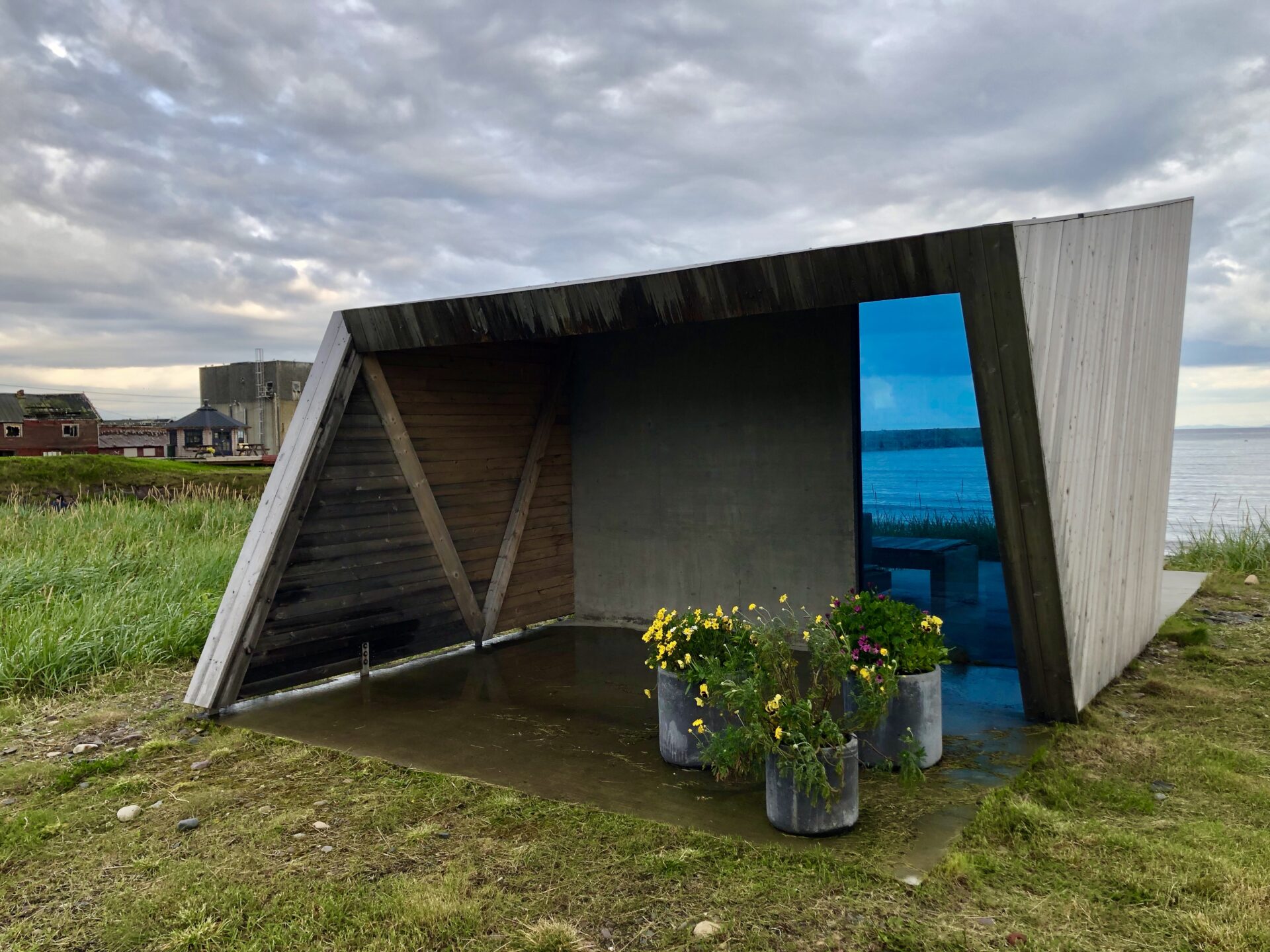
At the end of the narrow land that connects the tied island to the mainland, you will find a wind shelter/bird hide. It is close to the sea, at the end of the bay, looking straight out to the Barents sea in the east. A sheet of glass creates a space very open to the elements on one side and a more sheltered one on the other. This bird hide was completed in 2014

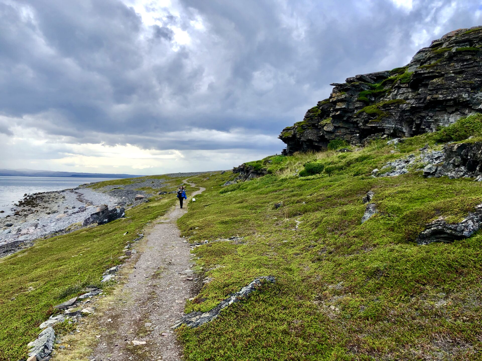
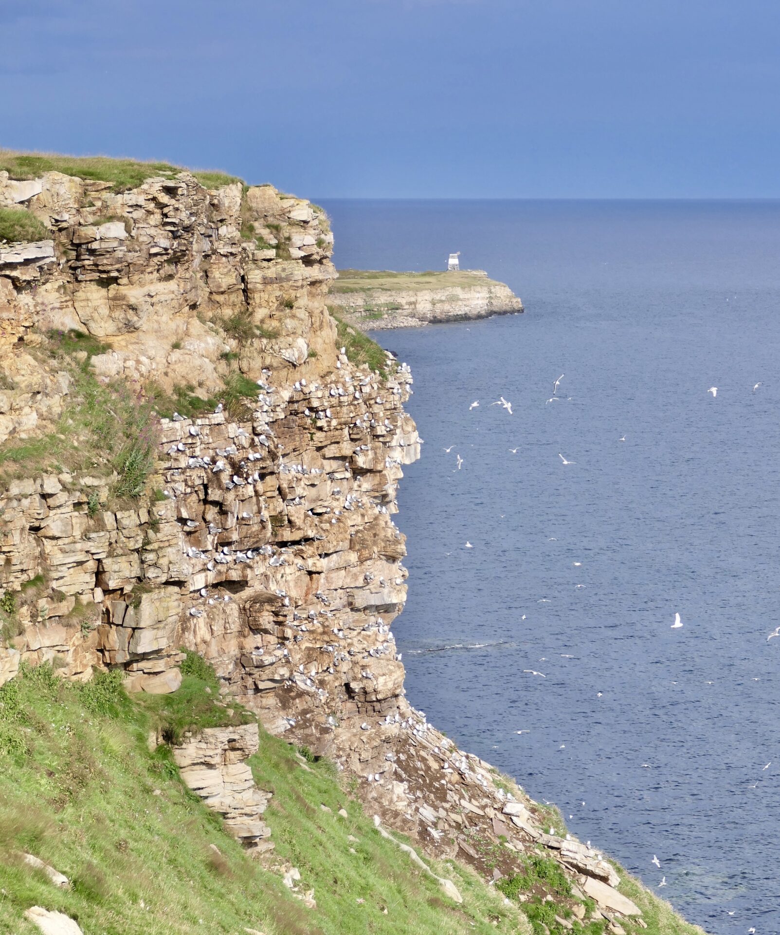
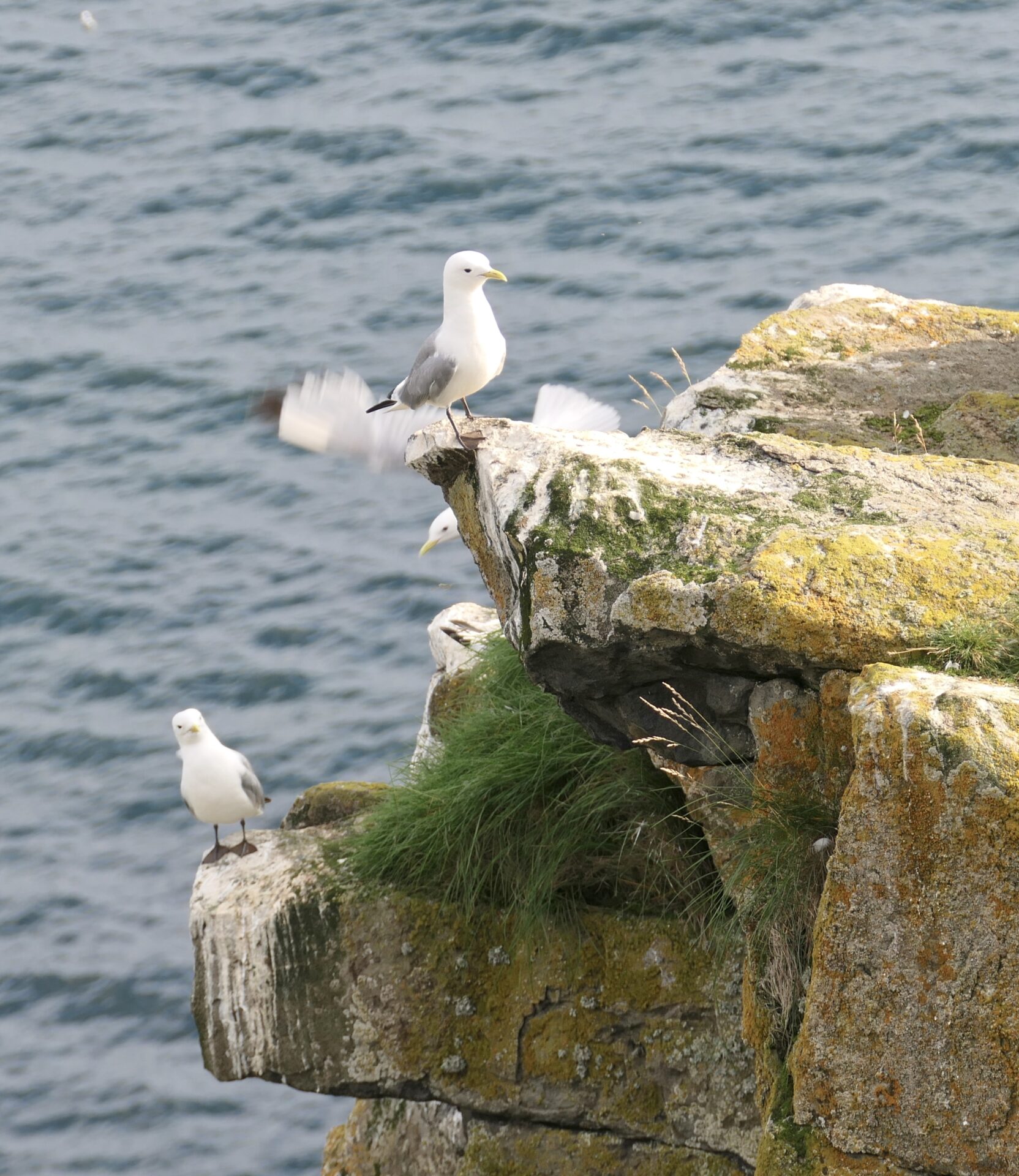
The bird rock and Ekkerøy nature reserve
We had a nice walk to the bird rock Flåget, situated on the outskirts of the village.
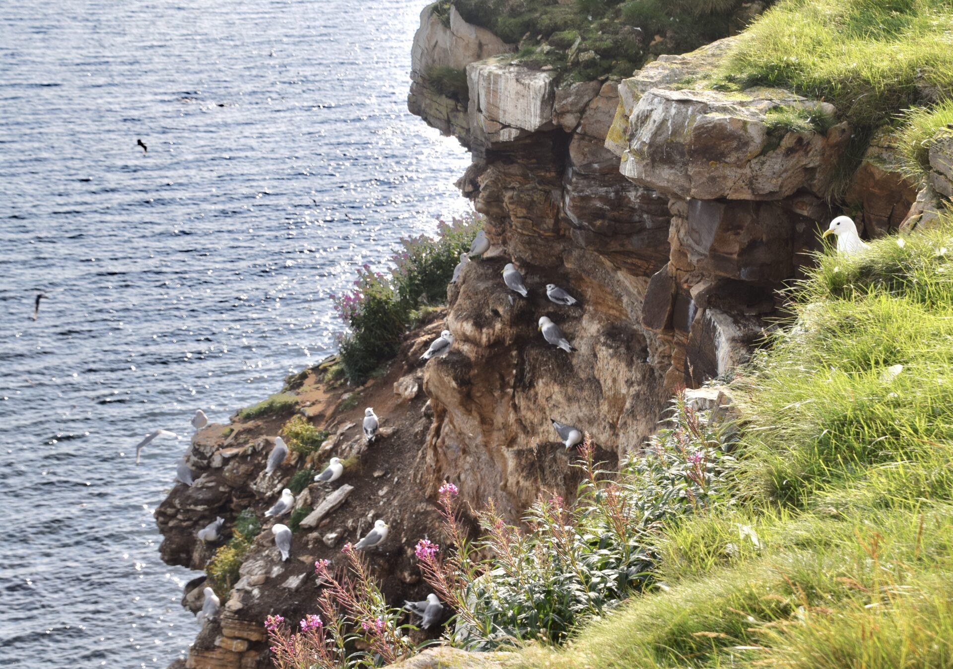
Here are about 20 000 pairs of seagulls/kittiwakes. The bird rock lies south-oriented towards the Varanger fjord and is a cliff that rises steeply 40-50 metres from the sea. The bird rock has a length of 1 km and is easy to get to – a short walk from a small car park.
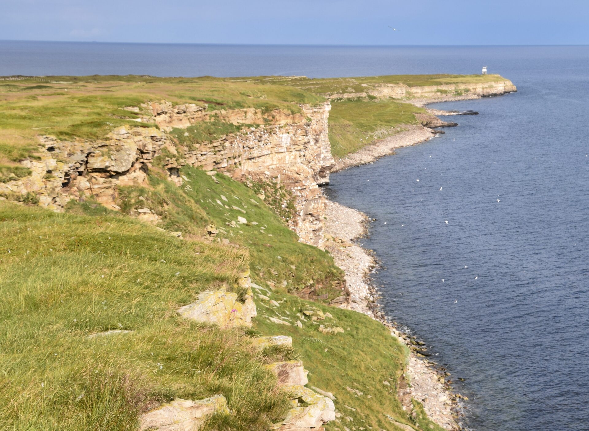
The kittiwakes arrive at Flåget in March and lay eggs in May. When the laying of eggs is at its peak, local people pick eggs using a long pole. The kittiwakes leave the bird rock in September.
A nature reserve has been established to take care of the bird rock and the rich bird life in Ekkeroy.
There are big colonies of eider ducks, and from January to April, you can observe the beautiful king eider and Steller’s eider in the Harbour. Several scarce species of birds have been seen in Ekkerøy.
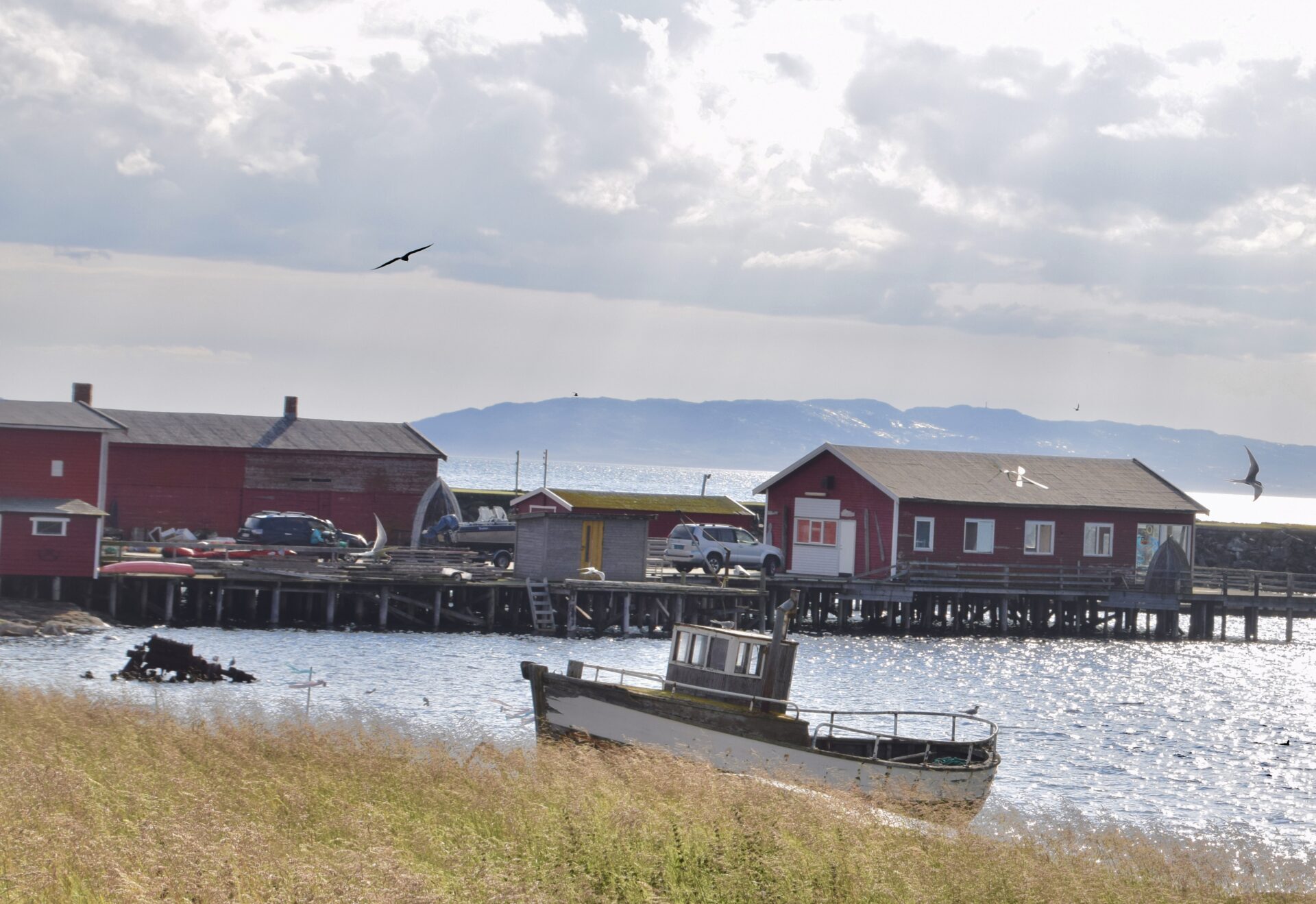
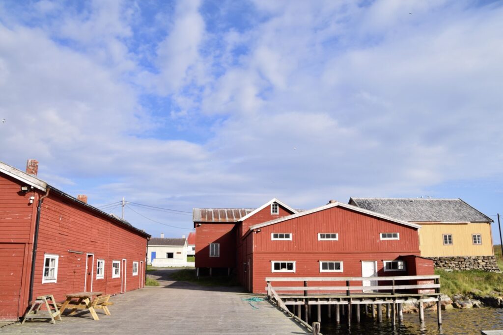
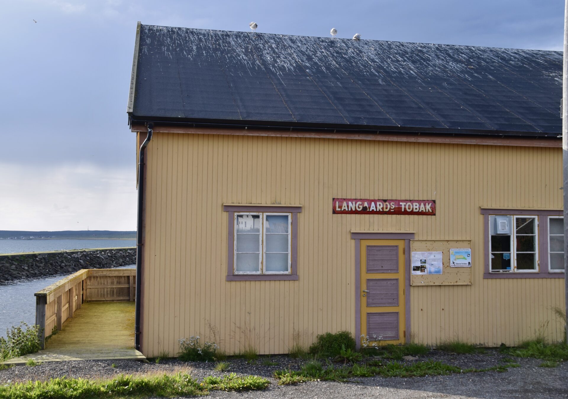
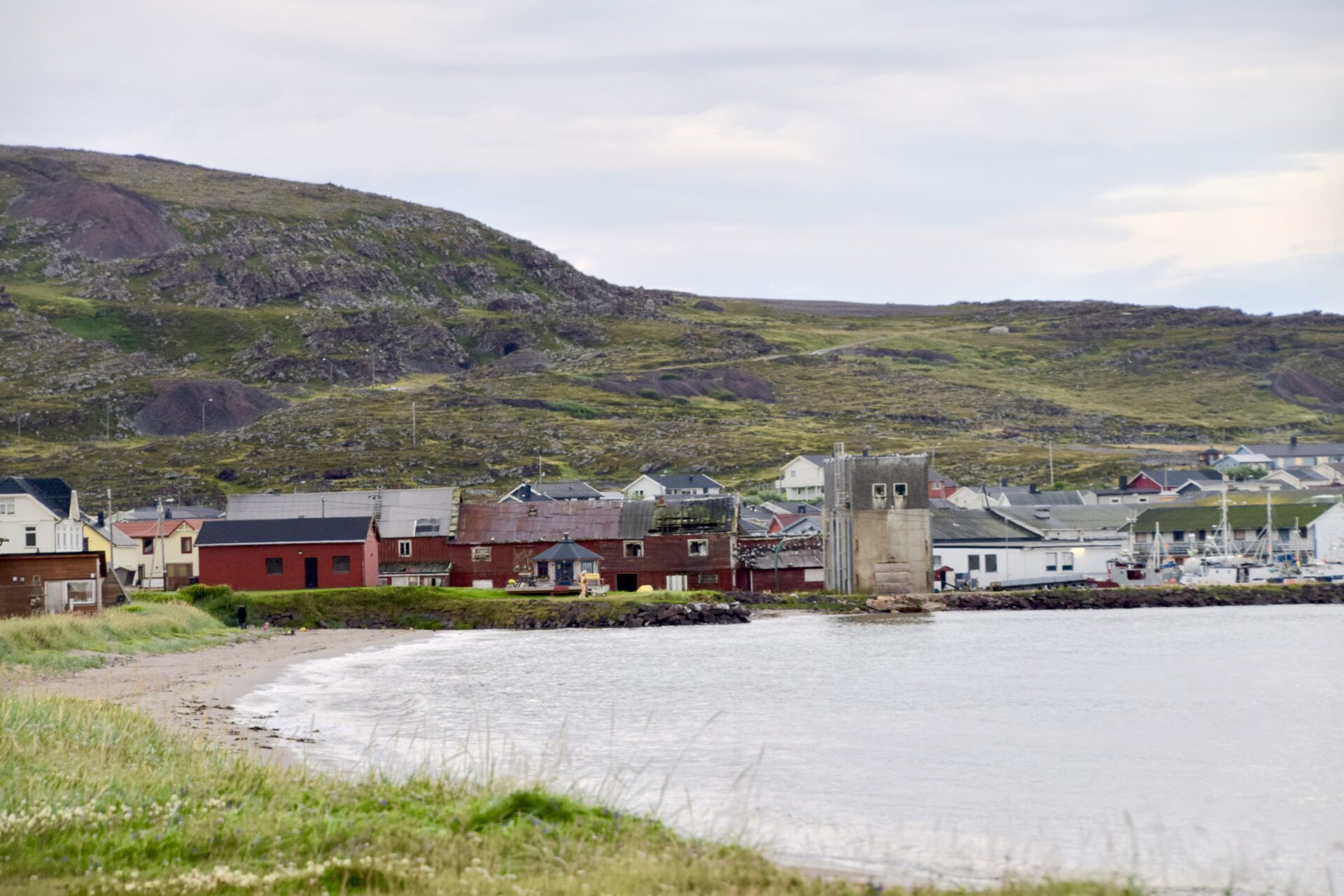
KJELDSENBRUKET
Kjeldsenbruket is one of the few fish processing plants left in Finnmark after WWII. It consists of a jetty, shrimp factory, warehouses, cod liver oil steamer, and gutting shed.
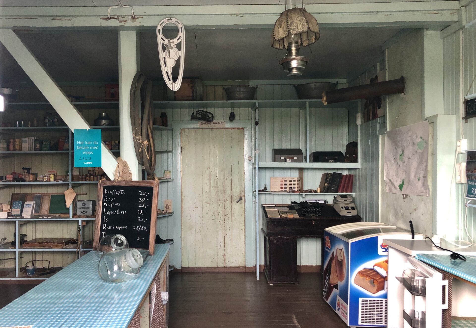
In addition, there is a restored barracks from 1946, which became both a shop and a home for the owner.
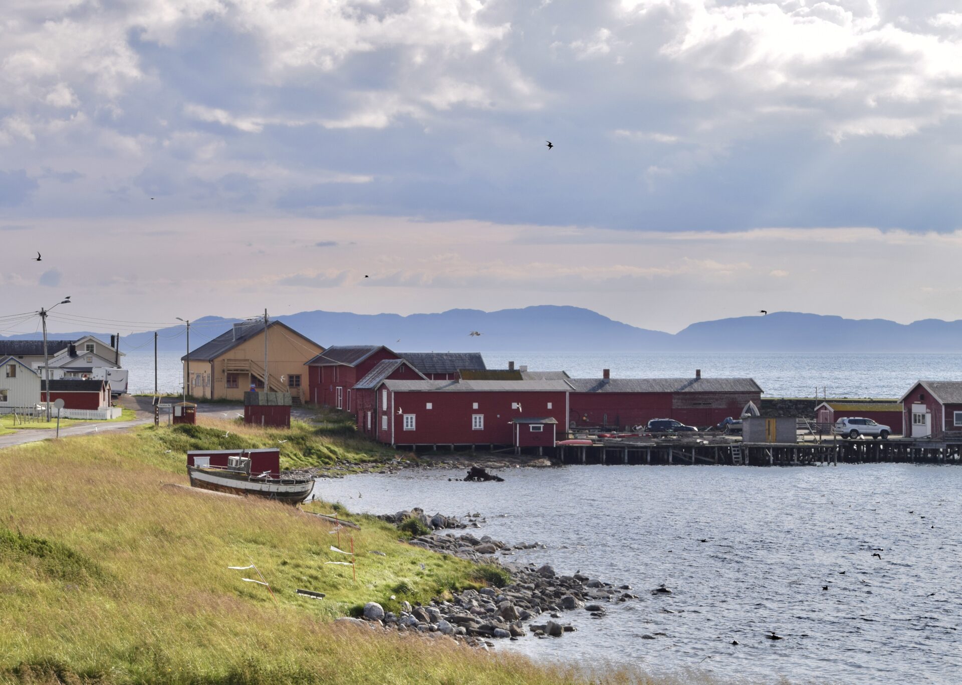
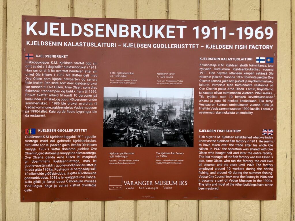
Fish buyer K. M. Kjeldsen from Vadsø established what we know as the Kjeldsen fish factory in 1911. He seems to have taken over the trade after his uncle Ole Nilsen. In 1937, the operation was shared with OveOlsen’ss son, Arne Olsen, who bought half – and later the entire facility. The last owner was the son of Ove Olsen, Arne Olsen. He ran the factory, the cod-liver oil steamer and the store until 1969. The factory employed around ten workers during the spring fishing season and up to 40 during the summer fishing.
Vadsø City Council took over the factory in 1986 and became part of the Vadsø Museum in the 1990s. The jetty and most of the other buildings have since been restored.
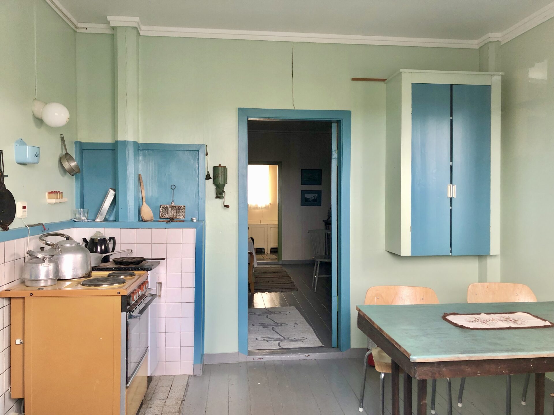
Merchant Arne Olsen and his family lived in the old store’s apartment while they ran the shop from 1946 to 1969. The apartment is furnished as it was in the 1950s.
Both the barracks and the other buildings are open to visitors during the summer. There is a café in the old shop and temporary exhibitions in the warehouse.
KIBERG – and the easternmost point on the Norwegian mainland
The fishing village of Kiberg, whose population is of mixed Sami, Finnish and Norwegian descent, is famous for its wartime partisans. During the German occupation of Norway, young men would cross into the Soviet Union for guerrilla warfare training, returning to participate in resistance activities. When the Second World War turned into the Cold War, the Soviet connection was seen as a threat by the Norwegian authorities, and many partisans were viewed with suspicion. The monument to the partisans unveiled in 1982 is intended to make amends for this and recognise their contribution to the war effort.
By the beach, there is a bird hide – also designed by Biotope.
The beach at Kiberg is a great place to see a variety of waders, especially Purple Sandpipers, which gather in large flocks to comb the beach. These birds are the only waders that stay during the Arctic winter and do not migrate to southern areas.
Kiberg is a haven for gulls, with many hundreds of Glaucous Gulls recorded during the later part of winter, with several Iceland Gulls joining the flocks each year.
Walk to the easternmost spot on the Norwegian mainland
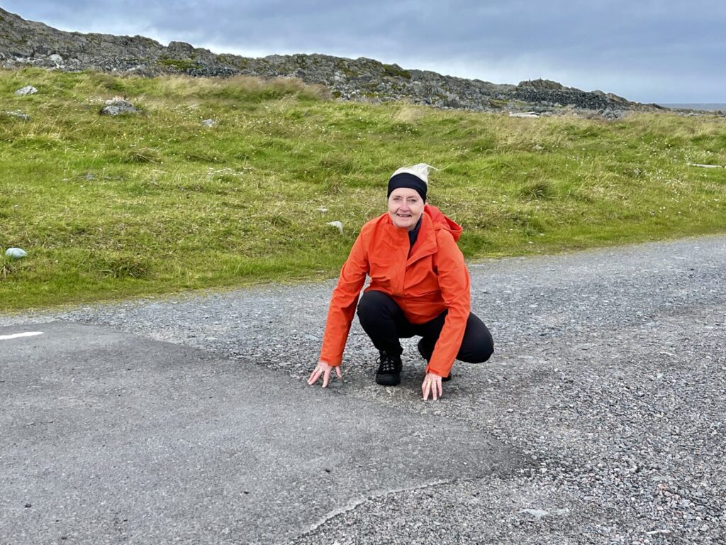
Kibergsneset (Cape Kiberg) is the easternmost spot on the Norwegian continent,
located on the larger Varanger Peninsula along the Barents Sea, – just east of the village of Kiberg.We were a bit surprised that there was very little information about this.
Even though Hornøy (island) east of Vardø is the easternmost point in Norway, Kibergneset is the easternmost spot on the Norwegian mainland; we wanted, of course, to experience this – and had a nice walk to Kibergneset, following the road that meanders up the mountainside.
The road up was built by German prisoners of war and takes you past several German war positions like buildings, bunkers, cannon emplacements etc. These are briefly described on info boards that have been set up.
Kibergsneset is a perfect point to watch the vast rafts of King Eiders, Common Eiders and Long-tailed Ducks during late winter and early spring. This is a good viewing point for seabird migration in spring and autumn. Skuas of all four species can be seen passing offshore. The small ponds around the German bunkers are good places to see Red-throated Divers and sometimes Greater Scaup.
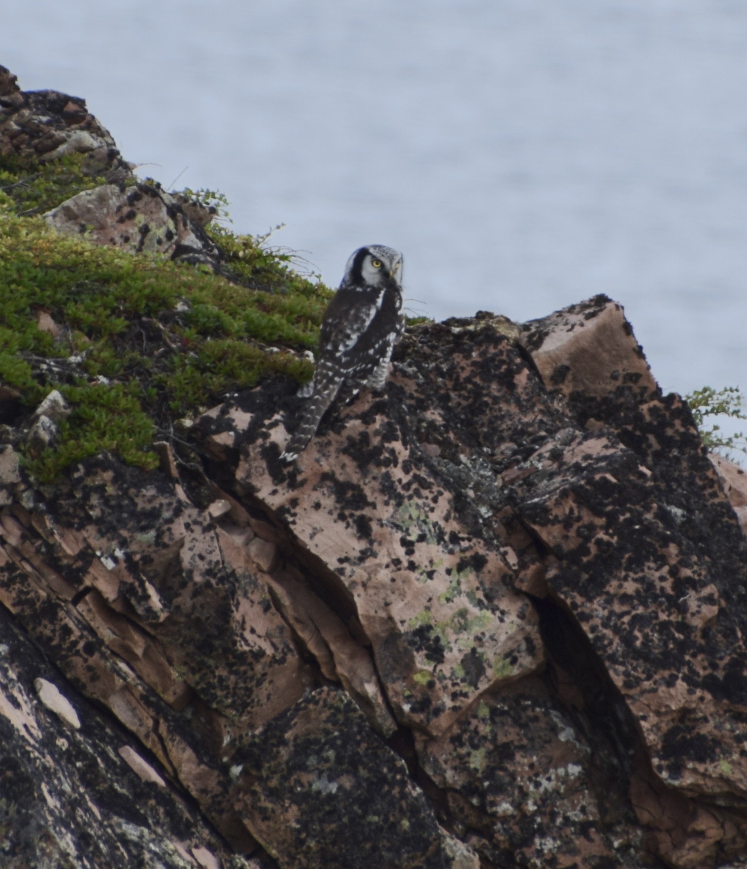
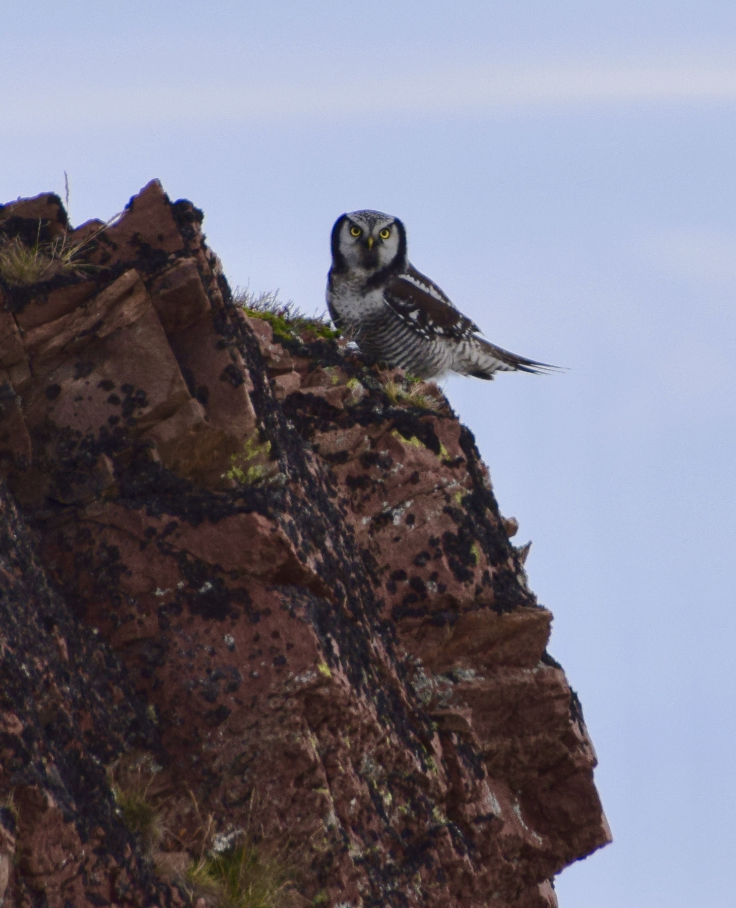
Just before reaching Østkapp Lighthouse – the easternmost point, a big bird suddenly came flying in front of us from a rocky area. Wow – what kind of bird is this, I thought, an eagle? It showed up that it was an owl – a hawk owl! I have never seen this kind of a bird before – amazing:
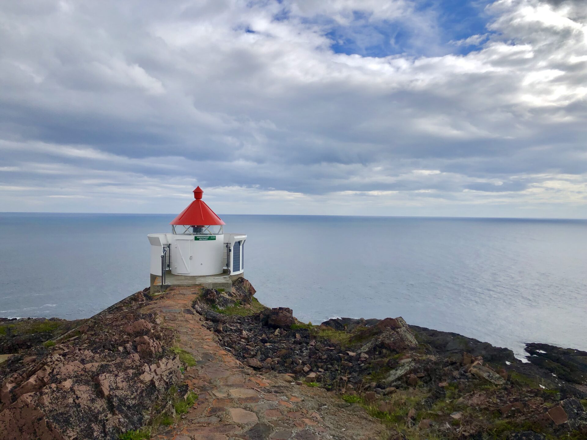
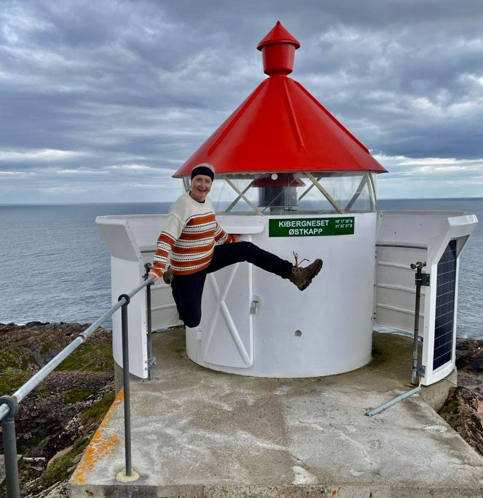
Finally – Kibergneset – the easternmost point on the Norwegian mainland,
The walk was easy and a great experience. It is about a 3,5 km roundtrip.
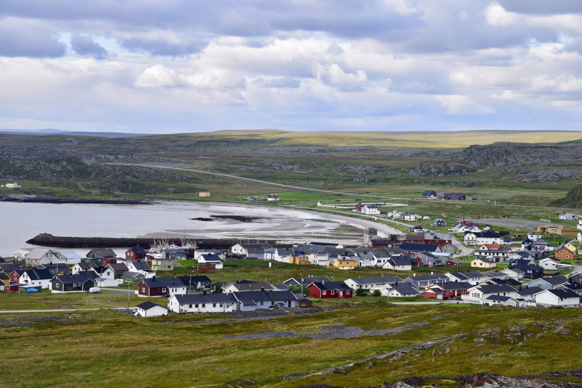
Nice view of the village of Kiberg on our way back to the car:
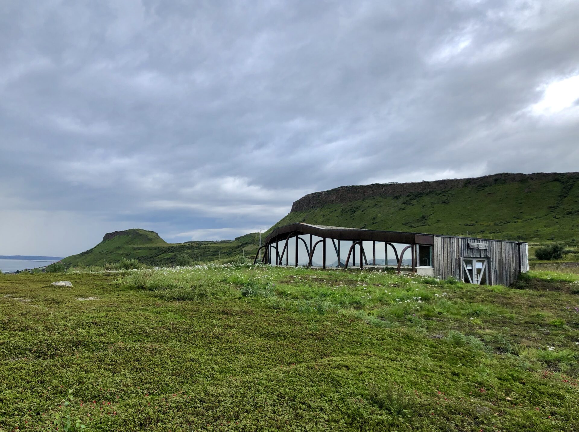
DOMEN
Mount Domen is known from folklore as the place where witches would have their meetings with Satan. At the top of this mountain, the Norwegian Public Roads Administration has established a shelter for resting and enjoying the majestic view.
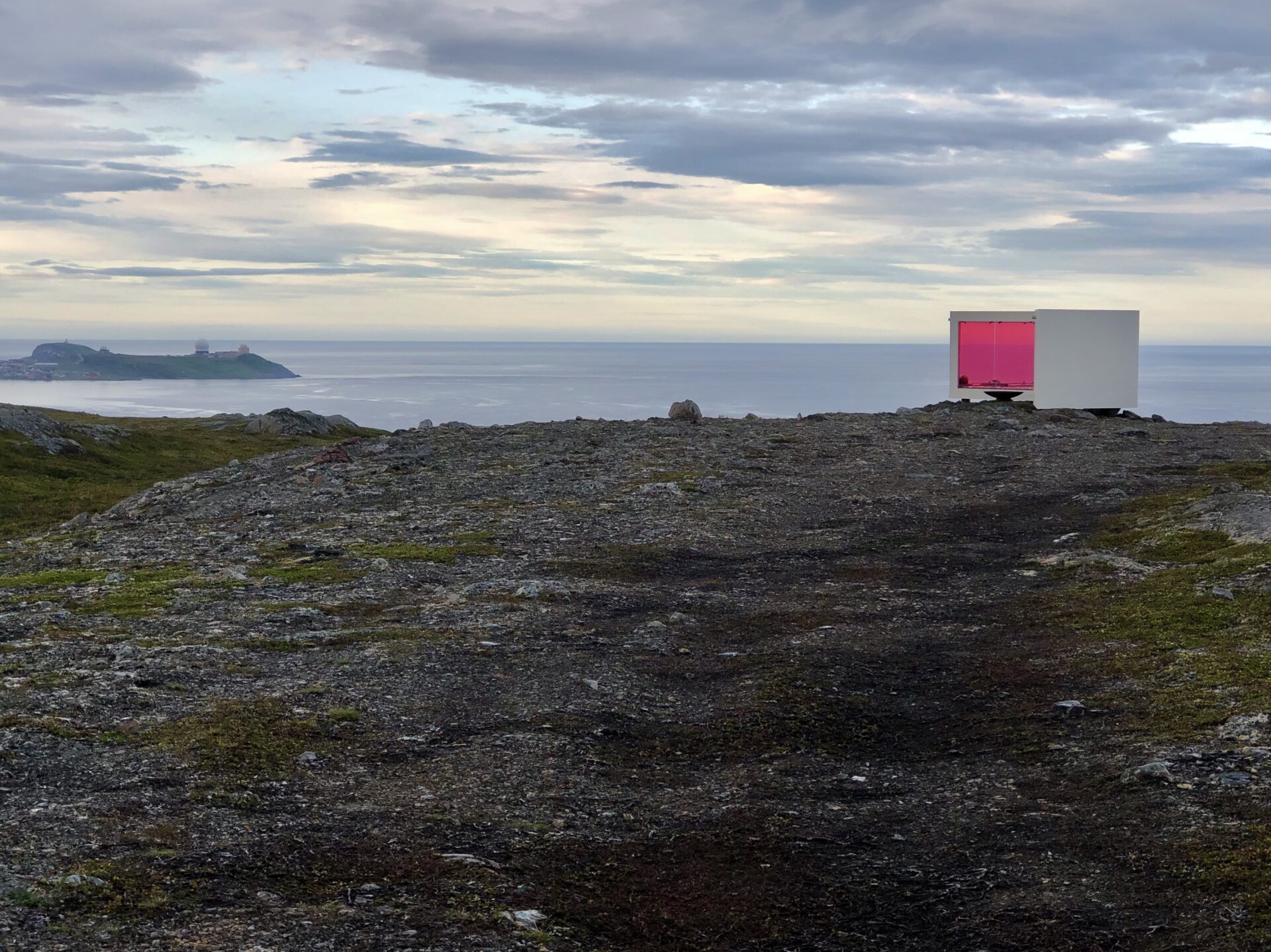
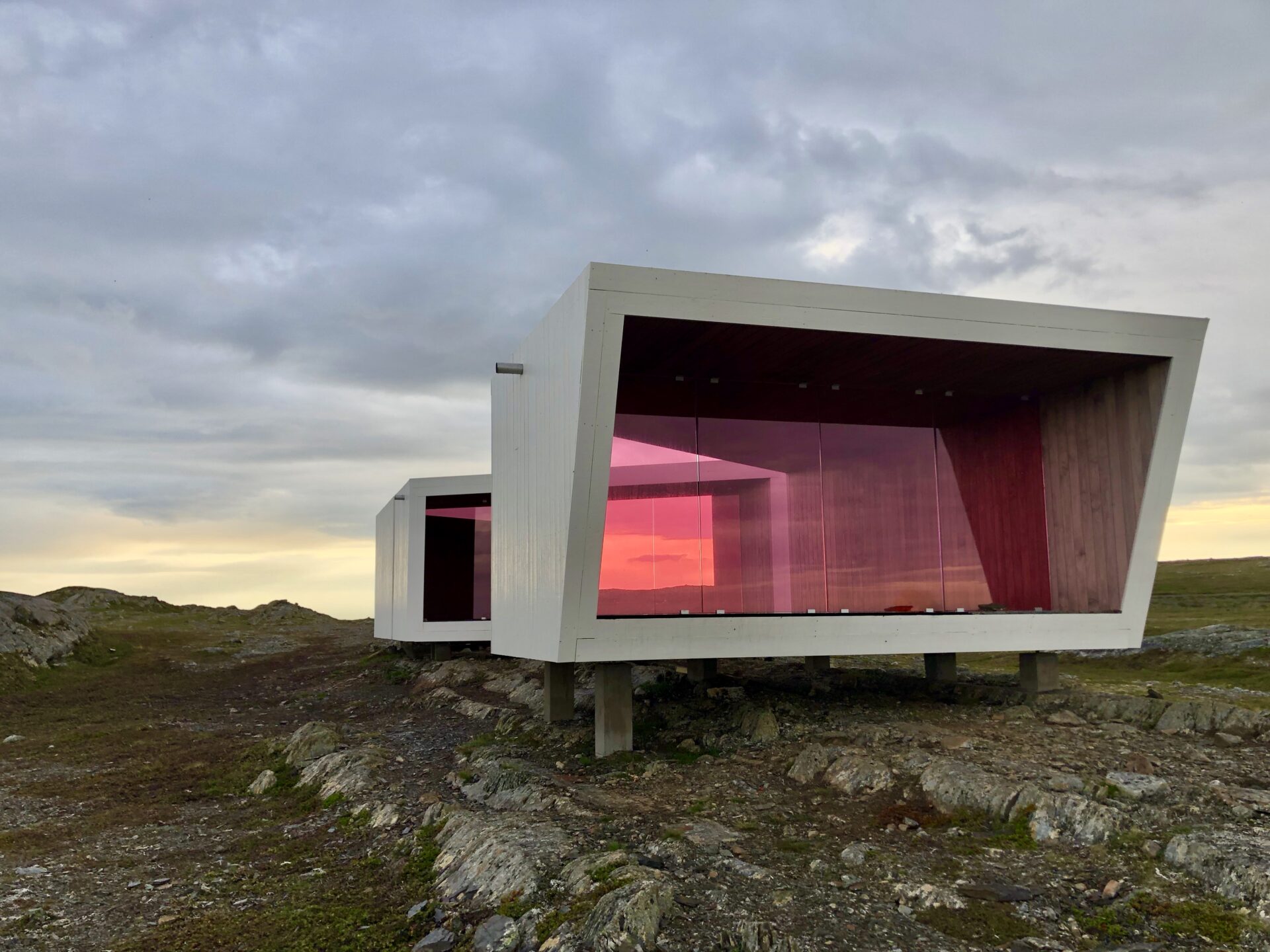

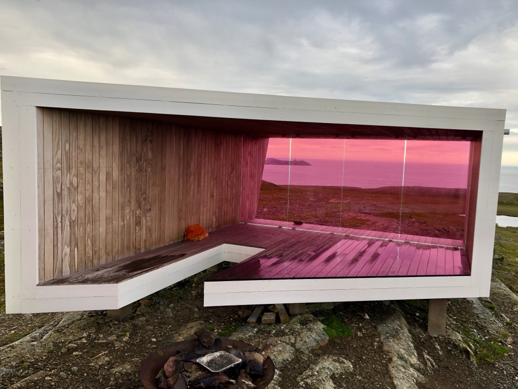
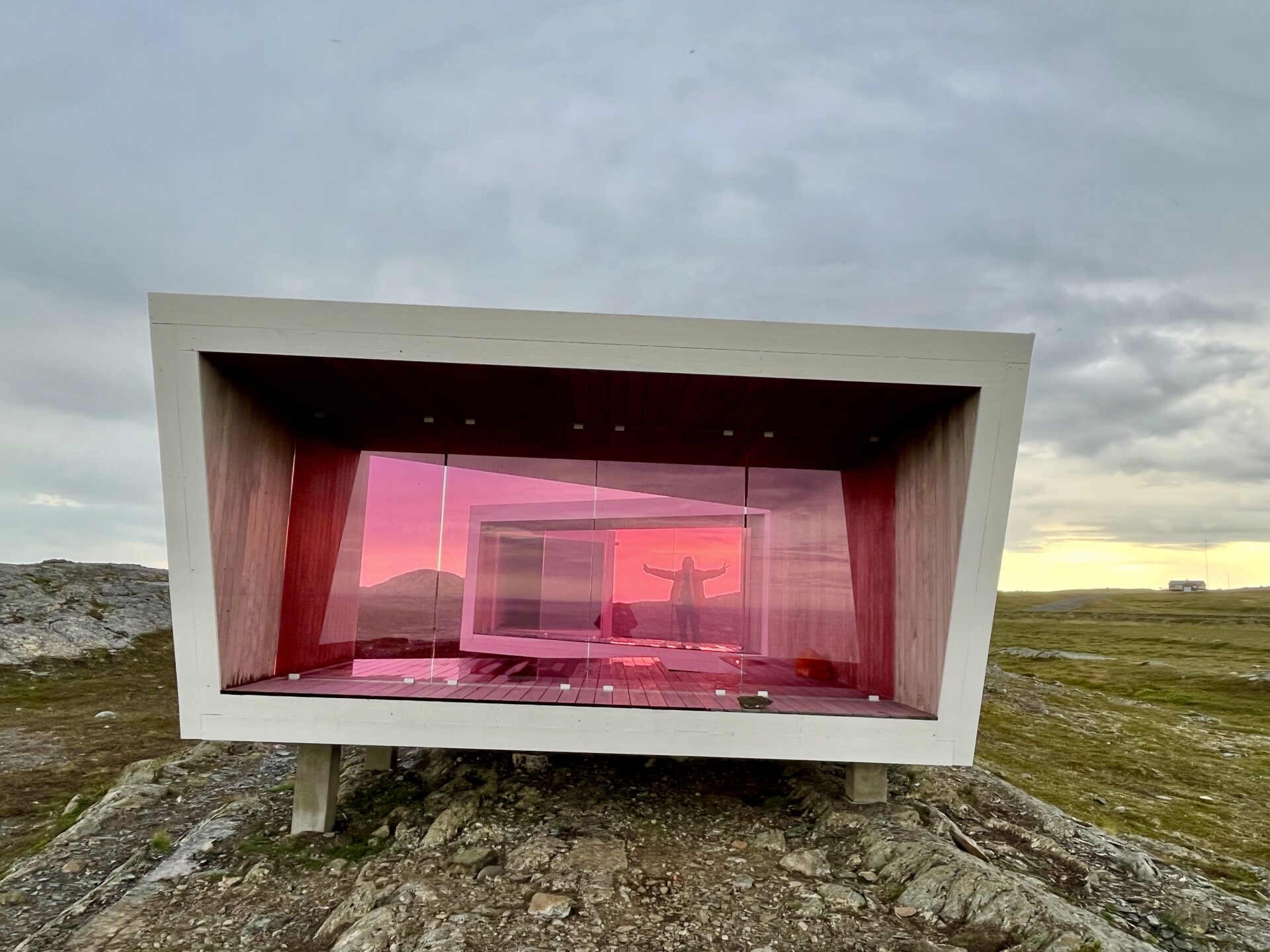
The project consists of three small buildings positioned to provide shelter and protect you from the elements. The buildings have steel frameworks, with whitewashed pine panelling on the outside and Norwegian Kebony wood on the inside. The windows are lightly tinted pink to prevent birds from flying into the glass.
From Domen, there is an excellent view of the inlet, the open sea, wildlife along the shore, and the small town of Vardø. The maritime area around Vardø is world famous for its Arctic birdlife, and from the vantage point on a sunny spring day, you can see several hundred thousand seabirds.
VARDØ – the gateway to the North-east Passage and the Barents Sea
Vardø is Norway’s only town in the Arctic climate zone and is also Norway’s northeasternmost town. As the oldest fishing village in Norwegian Lapland, it has a fascinatingly varied history; a fortress town, the centre for the Pomor trade between North Norway and Russia, and the centre for medieval witch hunts.
Vardø gets its name from the words wolf and island. People have lived on”wolf island” for over a thousand years. At all times, the rich natural resources of the outer Varangerfjord have created the basis of life for people.
Vardø is famous for its festivals, street art and snowball fights, winter storms and midnight sun, birdlife and fishing.
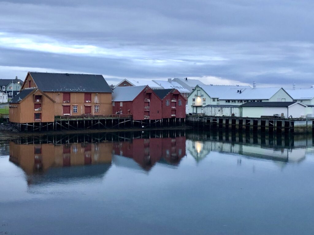
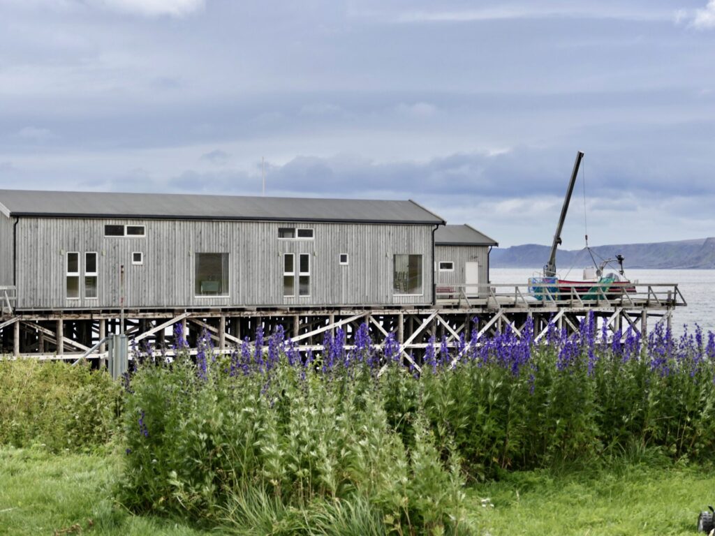
The town centre was severely damaged by aeroplane bombing during World War II. However, the town still has several preserved buildings that were built before the war. Innermost in the bay Vestervågen, one finds the Brodtkorb wharf-side warehouses.
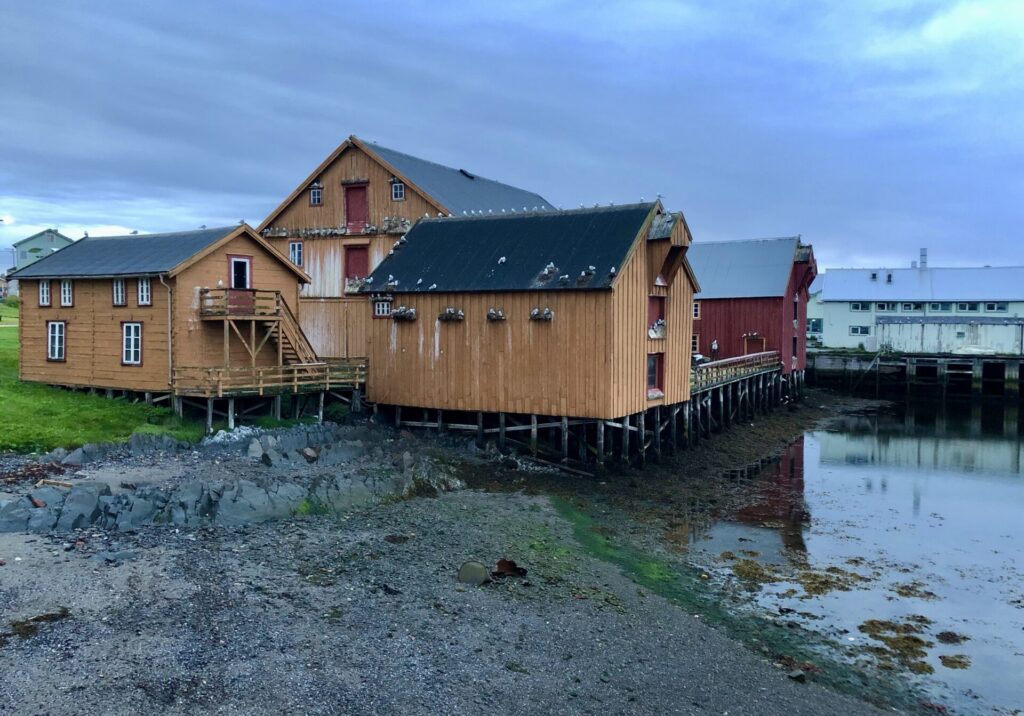
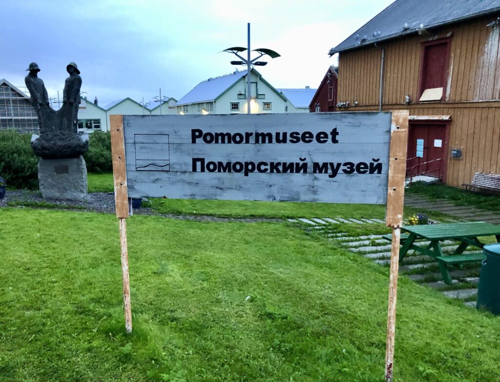
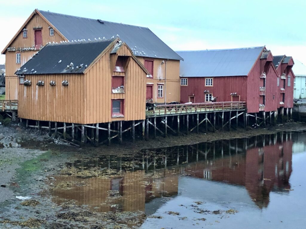
Brodtkorbsjåene (Brodtkorb Warehouses, Norwegian Pomor Museum)
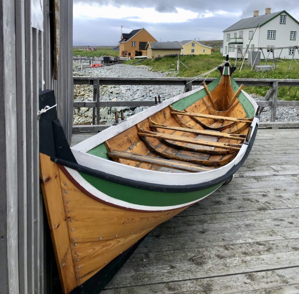
Innermost in the bay Vestervågen, one finds the Brodtkorb wharf-side warehouses. These four warehouses, from 1840-1900, are among Finnmark’s oldest preserved fishery buildings. In addition, it is the only warehouse milieu that documents the livelihood of the Pomors. These structures were designated as listed buildings after the Cultural Heritage Act was passed in 1990 to preserve cultural monuments. This listed building group includes the four wharf-side warehouses”Lillesjåe”,” Storsjåe”,” Tranbu”, and”Saltbu”. Today the warehouses are owned by the Varanger Museum. Each warehouse is constructed of solid Russian logs and panelled with wide planks made of Siberian larch. The Pomor Museum is located in the building”Storsjåe”. The exhibition is divided into two parts. The first is about the Pomors and their everyday life, and the second deals with the contact between Northern Norway and Northern Russia after the Pomeranian trade declined. The Pomors came from the area around Lake Kvitesjøen and lived primarily on fishing, but they were also skilled shoemakers. Part of the reason for the Pomor trade was, among other things, that the Pomors, who were Russian Orthodox, had a great need for fish during Lent, and even though they fished themselves, there was not enough for the whole area when they fasted. In Vardø, there were enough fish, but the lack of wood made the trade with the Pomors favourable. Where the Pomors lacked fish, they had plenty of trees, which was needed on the Norwegian side. Through texts, pictures and objects, visitors get an insight into the everyday life, faith and politics of the Pomor era.
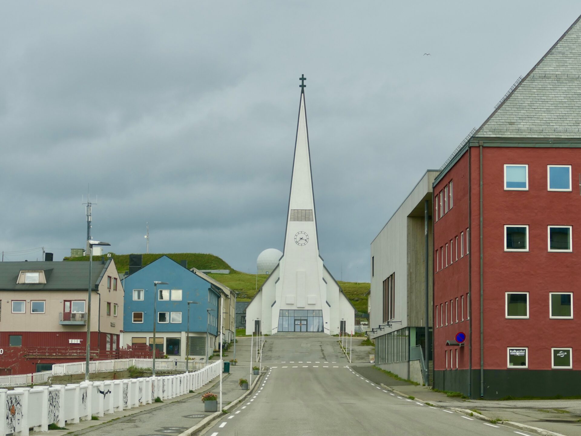
Vardø Church, built in 1958, occupies a significant position in the overall town picture. It is a landmark for sailors and catches the eye on approaching the town. The exterior is consciously adapted to the street as a whole: the road ends in front of the church, which, with its large glass doors and windows, has an open, light and enticing appearance. At the same time, the tower stretches high up into the sky.
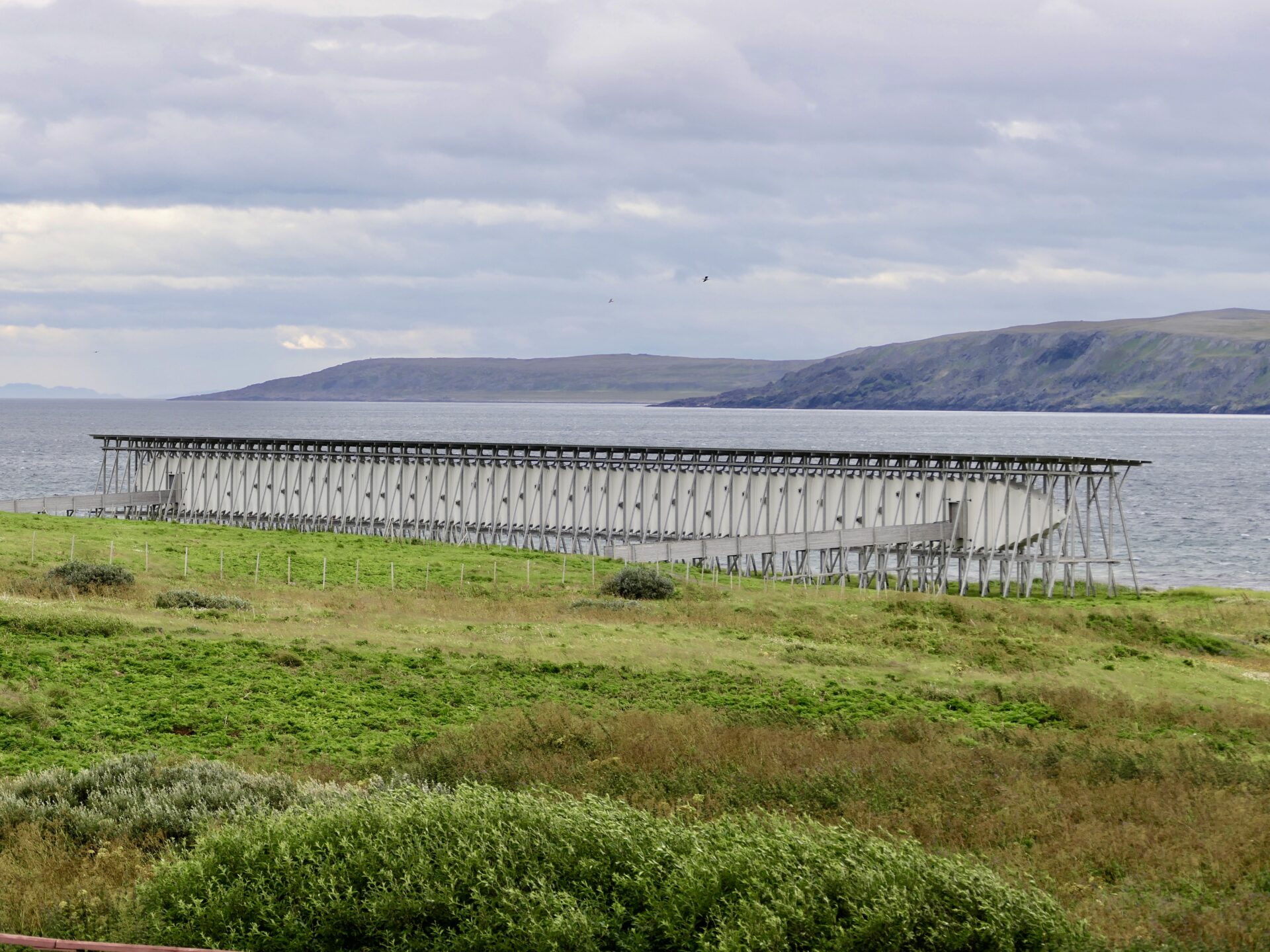
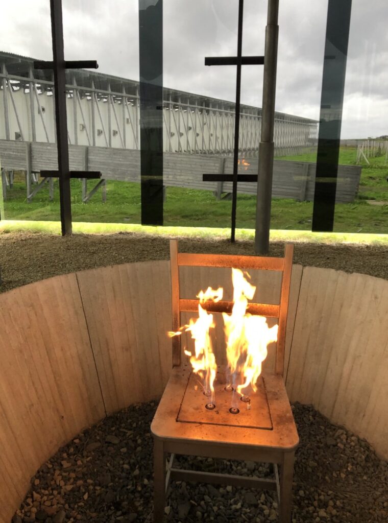
STEILNESET MEMORIAL – The witch monument
Her Majesty Queen Sonja of Norway opened Steilneset Memorial on 23 June 2011. Steineset Memorial, located along the National Tourist Route Varanger, is erected to commemorate the 91 people who were found guilty of witchcraft and burnt at stake here.
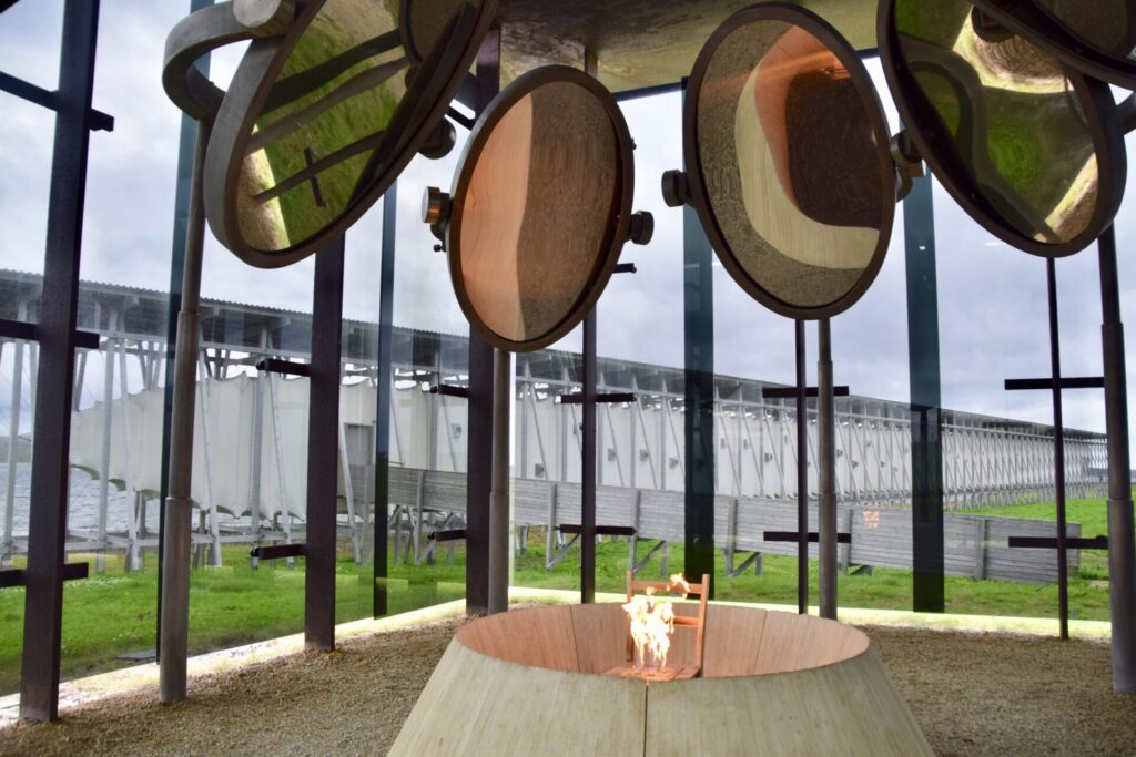
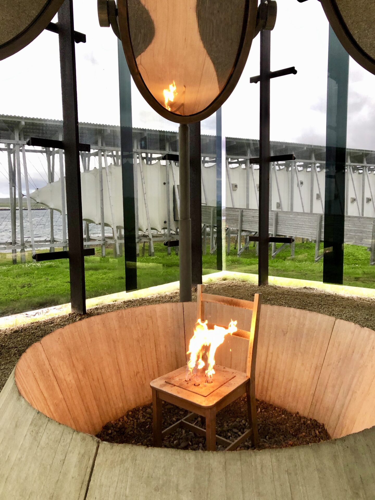
The artist Louise Bourgeois and the architect Peter Zumthor have joined in creating evocative space, a burning chair and a 130-metre-long memorial hall that communicate this gripping story.
The square building with dark glass walls and a steel ceiling is a clear point of attraction, contrasting with its open, weather-beaten surroundings. Inside this glass cube, you will find the artwork”The Damned, The Possessed and The Beloved” by the French-American artist Louise Bourgeois. Her contribution includes a chair with five gas flames reflected in seven oval mirrors encircling the chair.
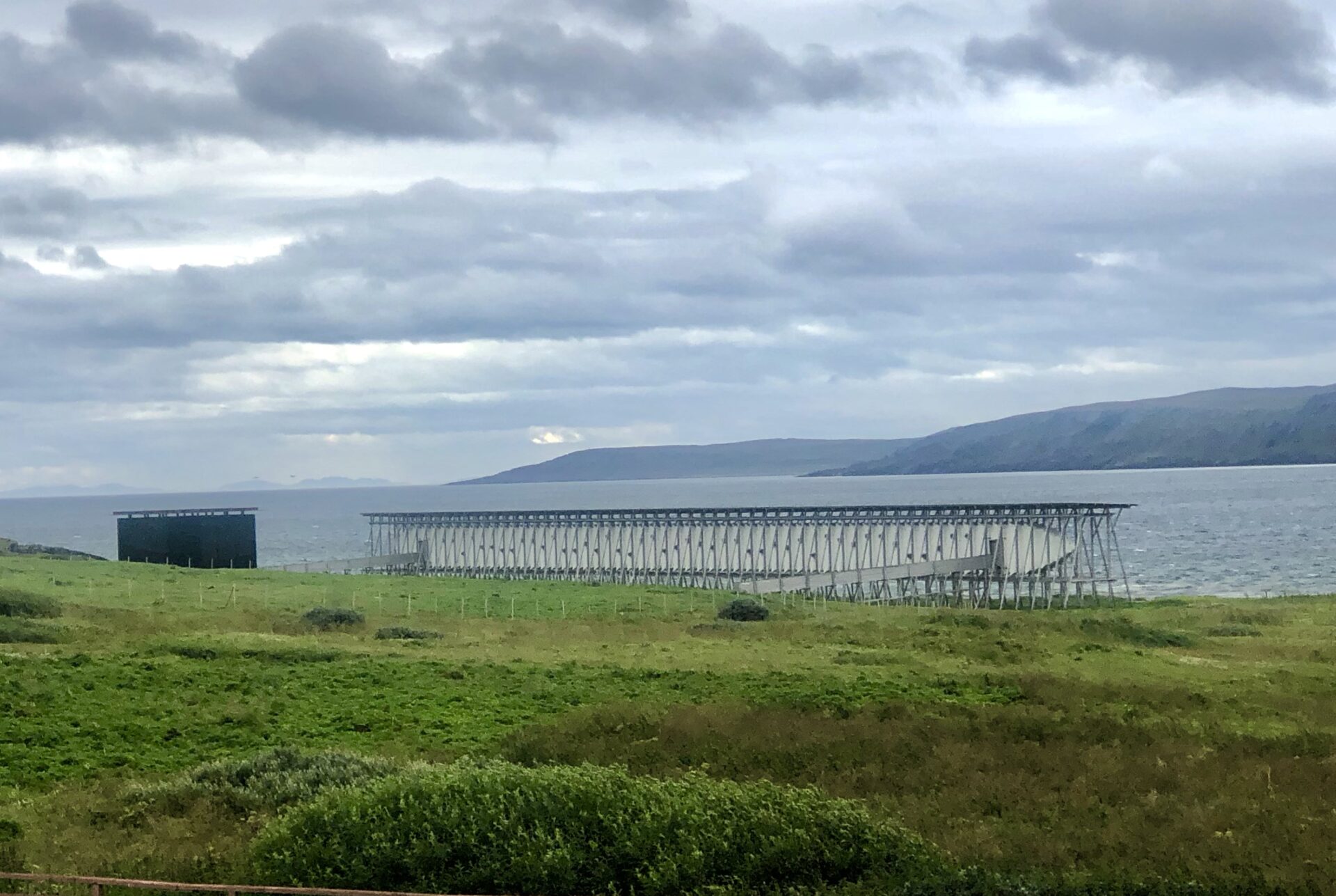
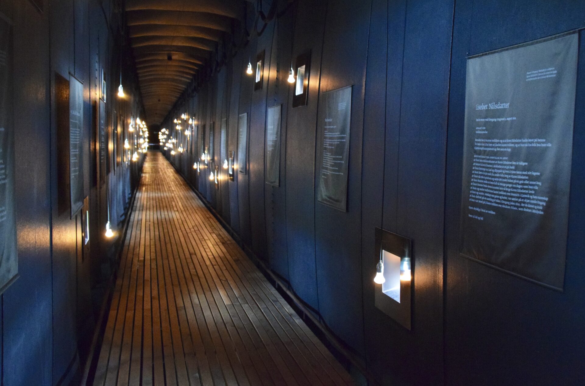
After watching the dramatic artwork of a burning chair, we were led via a narrow wooden corridor into the monument’s memorial hall. The hall is formed by canvas fastened with steel wires to an external, exposed framework. The canvas has been specially manufactured to withstand the forces of nature that may threaten to sweep the entire construction into the sea at any time.
The lighting consists of small windows and simple light bulbs with a faint reddish glow. On the walls are blackboards with information about the convicted witches; 91 plaques, one for each victim sentenced to death for witchcraft and burnt at stake at Steilneset between 1600 and 1692. The historian Liv Helene Willumsen has written the text in the memorial hall based on the original court records from the witchcraft trials.


One of the plaques:
Berigette Christophersdatter
Brought before the court at Vardehus Castle on 6 Febrary 1652

ACCUSED OF - having cast spell on Jon Jonsen´s Hess ship
Refused to confess and was bailed out by her husband

Brought before the court at Vardøhus Castle on 22 January 1653
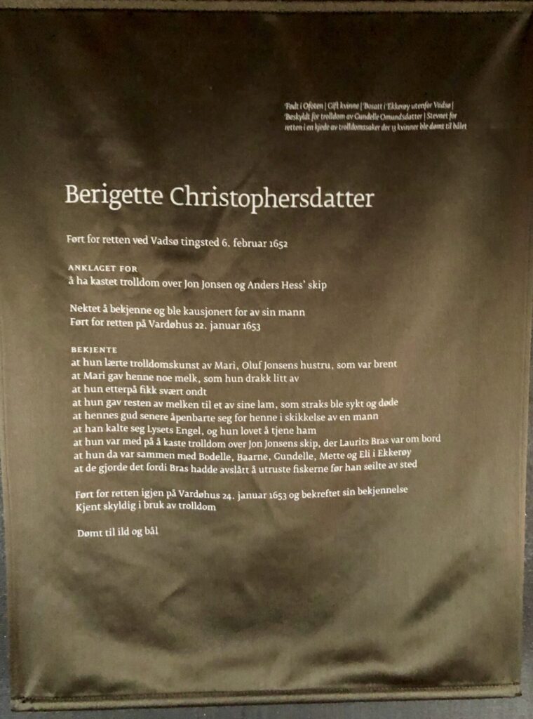
CONFESSED
that she learnt witchcraft from¨ Mari, Oluf Jonsen´s. wife, who was burnt
that Mari gave her milk, and she drank some of it
that afterwards, she got pains
that she gave the remaining milk to one of her lambs, and it fell ill at once and died
that her God appeared before her, afterwards,in the shape of a man
that he called himself Angel of Light, and she promised to serve himthat she took part in casting a spell on Johnsen´s ship, when Laurits Bras was onboard
that, on that occation, she was with Bodelle, Baarne, Gundelle, Mette and Eli from Ekkerøy
that their motive was that Laurits Bras had refusedto supply the fishermen before he left
Brought before the court again, at Vardehus on 24 January 1653; confirmed her confession. Convicted of practice of witchcraft

Sentened to death in fire at the stake
It is also hoped that the Steilneset Memorial will draw visitors to a remote and economically depressed region of Norway. The Vardø project is also part of the Norwegian Public Roadsadministration’ss National Tourist Routes program, through which distinctive buildings are erected to encourage visits to outposts of exceptional natural beauty. The memorial is part of the Steilneset Culture Path that encompasses large aspects of the city’s history.
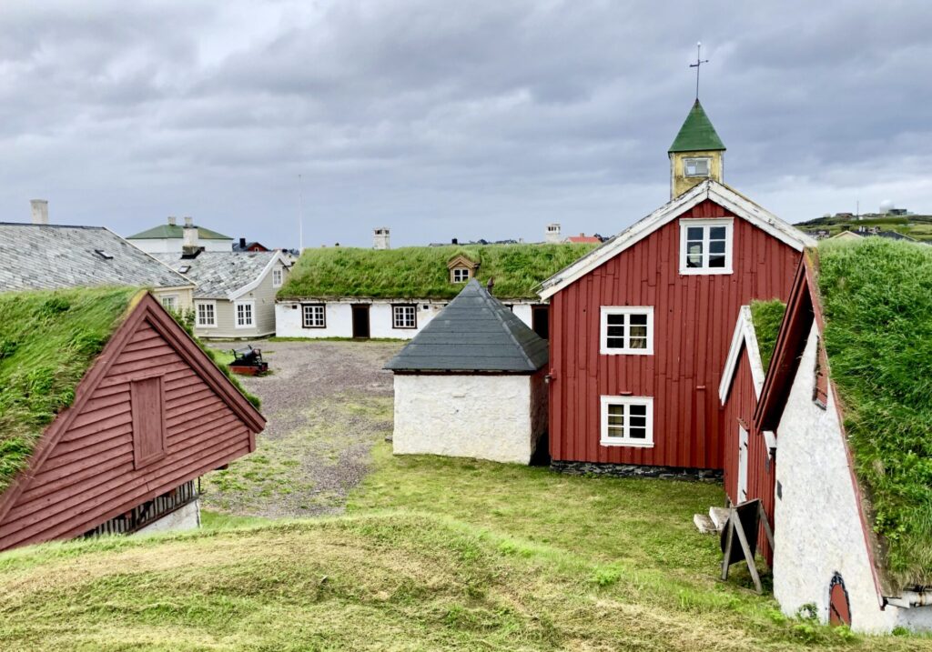
VARDØ FORTRESS
We also visited the Vardøhus Fortress, which is not far from Steilneset Memorial. This fortress was the setting for these witch trials held in Vardø. Altogether, it’s believed that 140 witch trials were held across Finnmark in the 17th century.
Vardøhus Fortress is the northernmost fortress in the world. King Håkon V Magnusson ordered and built the first fortress, completed around 1300. The octagonal fort was built between 1734 and 1738. The fortress is centrally located in Vardø, a stone’s throw from the Harbour and the hotel, with a great view over Bussesundet and the mainland.
The first fortifications on Vardøya Island were built as early as 1307 by King Håkon V Magnusson to protect the north-easternmost reaches of the Norwegian realm. During the Middle Ages, both Sweden and the Republic of Novgorod had interests in and around the Barents Sea, so it was important for Norway to highlight its sovereignty. A new fortress was built on the site sometime in the 1400s. In the seventeenth century, this fortress was the setting for the numerous witch trials held in Vardø, and the alleged witches were held for trial in these buildings.
The Steilneset memorial has also raised awareness of this dark chapter in Northern Norway’s history.


DRAKKAR – has become a landmark
The tremendous wooden sculpture DRAKKAR ( meaning”big Viking ship” ) – guards Bussesundet, the strait between Vardø island and the mainland, and shows the way so that people at sea can continue to find their way to Vardø. You see the remains of a Viking ship, a dinosaur and a whale in the pose of the sky.
The sculpture was built during the summer of 2016 by the Taibola Assemble team from Arkhangelsk/Severodvinsk on this desolate rock on Vardø island. The artists themselves say ;
it tells a story about the sea, people migrations, myths, ships, historical events, wood and whales. It is an anthem to the Arctic, humans and nature!


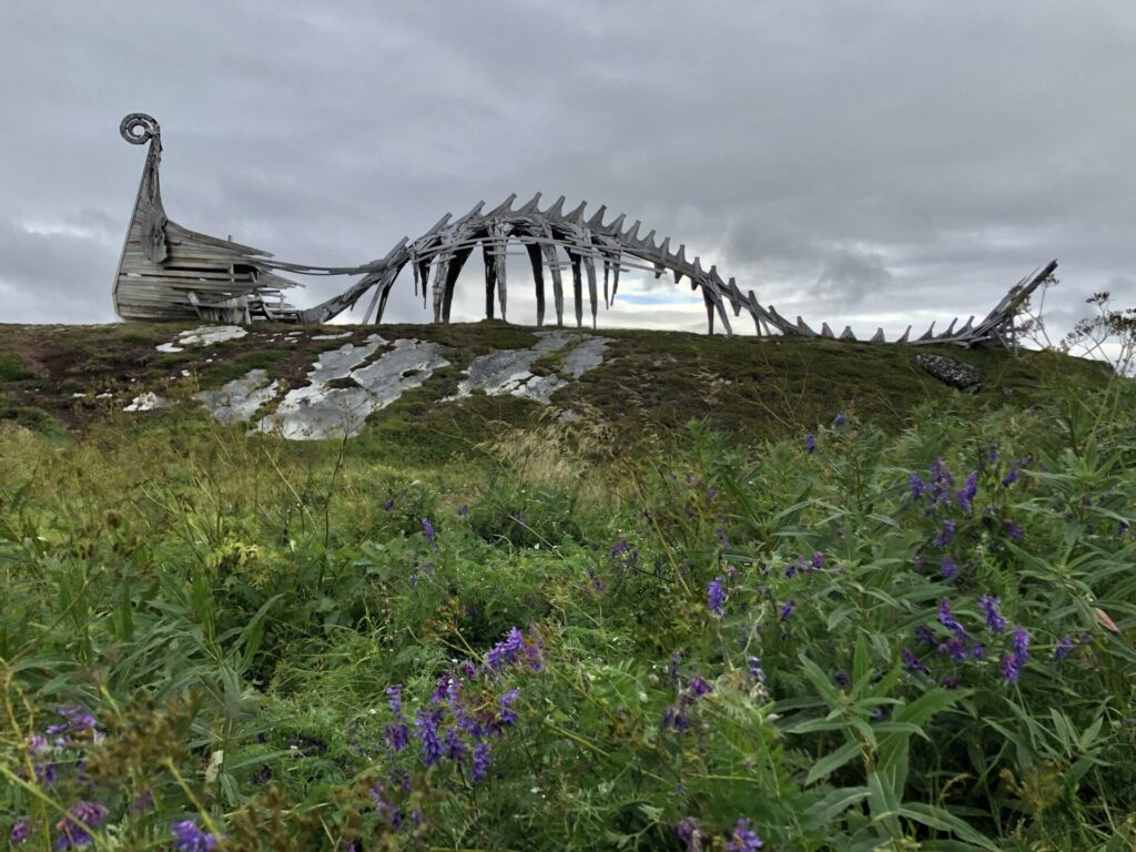
The population of Vardø has pressed it to his breast and made it a landmark.
You can drive and park nearby, or if you like to walk, it is an easy walk from downtown Vardø.
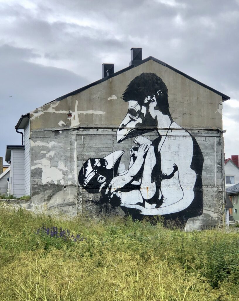
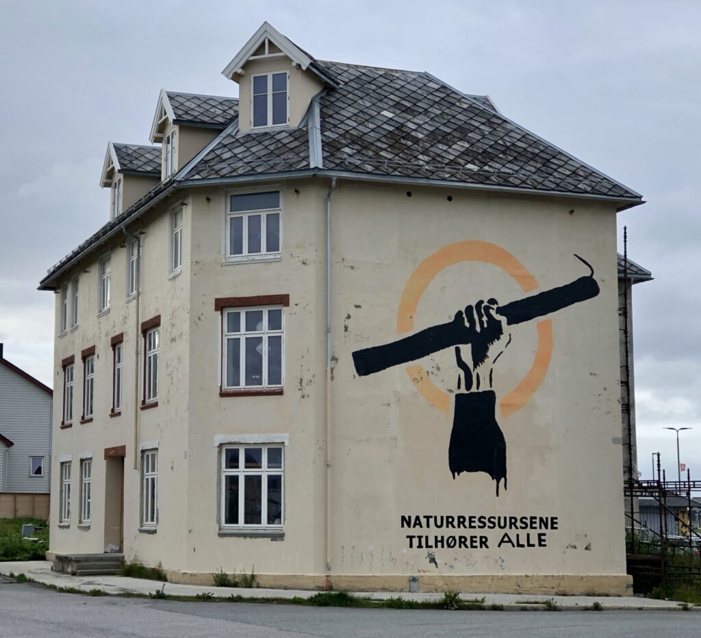
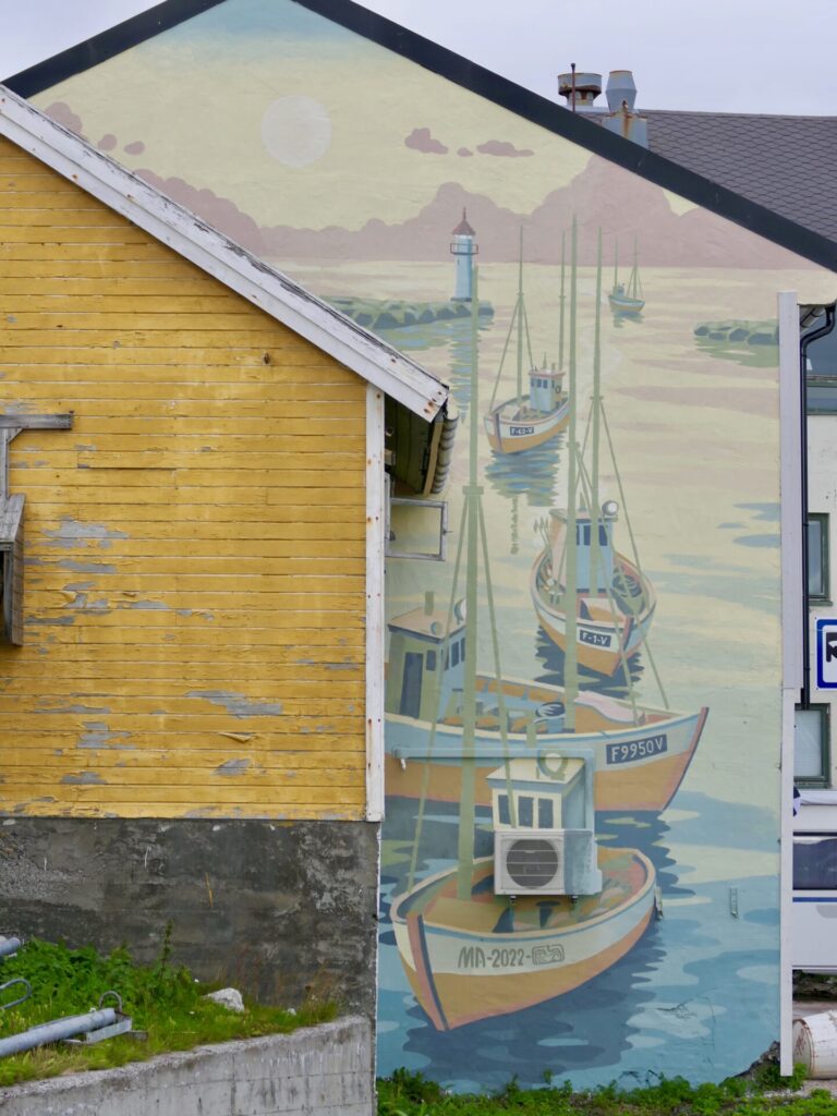
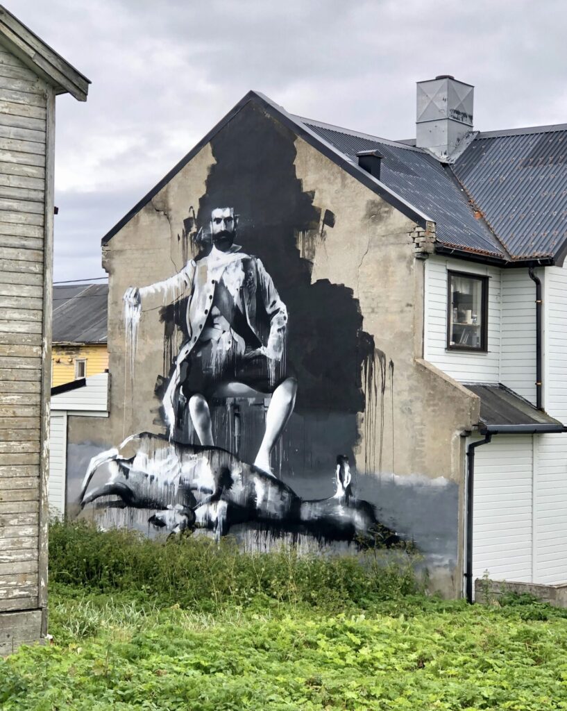
VARDØ STREET ART
Vardø street art. The festival of Komafest resulted in Norway’s northeasternmost city becoming a gallery for street art of the best kind.
The street art artist Pøbel, in collaboration with Nordnorsk Kunstnersenter and local actors in Vardø, carried out a large art project in Vardø in the summer of 2012. Pøbel invited 11 of the world’s leading street art artists to”Komafest”. These artists transformed the city into a living street-art gallery, a city full of fantastic murals and texts that, in various ways, try to tell a story, call for a smile and bring the city back to life. Hence the name Komafest.
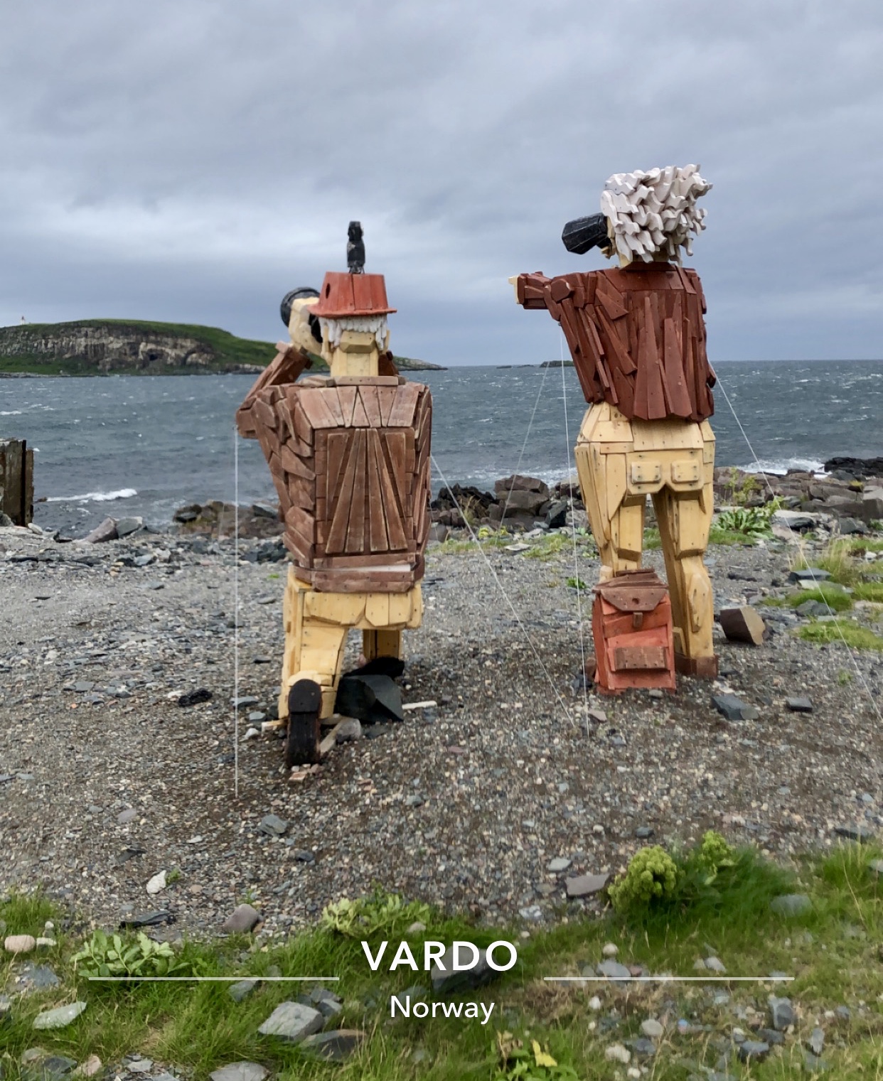
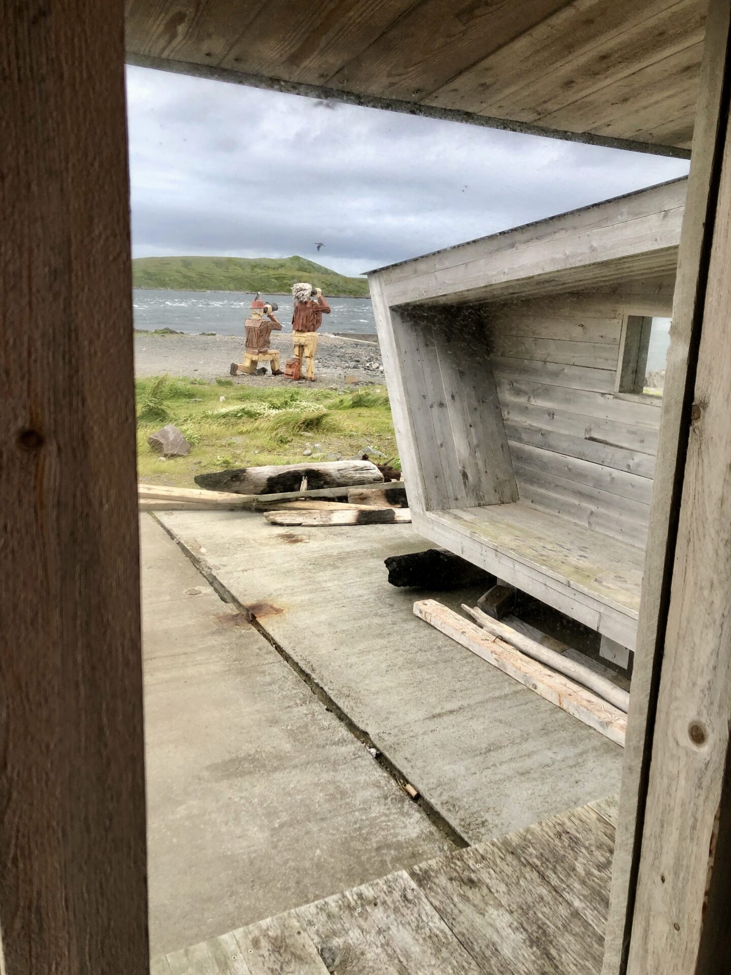
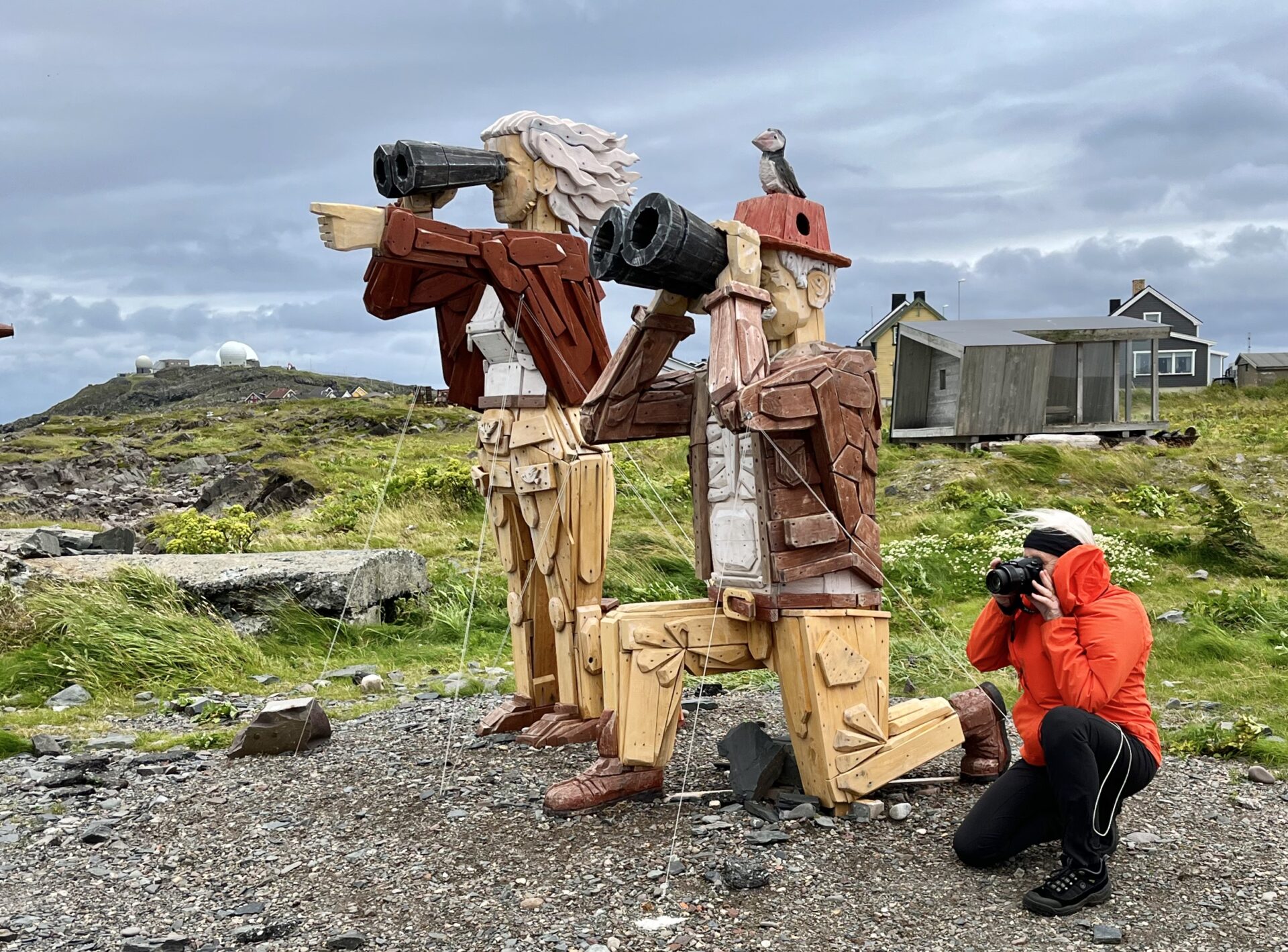
HASSELNES BIRD HIDE AND WIND SHELTER

At Hasselnes, northeasternmost at Vardø island ( and the end of Vardø main street) – a wind shelter/bird hide was built in 2015. The architect is Biotope here as well; they are specialized in designing bird hides.
Just north of the shelter are two tree-statues; two birdwatches – looking for birds at Hornøya.
The bird cliffs of Hornøya are one of Varanger’s main attractions. The nature reserve is home to 100 000 seabirds of up to 11 breeding species, making for a noisy, smelly, spectacular experience. Common Guillemot, Kittiwake, Atlantic Puf, fin and Razorbill dominate the bird cliff. Around 500 pairs ofBrünnich’ss Guillemots breed between the Common Guillemots, selecting the steepest cliff faces to lay their eggs. During the seabird breeding season, visitors to Hornøya have a good chance of seeing White-tailed Eagle and Gyrfalcon hunting the birds on the cliff. The list of vagrant birds it has hosted includes Black-throated Thrush, Lesser Short-toed Lark, Olive-backed Pipit, Paddyfield Warbler, Red-backed Shrike and Red-rumped Swallow. Along with the birds, Hornøya is also a great place to spot Grey Seals, Orcas and in summer, there is also the rare chance of seeing Belugas. Generally, Hornøya is amazing and sometimes stunningly surprising.
This is the easiest accessible bird cliff in Norway. From the Harbour of Vardø, it takes no more than 10 minutes by boat to reach Hornøya. We were planning to visit this bird cliff, but unfortunately, it was too windy that day, so the boat didn’t go. Next time…
Hasselnes used to be the town dump but has become an attractive place to visit with the new bird hide and wind shelter. It is already an important place for birders and all visitors to Vardø, but facilities and information have been absent.
Its varied seatings and spaces shelter you from the main wind directions. The views towards Hornøya bird cliff and the bird-rich Reinøysundet are brilliant, and the body of water between Vardø and Hornøya can boil with seaducks, alcids and gulls. The waters around Vardø are some of the richest in the vast Barents Sea. Vardø town is a favoured town to stay in for birders and nature photographers. And in the evenings, it works brilliantly as a Northern Lights-watching shelter.
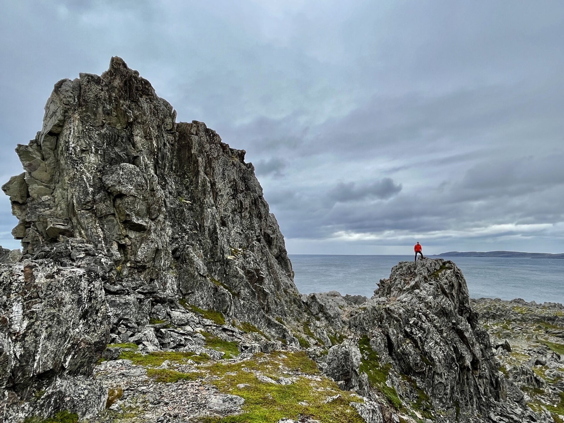
HAMNINGSBERG – a journey to the end of Europe
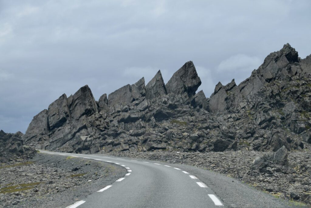
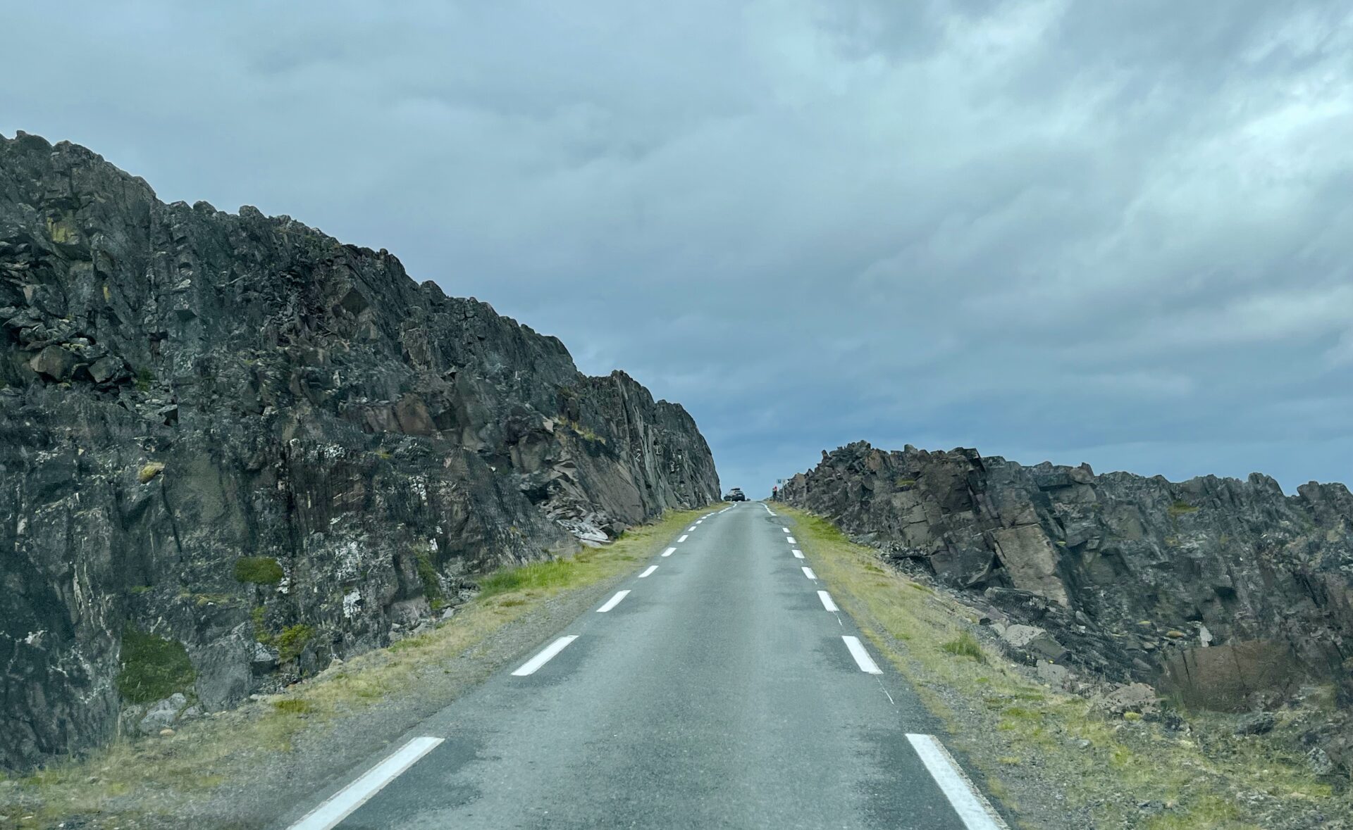
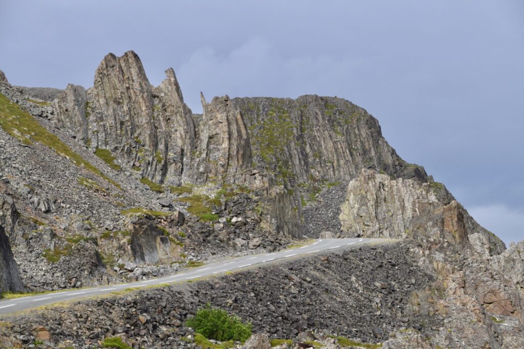
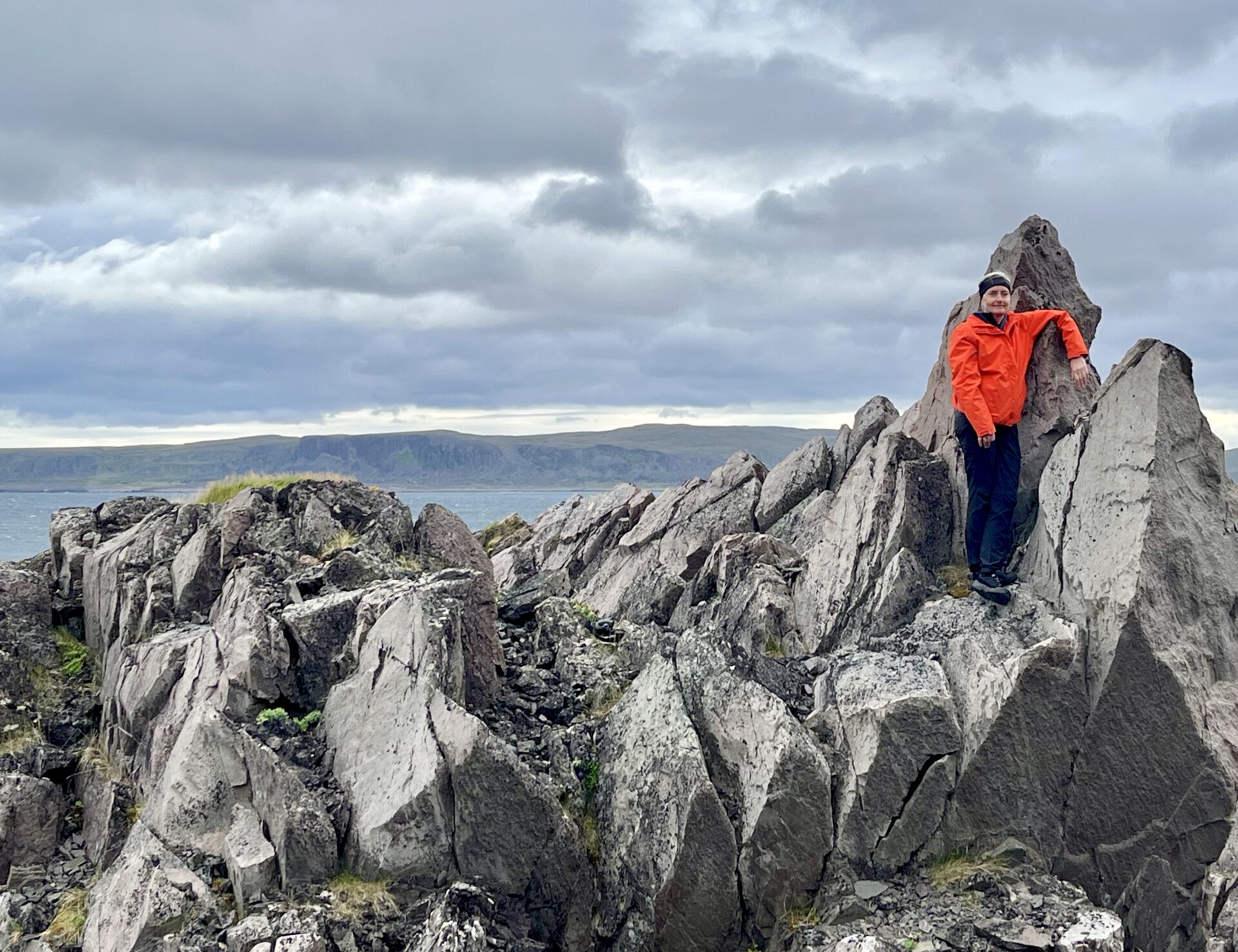
The drive from Vardø to the fishing village Hamningberg was maybe the most scenic and fascinating part of the Varanger Scenic Route. The landscape along the ocean – is rocky with pointy peaks and steep cliffs – a spectacular experience!
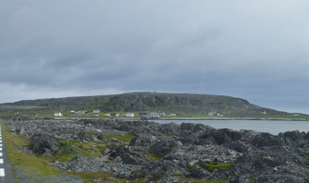
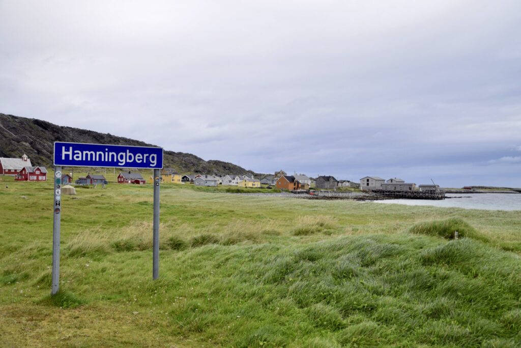
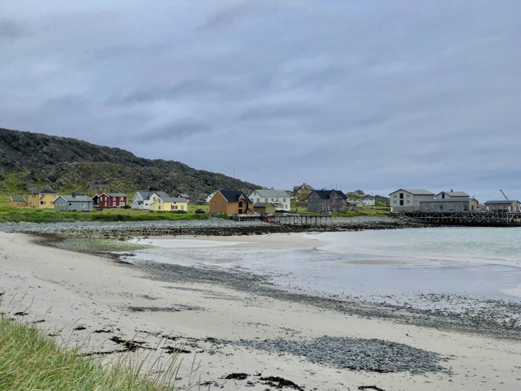
The fishing village Hamningberg – is one of few places in all of Finnmark county that the retreating Germans did not burn down in the latter part of the Second World War.
That is why Hamningberg has retained a large part of the building mass before WWII, where some buildings date from the 19th century.
That. is a cultural heritage site with intact buildings and is the best-preserved fishing village from pre-war times.
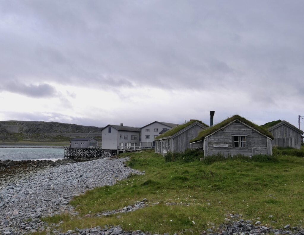
Around 1900, Hamningberg was one of the largest fishing villages in Finnmark and home to approximately 250 people. They primarily sold the fish they caught to the Pomors – the Russian traders who travelled to the region from Kvitsjøen every summer to buy fish and sell grain and timber. Many of the notched-join timber houses in the village were prefabricated in Russia and re-assembled in Hamningberg, as evidenced by the join technique.
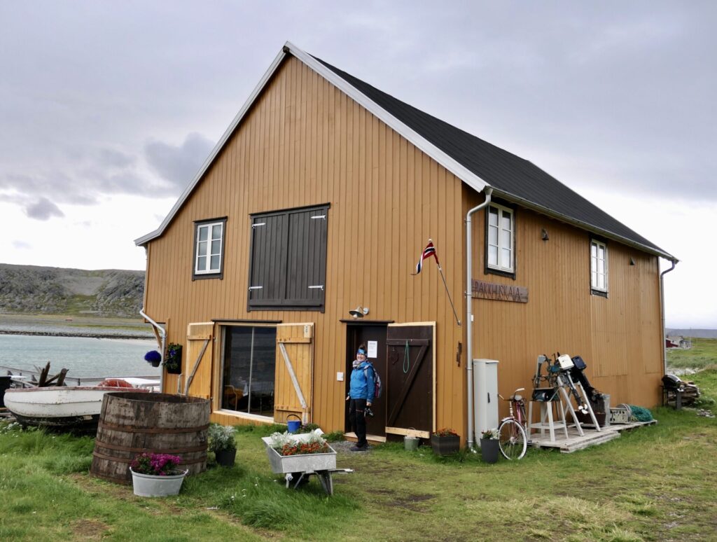
Today, around 65 buildings – warehouses, boathouses, the fishing station farm, the store and the church – form a traditional Finnmark environment. The fish factory dates back to the 1950s and constitutes an intact feature of industrial history from the reconstruction period.

During a hurricane in 1894, the lifeboat,” Colin Archer”, saved 36 people from death in the wrecks at Hamningberg. At the entrance of the town, a memorial monument is raised in honour of the R/S Colin Archer and its crew:
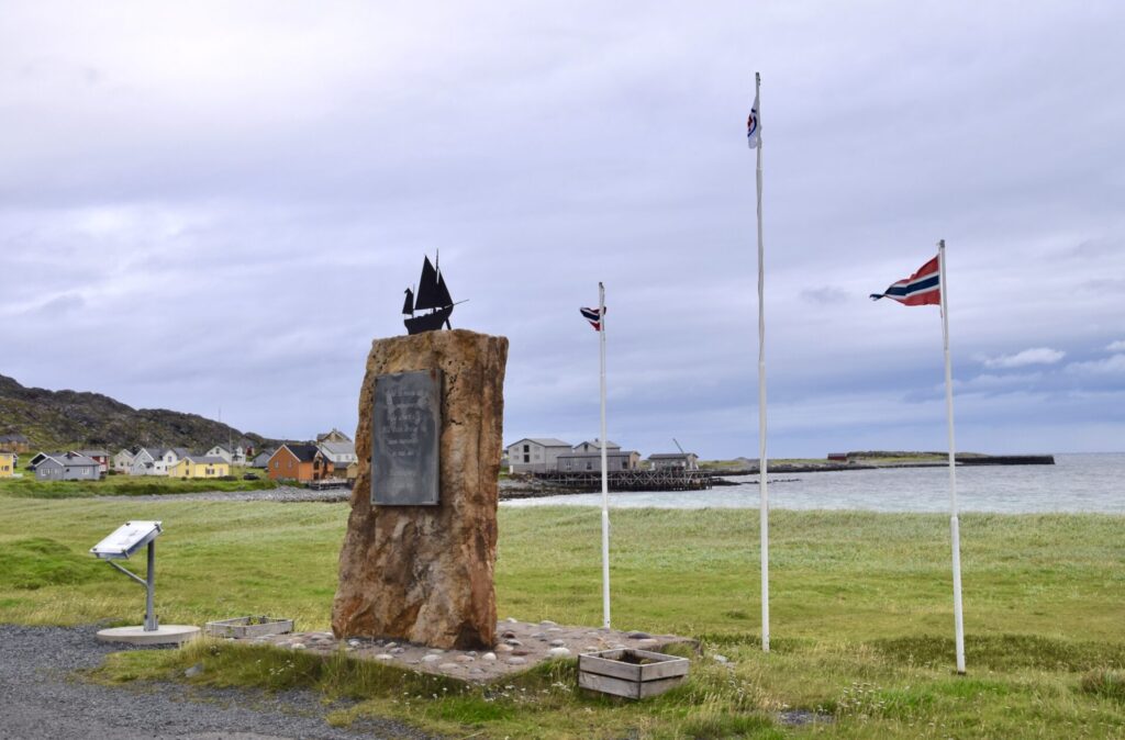
The first boat of the rescue company, “Redningsselskapet”,” R/S Colin Archer”, was stationed in Vardø on the 19th of May 1894. It was called out for a mission the very next day. A blizzard stormed in, and many boats lay in Hamningberg. It was the fishing season, and the Harbour was full of boats with people who didn’t manage to get into the quay due to Ice and the powerful windy forces against the shore. In Vardø, the captain of the” Colin Archer” received information about the situation through the telegraph.
About seven hours later” Colin Archer” was back in Vardø and had managed to rescue 22 people. The next day, they saved 14 more.
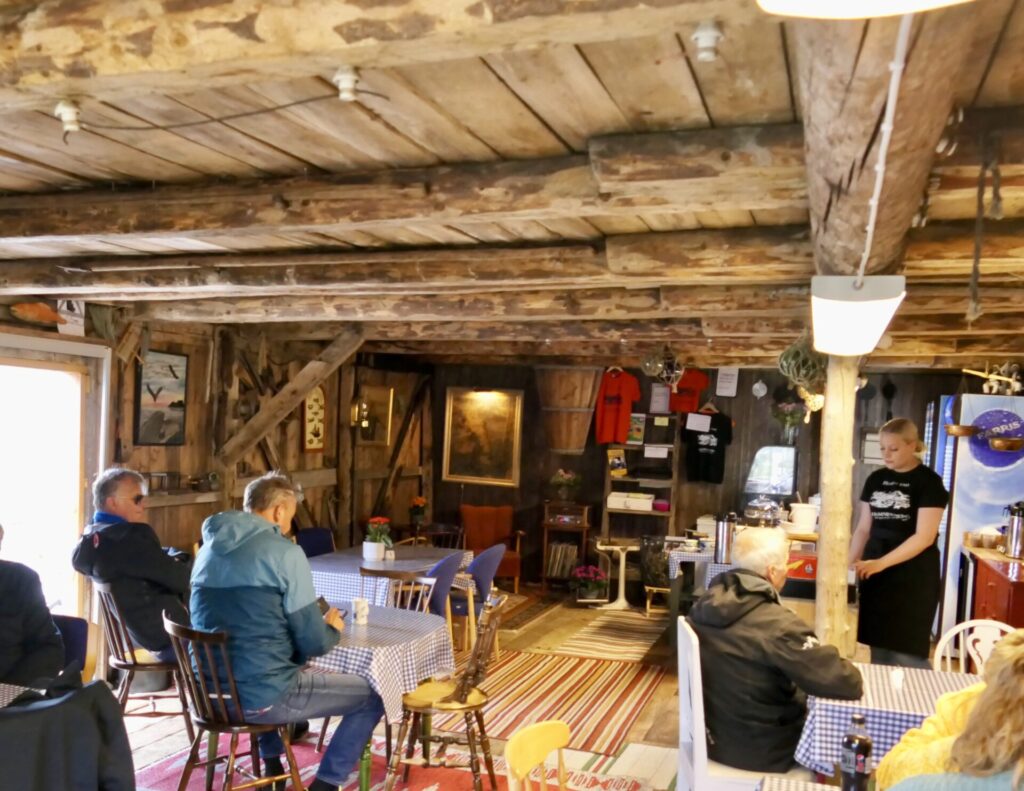
The village was depopulated and abandoned in 1964, although some houses are still used as summer cottages. In summer there is also a cafe where we had a nice warm visit.

In September 2022 – the Norwegian Public Roads Administration (NPRA) will be opening a new bird hide at the end of the Varanger Scenic Route. The new hide will be located close to the breakwater at Hamningberg. The location was chosen because of the major bird migration routes that follow the Norwegian coast. A sea full of food makes the area a popular stop for migratory birds and a suitable place for humans to experience and photograph bird life.
By the end of the road – the end of Europe:
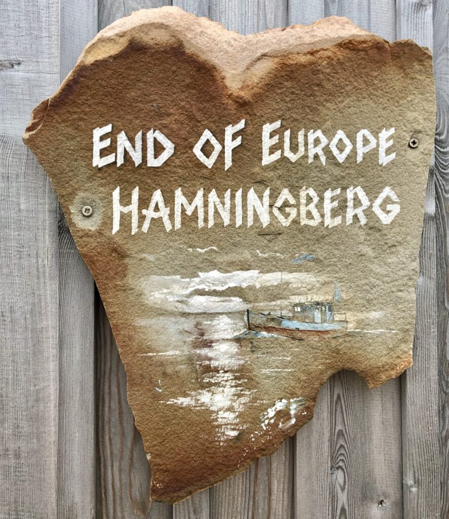
Hamningberg is the end of the Varanger Scenic Route.
This is the last of Norway’s 18 National Scenic routes.
I have visited all 18 – mission completed.
But I haven’t written articles about all of them on my website yet; some are still to come. I may start writing books about Norwegian scenic routes, and it may take some time before all 18 are online.
Even more dramatic landscape on the way back to Vardø: