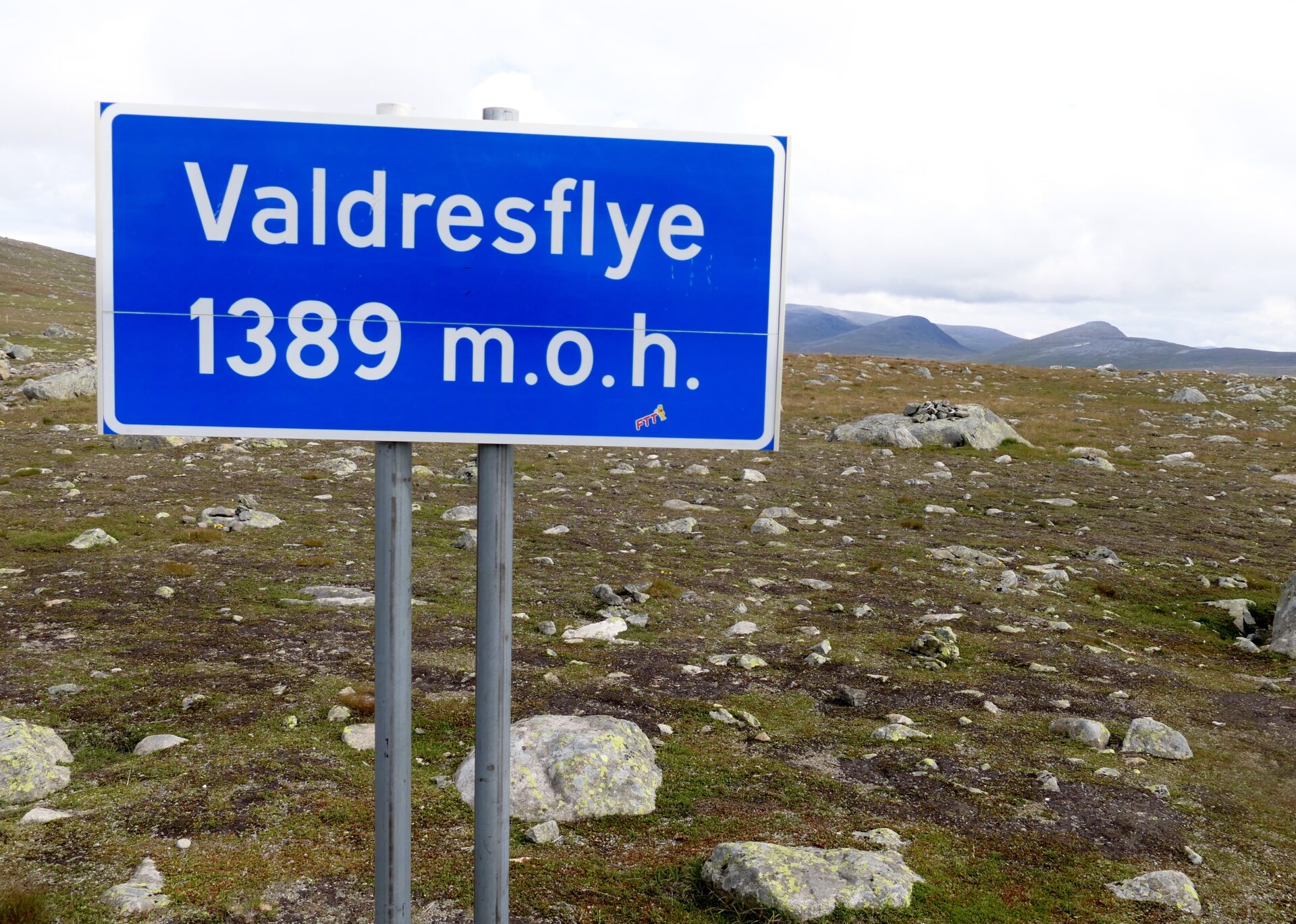
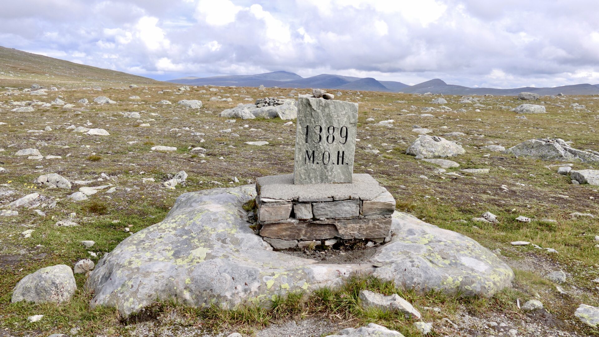
The Norwegian Scenic Route – VALDRESFLYE – runs along FV51 from Beitostølen to Hindsæter – over a mountain plateau with the highest point at 1389 masl. This makes it the second-highest (after Sognefjellet with 1434 masl) mountain pass and road in Norway.
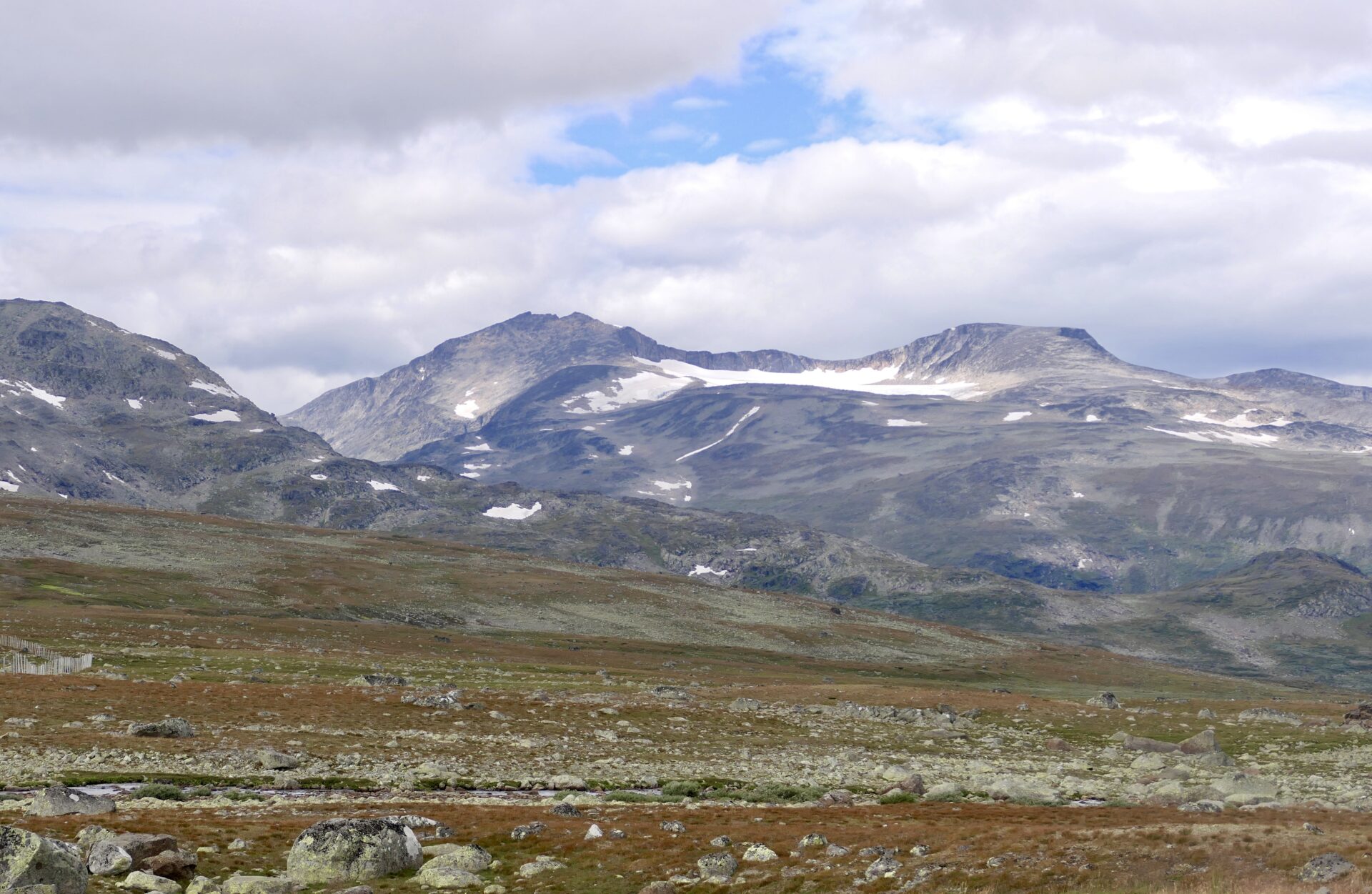
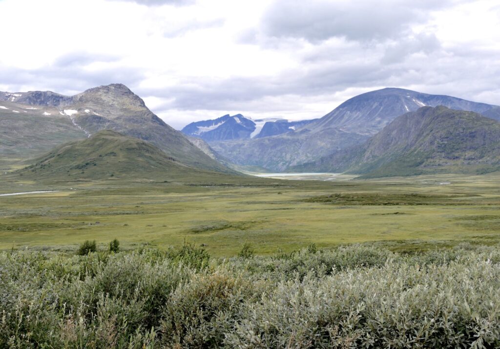
Great view towards many of the mountain peaks of Jotunheimen National Park.

MAIN SUBJECTS:
- THE OLD AND NEW CHURCH IN HOL
- HEGGE STAVKIRKE – HEGGE STAVE CHURCH
- THE START OF VALDRESFLYE SCENIC ROUTE
- BYGDIN
- JOTUNHEIMSVEGEN – THE JOTUNHEIM ROAD
- RJUPA REST AREA
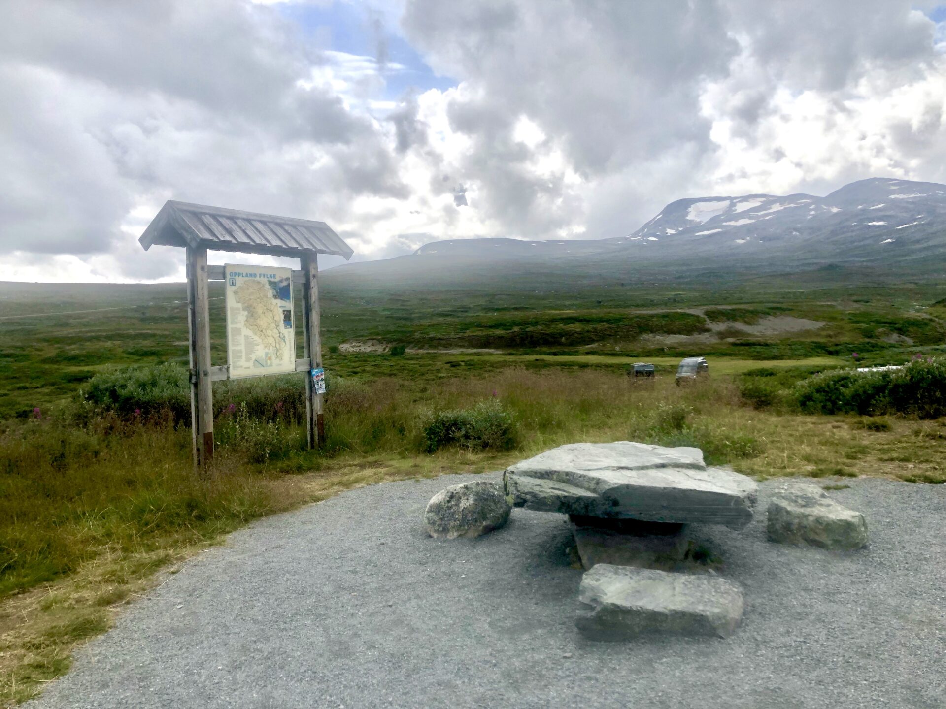
- VALDRESFLYE – 1389 masl
- STEINPLASSEN – Rest area and viewpoint
- LEIRUNGSMYRIN
- VARGEBAKKANE – Rest area and viewpoint
- GJENDE AND SURROUNDINGS
This drive was the second of the eight Norwegian Scenic Routes I visited last summer. I started from my hometown Stavanger, driving through part of the beautiful Hardanger area. The first scenic route was Hardangervidda which I also have visited before. (the article: Hardangervidda scenic route.)
On my way from Geilo to Beitostølen, the starting point of the scenic route Valdresflye, I visited some old churches of interest. My first stop was the old church of Hol, a 15 min drive from Geilo.
THE OLD AND NEW CHURCH IN HOL
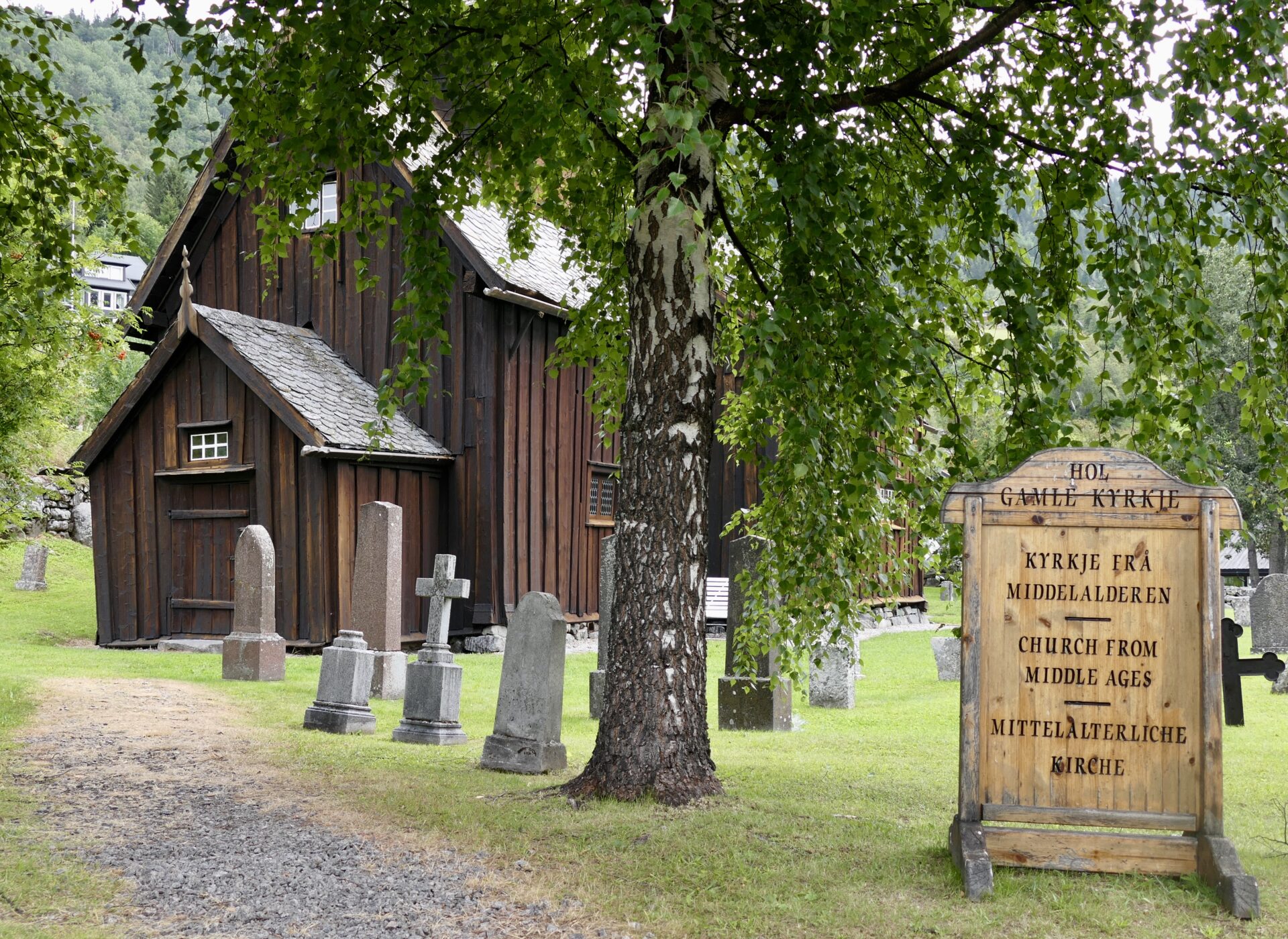
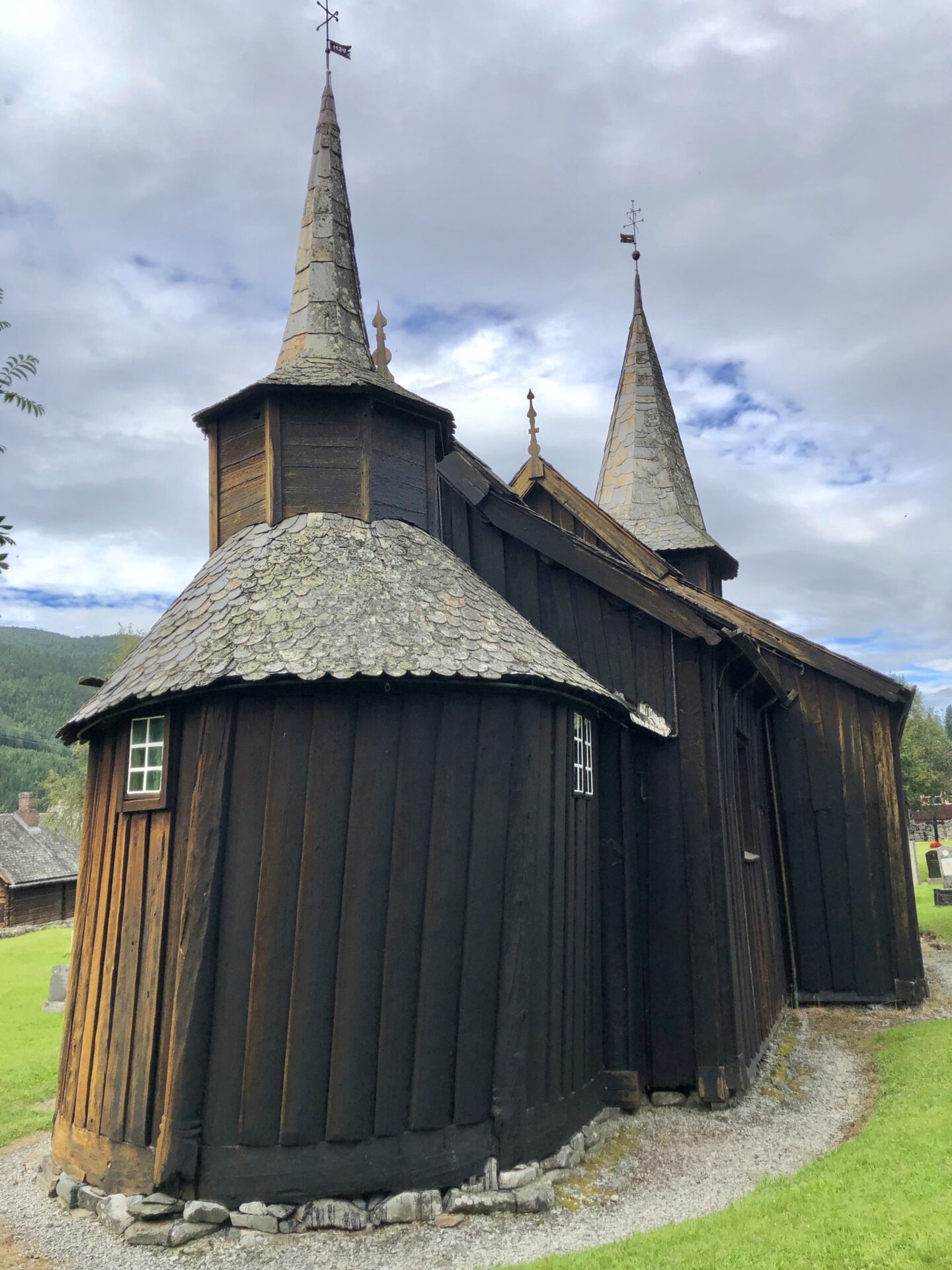
HOL GAMLE KYRKJE – HOL OLD CHURCH
The church has an idyllic location at the northwest end of Holsfjorden, which is not a fjord but an inland lake, great for fishing trout.
Hol Old Church is presumed to date from the 13th century and is the oldest parish in Hol. Only the apse, the eastern round part, now the sacristy, is preserved from the original stave church.
The church was expanded several times and got its present shape in 1799. Wood shingles covered the roof until 1838-40, when slates were laid. The church floor is still mainly large planks taken from the old stave church.
The church was closed when I visited, so I did not get to see the old interior. The pulpit and baptismal font are from the Renaissance period (1697), and the altarpiece is from 1703.
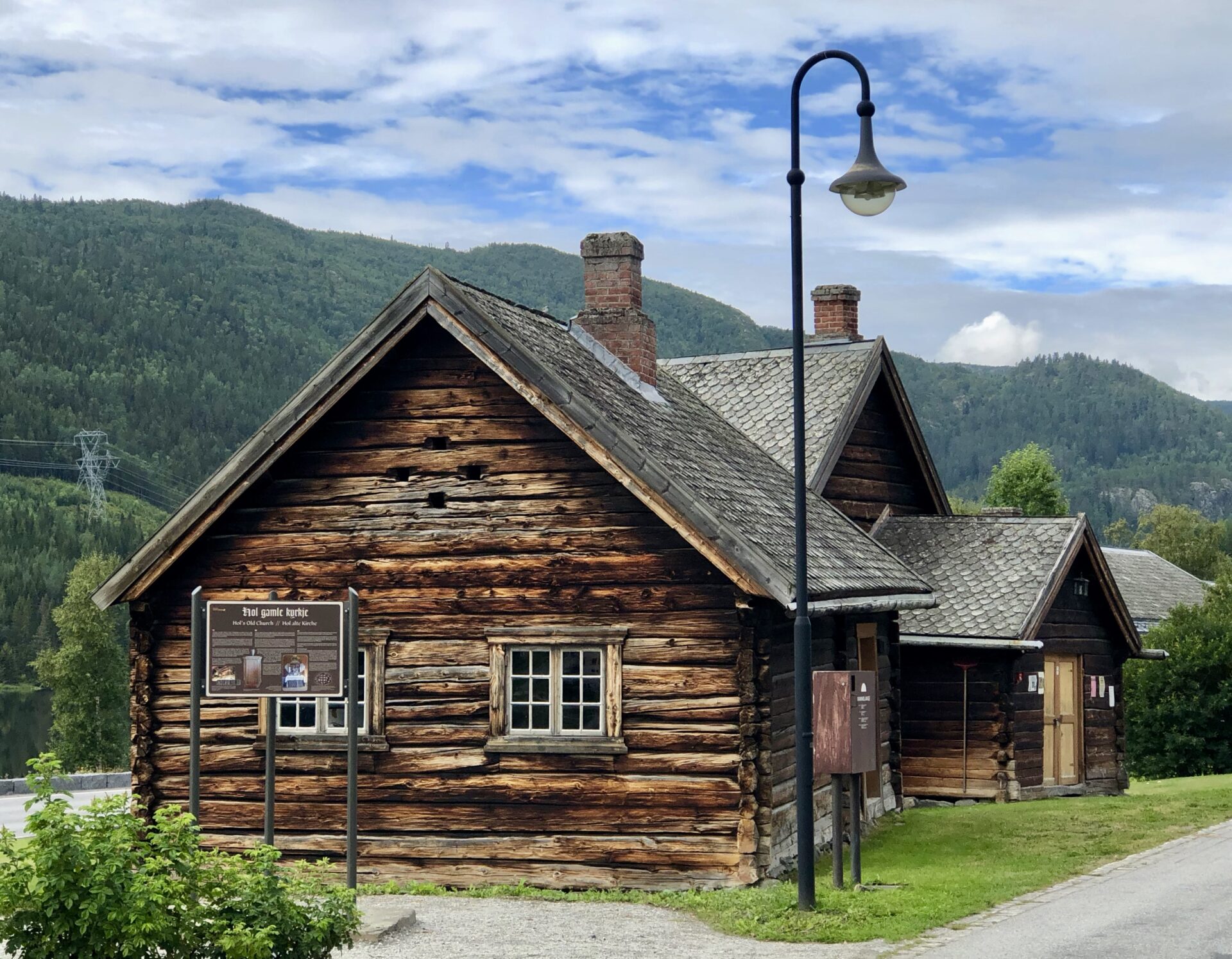
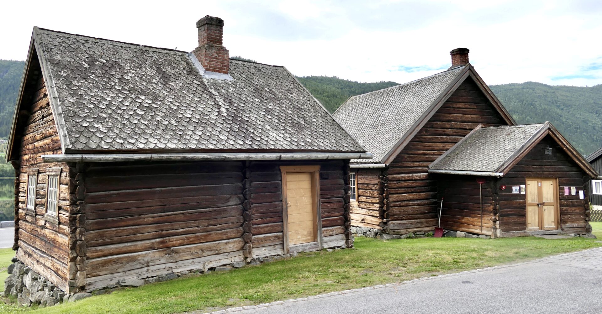
Across from the old church are two old buildings; Kyrkjestugu and Prestestugu. Kyrjkestugu, the church living room, is the most significant part of the two buildings built in 1815. Prestestugu, the Priest living room, was built in 1844 for the priests on their official journeys to Hol.
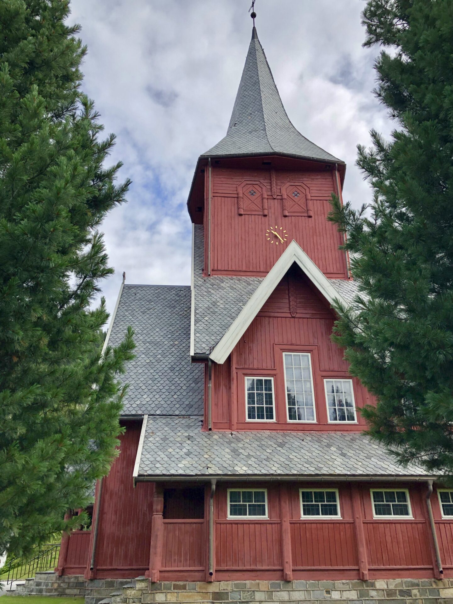
HOL KYRKJE – HOL CHURCH
At Hagafoss, the southeastern end of Holsfjorden is the newer Hol Church, built in 1924. It has beautiful stone-glass windows.
Hol Church is the biggest church in the municipality, with seats for 500 people. Architect O. Stein designed the church with elements like the tower and circular part against the east, reminding of the old church in Hol Centrum.
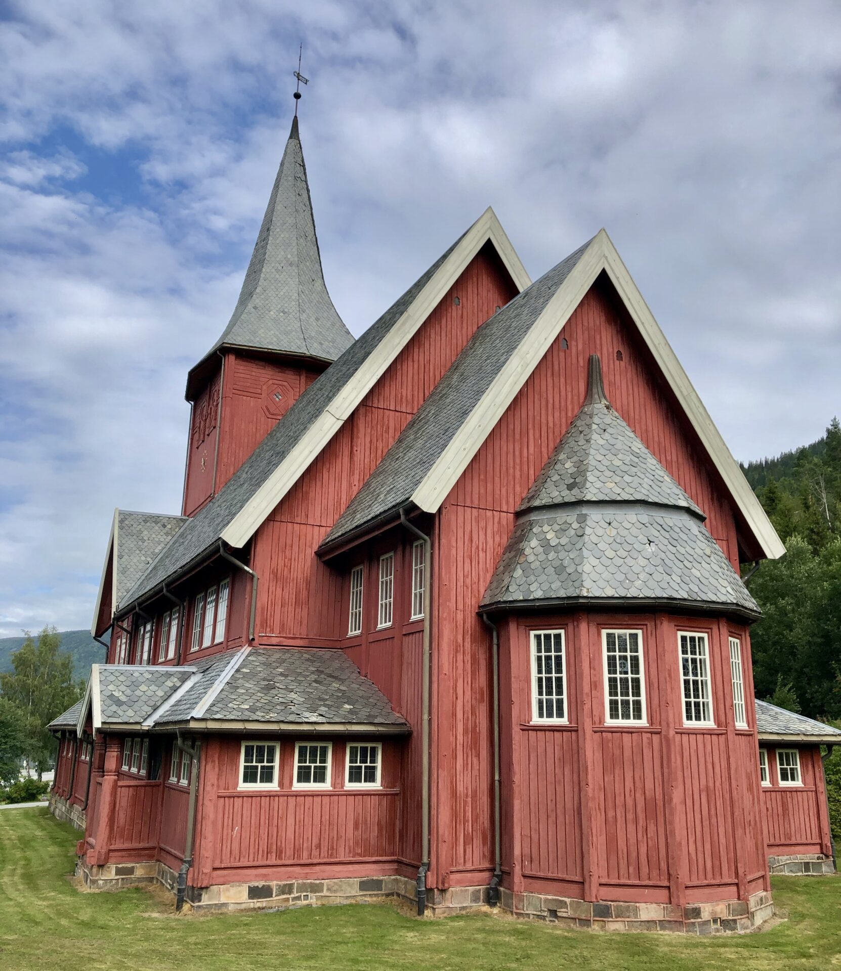
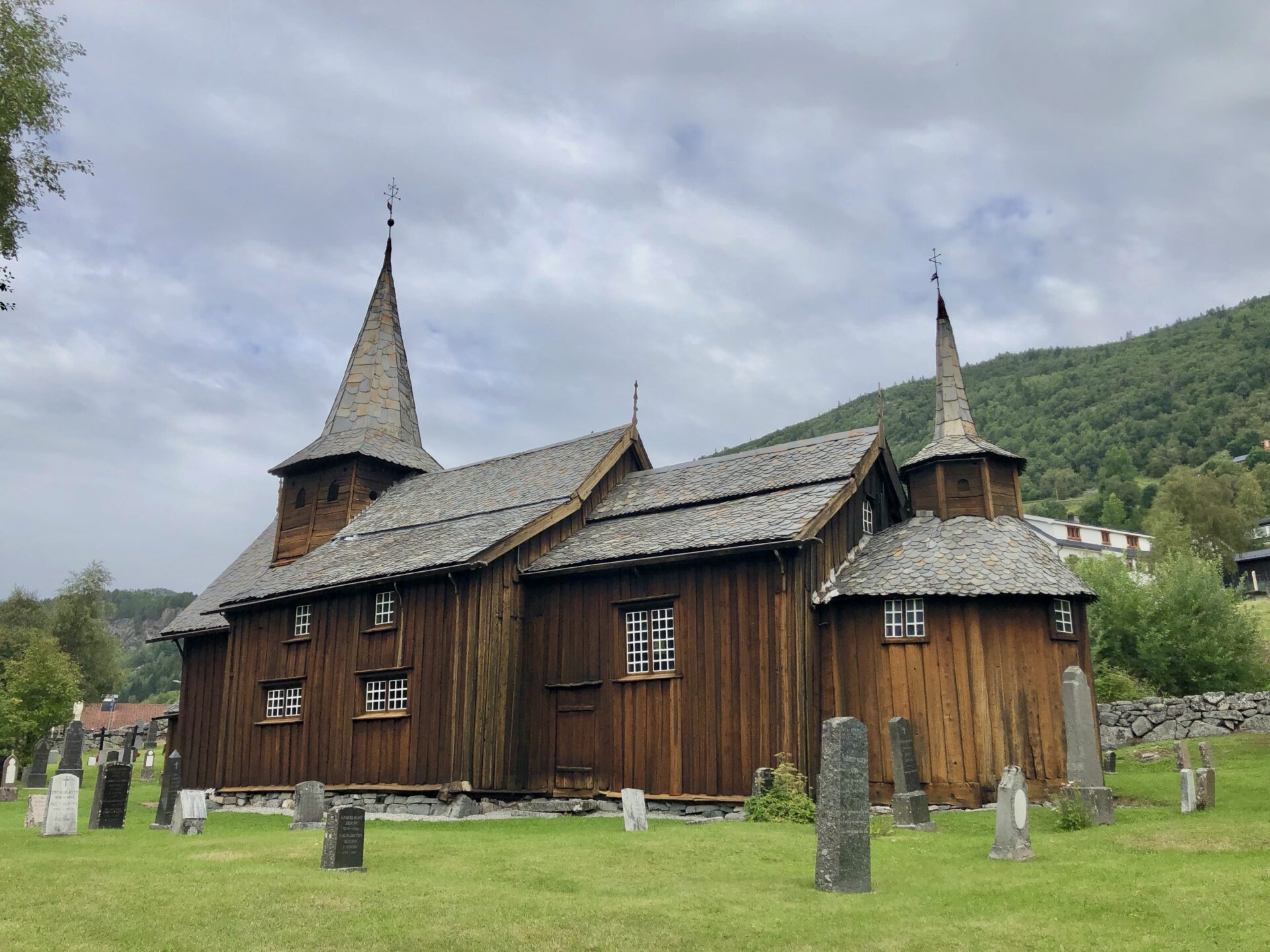
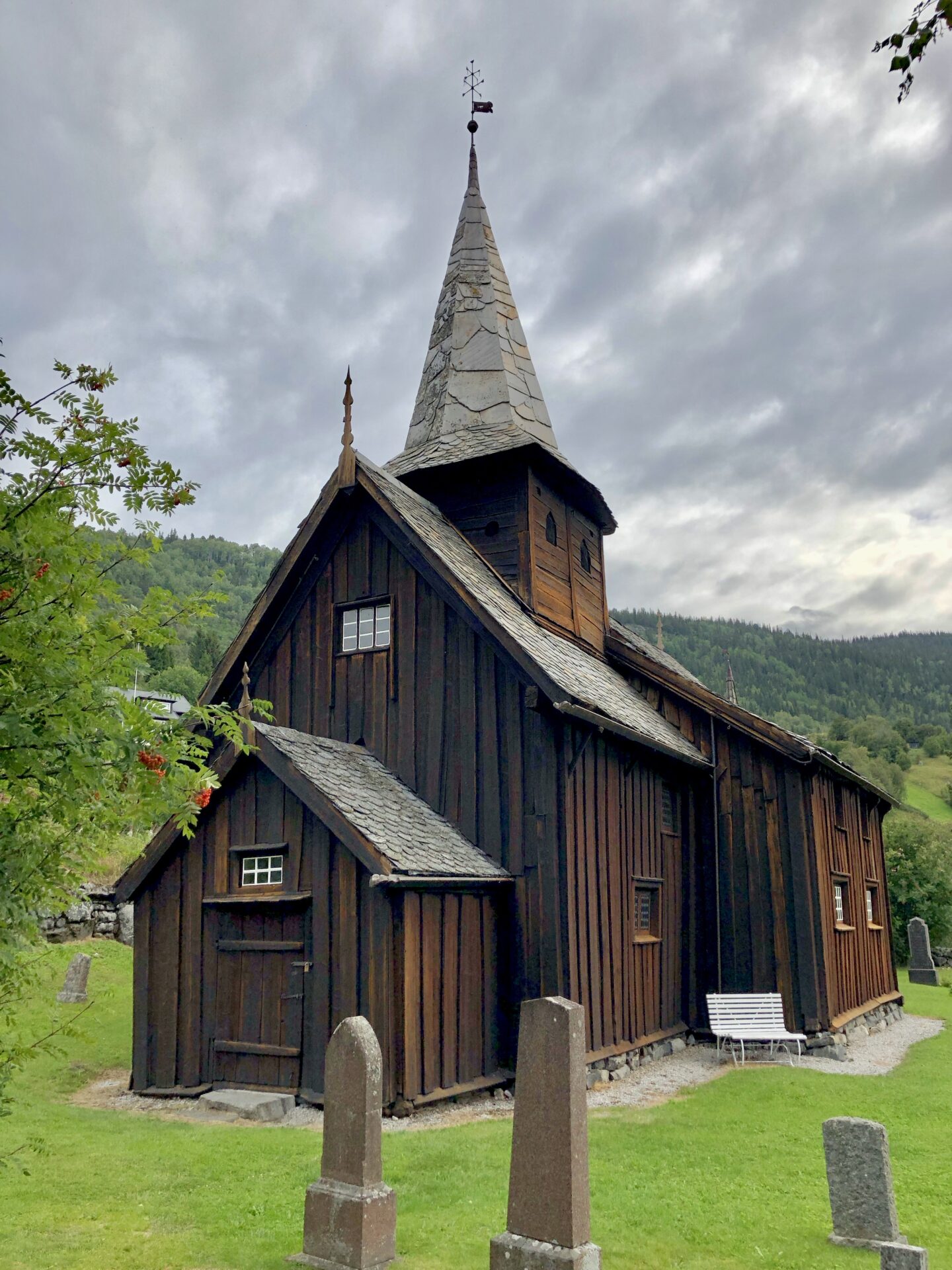
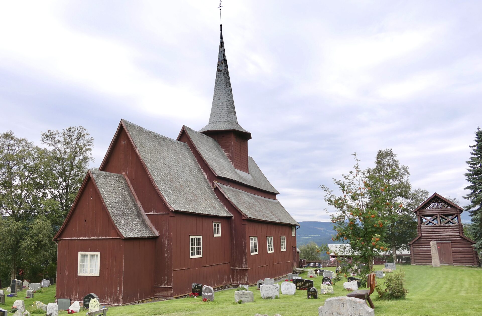
HEGGE STAVKIRKE –
HEGGE STAVE CHURCH
After 2 hours of driving from Hol Church, I came to another stave church in Hegge. I had then travelled along road RV51 northwards from Gol, passing Fagernes on my way.
Hegge Stave Church is about 13 km south of Beitostølen, where the scenic route Valdresflye starts.
Hegge Stave Church dates back to 1216 but is still the main church in Øystre Slidre. It is built with materials taken from two previous churches.
The church has eight free-standing interior columns forming an arcade, surrounding a central area with a raised roof.
In the 19th century, the church had several extensions. A restoration in 1924-25 also expanded the church further with a porch and gallery. A restoration in 1924-25 also expanded the church further with a porch and gallery.
BEITOSTØLEN
Beitostølen is a popular tourist destination that offers summer and winter activities and sports. There are several restaurants, bars, shops and accommodations.
Beitostølen lies at the entrance of Jotunheimen with the characteristic Bitihorn mountain as its recognizable landmark.
There are good hiking opportunities in summer, and in addition to DNT’s route network in Jotunheimen and Huldreheimen, there are separate marked paths in the surroundings.
In the summer, the alpine area is used for alpine sledge and downhill carting. Other activities include horseback riding, summer husky tours, mountain climbing, fishing and rafting.
In winter, you can strap on your skis right outside the door and go straight out into a beautifully groomed trail network. Beitostølen has an alpine centre with several lifts, and other winter activities include snow rafting, husky tours, and ice fishing.
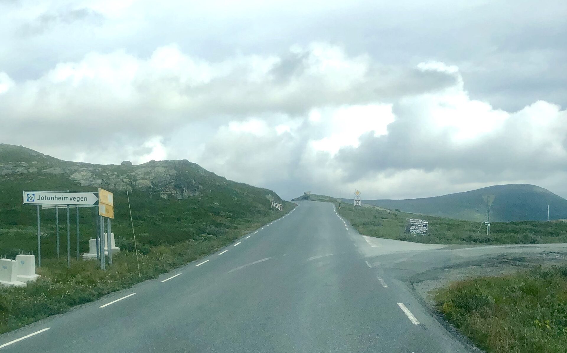
VALDRESFLYE SCENIC ROUTE STARTS
Valdresflye is a mountain plateau in the easternmost part of Jotunheimen in Øystre Slidre municipality, Innlandet county. County Road 51 crosses the plateau in a north-south direction. The highest point on the road is 1389 masl, making this Norway’s second-highest mountain pass and road for regular traffic after Sognefjellet with 1434 masl.
In winter, you have access to several 2000-meter stops in the area around the road. That is why Valdresflye is famous for mountaineering on mountain skis and randonnee, and hiking in the summer.
After a small stop at Beitostølen, I drove northwards on RV51 – the scenic route Valdresflye starts.
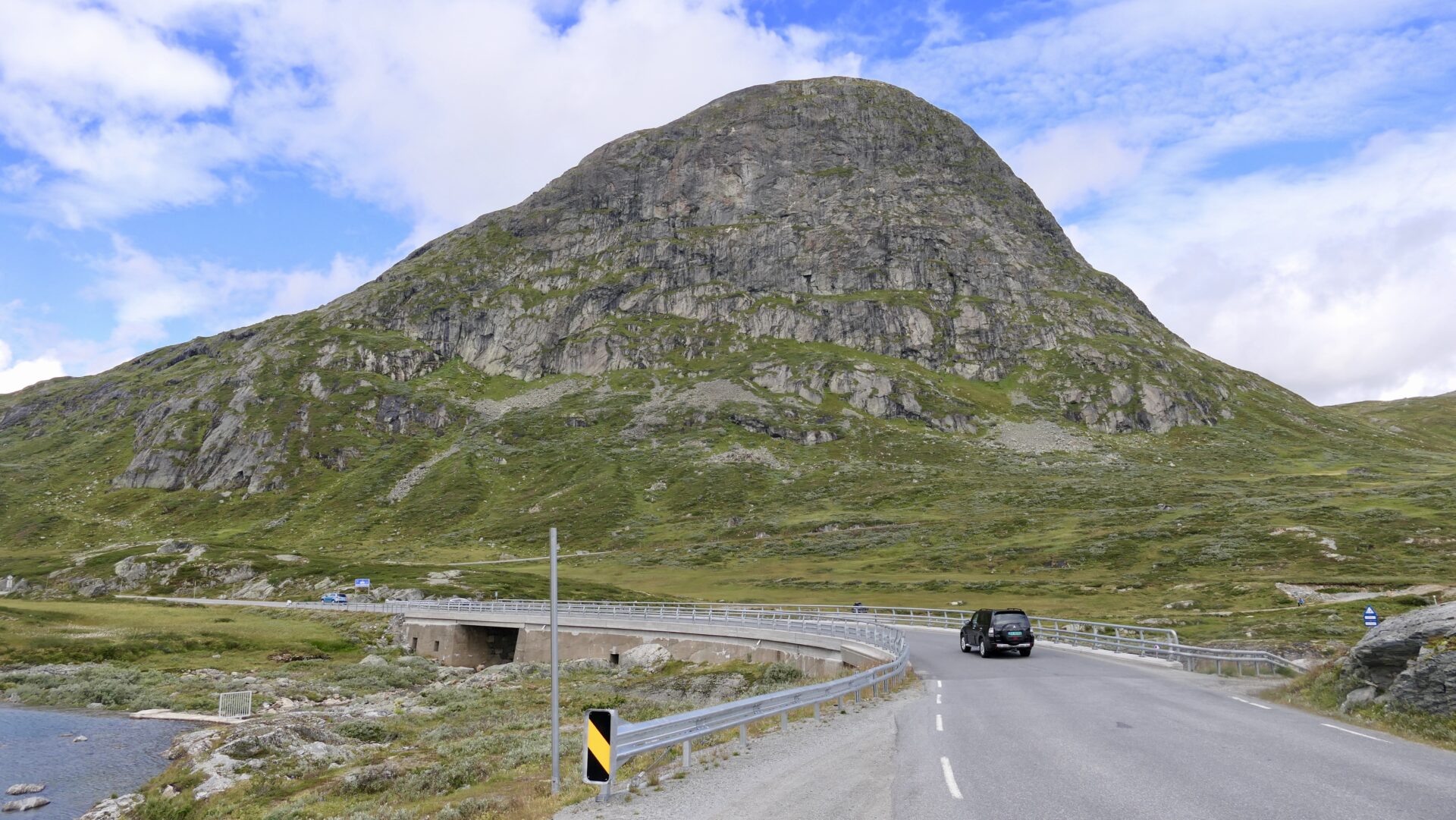
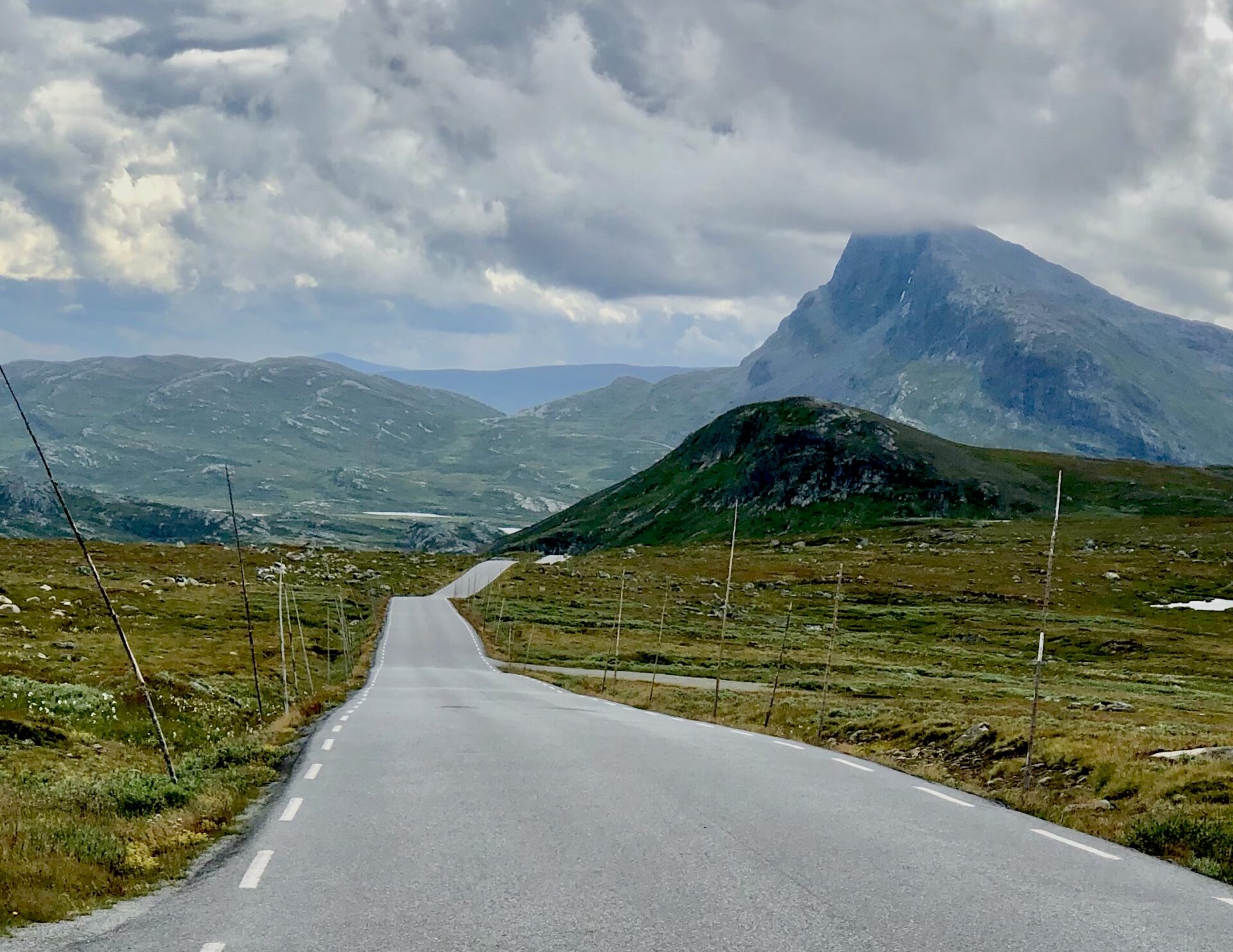
I stopped at a small rest area before passing Bitihorn (1607 masl). We couldn’t see the mountain top as the fog covered it.
Apart from that, there was a nice view westwards around the smaller rock and southwards against Beitostølen.
Another rest area after having passed the Bitihorn.:
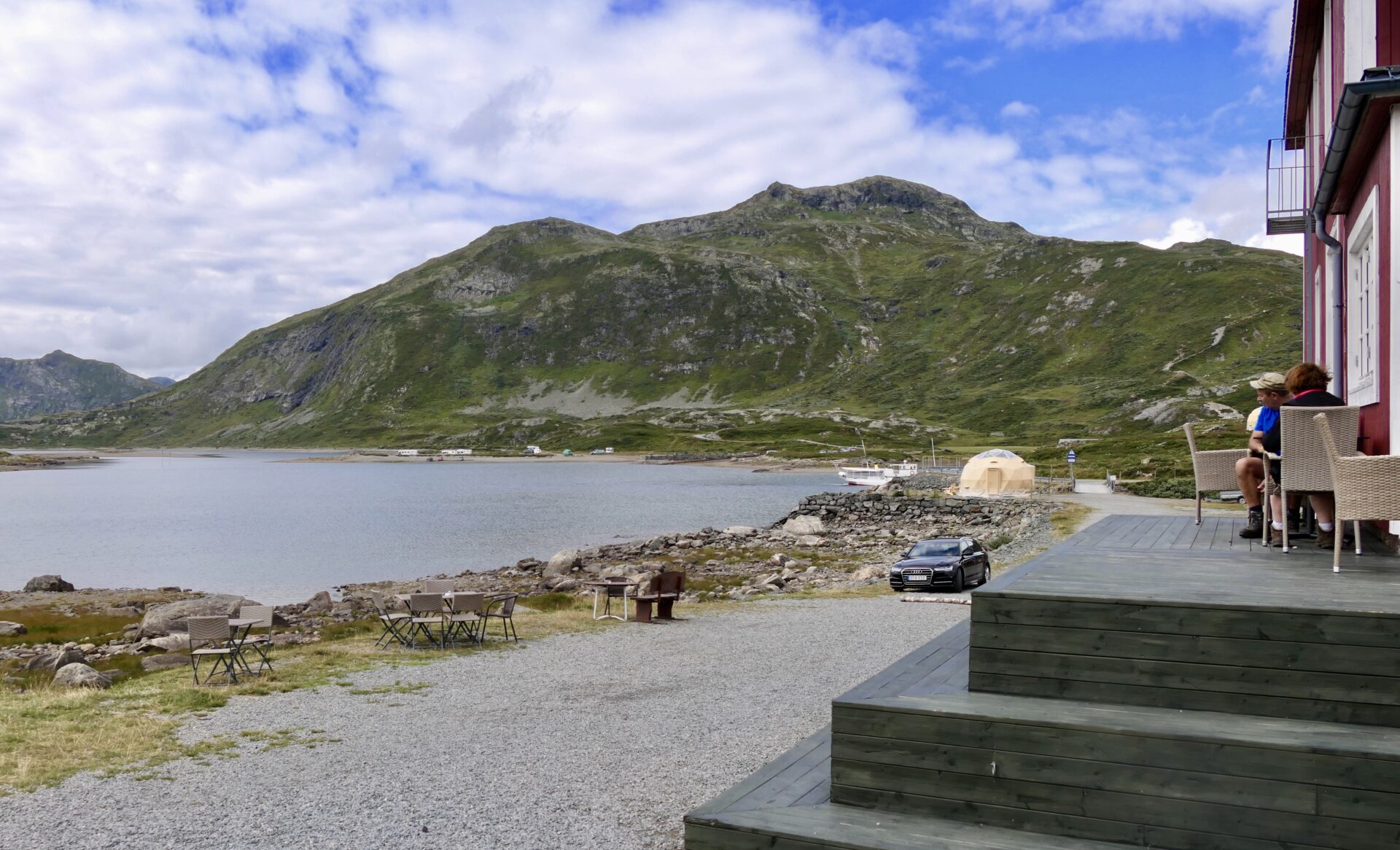
BYGDIN
Around 12 km from Beitostølen is Bygdin – a regulated lake that lies at a level between 1,048 and 1,057 masl. The lake is 25 km long and surrounded by many tourist cabins. On the west end lies Eidsbugarden, on the north side lies Torfinnsbu and on the east side lies the mountain hotel Bygdin Høyfjellshotell. In the summer, these cabins are connected by the boat “MB Bitihorn”. The vessel has operated on Lake Bygdin every summer since 1912. The route between Bygdin and Eidsbugarden has two departures daily.
The most popular hikes around Bygdin are Synshorn, Bitihorn, Besseggen and Svartdalen.
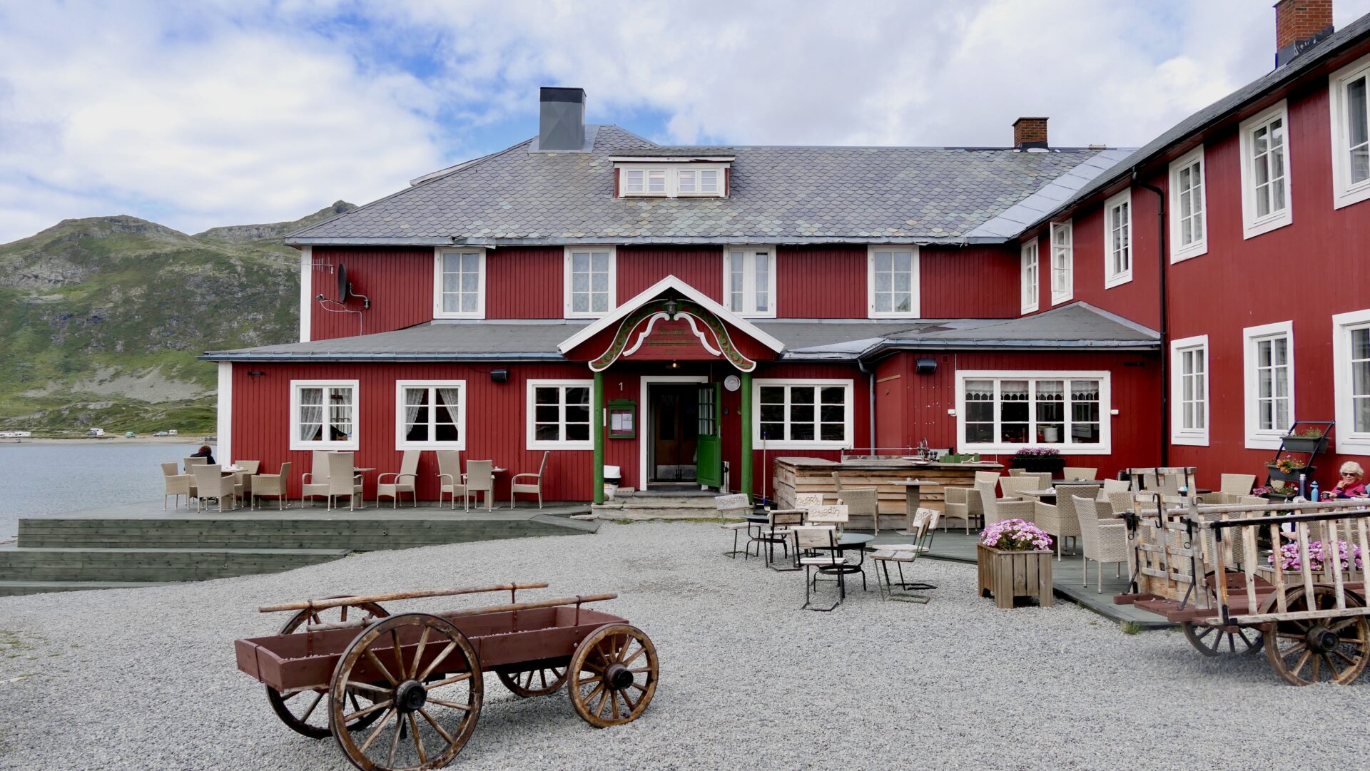
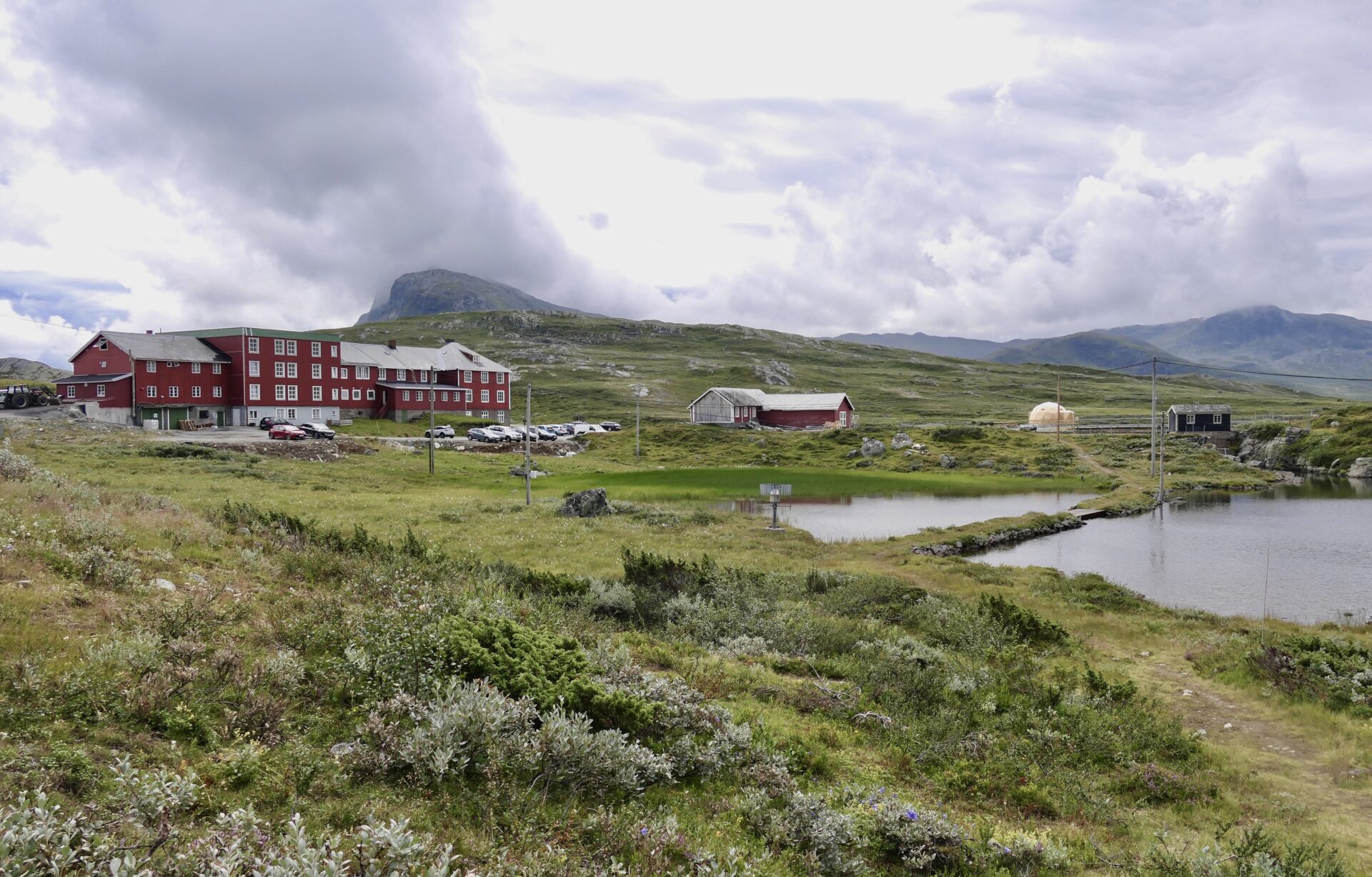
The traditional and family-run Bygdin Høifieldshotel – at the east end of Lake Bygdin and next to Jotunheimen National Park – makes a perfect base for many activities.
Several hiking routes of varying lengths and difficulties and trails lead into Jotunheimen in summer. The area between the Lakes Bygdin and Gjende is called “Gjende-Alps”, which have several 2000-meter-summits.
During winter, the hotel is connected to the extensive cross country trail network of Beitostølen by several groomed trails. From mid-February to Easter, marked back-country skiing routes lead Jotunheimen to Torfinnsbu, Yksendalsbu and over the high mountain plateau Valdresflye to Gjendesheim. Early and late in the season, when the road is open, Valdresflye usually has the first and last cross-country skiing trails in the country on natural snow. In mid-winter, the road is closed.
JOTUNHEIMSVEGEN – THE JOTUNHEIM ROAD
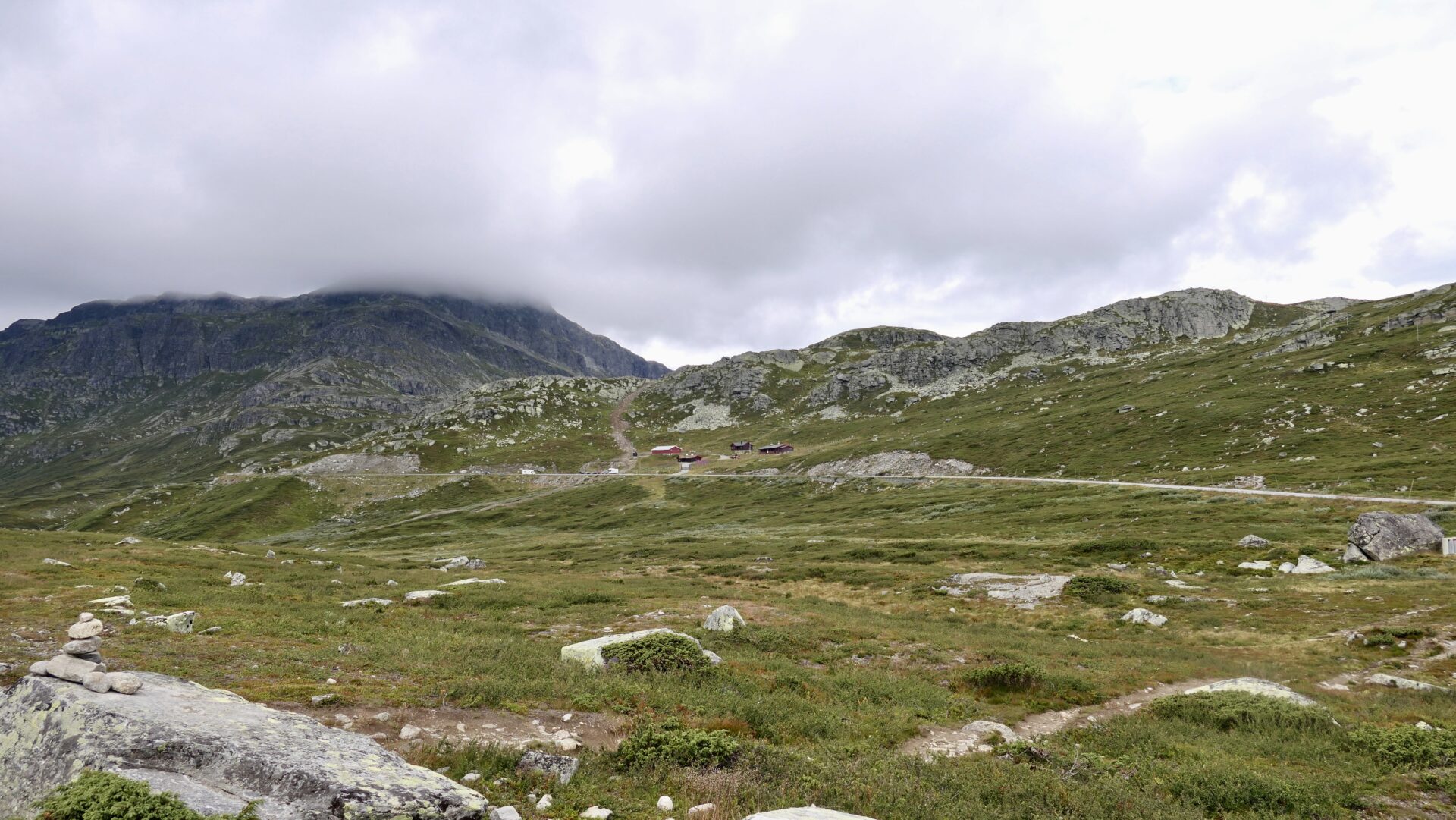
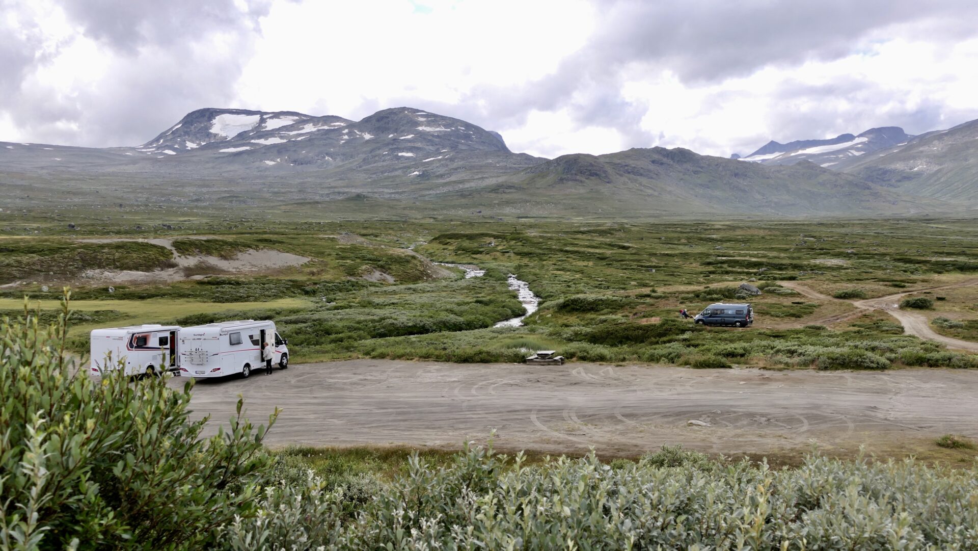
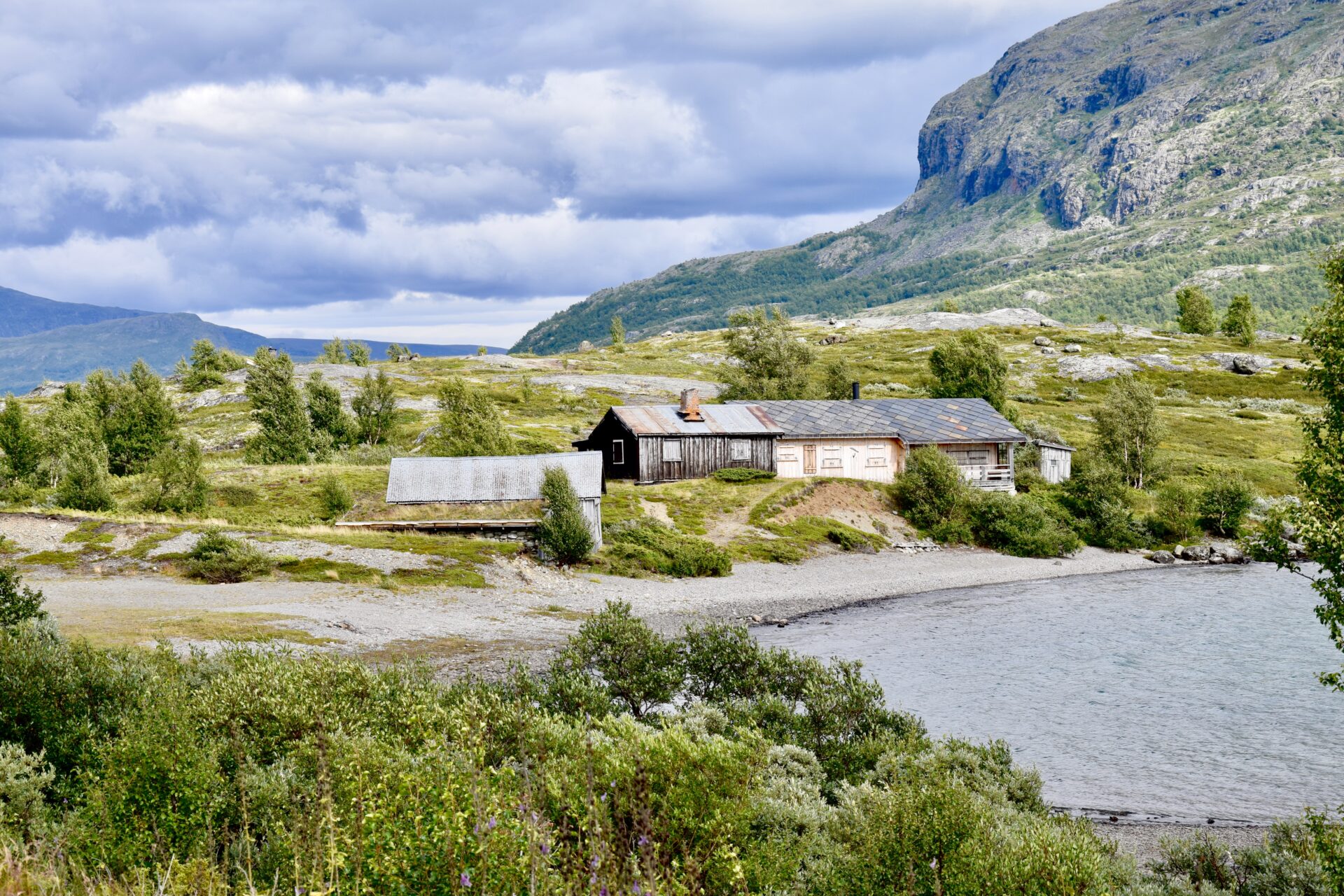
Some kilometres drive north from Bygdin Høifjellshotel, close to the northwestern part of Vinstre lake, is the exit to “Jotunheimsvegen”. This gravel road is a toll road going eastwards, ending in Skåbu. It is 45 km long and winds through open and easily accessible mountain terrain, passing large lakes and views toward spectacular mountain peaks. You can see Herds of reindeer grazing in the area.
Around the Vinstre lake, the are several red, nostalgic summer farms and cabins. I had a great view of this area from Rjupa Rest Area, my next stop.
Among these mountains farms and cabins, you will find Haugseter Fjellstue – a traditional, Norwegian mountain cabin with a history going back 140 years. For generations, it has been known as the “heart” along Jotunheimvegen and offers accommodation, homemade food, and beverages. You have excellent opportunities for canoeing, rambling, peak ascents, fishing, and bicycle trips in the surroundings.
Mountain farms have lined the Jotunheimvegen (road) for more than a century. Today the road is named “the Milk Road”, and you are sure to meet cows, goats and sheep.
Jotunheimvegen is only open in the summer, from June until it snows, generally in October.
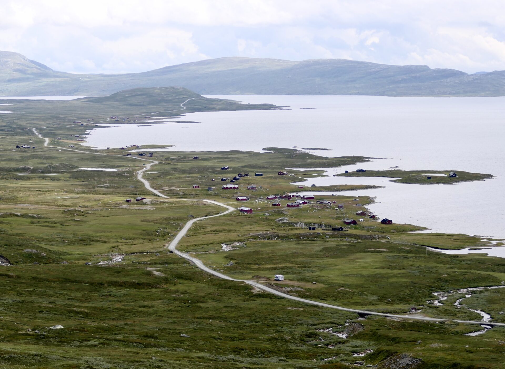
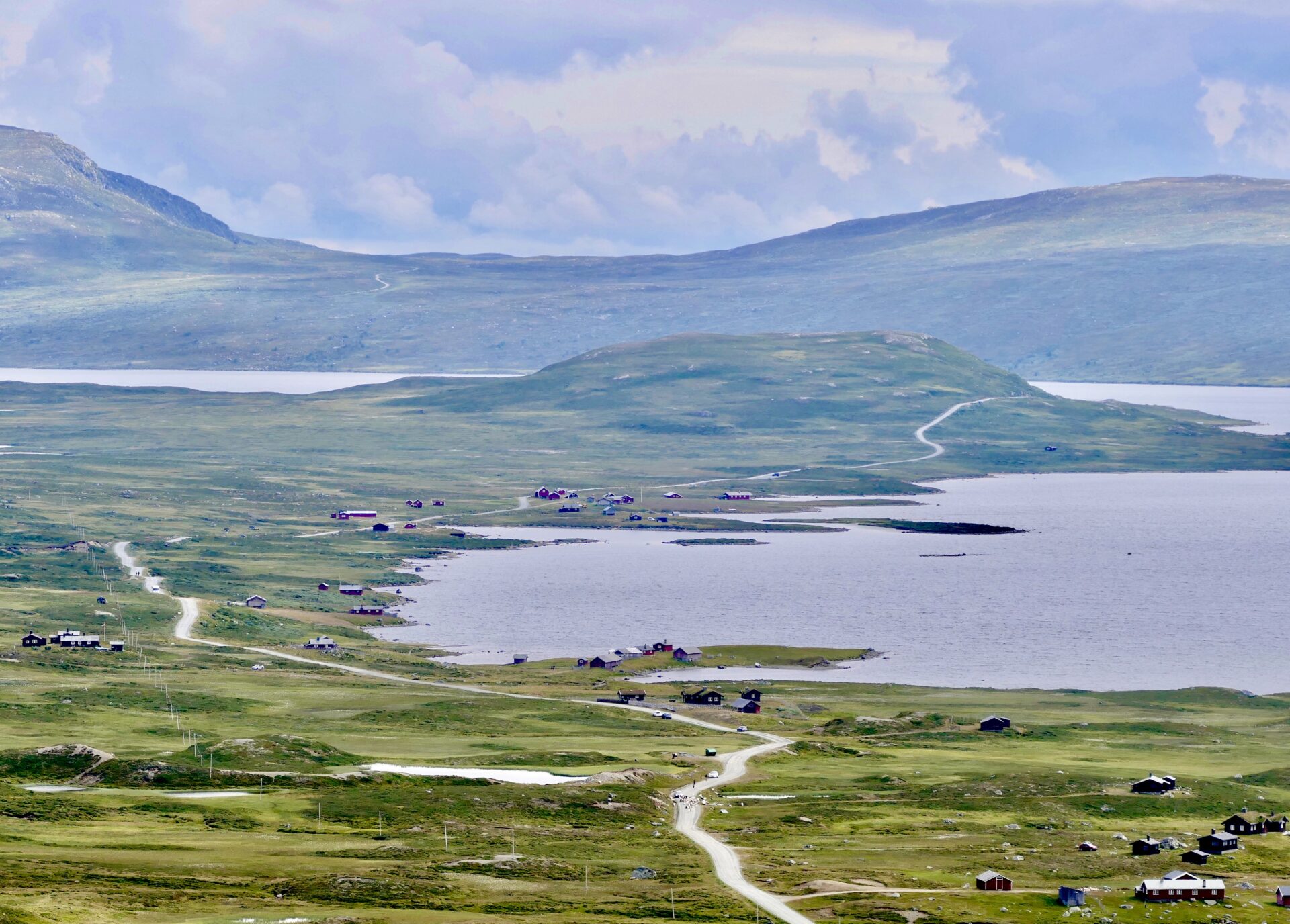
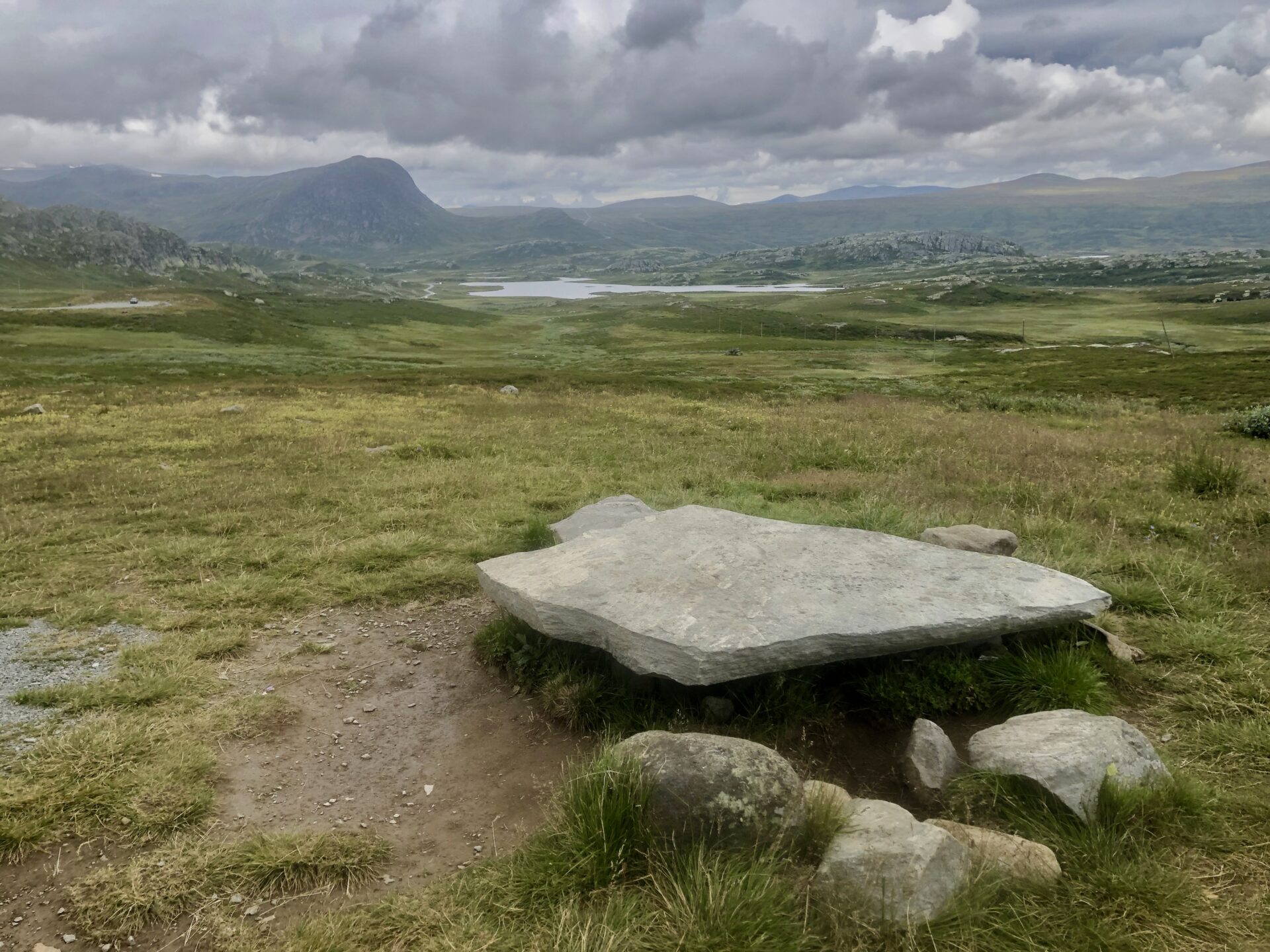
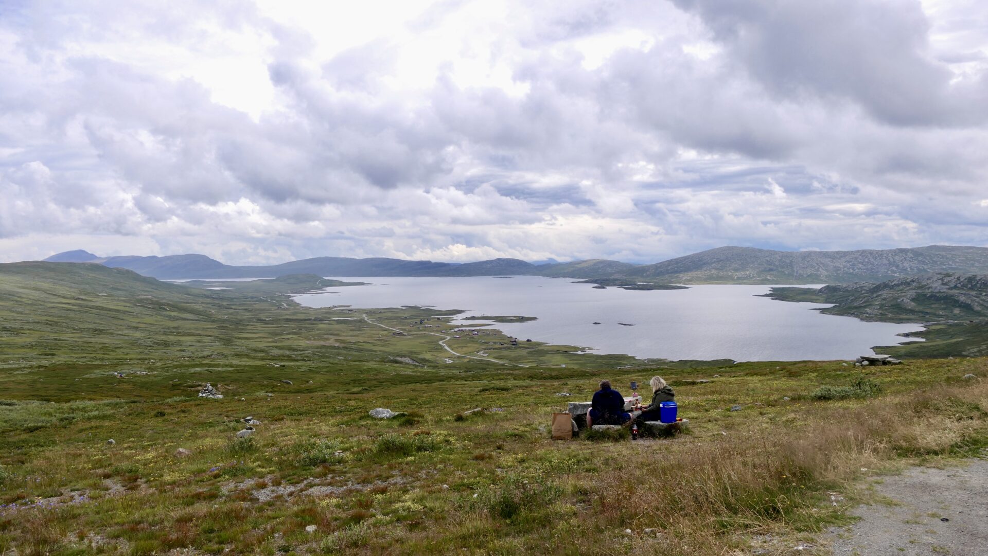
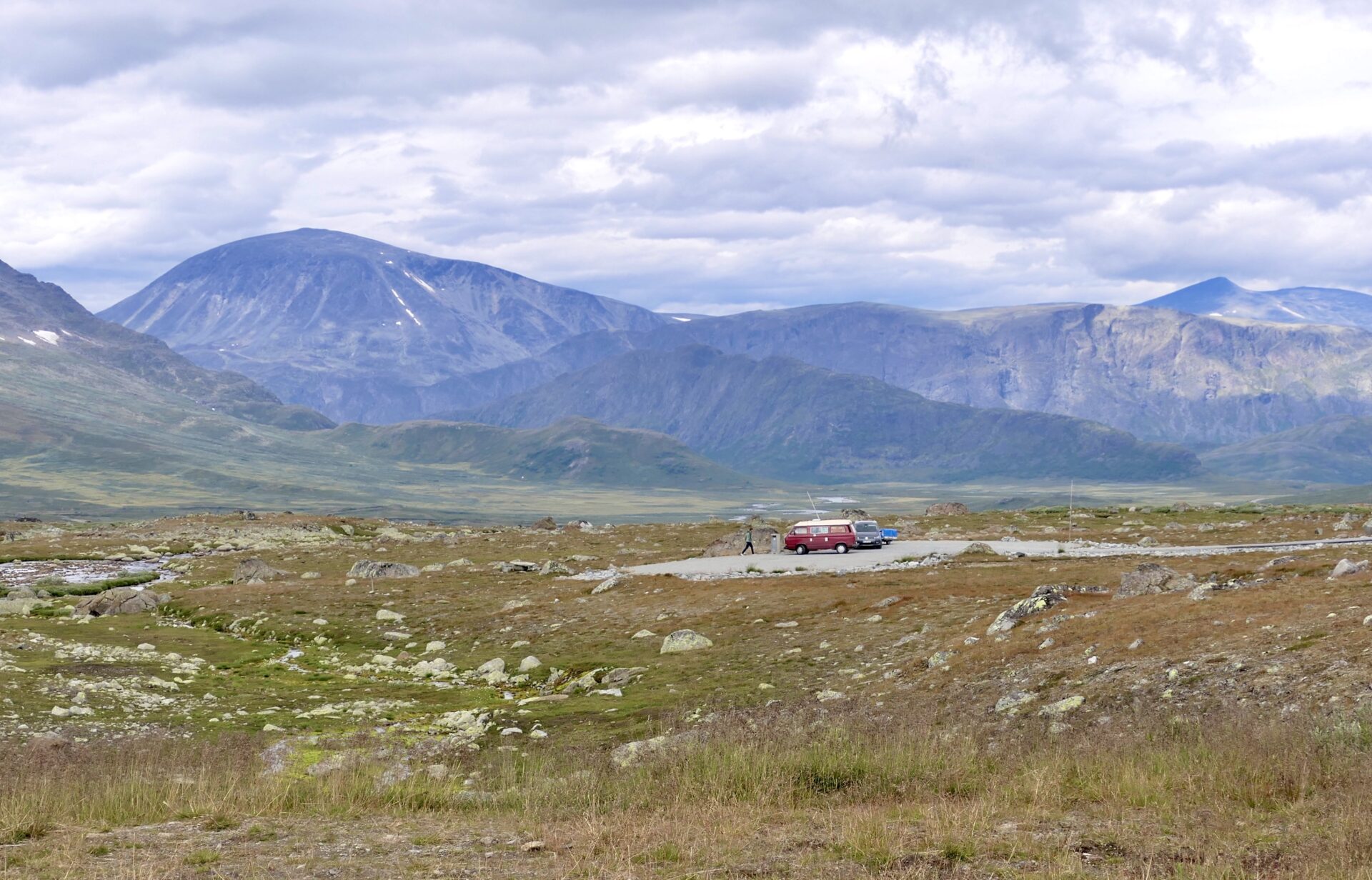
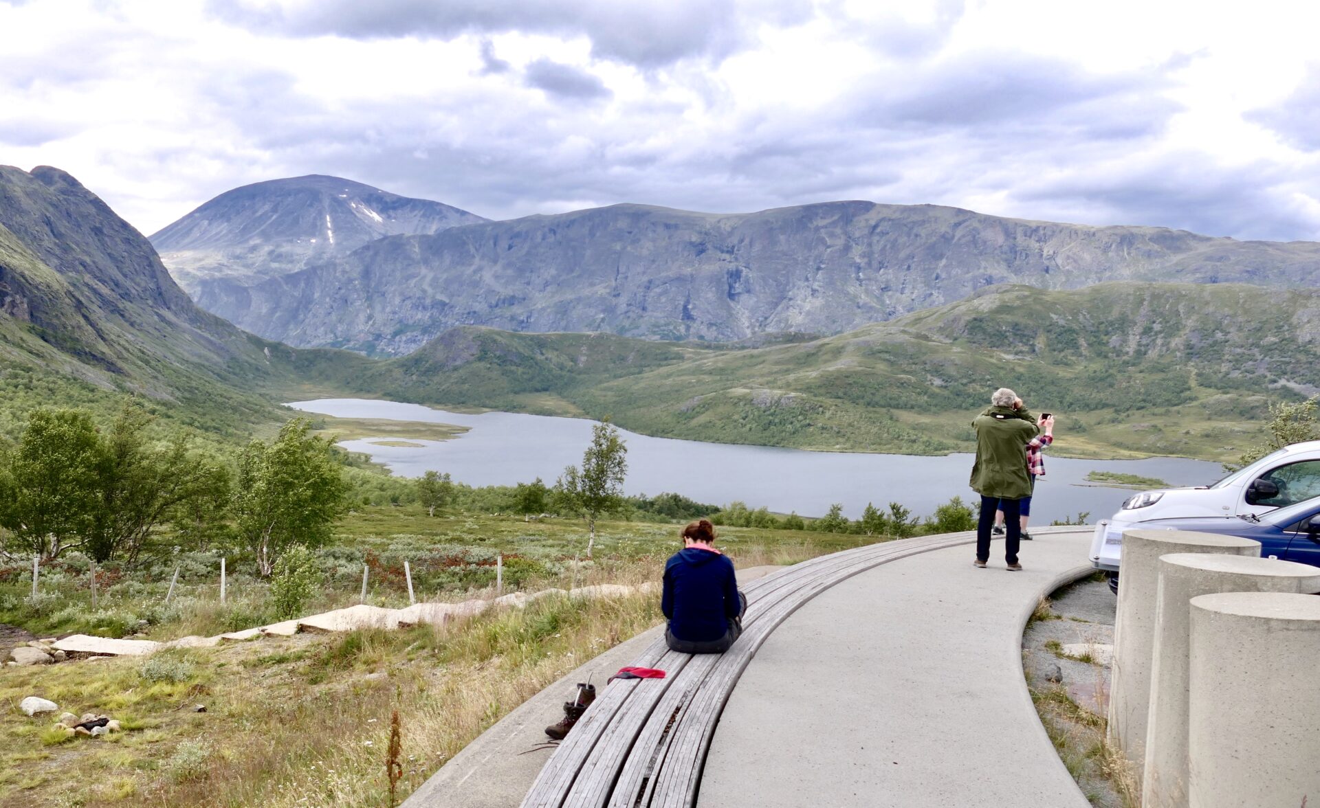
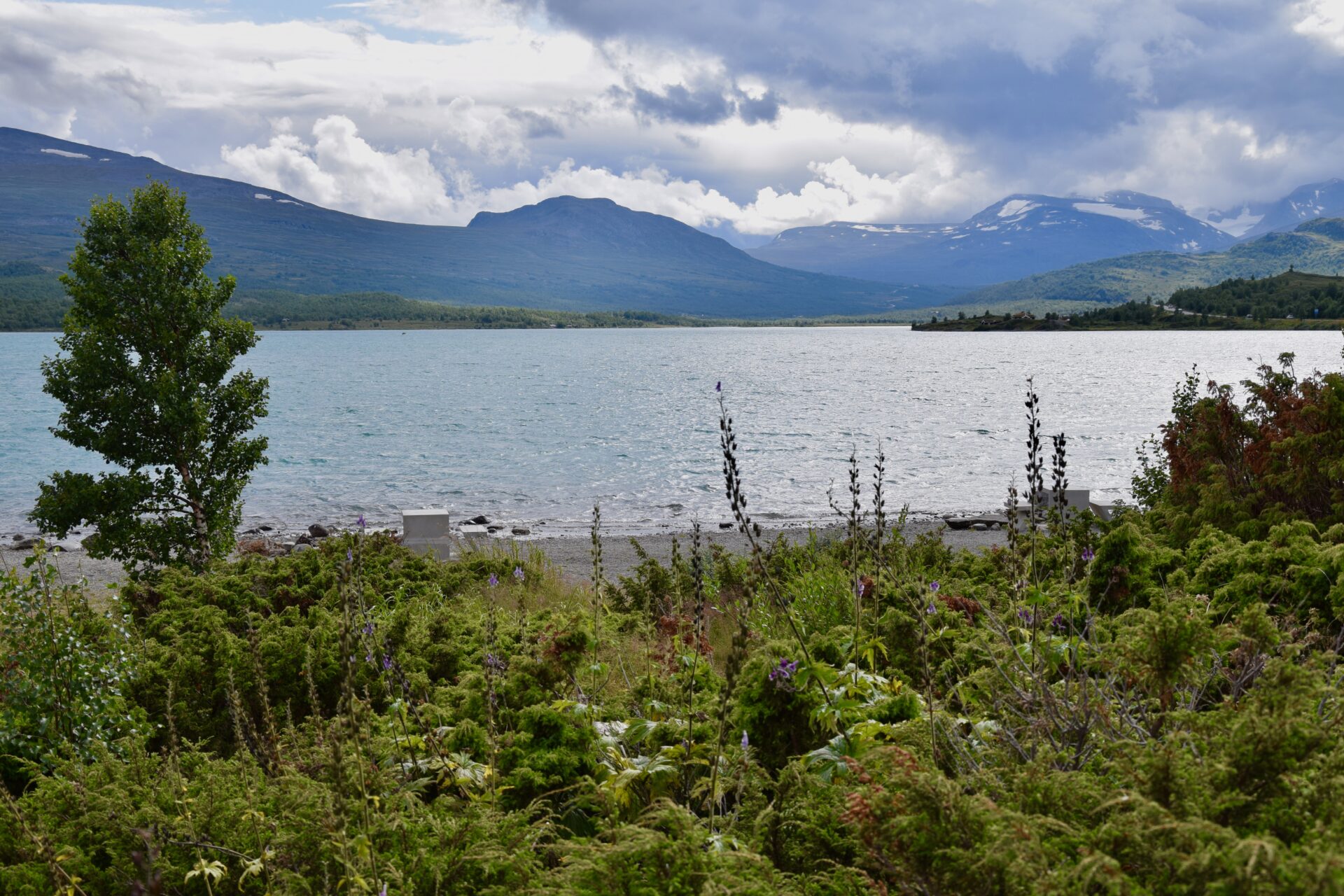
RJUPA REST AREA
As shown above – from the Rjupa rest area, you have a panoramic view of the old mountain hamlets along Vinstervatn lake and the mountain landscape of Valdres valley.
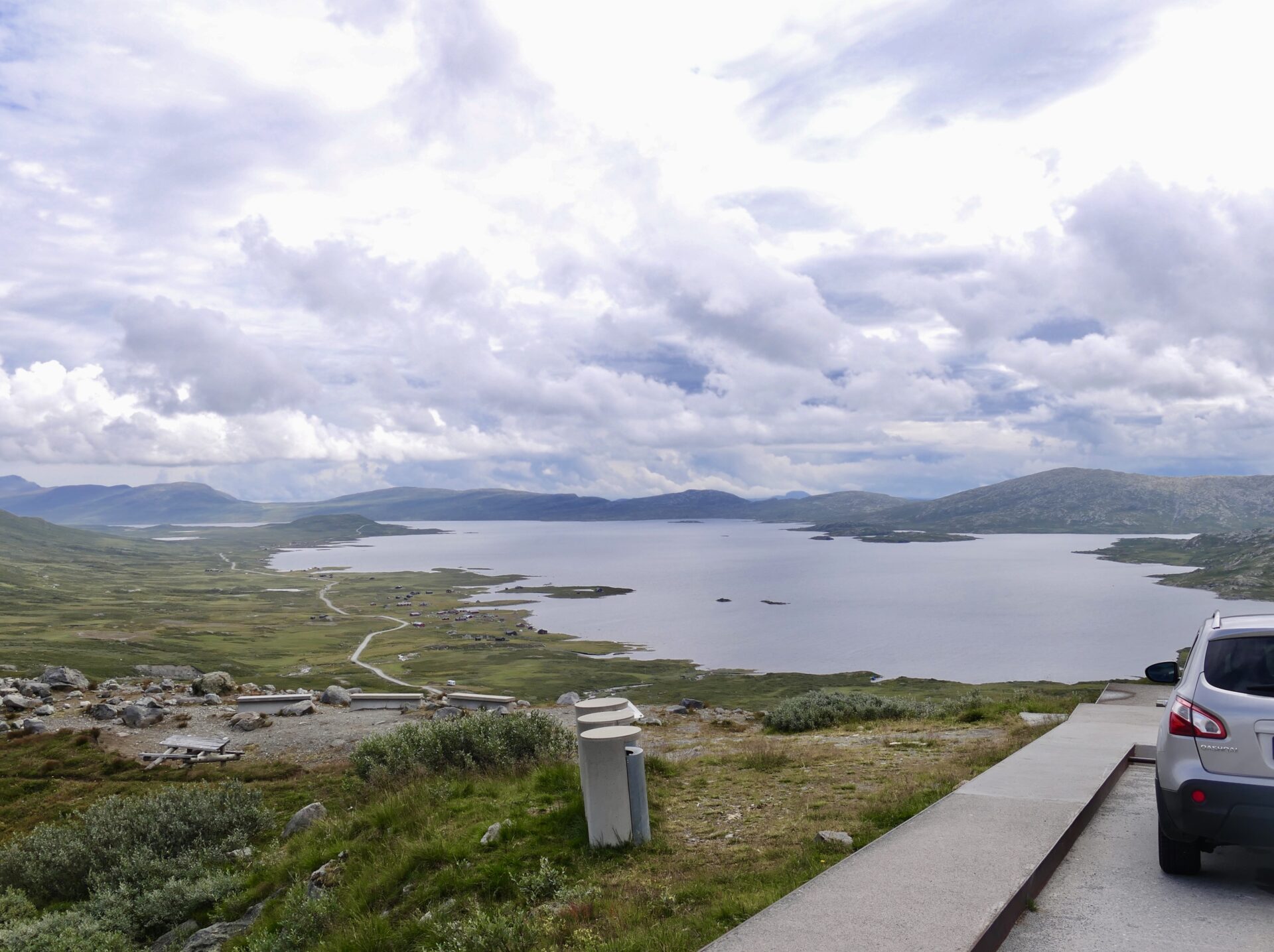

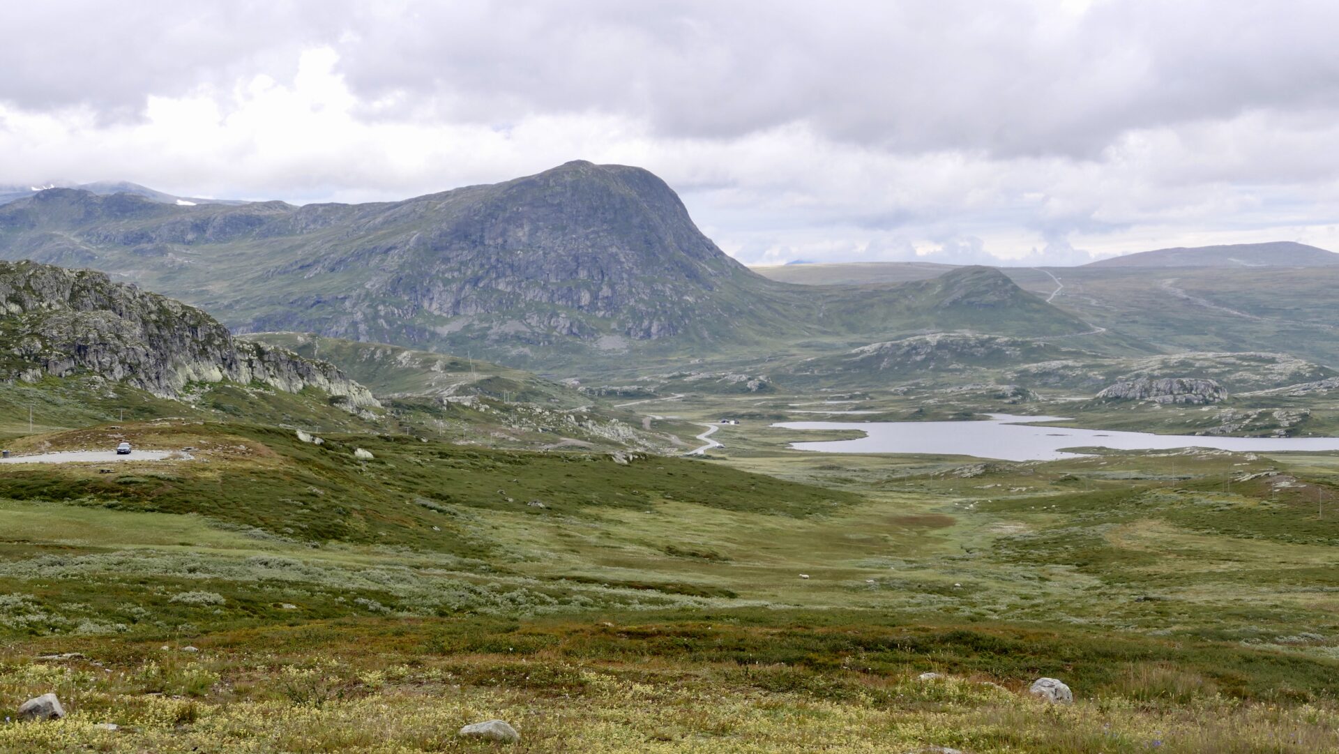
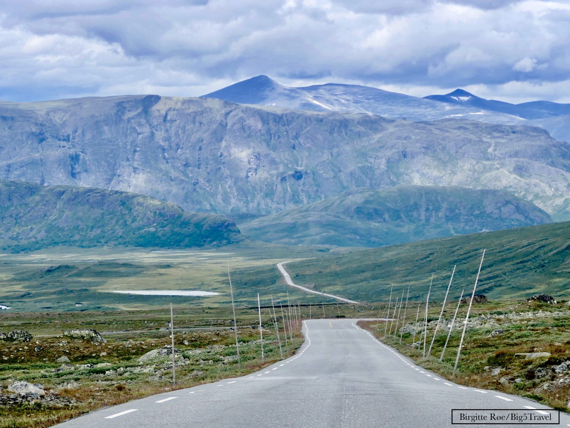
A bit further north, not far away from the highest point on the route, I stopped and got this great view southwards, a better view to Bitihorn :
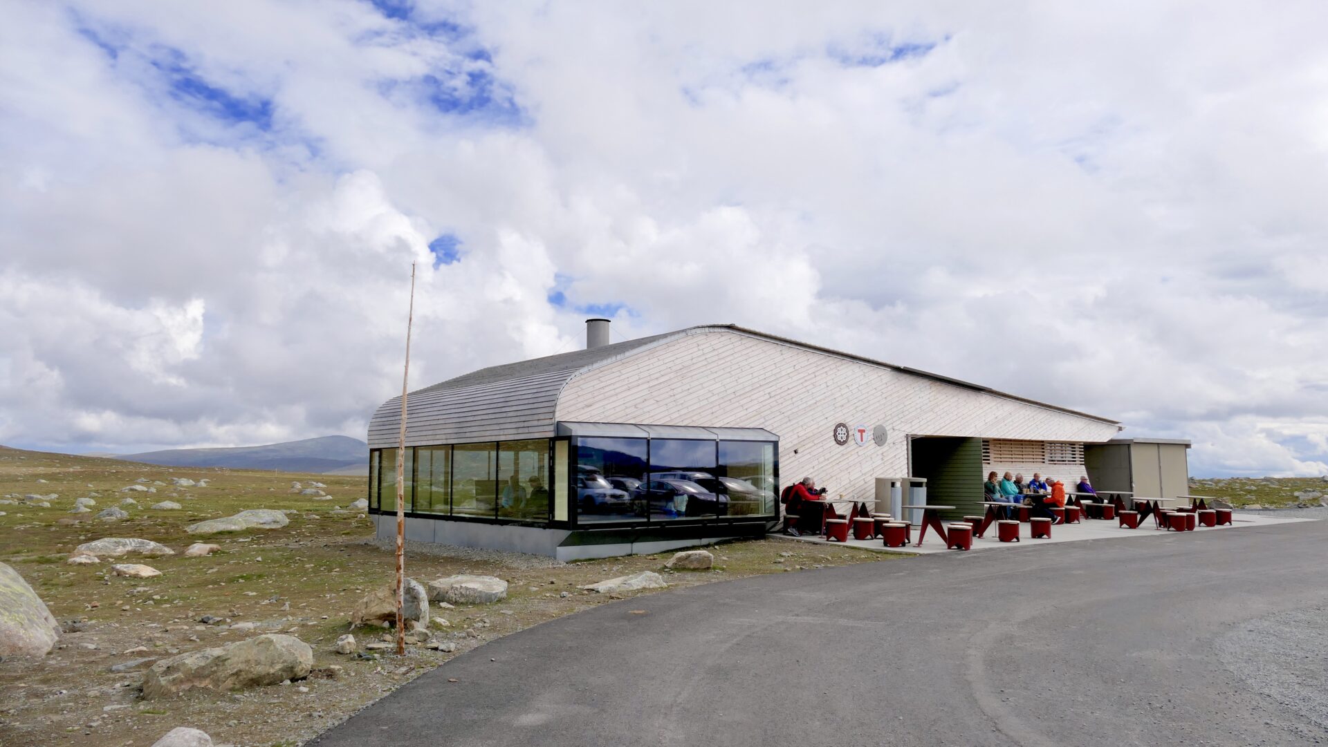
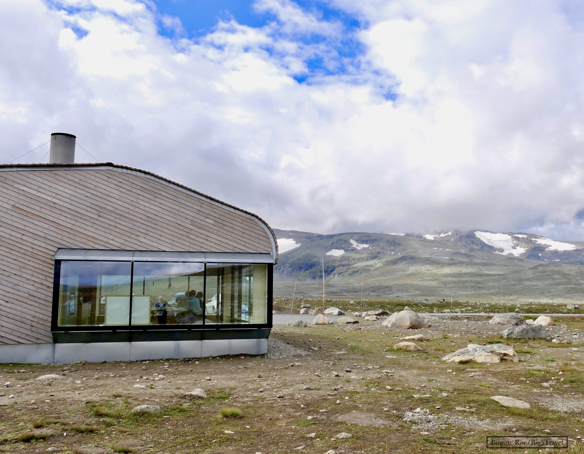
VALDRESFLYE – 1389 masl
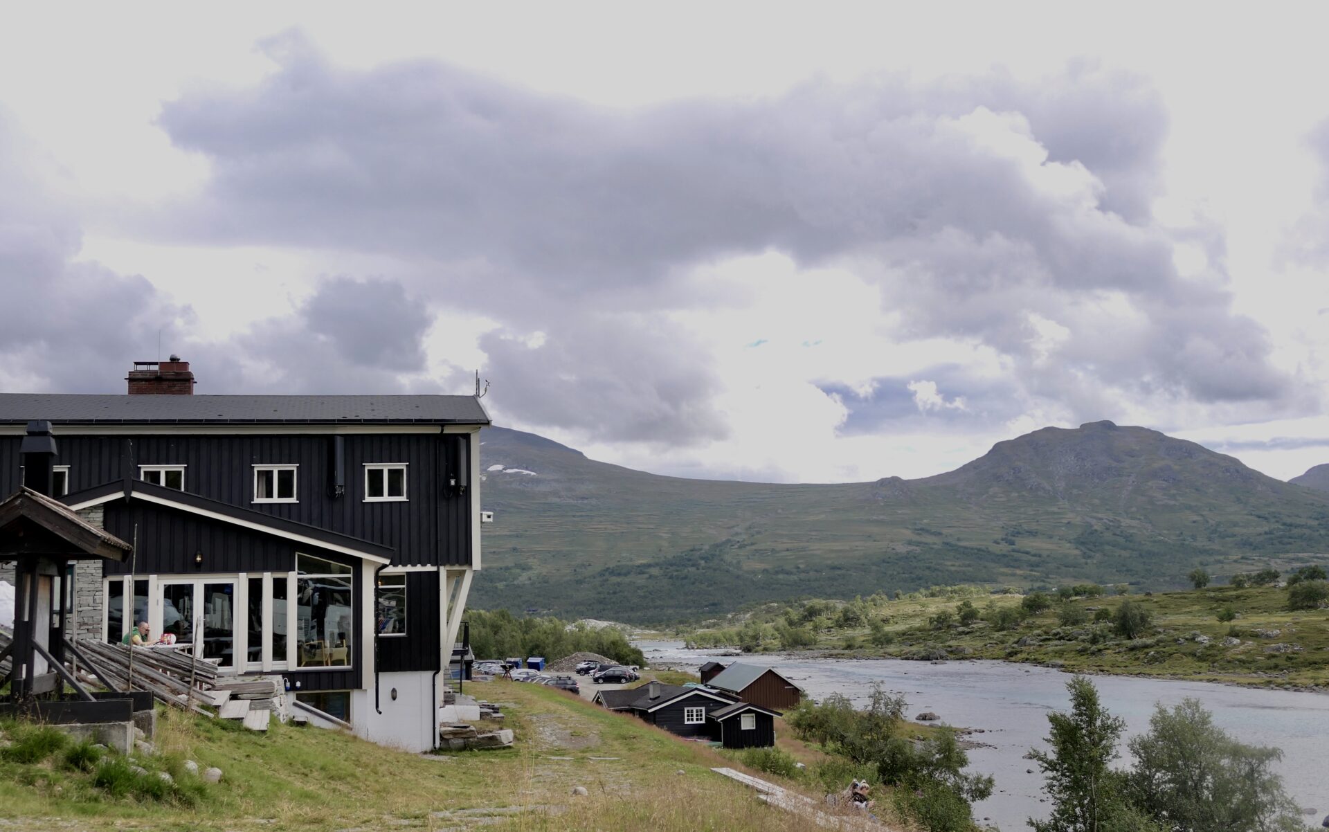
Situated at the highest point of Valdresflye, with panoramic views in all directions, is Flye 1389. The iconic building opened in summer 2020 and is a new attraction along the Valdresflye route.
The building contains long tables with 25-30 seats and large windows facing three directions. The windows have wide benches to enjoy the view. There are also kitchens and toilets, but not accommodation.
In the café, you can enjoy local food from Valdres and Gudbrandsdalen while admiring the view of peaks such as Besshøe, Høgdebrotet, Tjønnholstinden and Rasletinden. This mountain café is run by the Norwegian Trekking Association (DNT) and hosts at Gjendesheim Tourist Lodge.
Flye 1389 is a good starting point for hiking or cross-country skiing, and here you can also rent equipment for such activities.
JOTUNHEIMEN NATIONAL PARK
The Jotunheimen National Park, west of the road FV51, is home to all Norwegian mountain peaks more than 2,300 metres above sea level. Jotunheimen is a paradise for ‘peak baggers’. Galdhøpiggen (2,469 metres) is the tallest and the most visited, while Hurrungane offers legendary climbing peaks, with Store Skagastølstind taking pride in place.
These mountain peaks are best seen from the scenic route Sognefjellet, which runs along RV55 west of Jotunheimen National Park.
Mountain tourism in Jotunheimen began as far back as 200 years ago, and today there is a well-developed network of trails with mountain cabins and lodges to stay in at, for instance, Gjendebu, which is close to Rv 51 in the north of this route.
Other mountains peaks over 2000 m which is close to the Fv. 51 are Høgdebrotet, Tjønnholstinden and Besshøe.
The national park has high peaks, lush mountain valleys and mountain lakes where you can try your luck at fishing. Emerald green Gjende is widely considered the most beautiful of the lakes, and visitors flock here every year to take the famous mountain hike over the Besseggen ridge. Many plant species grow to record heights here, and several prey species nest in the steep mountainsides.
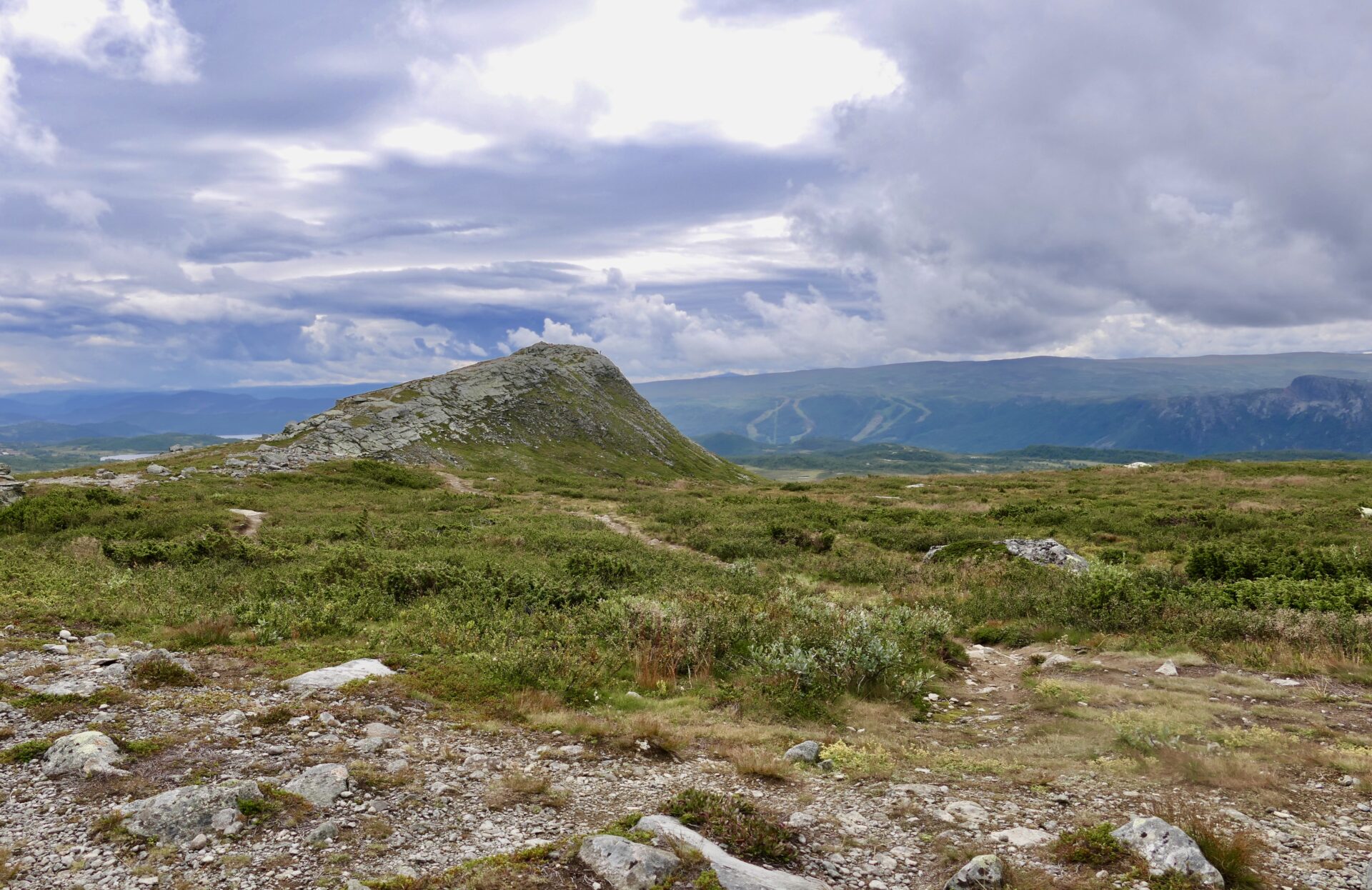
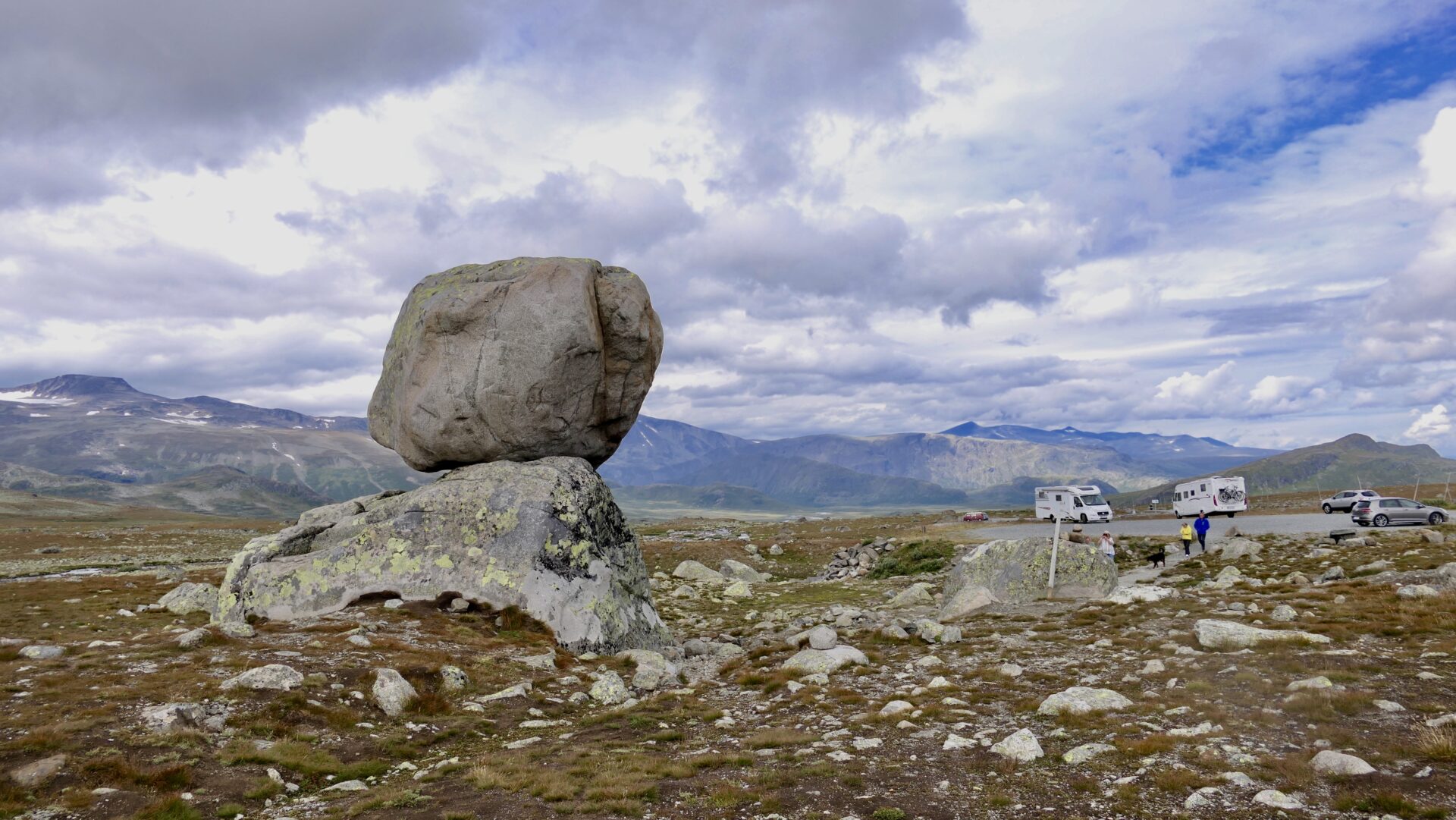
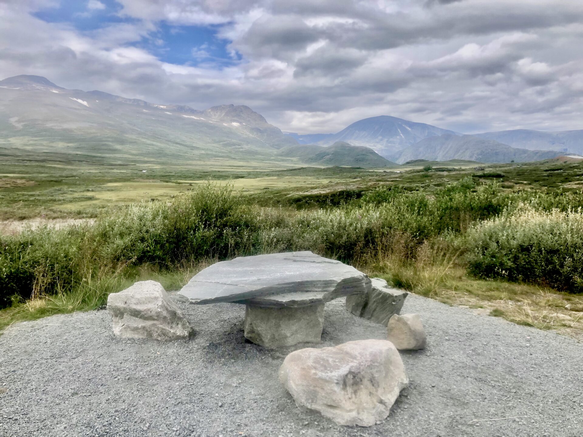
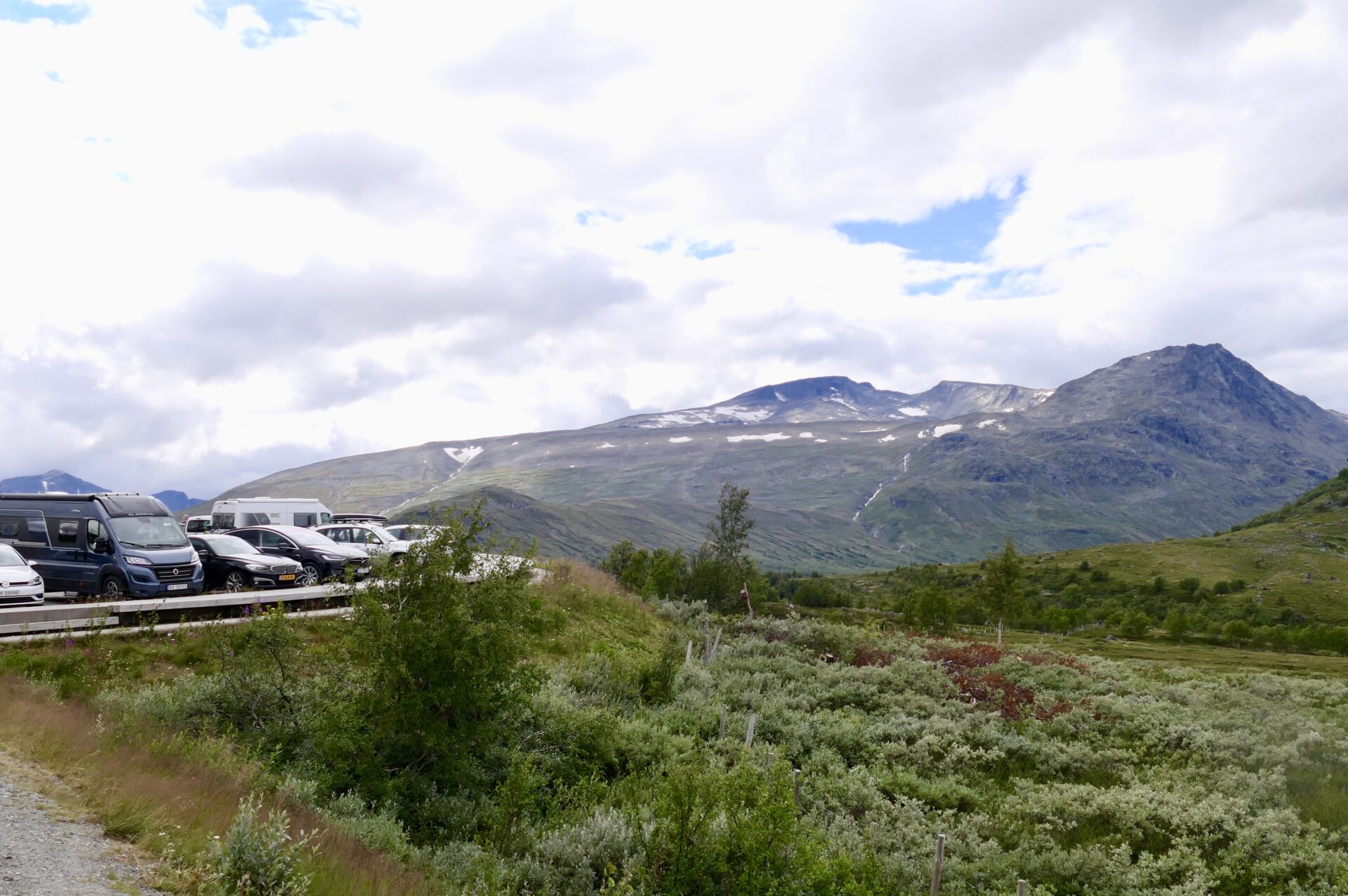
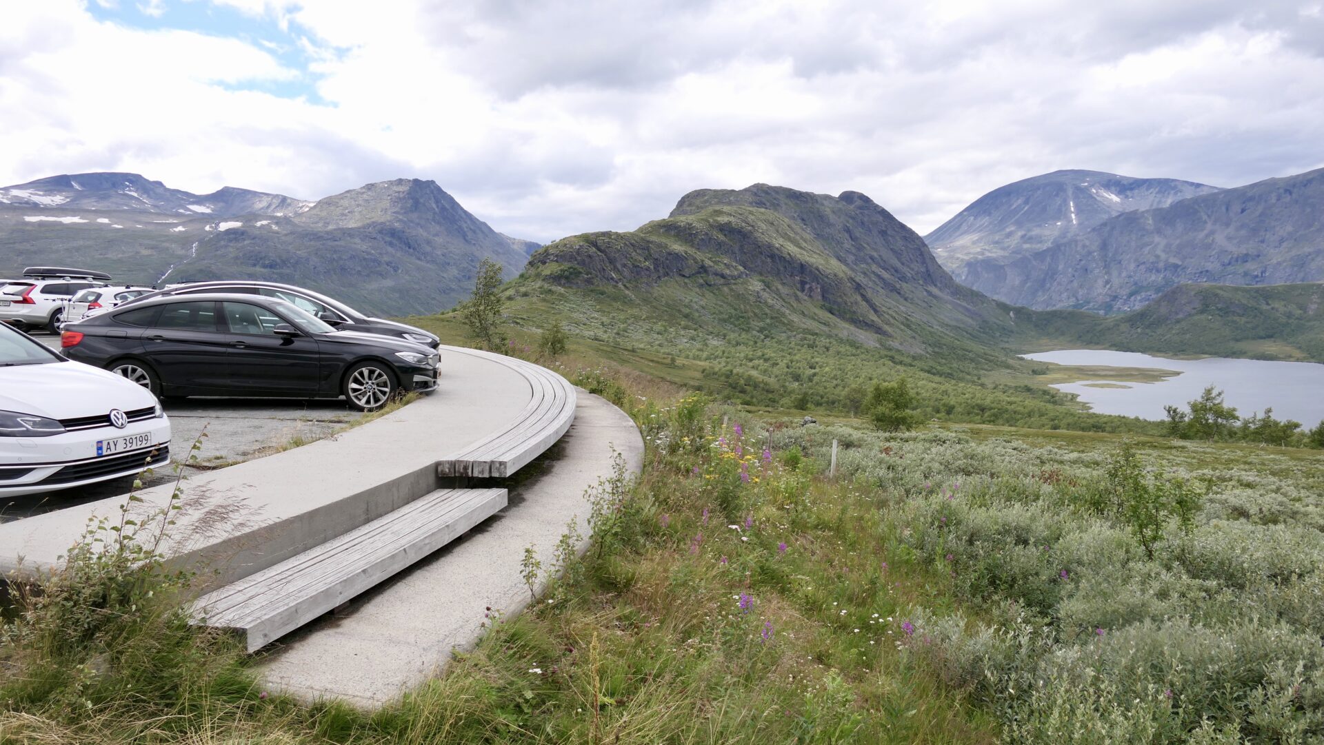
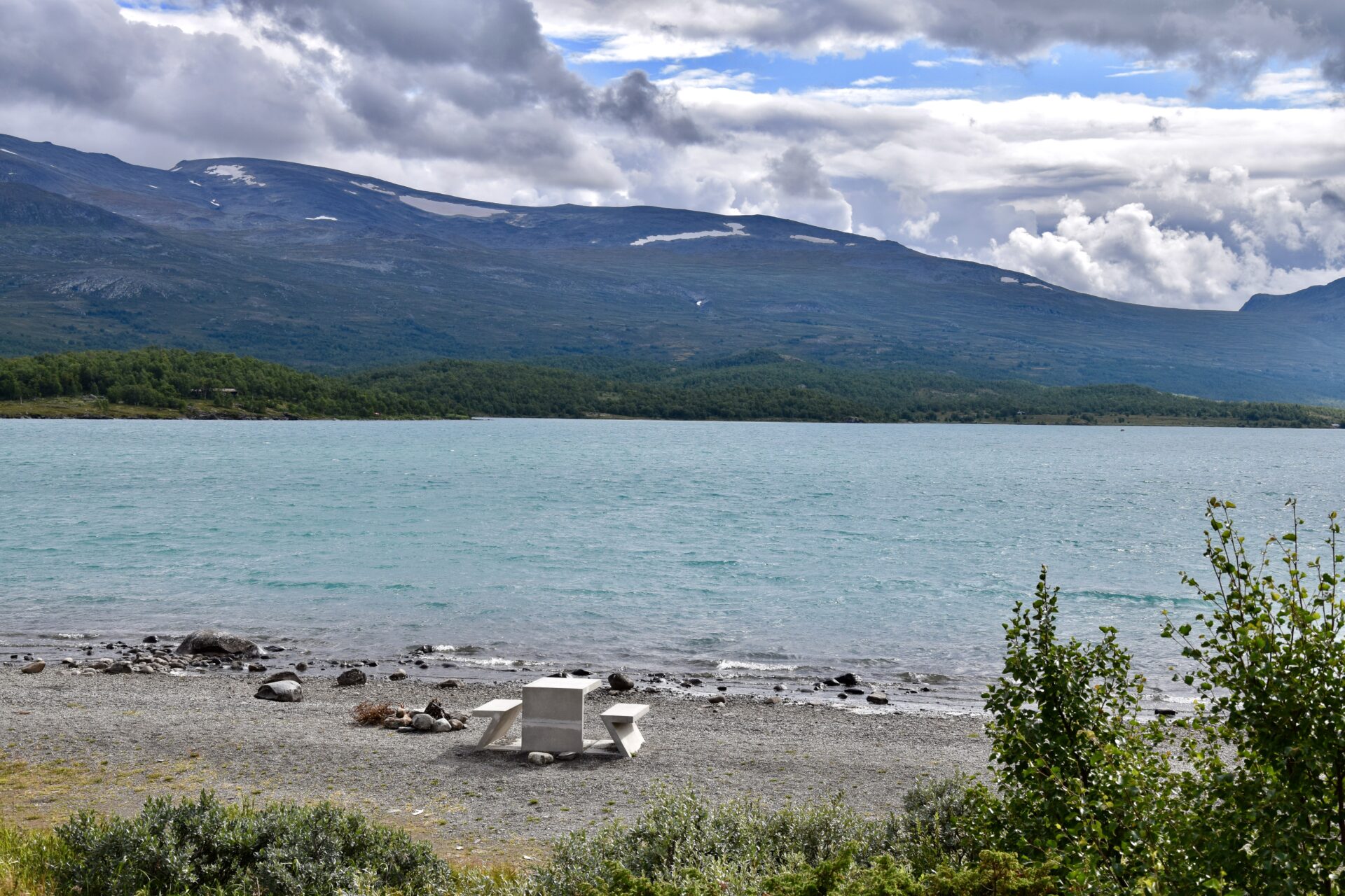
STEINPLASSEN – Rest area and viewpoint
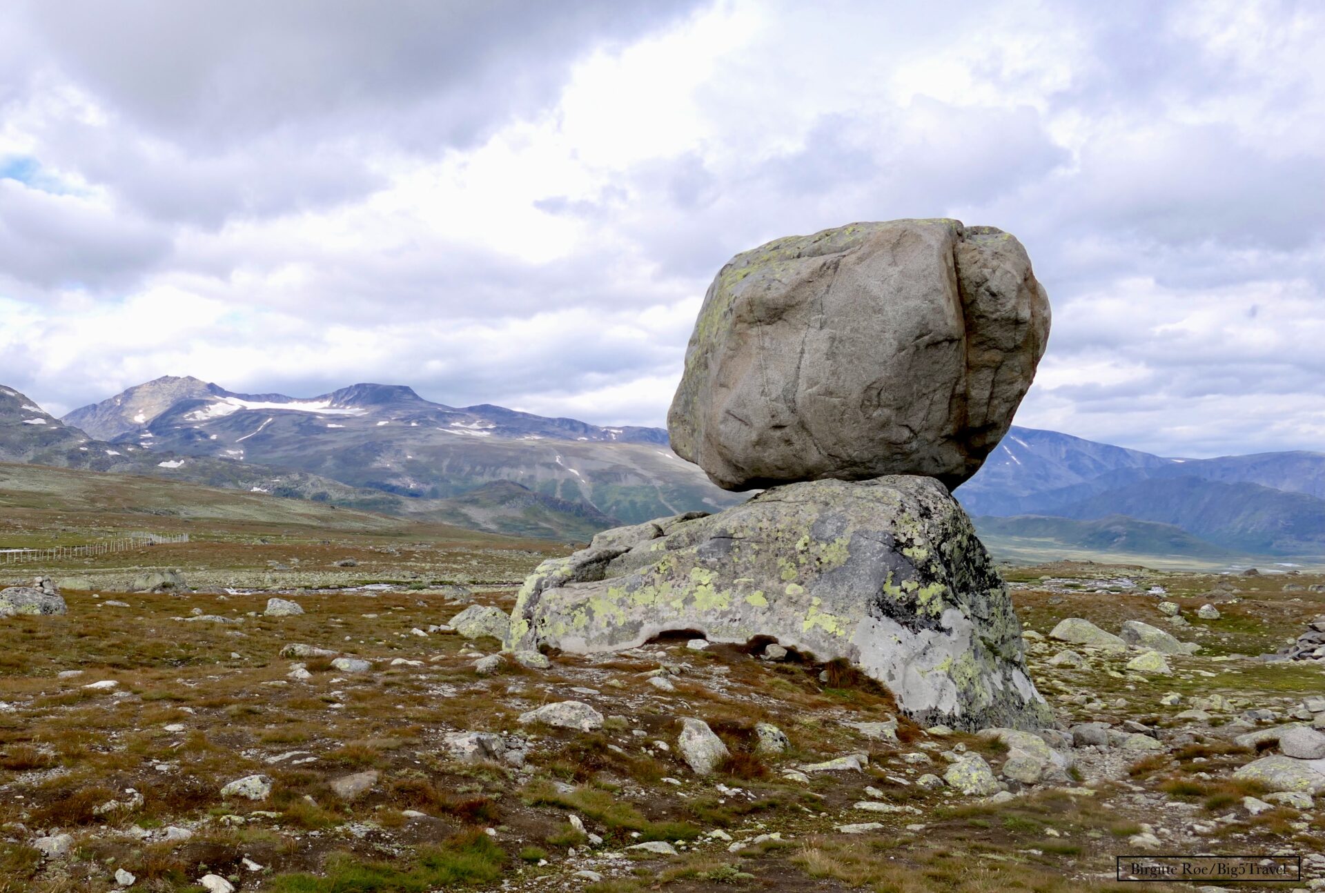
It is a mountain custom to erect cairns, placing one rock on top of another, marking paths or conquering peaks.
The two stone blocks, “Rock on Top of Another Rock”, are artwork and a pointer to such cairns. Artists: Fischli/Weiss
It is a fascinating artwork on the open plateau not far from Flye 1389 and makes this rest area special. A popular place for taking photos. There is a great view to several mountaintops such as Tjønnholstinden (2332 masl) and Høgdsbrotet ( 2226masl).

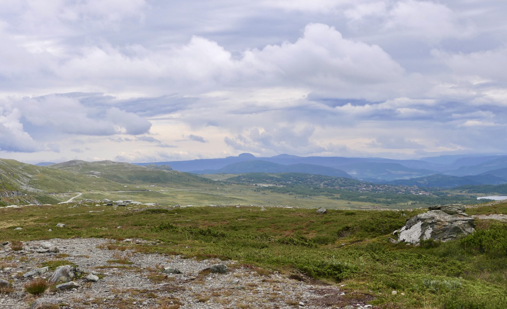
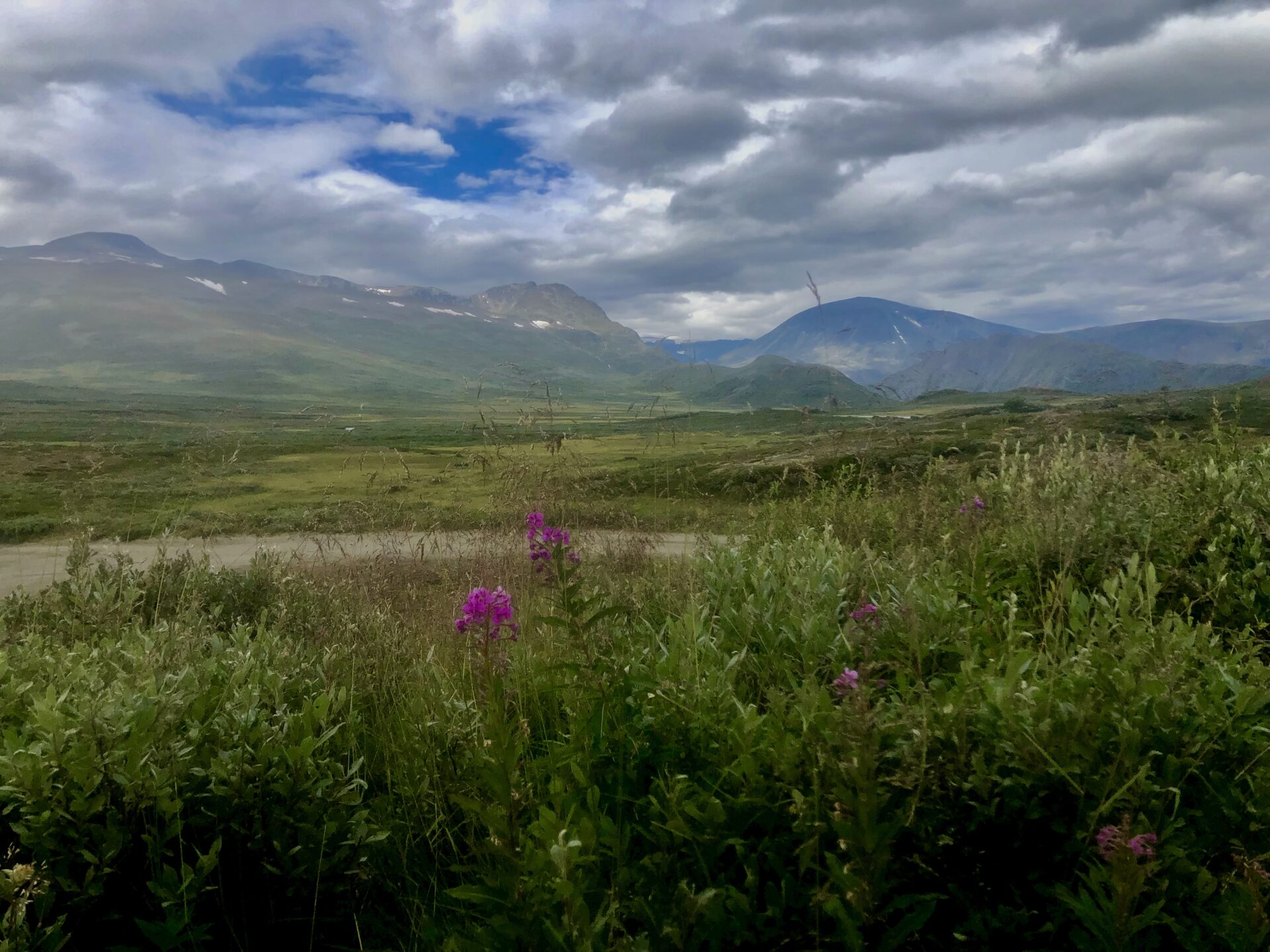
place down below Steinplassen
A great view to the north before the road begins a slow descent to Leirmyrin (marshes) and Leirungdalen (valley). The mountaintops far behind is Nautgardstinden på 2258 m and Stornubben på 2174 m
There is another small rest area a bit further north, just before Leirmyrin, with a beautiful view.
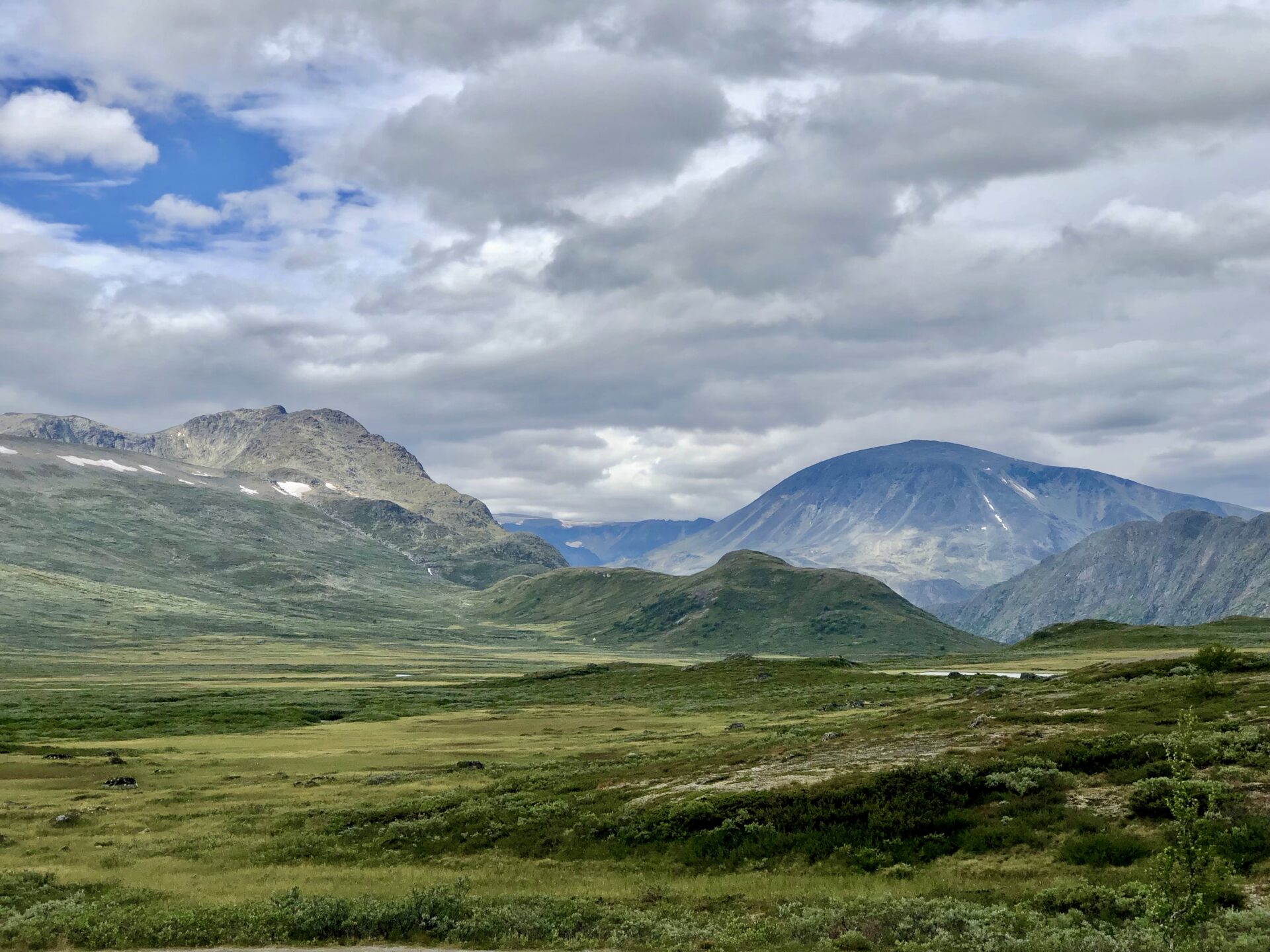
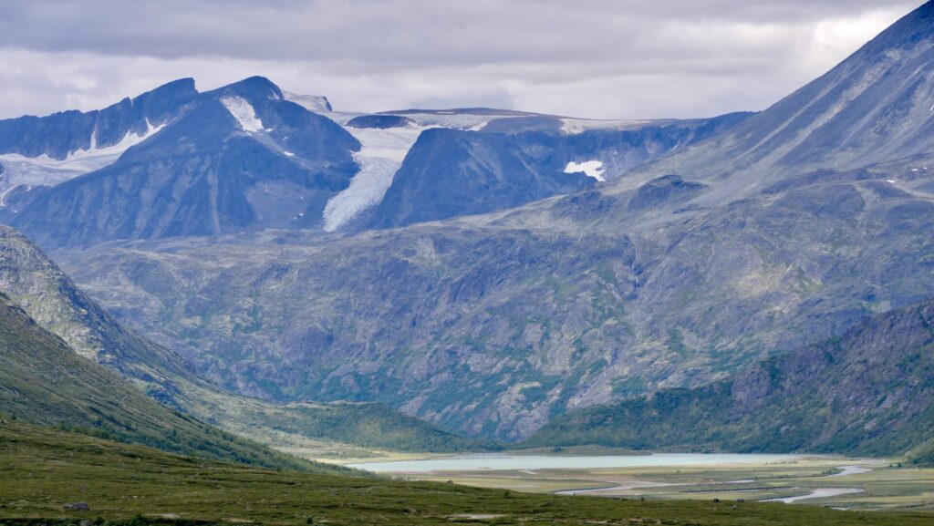
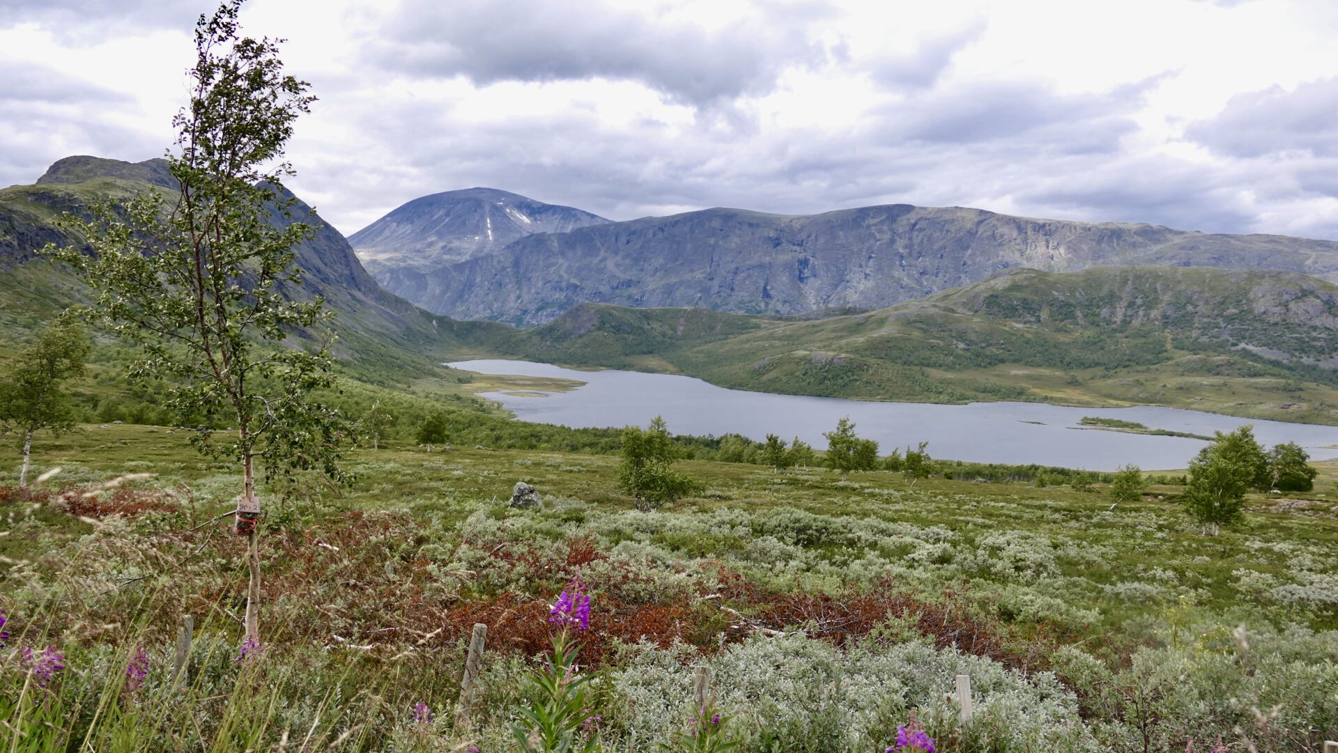
LEIRUNGSMYRIN
At Leirungmyrin (marshes), there is a good view of several mountaintops from the road.
In the picture below, you can see Leirungsdalen, the Øvre Leirungen Lake in the middle and Blåbrean (glacier) at Surtningssue (2367) behind. The highest peak to the left is Bukkehåmåren (1910 m), Knutshøe (1517m) to the right in front, and behind Knuthøe is Besthøe (2258m).
VARGEBAKKANE –
REST AREA AND VIEWPOINT
Vargebakkane lies just a little further down the hill from Leirungsmurin, at the mountain pass between the Gudbrandsdalen and Valdres valleys.
Architect Knut Hjeltnes designed the facility.
From here, you have a clear view of the highest peaks in the eastern part of Jotunheimen.
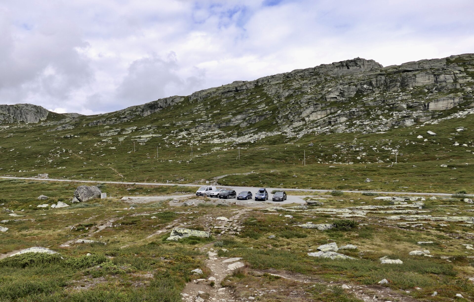
The small car park at Vargebakkane is an excellent starting point for many pleasant hikes through this area.
After Vargebakkane Rest Area, the next stop was Gjendeosen – famous for being the starting point of the hike to Besseggen.
Parkering for hikers is at Reinsvangen, 1.5 km before Gjendesheim. From there, a free shuttle takes the hikers to the trailhead and the boat. There’s a kiosk and toilets at Gjendeosen.
If you just want a short stop, you can park near Gjendeosen Kiosk.
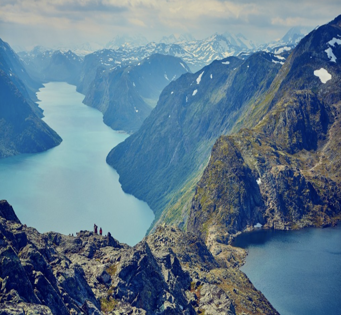
GJENDE AND SURROUNDINGS
GJENDE
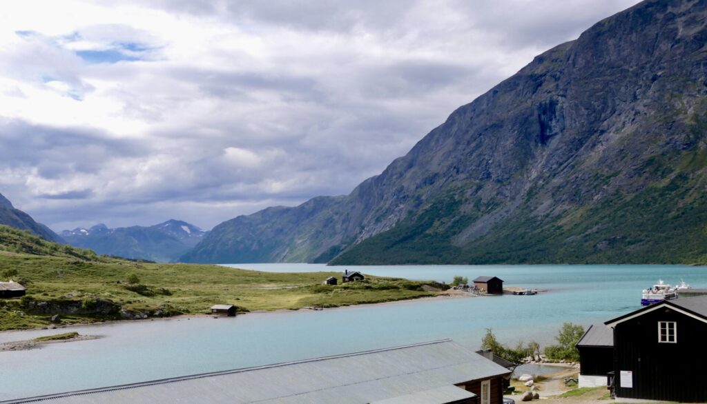
Gjende is possibly Jotunheimen’s most beautiful mountain lake, untouched by all regulations, surrounded by wild mountains and known for its turquoise green colour.
At the west end is the serviced DNT cabin Gjendebu and at the east end is Gjendesheim which I visited. Midway to Gjendebu is the tourist cabin Memurubu.
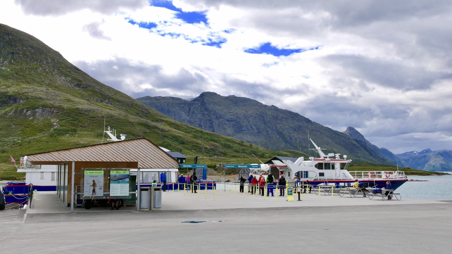
GJENDESHEIM
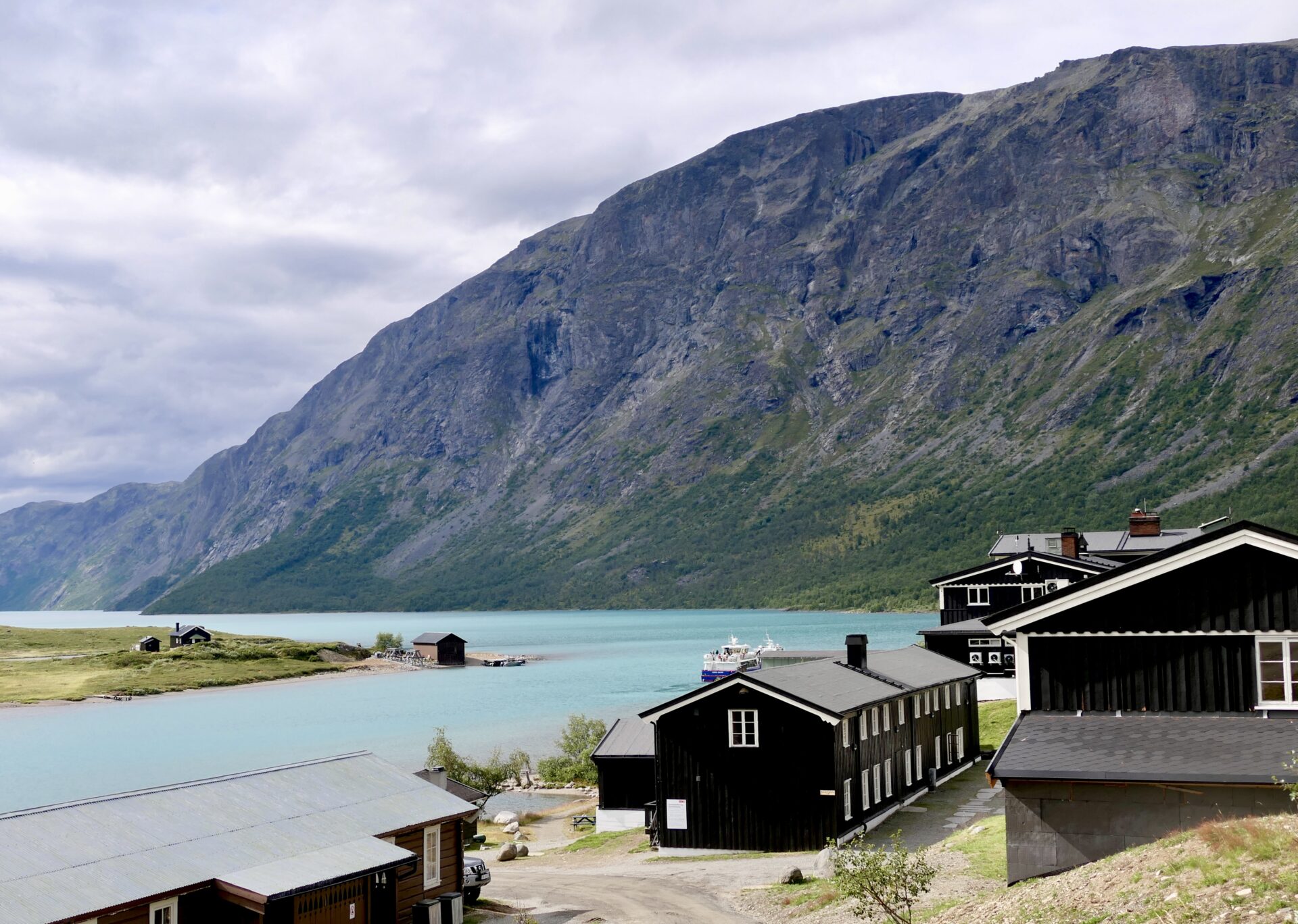
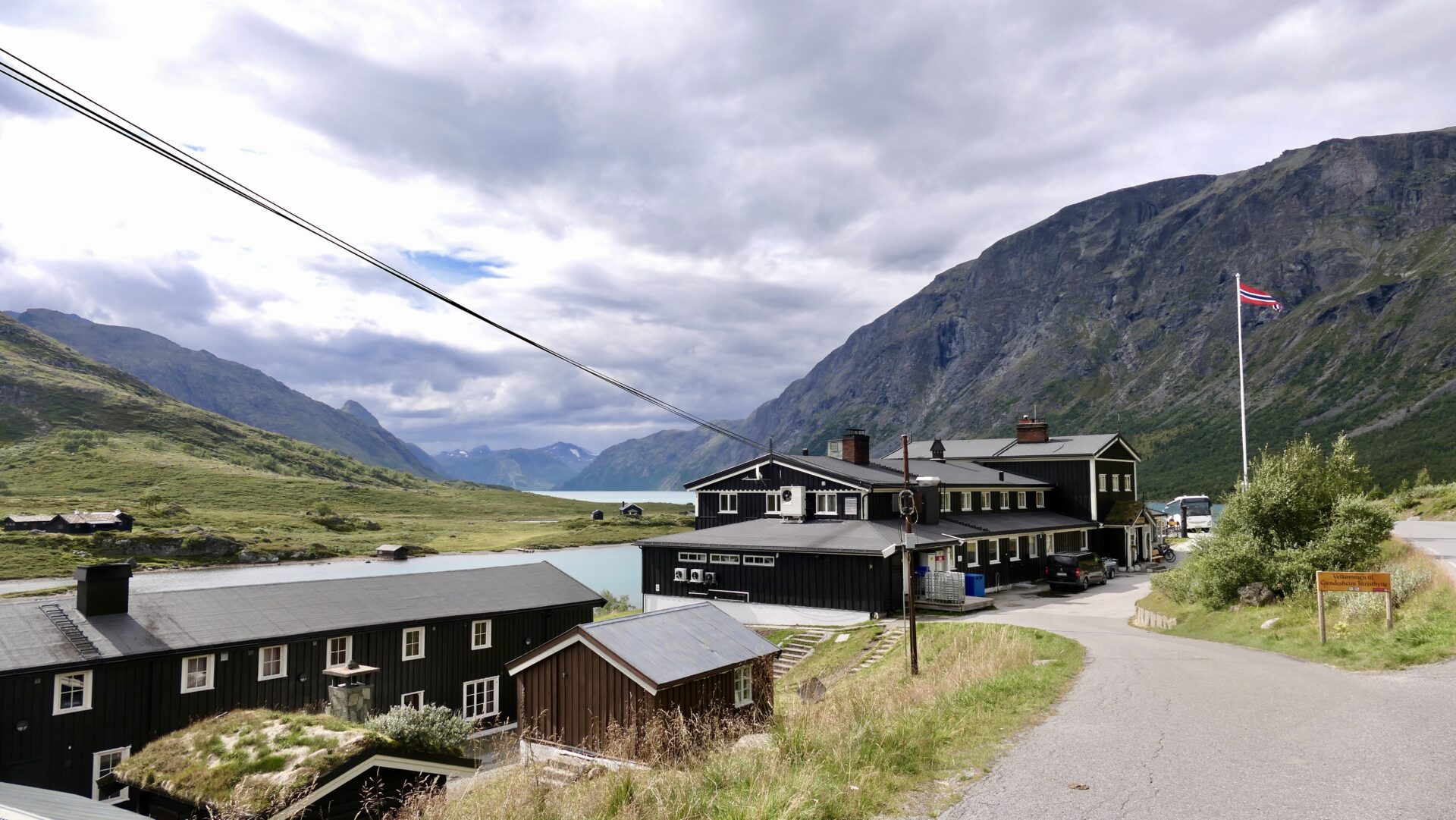
Gjendesheim Turisthytte (lodge) has been a serviced lodge with Norwegian Mountain Touring Association (DNT) since 1878, offering easy access to adventures in fantastic mountain surroundings. Lying at the foot of the world-famous mountain ridge Besseggen – it is the most visited mountain lodge north of the Alps.
BESSEGGEN
Besseggen is definitely one of Norway’s most famous hikes and mountain ridges! The spectacular view of Jotunheimen’s peaks and the two lakes Gjende and Bessvatnet separated with just the small mountain ridge – is breathtaking even for the most travelled hiker.
The 14 km long trail leads between the two DNT cabins, Gjendesheim and Memurubu. It climbs/falls 1200 m in total and is quite demanding over its entire length, so you need to be in good physical shape to hike it.
The trail´s highest point is Veslfjellet (1,743 m).
The Besseggen ridge, approx. one km long and 250 meters in elevation, is located midways along the trail. It involves some scrambling, and people sensitive to heights should mentally prepare for a challenge. For most people, it takes approx. 7-8 hrs to complete the hike.
The most popular way to hike the Besseggen is to take the boat from Gjendesheim to Memurubu and walk back. Many may experience the ridge easier to climb up than down, especially if one is afraid of heights. Another advantage is that you don’t have to rush to reach a boat. However, the disadvantages of this direction are that there is no good way out in case you need to break and that you’re walking away from the view.
The greatest advantage of hiking in the opposite direction, from Gjendesheim to Memurubu, is that you can start at any time and don’t share the trail with a boatload of people. Early birds may even reach over the ridge before the meeting traffic starts. Later during the day, when it gets crowded, you may have to wait your turn at the narrowest passages. Plus, you don’t have to remember to turn around to take in the view.
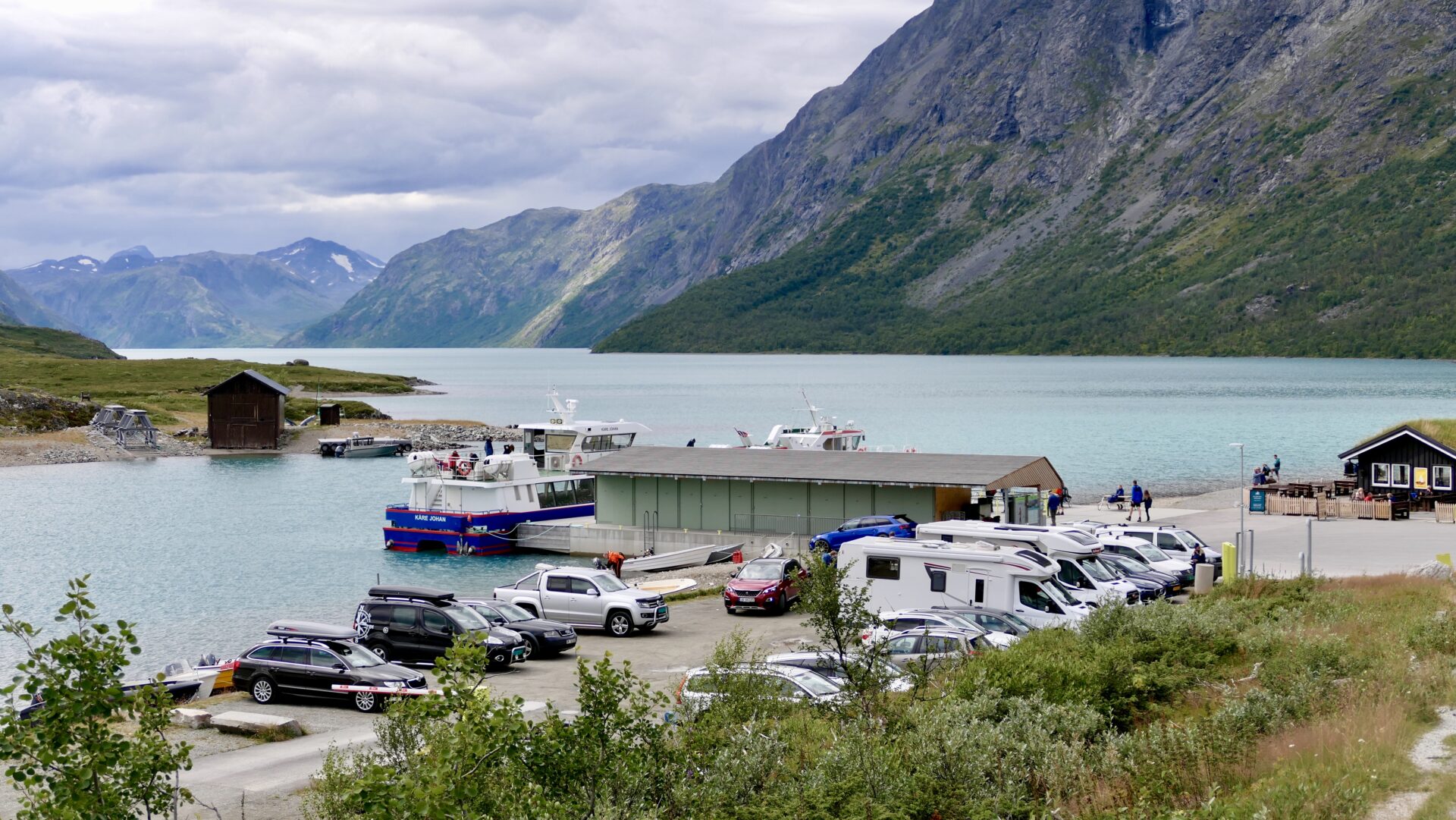
GJENDE BOATS
On Lake Gjende, you will find the boats «Gjende III» and «Gjendine» that transport thousands of eager hikers every year to the most beautiful areas of Jotunheimen. These boats are also excellent sightseeing boats for those who just want to enjoy the view from the lake. Departures from Gjendesheim to Memurubu and Gjendebu. The boats have corresponding connections with public transportation to and from Fagernes.
The departures from Gjendesheim in the mornings tend to be more crowded than the afternoon departures from Memurubu. It is highly recommended that you book the boat trip in advance. The boat service runs daily from the middle of June to October; see more details at gjende.no.
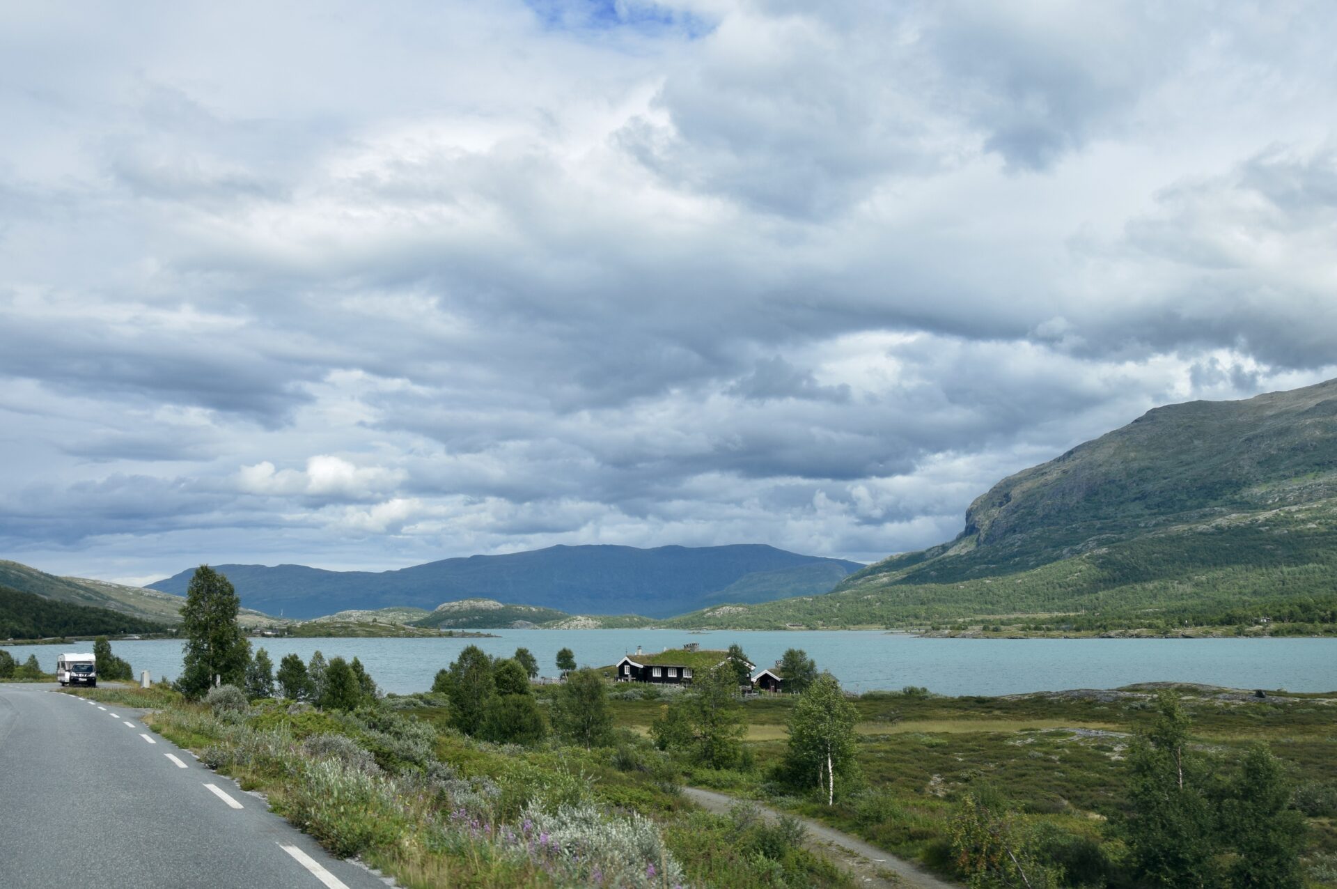
The last stretch of this scenic route is along the lake Øvre Sjoavatnet to Hindsæter, about 20 km from the lake.
Øvre Sjodalsvatnet is a lake that is part of the river Sjoa. At the south part of the lake are Maurvangen campground and Bessheim mountain lodge.
Hindsæter,north of Øvre Sjoavatnet, makes the end of Valdresfly Scenic Route.
At Hindsæter you will find the small historic Hindsæter Hotel at 950 masl, which has a stunning view of Sjodalen valley and Jotunheimen National Park. It is a timber hotel, and the first guest came in 1898. Quite a few artists were staying at Hindsæter during the first years, which were all inspired by nature. Hindsæter was therefore later called “Hotel of the Artists”. In 1969 the hotel was extended, and at some point, the pretty balcony was removed.
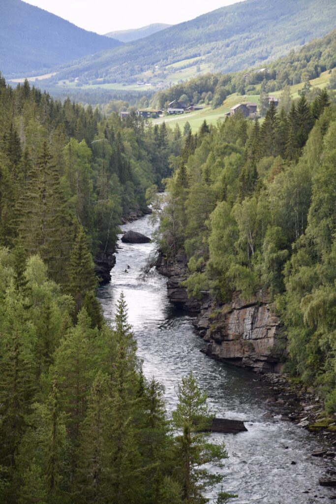
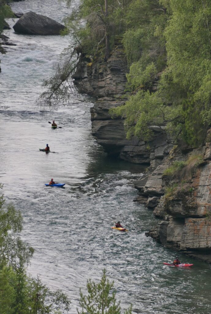
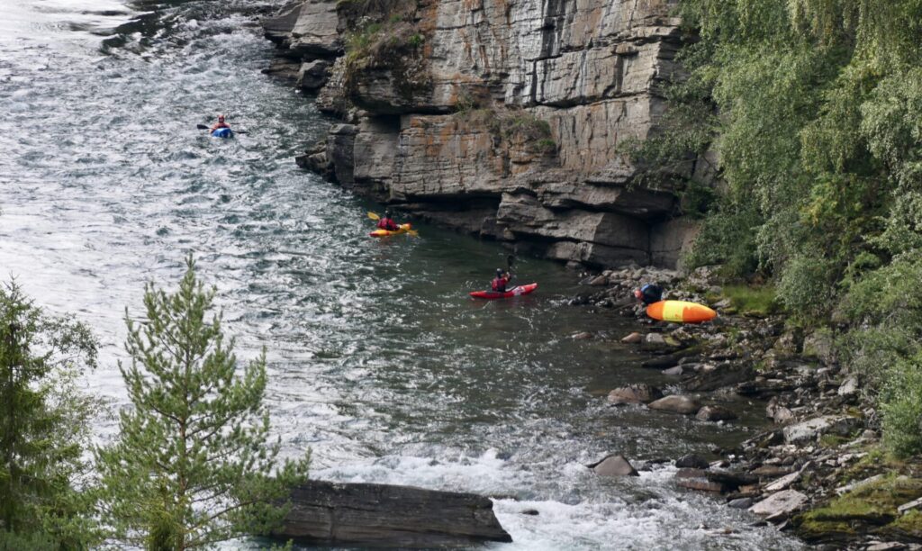
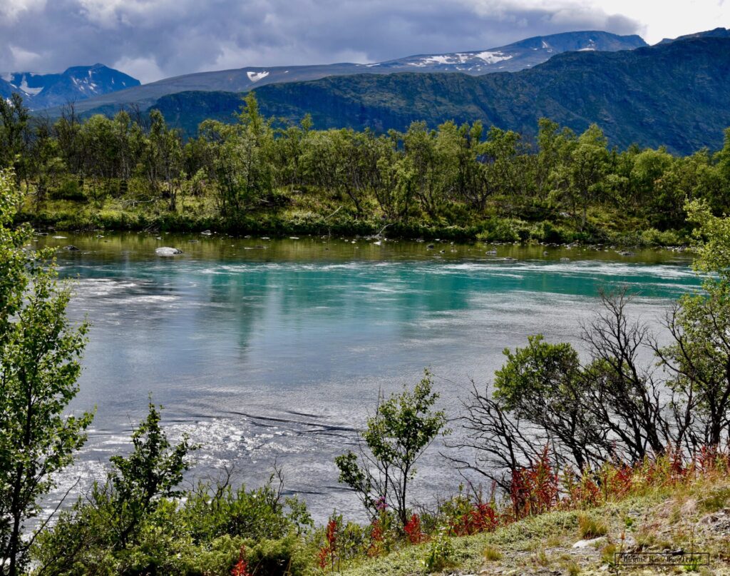
DRIVING ALONG SJOA RIVER –
ON MY WAY TO THE NEXT SCENIC ROUTE
After driving the Valdresflye Scenic Route, I headed for the next scenic route – Rondane – which starts north of Ringebu in Gudbrandsdalen.
First, I continued northeast through Sjoadalen and then to Heidal and southeast along Gudbrandsdalen. For a good while, I followed Sjoa River (starts at Gjende Lake), which continues in Gudbrandsdalen and flows into Gudbrandsdalslågen at the village of Sjoa. Sjoa is a popular river for rafting and kayak trips.