
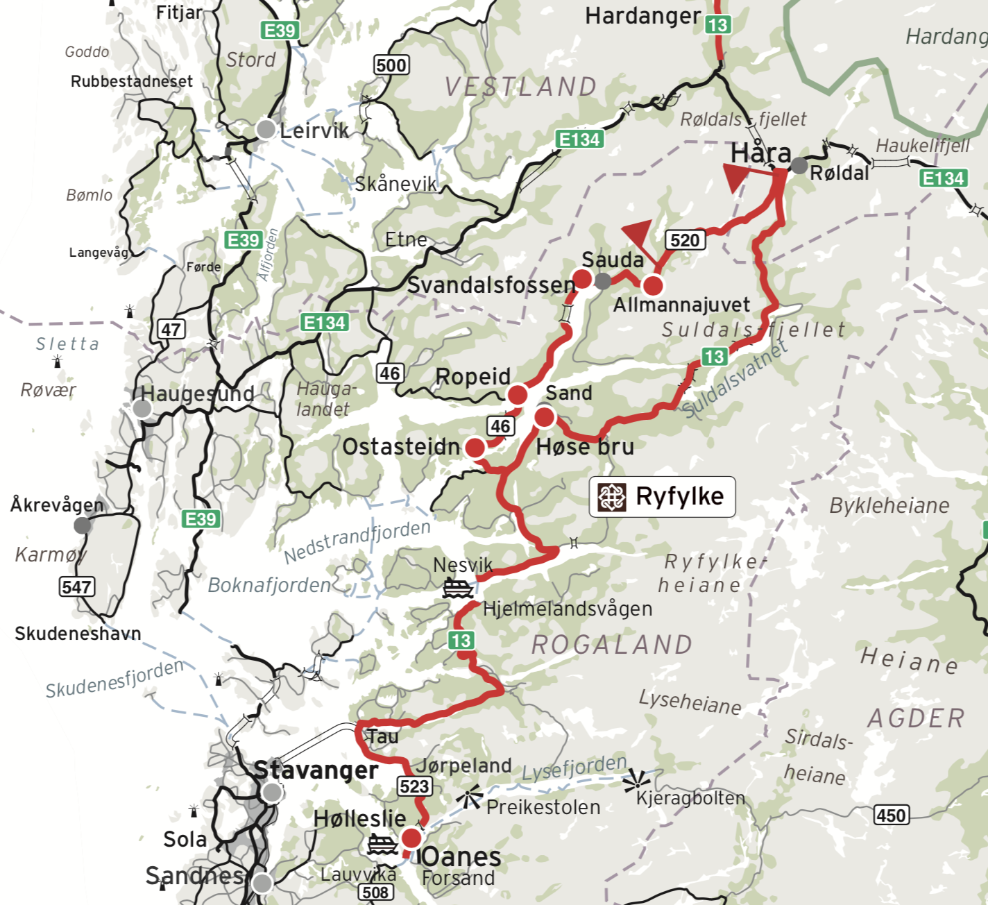
The Norwegian Scenic Route – Ryfylke – starts in the south from Oanes at the mouth of the Lysefjord – to Håra near Røldal in the north, around 260 km.
The route follows Rv13 with another branch travelling via Sauda and over the impressive Saudafjellet mountain.
PART 2
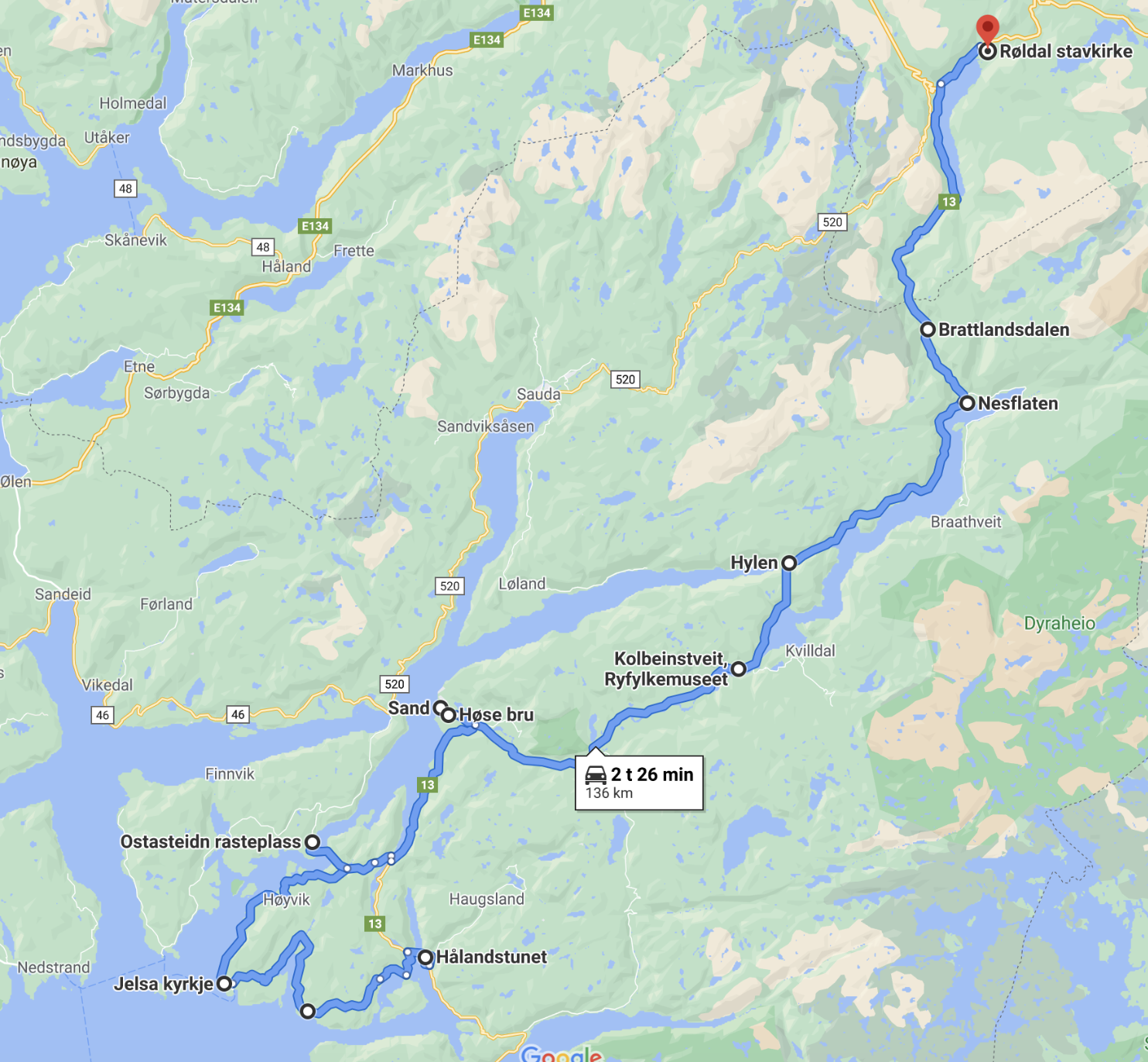
Part 2 of Ryfylke Scenic Route – takes you through the municipality of Suldal.
From Håland Farmstead near Erfjord in the south,
– to Røldal in the north.
RYFYLKE – PART 2:
HÅLAND FARMSTEAD – RØLDAL
Main stops that I had along this part :
- Hålandstunet – Håland Farmstead
- Detour to Jelsa
- Ostesteidn rest area
- Lovrafjorden rest area
- Sand and Nesasjøhuset
- Sandsfossen, Suldalslågen and Høst bridge
- Kolbeintveit Farmstead
- Hylen
- Nesflaten
- Brattlandsdalen
- Røldal
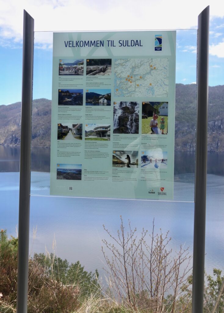
SULDAL MUNICIPALITY
After leaving Jøsenfjord, you enter another municipality – SULDAL.
SULDAL has some of the tallest mountain peaks in the region, deep fjords, the famous salmon river Suldalslågen, award-winning architecture, charming villages, remote beaches, and communities rich in culture and traditions.
Suldal is one of the big electricity-producing municipalities in Norway – with a base for both Statkraft and Hydro Energi.
HÅLANDSTUNET – HÅLAND FARMSTEAD
I visited the Håland Farm which is located in the hills west of Erfjord. Take the exit to the right when you see the sign “Østerhus”, after Erfjord Church. The road is called “Fjellvegen”, and it is just a 1 km drive from the intersection.
The farmstead Hålandstunet became a part of Ryfylke Museum in 1998. Håland farm has always been one of the most important farms in Erfjord.
The main farmhouse is the best-furnished and best-equipped of all Ryfylke Museum’s antiquarian buildings.
Between 1640 and 1740, Håland was the seat of both the district sheriff and, for several periods, of the local assembly. Hålandstunet has been restored and consists today of three buildings: the main house, the richly decorated Målarstova, and Håmannsbua which was used for guests and storage.
Målastova is an important part of the region’s cultural heritage with its painted interior probably dated to the 1640s. This was the farm’s most elegant building where visiting people of similar rank, town dwellers, clergymen, and other officials were entertained. At some point, the building lost its importance and was used both as a stable and a woodshed. This has led to a great deal of wear and tear on the décor and conservation work was carried out both in 1980 and the 2000s. The decoration is special because the painting is very old and is one of the few still existing in Norway.
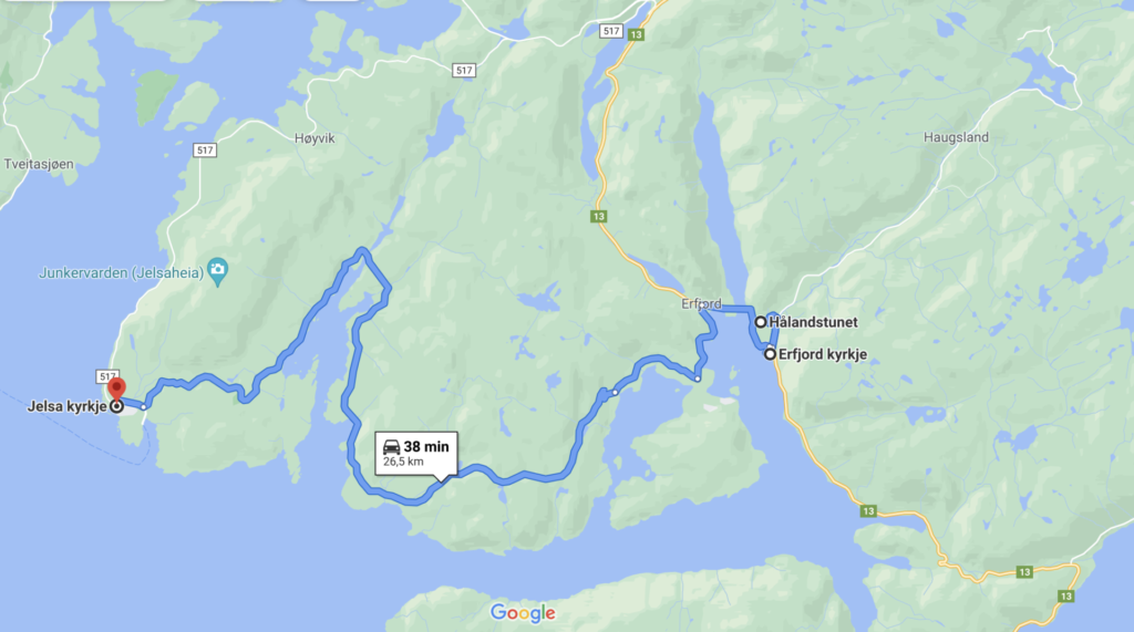
A detour to Jelsa – known for its old wooden houses and distinctive church.
I drove the southern route which was very winding and narrow, but great scenery along the way!
Places that I passed on my way to Jelsa


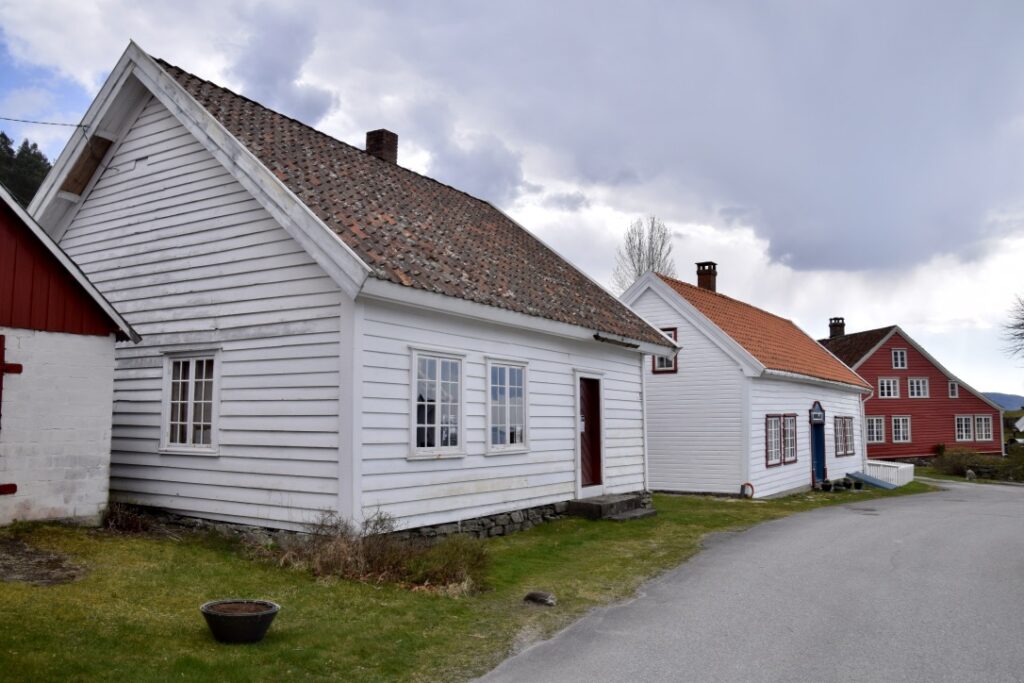
JELSA – oldest fjord village in Ryfylke
Jelsa is the oldest and also the best-preserved fjord village in all of Ryfylke. In 2008 Jelsa was voted the most idyllic place in Rogaland – which I can well understand with its old white wooden houses, a beautiful wooden church and its great location by the sea.


There have been settlements at Jelsa since the stone age, 3.000-10.000 years ago. More than twenty graves from the stone age and three sites with rock carvings and cupulate hollows have been registered in the area.
Jelsa has a rich cultural heritage. In the 13th century a church was built here; an inn and trading post was established in the late 1600s. In 1855 scheduled fjord steamers started calling at Jelsa. The area blossomed thanks to better communications, the lucrative herring fisheries, and the high demand for local barrel-making and shipbuilding.
JELSA CHURCH
Jelsa church, completed in 1647, was originally built in renaissance style. Earlier there was a stave church in the same spot.
The impressive Renaissance décor on its interior walls was painted by Gottfried Hendtzschel, a German church painter living in Stavanger. Peter Reimers was the one who painted the epitaph of the priest Peter Hørlich.
It was probably Thomas or Lauritz Snekker who made the pulpit.
The church has subsequently been altered several times. Part of the old interior decoration was restored in the 1950s. Much of the 17th-century interior and fixtures were restored. The original ceilings were restored and reconstructed. The ceiling of the nave has a starry sky painted on the ceiling, and in the chancel, there are vines and arches with biblical figures painted on the walls. The richly decorated bench rails and doors from the original interior were restored and supplemented.
JELSA SCHOOLHOUSE
The schoolhouse was built in 1774 with funds from a foundation set up by Marcille Riiberg in 1755. Marcille was the niece of the present priest and must have been a rich woman as she bought both the church and the school.
The school was both a primary school for local children and also a free two-year training school for two young people at a time. They were then sent out to work as itinerant teachers in the countryside. This continued for more than 40 years until teacher training was abandoned in 1820 for economic reasons. The primary school remained here until the early 1900s. The schoolhouse was restored and became a part of Ryfylke Museum in 1984.


The schoolhouse and two other houses included in Jelsa culture heritage – the Brodersenhouse (1786) and Bjergsted Trading House (from the 1700s)

The Brodersen house – built in 1787 of Priest Christian Brodersen´s widow – Anne Brodersen. The building has many details of the rococo style.
OSTASTEIDN – special rest area
Next stop – the rest area OSTASTEIDN – which is a new special rest area established by the Norwegian Public Roads Administration and Norwegian National routes. It is located on the west side of Sandsfjord Bridge.
If you follow road Rv13 straight from Erfjord, without the detour to Jelsa, you will come to a crossroad at Lovraeidet. It is from this place, the tourist route splits into two sections. One section travels across Sandsfjord Bridge to Sauda (Fv520) and Røldal over the Sauda mountains. This part I will drive later, but wanted to include Ostasteidn and Sandsfjord bridge before going back towards Sand on Rv13. It just a short drive north of Jelsa. Instead of going east on road Fv517 at the intersection, take Fv517 west
A walkway leads to seating facilities facing north with a beautiful view of Sandsfjorden in both directions.
SANDSFJORDEN – goes from the southwest to the municipal centre Sand in the northeast. Sandsfjorden is about 25 km long.
This rest area is situated in a landscape where Norwegian artist Lars Hertervig found his motives, and the architecture is inspired by Hertervig’s art.
There are also other seating areas, including a bench by the rock. At this big rock, a sign shows that this rest area has got a prize called “Betongelementprisen”.
The architect KAP (Kontor for Arkitektur & Plan) – got a prize in 2019 for their work with Ostateidn. The characteristic toilet building has been painted with a moss blend so that in time it will have a moss-covered surface.
LOVRAFJORDEN
After Ostasteidn I crossed Sandsfjord Bridge once more, and at the intersection at Lovraeidet continued the route north on Rv13.
There are some viewpoints along Lovrafjorden and be sure to look out for the red cabin that sits on its own islet in the middle of the fjord.
– A popular photo motif!

Further along Lovrafjorden, I stopped by another attractive rest stop. This area has a great view of Lovrafjord and also to the small islet in the distance.
SAND
Sand is the administrative centre of the municipality of Suldal.
In earlier times, Sand was the trading centre for the inner part of the Ryfylke region. The fjord village is situated at the junction of four fjords: Saudafjorden, Hylsfjorden, Lovrafjord enand Sandsfjorden. Up until recent decades, the fjord was the most important means of transport and travel in Ryfylke. The village is also at the mouth of the river Suldalslågen

NESASJØHUSET
The old wharf house – Nesasjøhuset – which is the headquarters of Ryfylke Museum, is one of the main attractions in Sand. Nesasjøhuset is located at the fjord and gives you a wonderful view over the fjord and the historical village. It houses exhibitions, a museum shop and a café.
An interactive children’s exhibition, based on an adventure of a white bear by a local writer, is the main attraction.


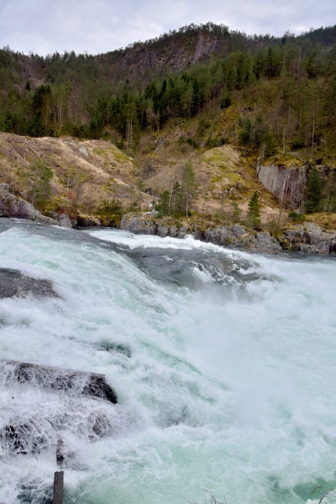
SANDSFOSSEN – SULDALSLÅGEN – HØSE BRIDGE
SANDSFOSSEN AND SULDALSLÅGEN
A couple of minutes walk from Sand village centre takes you to Sandfossen. This waterfall is an impressive conclusion of the Suldalslågen – one of the longest rivers of Rogaland county and one of the best salmon rivers in Norway. Suldalslågen is gaining popularity also for other activities, such as salmon safaris, canoeing and river rafting.
The waterfall of Sandfossen is not particularly high, but it is broad and powerful.
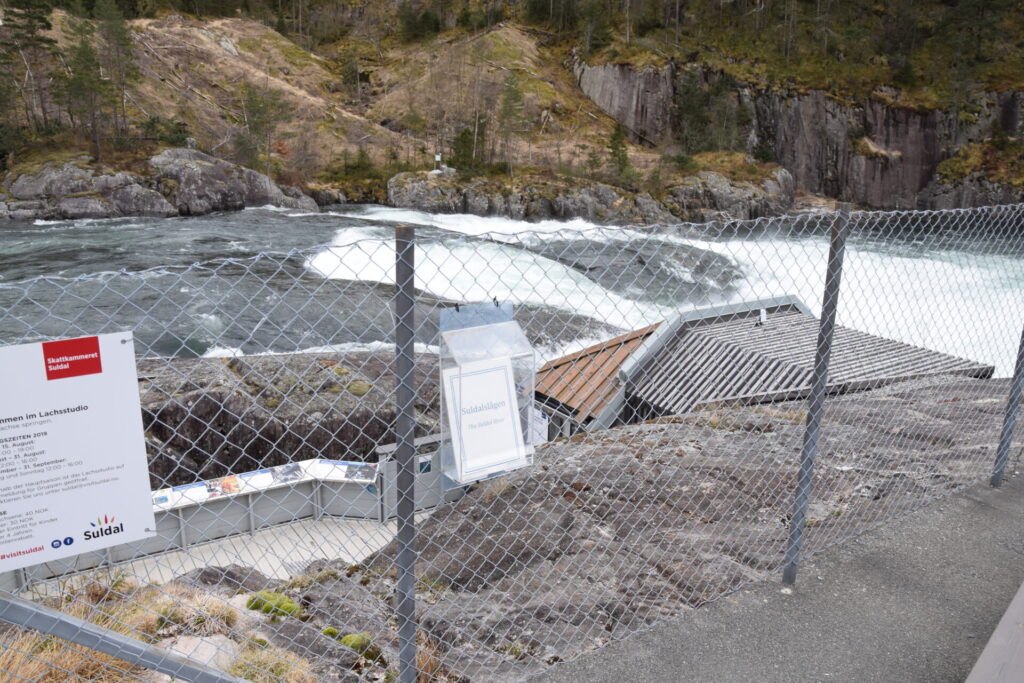
Situated nearby is the Salmon Studio, with parking and an attractive rest area. The Salmon Studio has two large windows into the river and you will maybe spot some salmons make their way upstream to spawn!
A fish ladder was built in 1987, one year before the Salmon Studio, to make the annual salmon migration easier.
The Salmon Studio is open in the summer – Sandsfossen can be savoured year-round!


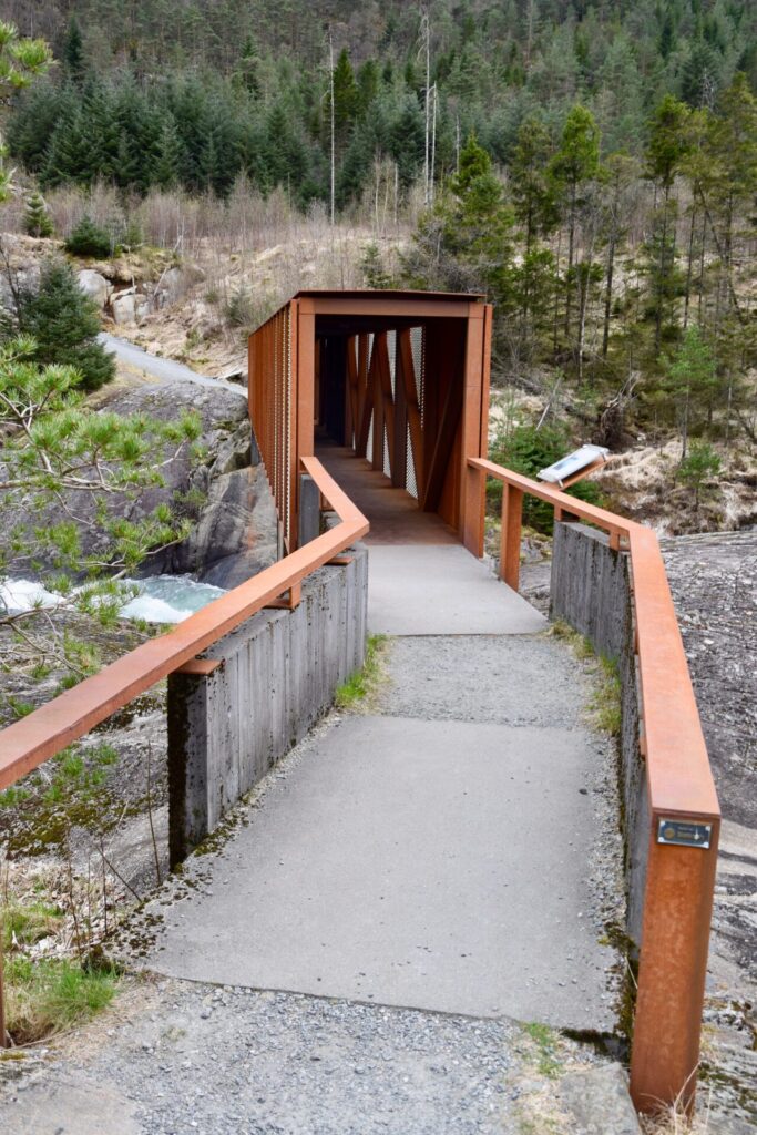
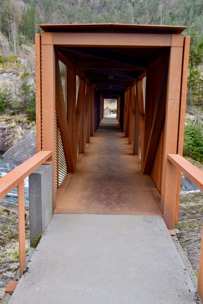
HØSE BRIDGE
Close by lies Høsebrua – a pedestrian bridge across Suldalslågen river.
It lights up beautifully on dark autumn and winter nights and leads to the recreational area across the river. The bridge won Bridge of the Year from Travel + Leisure Magazine in 2014. Architect: Sami Rintala/ Eggertsson og Ivan Kroupa.

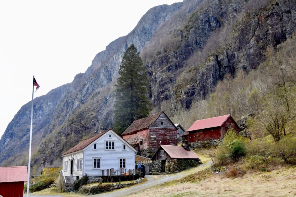
FARMSTEAD OF KOLBEINSTVEIT
The next stop was the old farmstead of Kolbeinstveit from around 1850.
It is situated in the southern part of Suldalsvatnet lake.
Kolbeinstveit Farm was the home to the mayors and members of parliament Lars and Njeld Kolbenstvedt. It was in use until 1965 and is now a part of Ryfylke Museum.
The main buildings in the yard are the dwelling house and the barn, built here about 1850.

At this complex, you will also find Guggedalsloftet, an old storehouse (stabbur), which originally stood at Bråtveit farm in Suldal.
The upper part of the building is dated to 1281, while the lower part was built around 1340. This is the oldest secular wooden building in Rogaland county. It is thus a unique part of our building heritage and an important cultural monument.
During the summer season, Kolbeinstveit is an active museum farm featuring farm animals and guides who tell you about the history of the farm or cook you a traditional meal. There are alternating exhibitions at the farm, as well as concerts, activity days and market days.
SULDALSPORTEN
Right after leaving Kolbeinstveit, I passed – Suldalsporten – a striking narrowing of the lake between two cliffs. I was not aware of this motif until I suddenly saw the sign. This photo is taken through the car window whilst driving:

I read that Suldalsporten was a highlight for 19th-century tourists who travelled a popular route that included crossing Suldalsvatnet by steamer.
There is an ancient prophecy that when seven sisters marry on the same day, and the wedding procession returns in rowing boats from church, – the cliffs of Suldalsporten will collapse into the water.
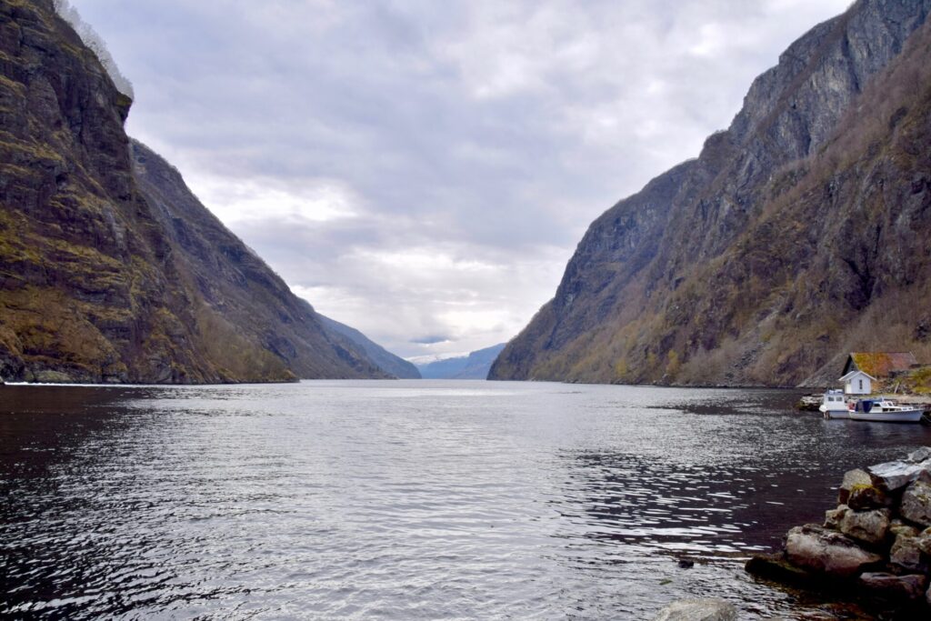
HYLEN
A little detour to Hylen, a small area at the bottom of Hylsfjorden.
Hylsfjorden – is a 20-kilometre (12 miles) long fjord that runs from Hylen in the east, and westwards to the north of Sand. It joins Saudafjorden and together they form Sandsfjorden, an inner branch of Boknafjorden.
There are still people at the farm – the only buildings at this place,- except for Hylen Hydroelectric Power Station. The plant exploits water through a tunnel from the lake Suldalsvatnet.

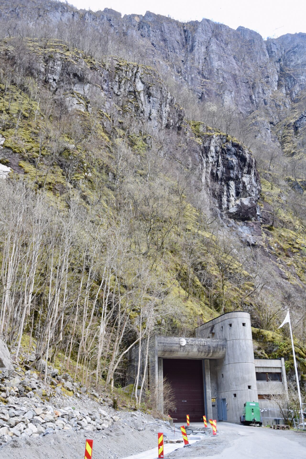
Hylen power plant is one of Statkraft’s facilities being considered for preservation as a cultural heritage site. The reception building has therefore been proposed for preservation. In addition, several of the power plant’s caverns inside the mountain are included in the conservation plan.
The reception building of Statskraft´s Power Plant at Hylen
NESFLATEN
The next stop was Nesflaten, located at the northern shore of Suldalsvatnet lake. Nesflaten was an important centre in the early days of tourism. Brattlandsdalen north of Nesflaten became a famous tourist spot, as a part of the Discovery Route from Stavanger, through Ryfylke, to Hardanger and Bergen. Three hotels were built in Nesflaten from 1880 onwards. After WW1 this traffic ceased.
In the 1960s Nesflaten bloomed again during the hydropower development of Røldal-Suldal. Today this village is known through the hydroelectric facilities of Hydro Energi designed by the renowned Norwegian architect Geir Grung.
Besides the hydropower station, the architect Geir Grung has designed the nearby residences as well as the building that is now Energihotellet. These buildings of Geir Grung are some of the finest and best-preserved examples of Norwegian functionalism.
ENERGIHOTELLET
I was very happy that I decided to stay overnight at Energihotellet, it was a great experience! The owner told me that this building was the former staff hotel and canteen. It has been refurbished into a distinctive hotel with comfortable rooms – all with a lovely view of Suldalsvatnet and the surrounding mountains. The restaurant gives you a great view and serves tempting dishes based on local ingredients.
The hosts gave me a warm welcome and the staff did their utmost for me to enjoy my stay! They will also give information about the surroundings and the fascinating story about Hydro Energy. In the main season, they arrange guided tours of Hydro’s buildings.
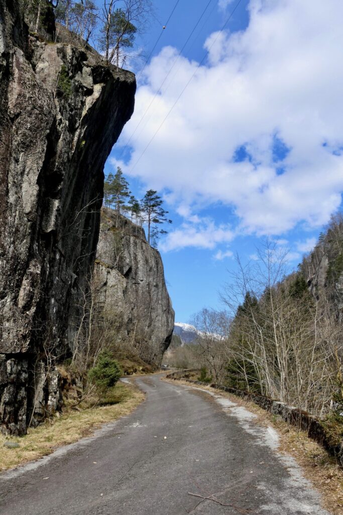
The next day I continued on Rv13 and had a stop in Brattlandsdalen which starts just some kilometres north of Nesflaten
BRATTLANDSDALEN

In 1887 the Tourist Route 7, Suldal – Brattlandsdalen, opened as a part of “the new inland route from Stavanger to Odda in Hardanger through the Ryfylkefjords, Sand, Suldal, Brattlandsdalen and Røldal”, also known as Discovery Route.
With tunnels and half tunnels through the wild and narrow valley, the spectacular road was considered a highlight of the route. Lots of postcards were produced and sent home by many foreign tourists. Several hotels were built in Suldal at this time.
A postcard from 1893:

The First World War put an end to most of the foreign traffic. The road underwent minor changes until the 1990s when a new road was built to accommodate modern traffic. Only parts of the original road remain, which is now part of Ryfylke’s cultural heritage.
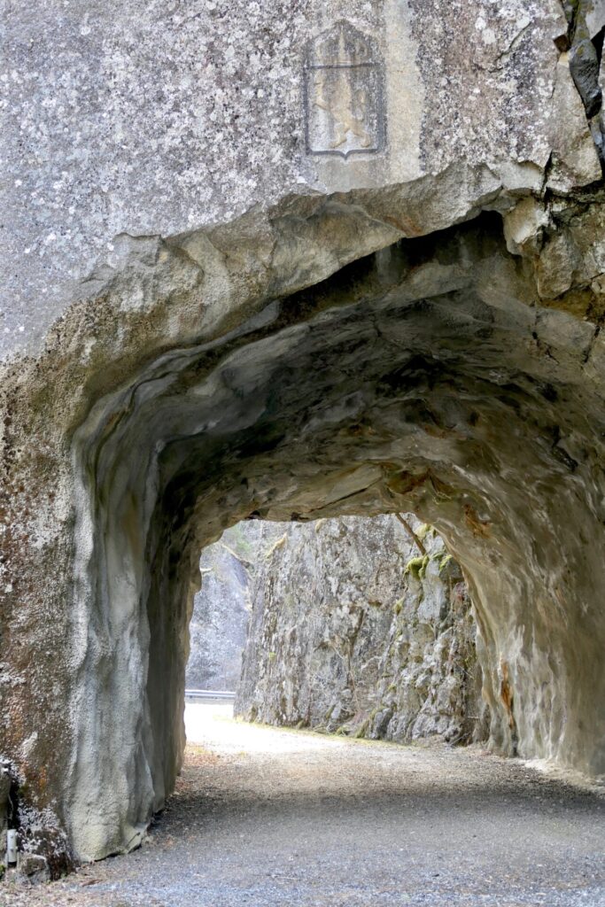
At this stop, you can discover a section that remains of the old route. This part was built in 1892 and both the road and the tunnel is preserved.
I thought it would be interesting to explore this part of the old route, so I parked my car and found myself walking on an old 19th-century road, along an amazing gorge! The valley is quite narrow at this part, with steep mountain walls and a small river at the bottom! I discovered a series of potholes, and with the green coloured water, it was an impressive sight!
In earlier times huge amounts of water have flowed through the valley and left these traces. Today the water is much reduced as the river is used in a large hydroelectric power system.


The preserved tunnel at this road, the Kvelven Tunnel, is one of the oldest tunnels in Norway, and the oldest in Rogaland. A royal monogram has been carved over the tunnel opening.
This tunnel was built in 1886 as a half-tunnel, with the section to the right still open. In 1920, the road was widened for automobiles and the outside tunnel wall added.


I was glad I had this stop. Fascinating landscape with an interesting history, definitely a great piece of cultural heritage!
I am surprised it is not mentioned in the information of the Ryfylke Scenic Route.
HÅRA
Håra in Røldal is the endpoint of Norwegian Scenic Route Ryfylke (Fv520).
The other branch of the route, Håra – Sauda, that crosses the mountains of Røldalsfjell, was still winter closed then I travelled at the end of April.


RØLDAL


In 2020, Røldal became part of Ullensvang municipality in Vestland county. The village lies in Røldal valley along Storelva river on the northern side of the lake Røldalsvatnet.
It also lies at the crossroads of the scenic roads to Ryfylke, Hardanger and Telemark, and is a great base from which to explore a large region.
Røldal is a popular place for winter sports enthusiasts. The Ski Centre in Hordadal valley is famous for receiving the most snowfall of any populated area in Norway, and it is usually open from November to May.
On the mountain peaks, snow lingers well into the summer.
Røldal Stave Church
Røldal’s greatest tourist attraction is the 13th-century stave church that stands at the heart of the village.
The church is a preserved historic museum, but it is still a regularly-used parish church that holds scheduled worship services twice a month
A crucifix in the church dates from about 1250. There are many stories of healing miracles associated with the crucifix, which has attracted pilgrims through the centuries.
The altarpiece dates to 1629. It was the design of the German-born painter Gottfried Hendtzschel who also did paintings on the interior walls of both Old Årdal Church and Jelsa Church.
Røldal Church received large donations from pilgrims over the years and the small village became quite prosperous. In the 17th century, the walls inside the church were richly decorated with paintings.
From 1913 to 1918, the church underwent extensive renovation and restoration. Panelling from the 19th century was removed and the Renaissance interior was restored.
The church was not open when I visited, so I have no photos of the interior. I guess I have to come back to Røldal in the summertime and do some more exploring.


