
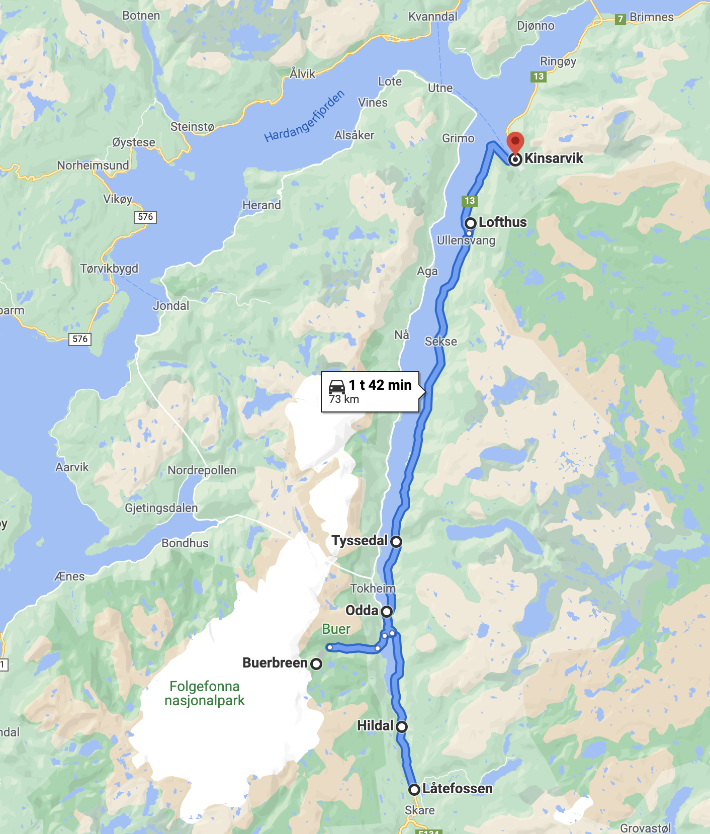
Låtefoss – Kinsarvik
The first section of the Norwegian Scenic Route – Hardanger – cover the east side of the Sørfjorden; from Låtefoss to Kinsarvik (Rv13)
This section of Hardanger – has a fjord landscape with mountains, several waterfalls, a Power Station Museum- popular hiking areas, and the centre of fruit production!
Main stops:
Låtefoss
Hildal
Odda
Buerbreen Glacier
Tyssedal
Lofthus
Kinsarvik
I drove from Røldal, the last destination at the Norwegian scenic route Ryfylke. It took me just half an hour to reach Låtefoss, driving over the Røldal mountain area. If I were going to travel from my home town Stavanger, it would take me around 3 hours to get there.
LÅTEFOSS
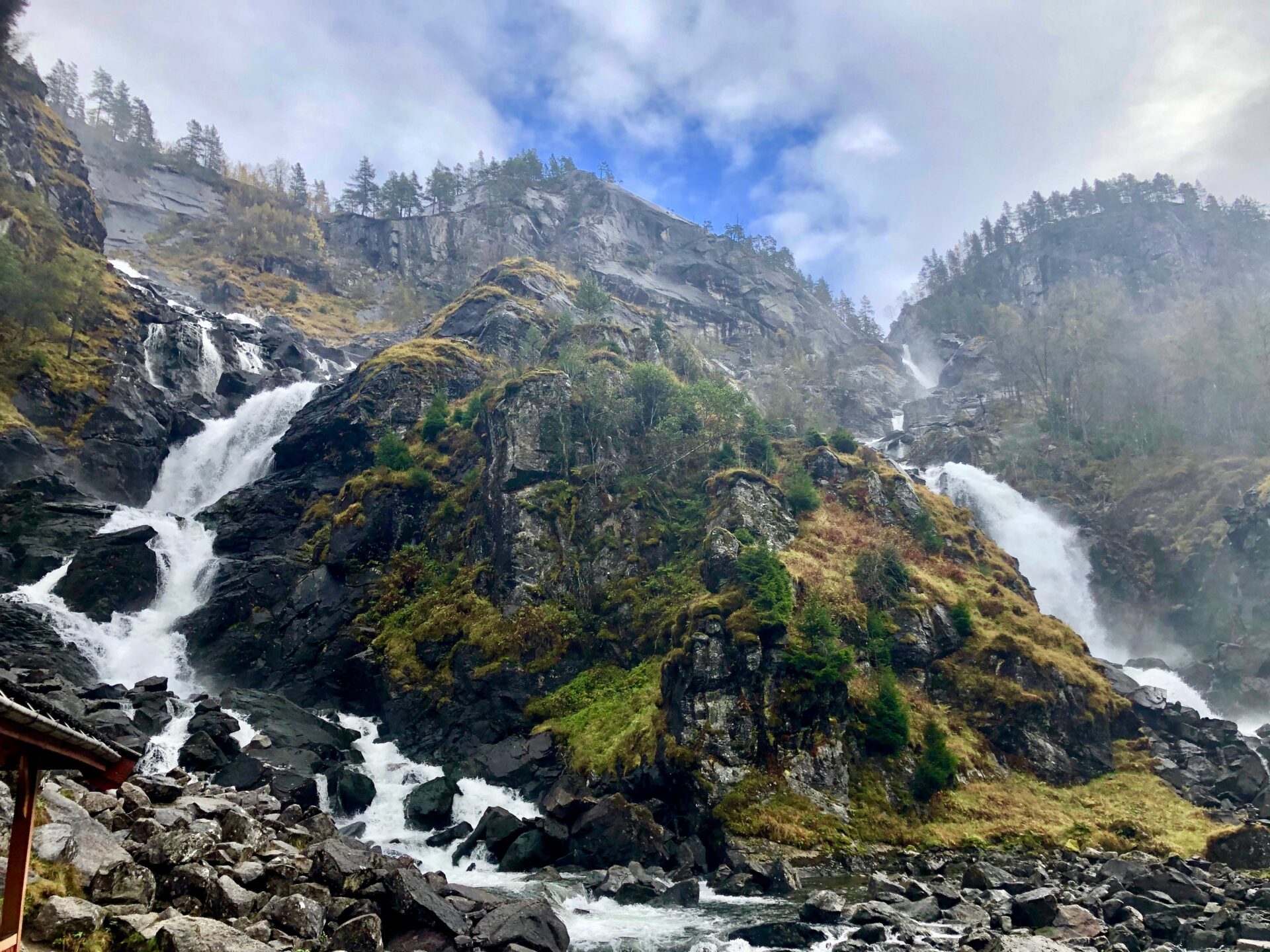
Låtefoss marks the gateway to Hardanger and the Norwegian scenic route Hardanger. It is located directly by the main road RV13 south of Odda.
The waterfall is 400m tall with a drop of 165m. It is a twin waterfall and has been a popular travel destination since the 19th century.
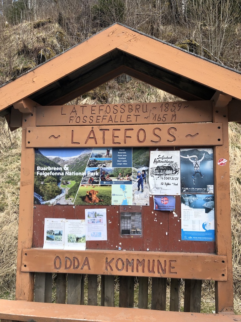
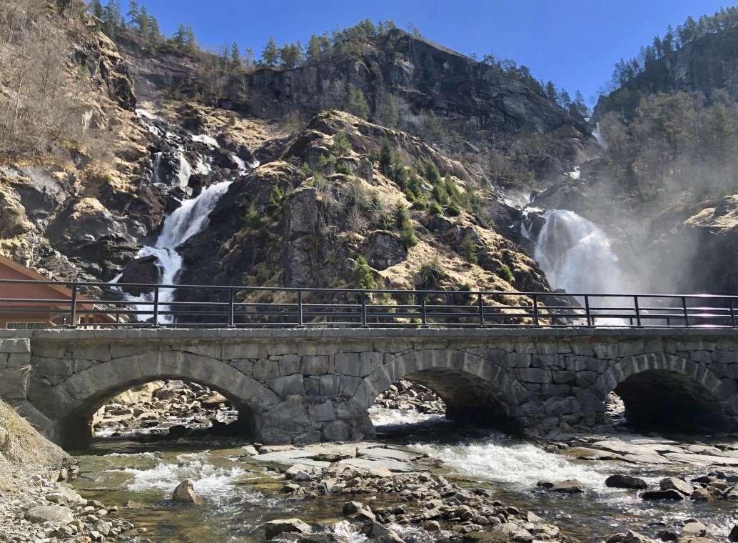
The Låtefoss bridge was finished in 1859 and expanded in the mid-1940s. The part that you see today was a newer extension around the 1970s.
This valley – Oddadalen – is also called “Fossenes dal” ( the Valley of Waterfalls), as there are several smaller waterfalls. Låtefoss is though the main attraction.
HILDAL
The next stop was the small place Hildal where you can see a massive boulder – between some old wooden houses on an open field. It fell there – from the mountain in 1978. The boulder is called Oddmundsteinen and is named after the landowner Oddmund Hildal.
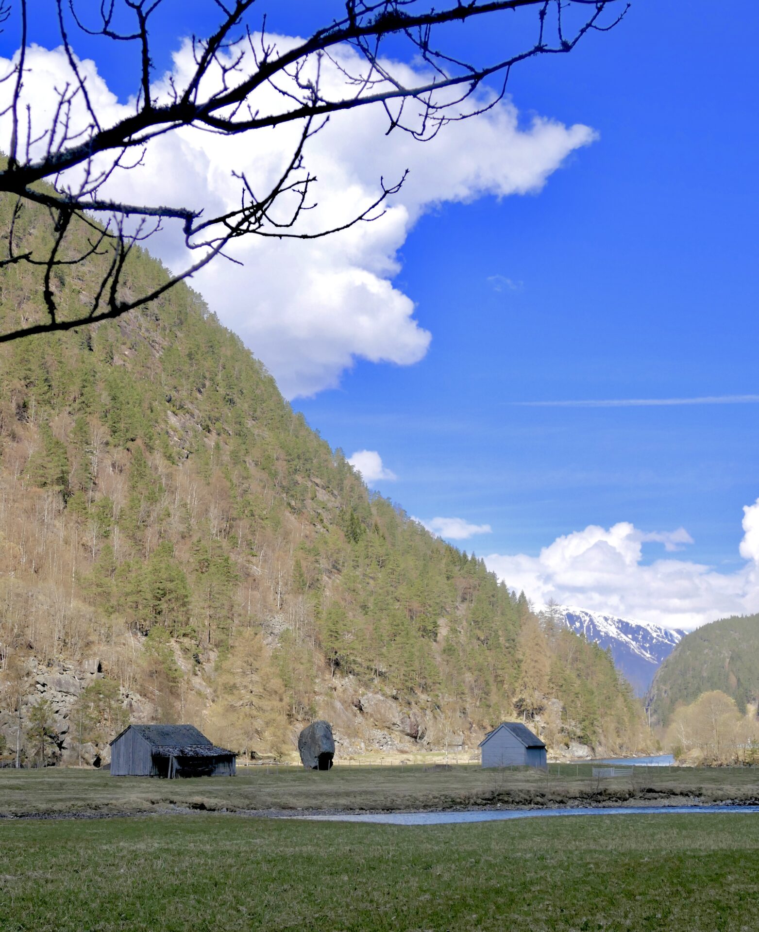
On the other side of the valley, close to this boulder, is Vidfossen, but the water flow was not that great.

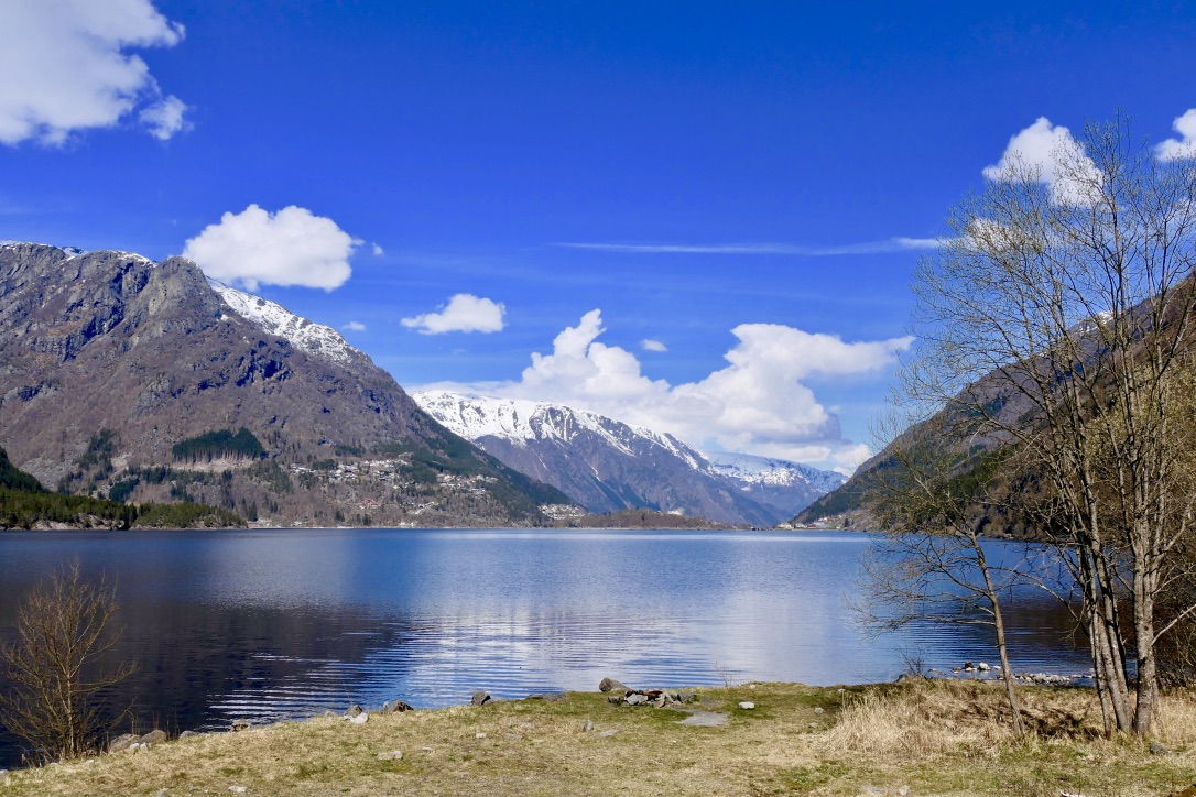
Before you reach Odda – you will drive along this lake – Sandvinvatnet:
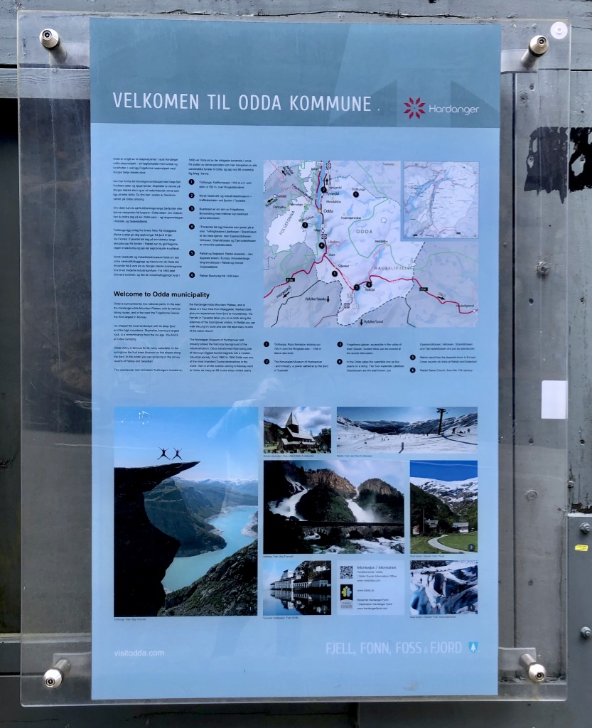
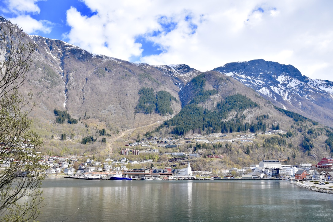
ODDA
Odda is the administrative centre of the municipality of Ullensvang (formerly, Odda was a separate municipality). It is the largest urban area in the whole Hardanger district.
Odda is a small, modern town – located at the southern end of Sørfjorden, a branch of the main Hardangerfjord. The town grew up around smelters built around the fjord in the mid-twentieth century, drawing migrants from different parts of Norway.
Already in the 19th century, Odda became a significant tourist destination. Visits ranged from English pioneers around 1830 to German Emperor Kaiser Wilhelm II, who visited Odda every year between 1891 and 1914. This tourist boom led to the construction of several hotels in the town.
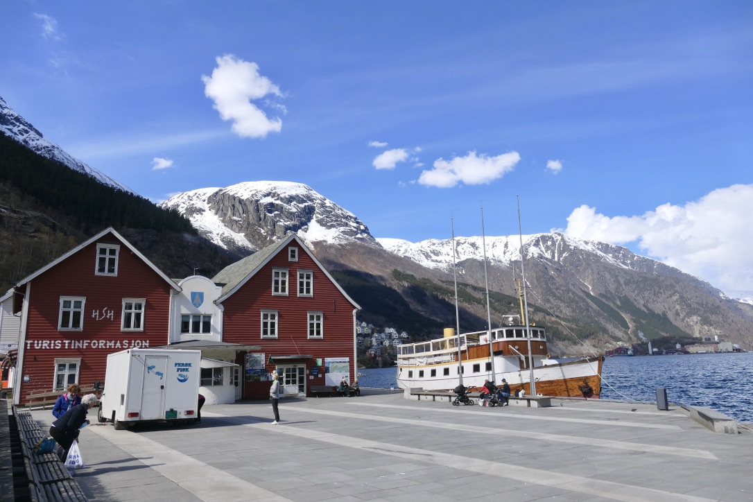
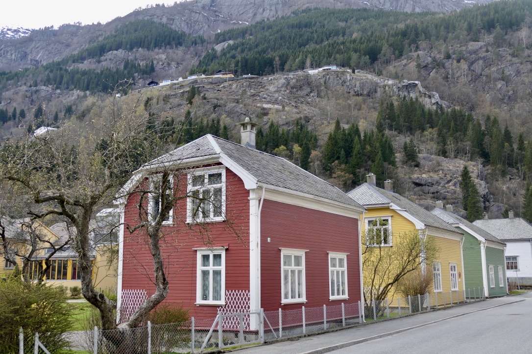
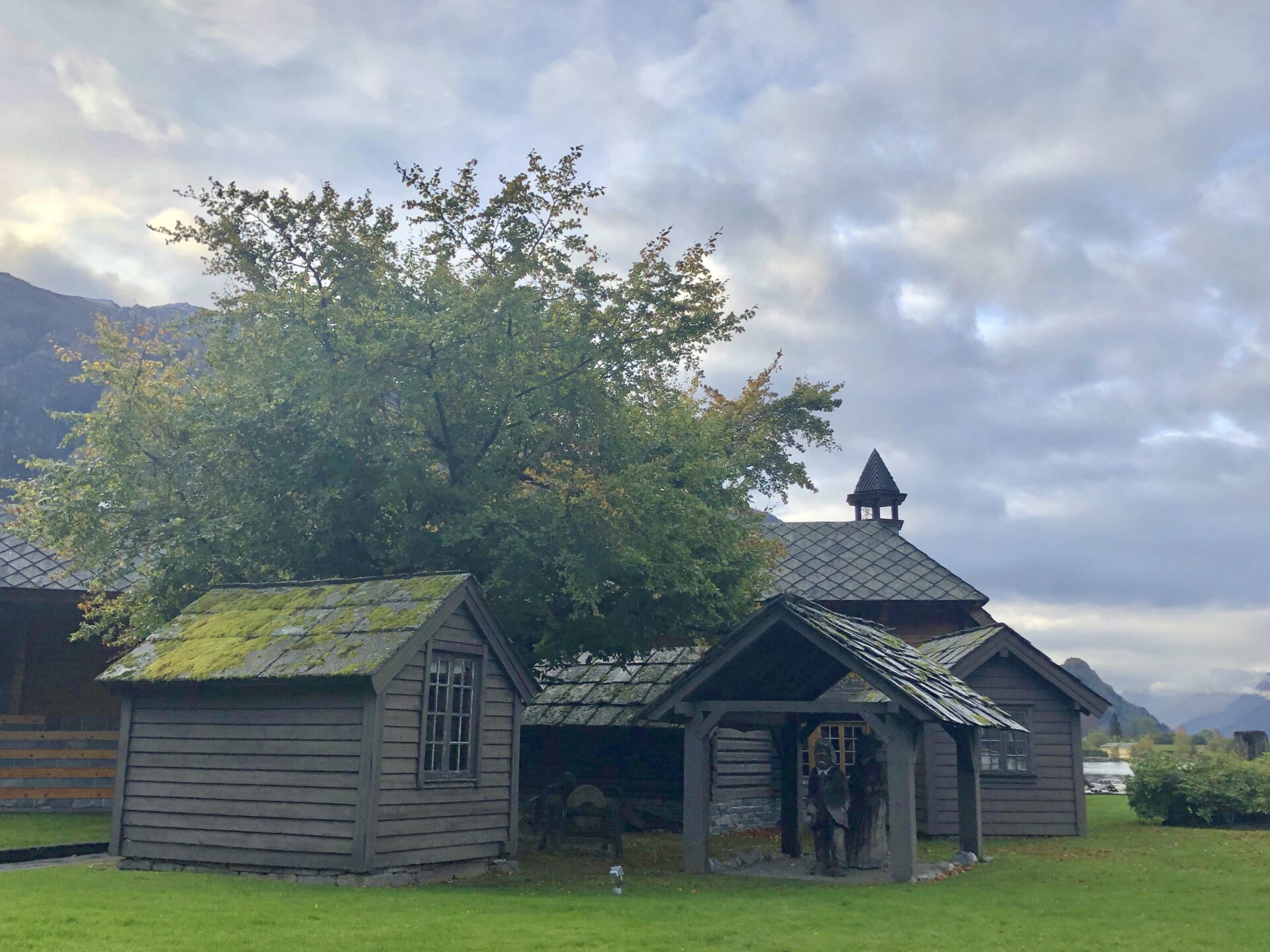
These small wooden houses in Folgefonngata are among the oldest in Odda, built around 1907/8 for workers housing. Three of them have become a museum, “Industristadmuseet in Odda”, a department of Kraftmuseet.
BUERBREEN GLACIER
After visiting Odda, I travelled to Buer to look at the Buarbreen glacier, an arm of Folgefonna glacier.
It is just an 8 km/15 min drive southwest of Odda. Buer has been a popular destination as long as there have been tourists in Hardanger.
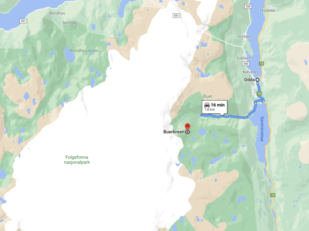
It is a narrow gravel road that leads you through the last part of the road in the Buerdalen (valley). You will drive Jordselvi, the river leading meltwater from Buerbreen through Buardalen to Sandvinvatnet.
There is a small parking lot before you come to the National Park Farm at the top of the valley.
The National Park Farm is Odda’s gateway to Folgefonna National Park and an ideal starting point for Buarbreen and Reinanuten.
It is also just lovely to take the trip to this place to see the view of the glacier, which I did. There are tables and benches set up for resting in several areas on the farm.
If you want to reach the blue ice yourself – you can have a 1,5-hour walk from the National Park Farm. You will walk through nature and forests, along rivers and over the suspension bridge on your way to the top.
You can have a guided hike at Bruarbreen glacier at the glacier plateau, where the guide provides and adjusts the necessary equipment, level and pace before the real adventure begins.
The glacier tour on the 5.000-year-old glacier is suitable for adults and children- it should be a fun and varied trip for everyone.
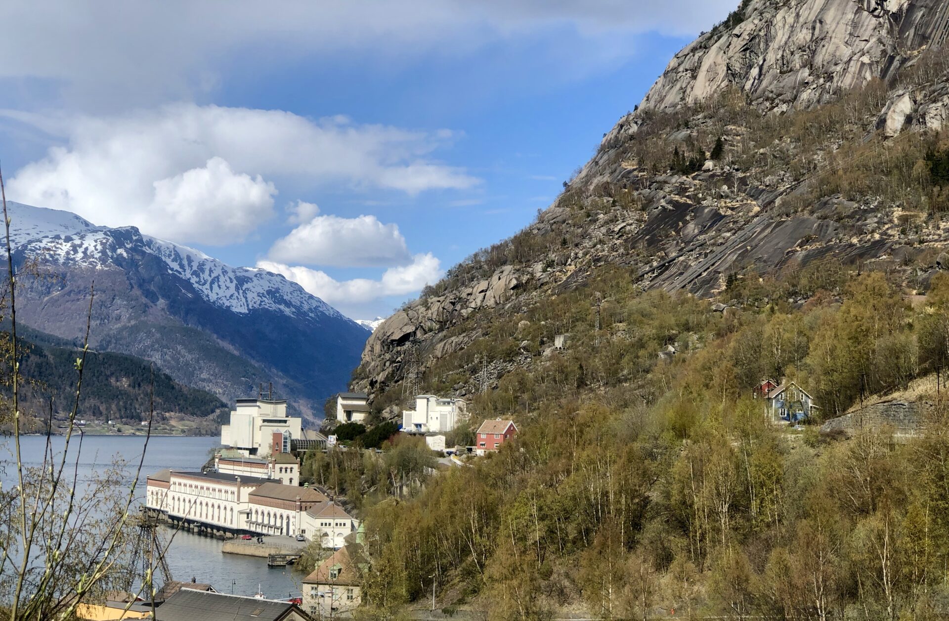
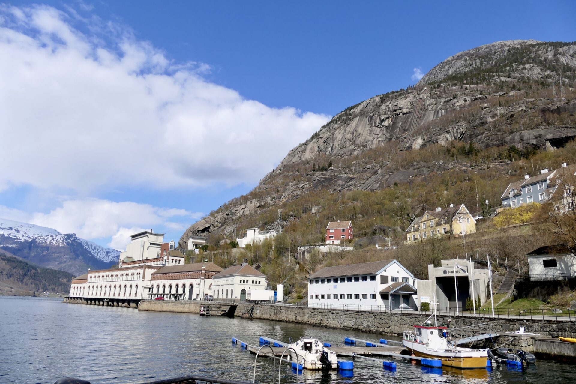
TYSSEDAL
Only 6 km north of Odda is the village Tyssedal (which means Trolldal – valley of trolls). Tyssedal is located at the mouth of the river Tysso and in the east, you will find mountains that lead up to the Hardangervidda.
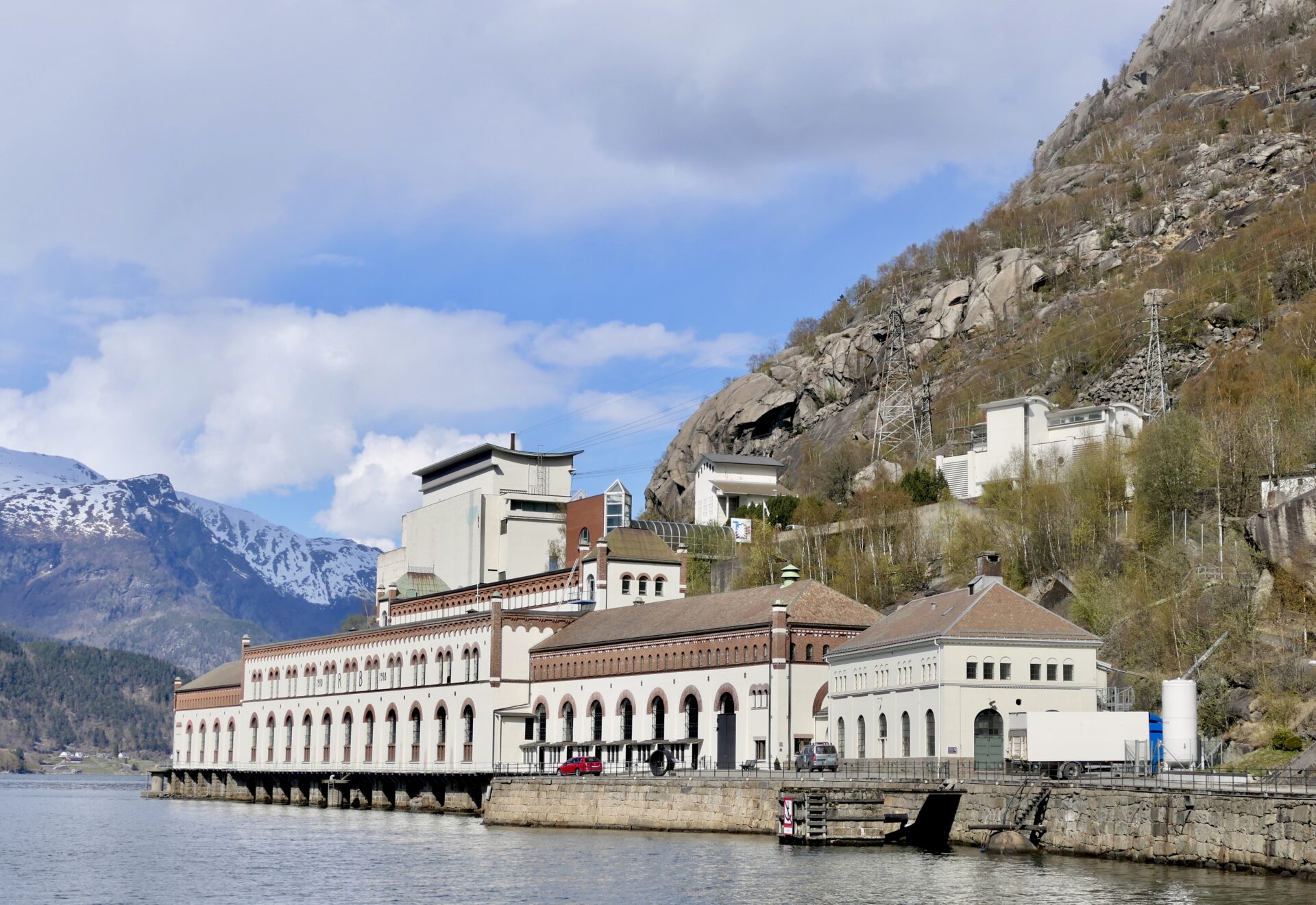
TYSSEDAL POWER STATION – NOW A MUSEUM
To deliver electricity to the large factories in Odda,-the Tyssedal Power Station (Tyssedal kraftanlegg) was built between 1906-1918. With a vertical drop of 400 metres, Tysso I was one of the largest high-pressure plants in Europe. Close to 1000 men, and a few women, came to participate in this construction adventure.
The 180-metre long power station by the fjord was built in three stages and was continuously developed with new technology and support functions- until 1989 when the production was shut down.
The plant was protected by the Norwegian Directorate for Cultural Heritage in 2000 and is part of the Norwegian Museum of Hydropower and Industry. The power station was added to the list of priority technical and industrial cultural heritage by the Norwegian Directorate for Cultural Heritage.
A visit to the Kraftmuseum explains Norway’s development from a farming society to an industrial society. The museum gives exciting insights into engineering, architecture, and urban development that arose here in the middle of the western Norwegian landscape.
The lake Ringedalsvatnet and the Trolltunga cliff are located just to the east, higher up in the valley.
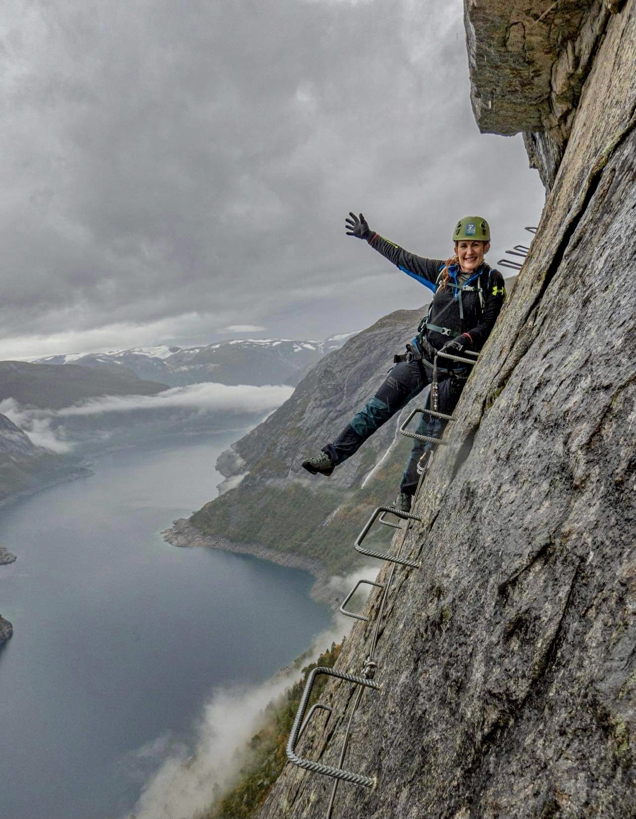
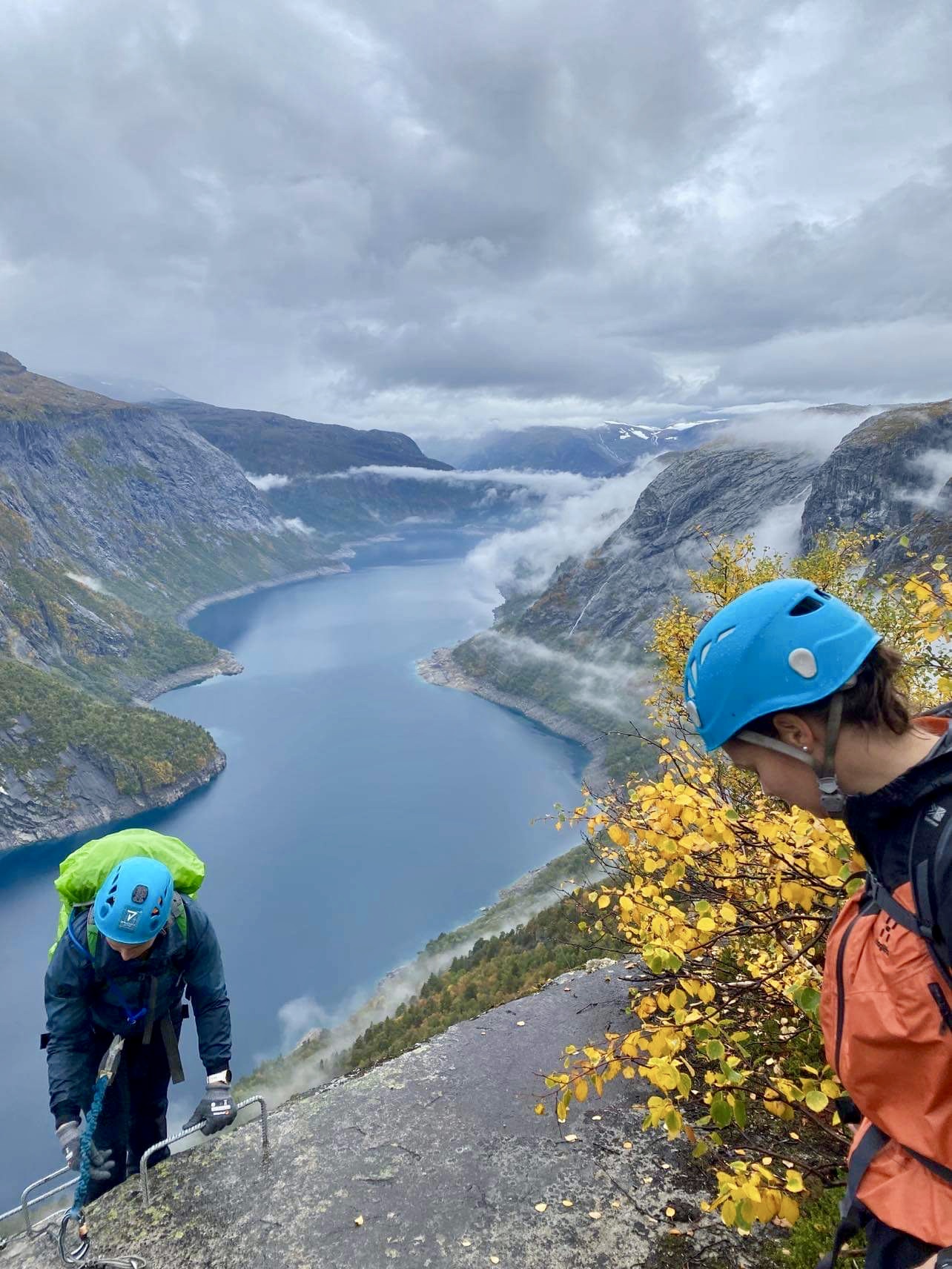
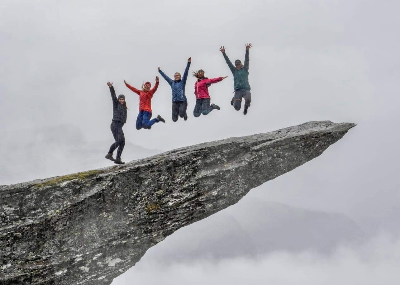
TROLLTUNGA – NORWAY’S MOST SPECTACULAR ROCK FORMATION
Trolltunga is one of Norway’s most spectacular scenic cliffs, hovering 700 metres above Lake Ringedalsvatnet in Skjeggedal, at 1100 m.a.s.l.
The hike through high-mountain terrain up to Trolltunga (1180 m) is long and demanding, but you are rewarded with magnificent views.
From the main trailhead in Skjeggedal, the roundtrip hike is 27 km with an ascent of almost 800 metres. The estimated hiking time is 8–12 hours.
The hike to Trolltunga is only possible during summer without a guide. From October to May, you can go with a guide.
Or are you looking for a more challenging and exciting adventure?
Then Trolltunga Via Ferrata is a perfect choice. This tour includes 6 km cycling along Ringedalsvatnet lake, then climbing the 250–metre Via Ferrata route, before walking the final 3 km to Trolltunga. The return is a hike down the Trolltunga Trail. See more:https://www.trolltunga-active.com/trolltunga-ferrata
My friend Elin joined this tour in September this year. Amazing pictures -taken by Trolltunga-Active:
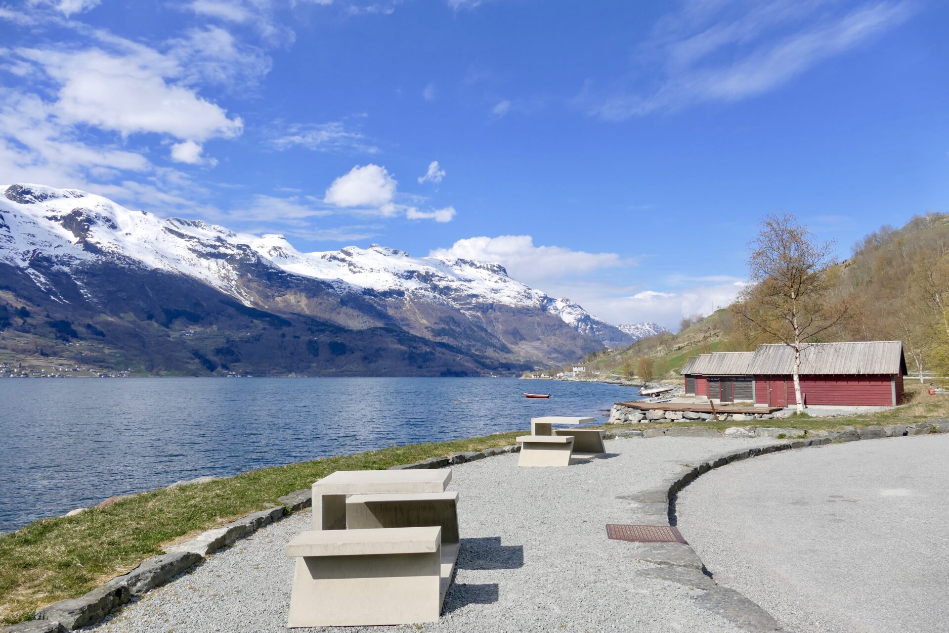
Idyllic rest area by Sørfjorden:
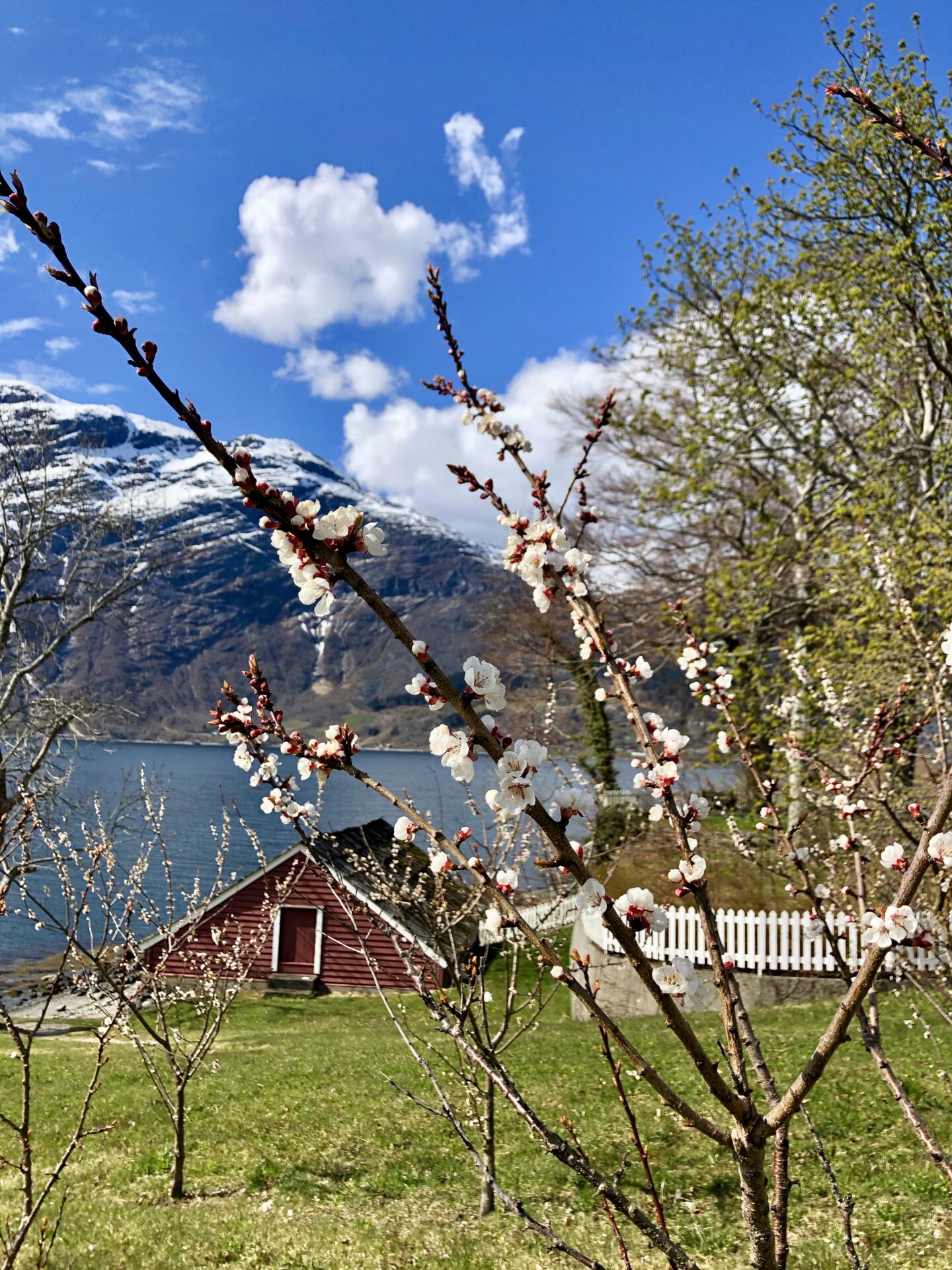
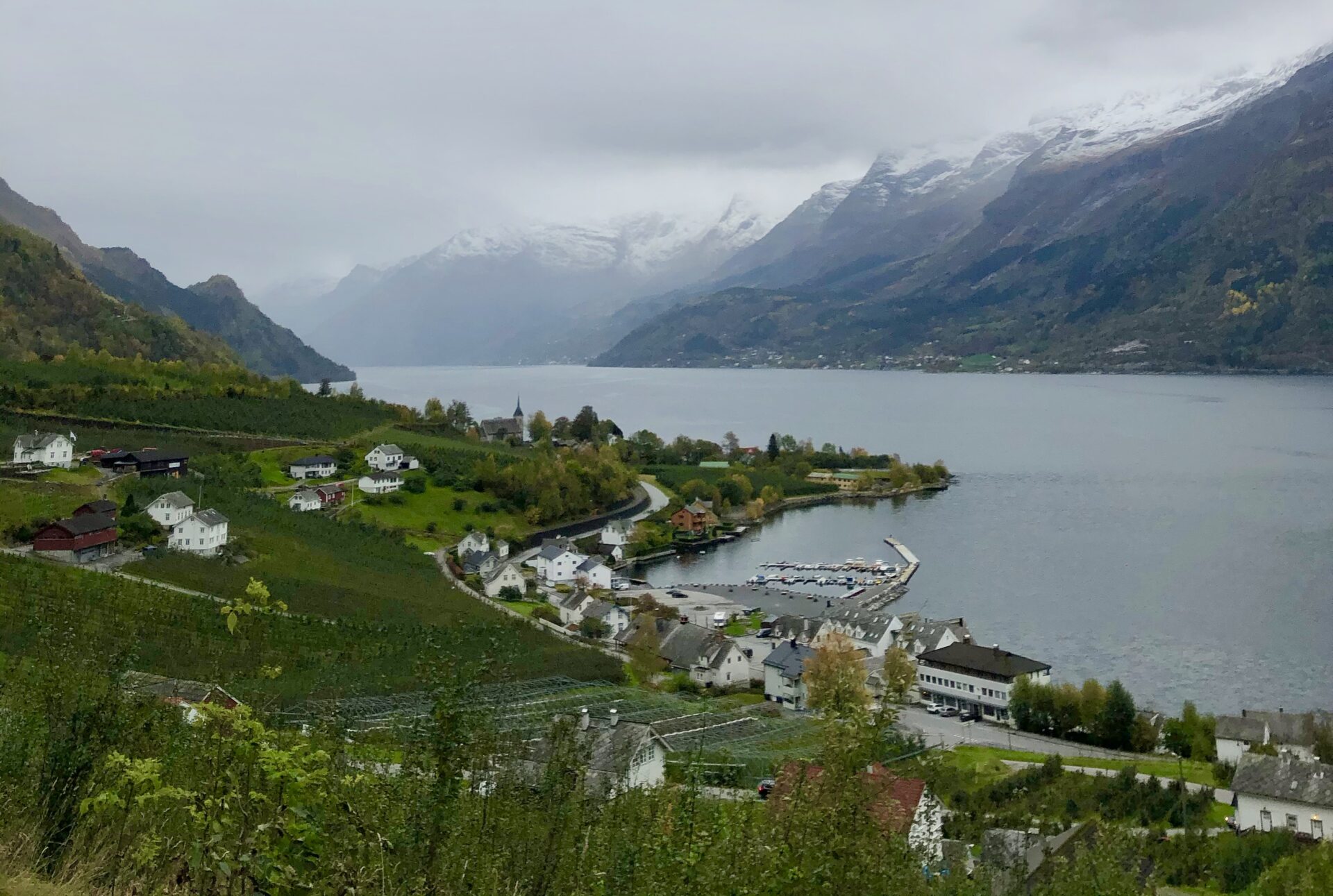
LOFTHUS
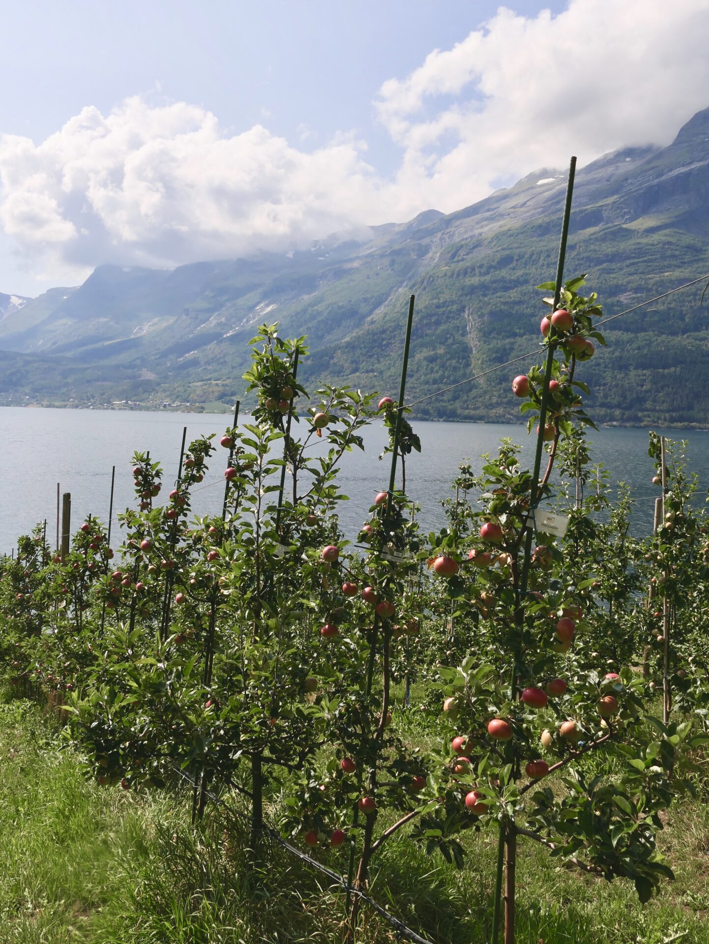
The next stop was Lofthus – a bit further north of Sørfjorden. Lofthus is known as the orchard of Hardanger, as it is one of the largest fruit villages in Norway. The village is sheltered in the rear by the Hardangervidda Mountain Plateau (National Park) and looking out over towering mountains and the Folgefonna glacier. During blossom time in May, there are more than 600.000 fruit trees in flower in Hardanger, about 512.000 in the villages along Sørfjorden.
This year I visited Lofthus both at the end of April and August. The tour in April was just a couple of weeks before the flowering season. However – I have been here several times and will also show some pictures from that season.
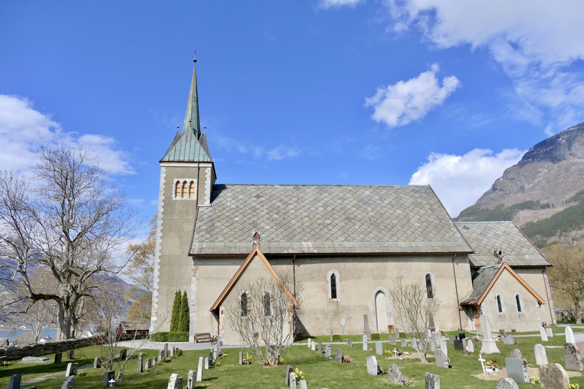
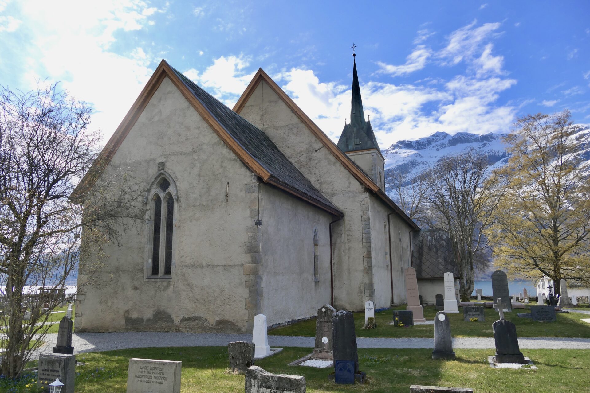
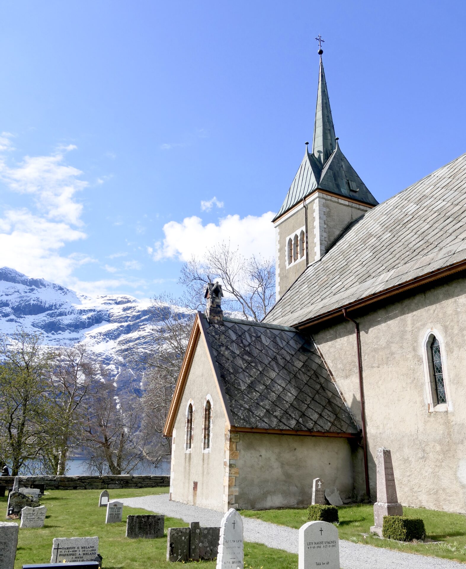
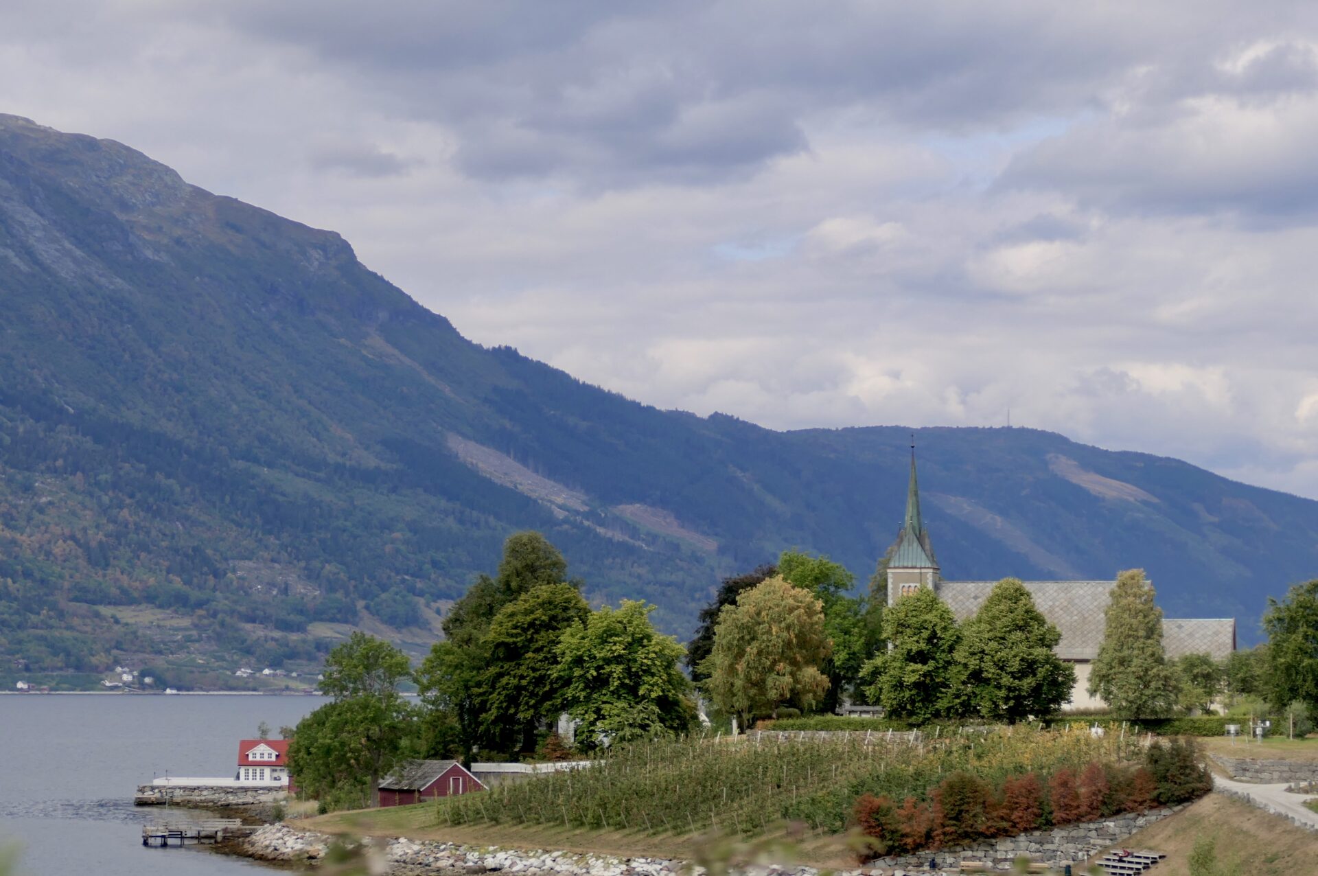
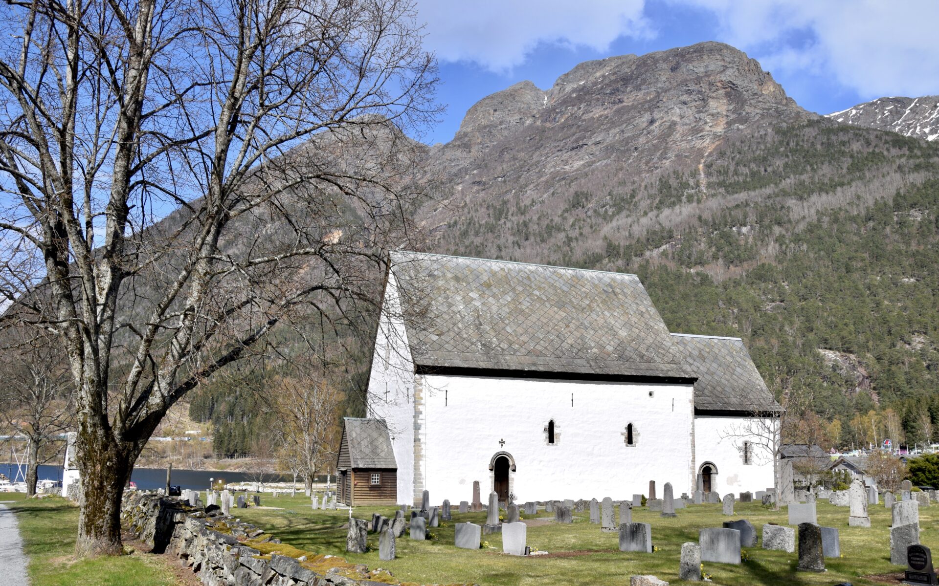
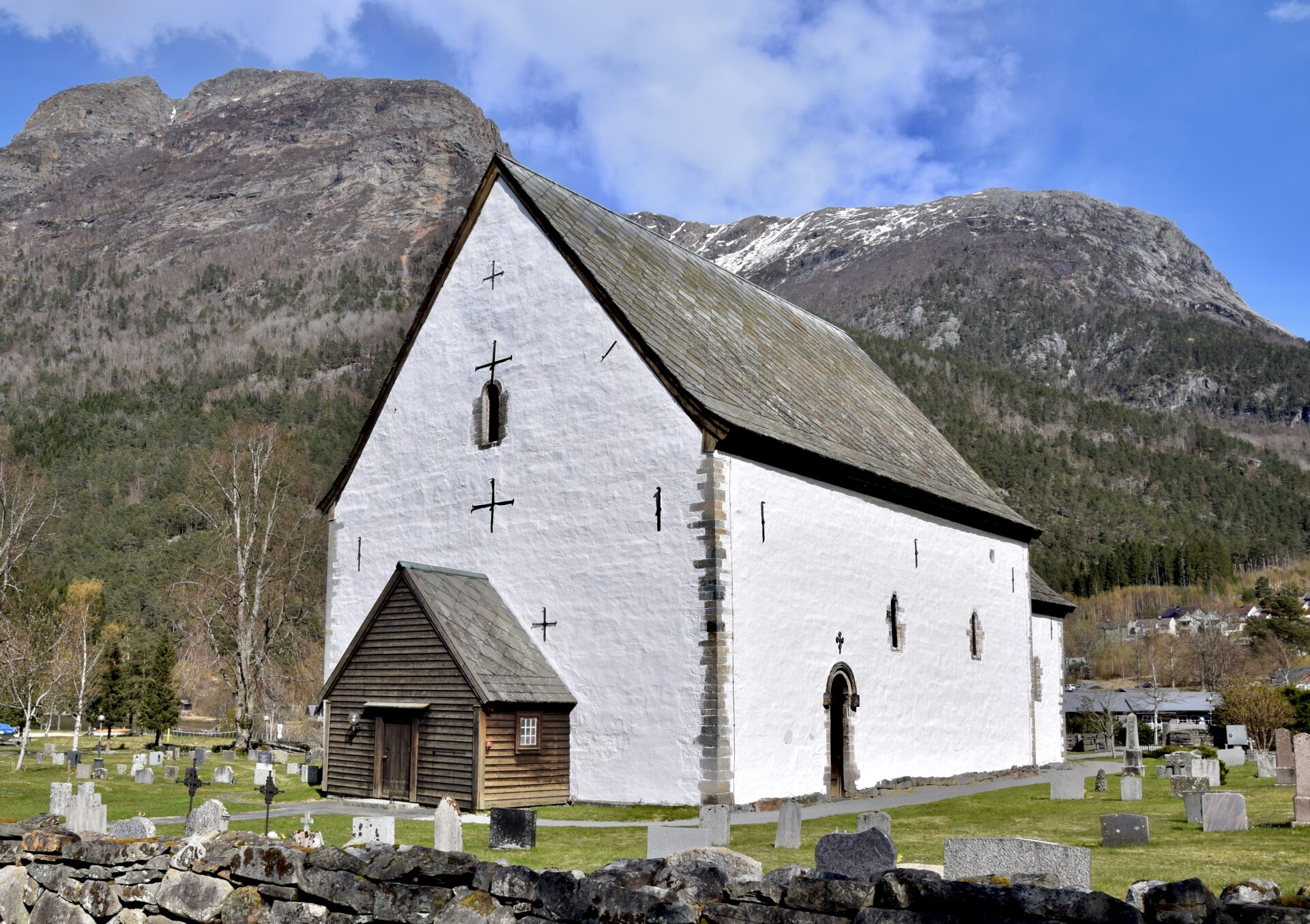
ULLENVANG CHURCH
Ullevang Church is a large stone church built in a long church style around 1250. It has expanded several times over the centuries, and the current tower was built between 1883-1885:
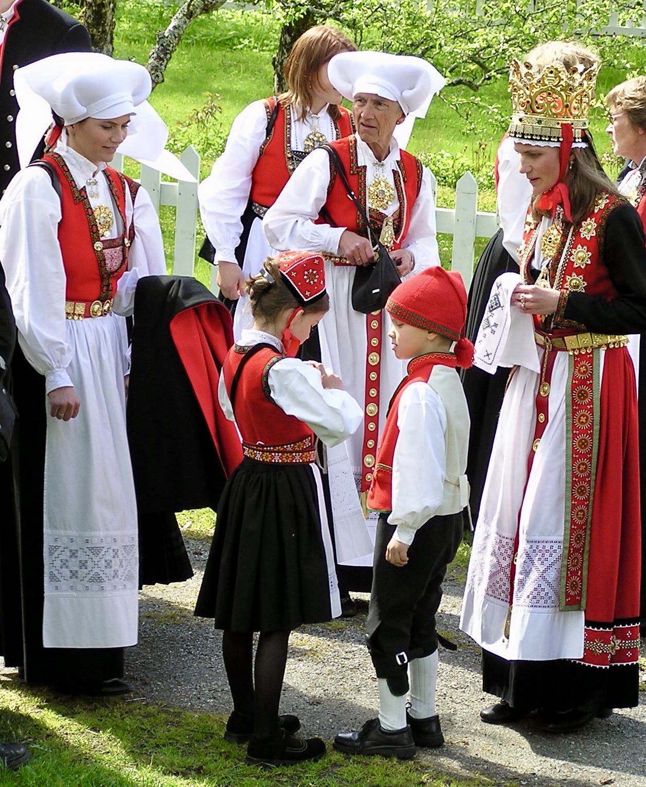
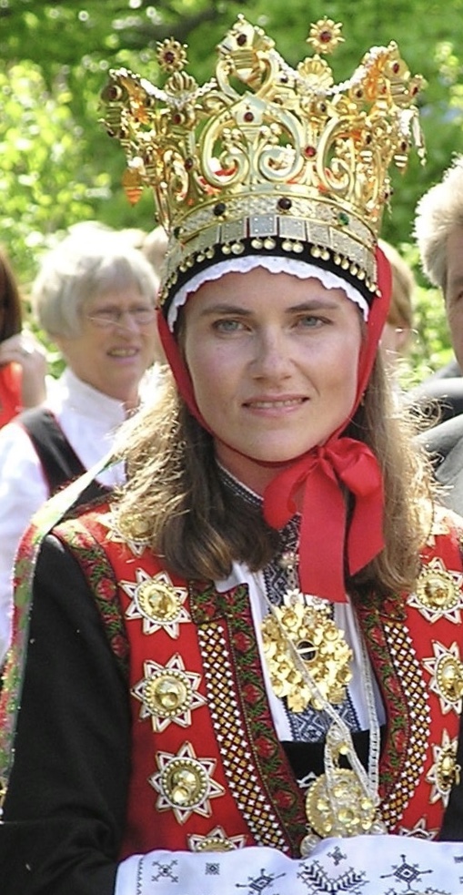
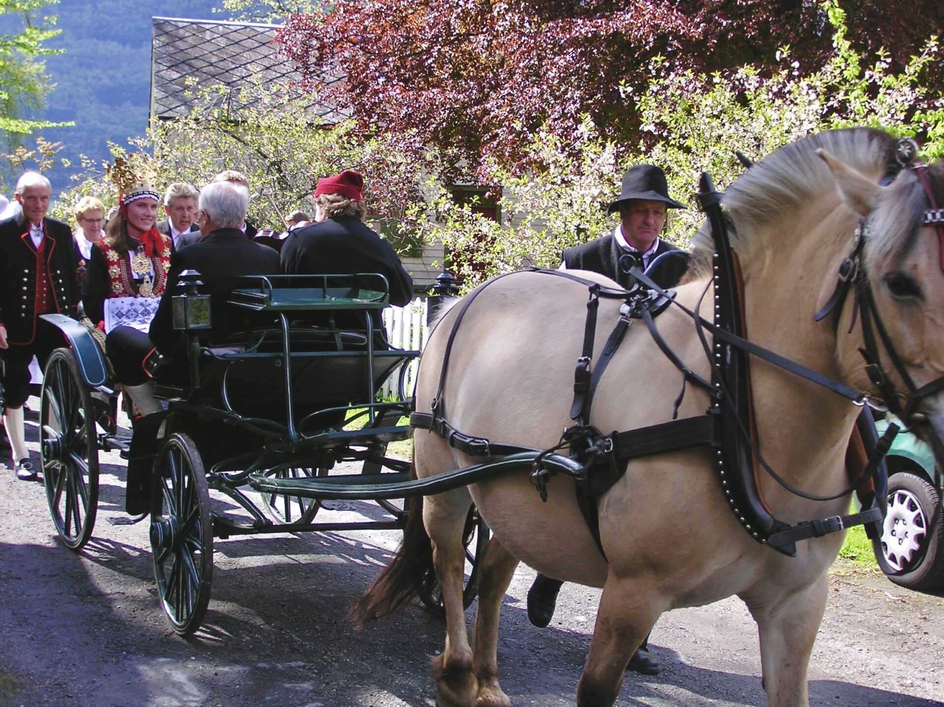
Some years back, we saw a bridal party at this church. Many of these wore the national costume of Hardanger (bunad ). Hardanger has rich costume traditions. The bridal costume is different from the ordinary woman’s national costume. It has a red skirt, is richly decorated and has a black jacket. Two bodice pieces are attached to the coat, which is beaded or has eyelets. The silver belt is worn first as a bride, as is an ‘Agnus Dei’ necklace around the neck. The beautiful bridal crowns are rooted in the worship of the Virgin Mary during the Middle Ages.
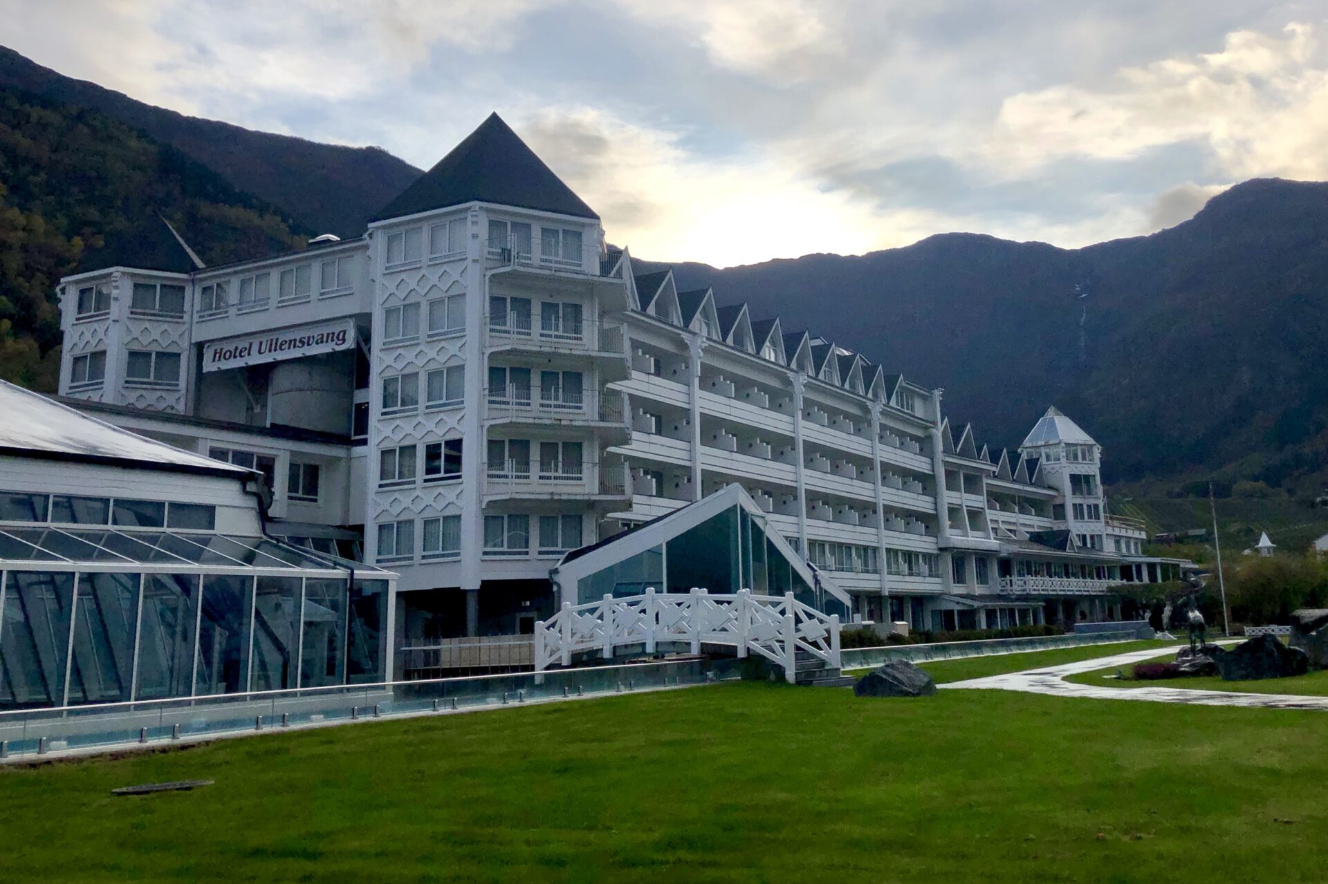
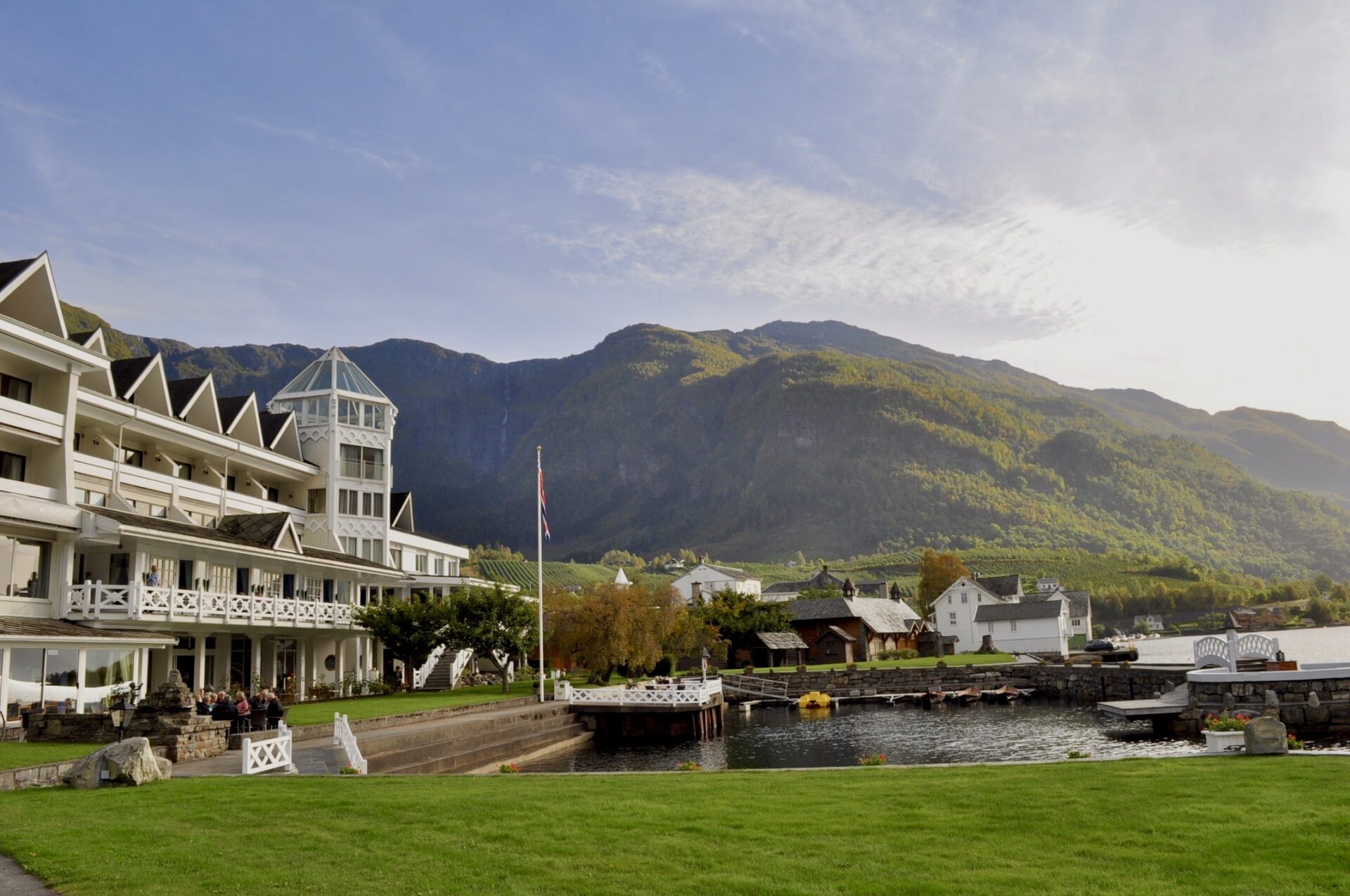
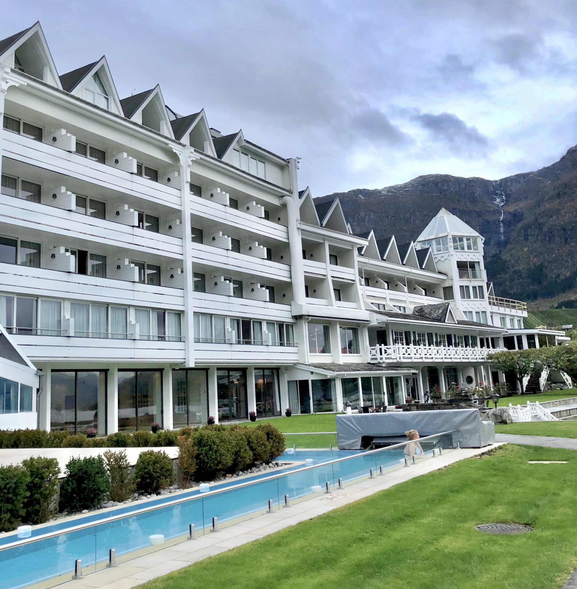
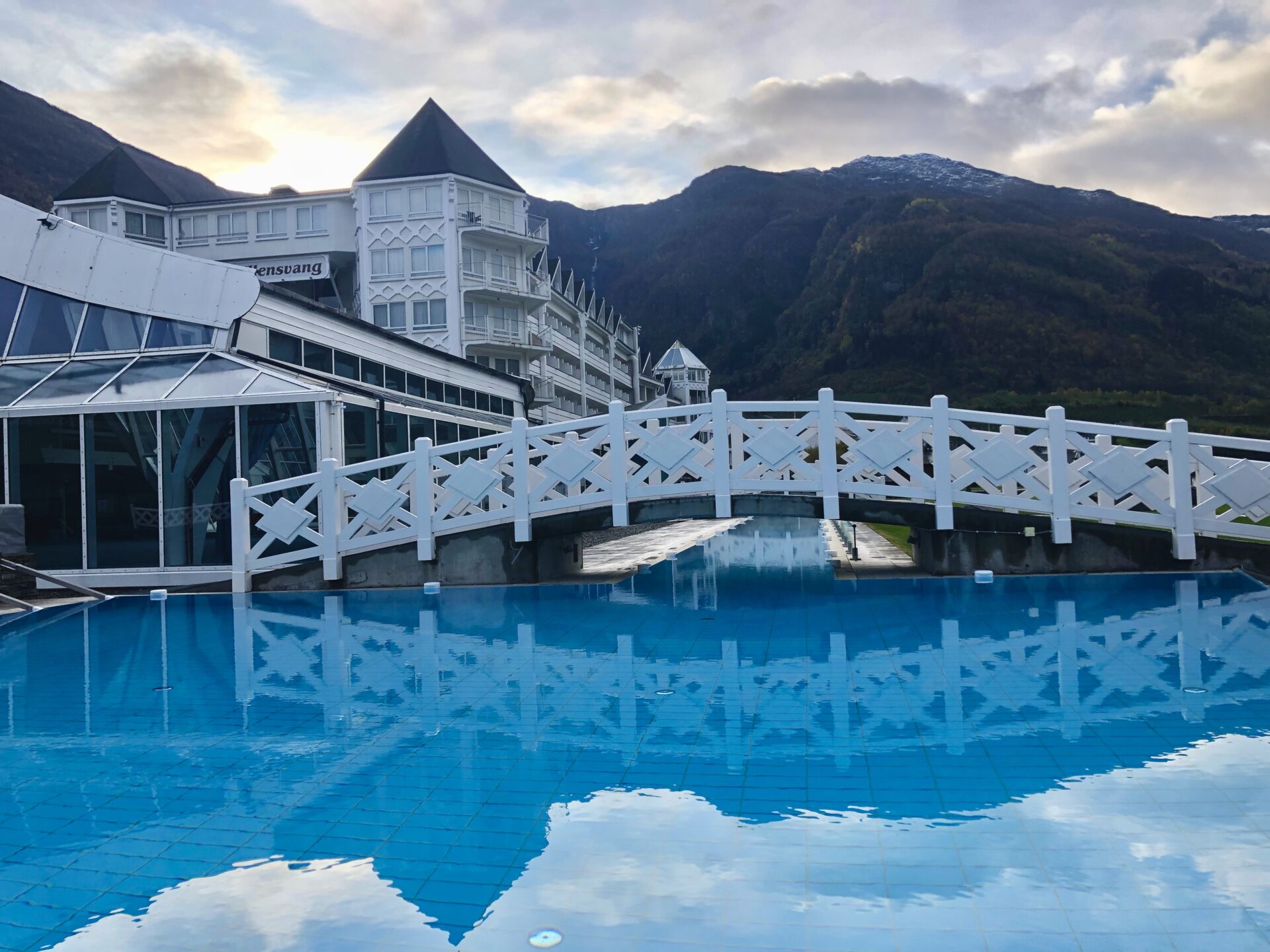
ULLENSVANG HOTEL
European royalty and persons such as Indira Gandhi, Willy Brandt and Henry Kissinger are among those who have stayed at the hotel over the years.

Hotel Ullensvang owns a “Kjenga” (beer bowl) dating back to 1846, the year the hotel was founded. The hotel has chosen to use this as its symbol and trademark. The drinking bowl was an ordinary household article on farms in Hardanger in the 19th century. Ale brewing has roots far back through the centuries, and on most of the farms, the farmer had a barrel of ale in the cellar.
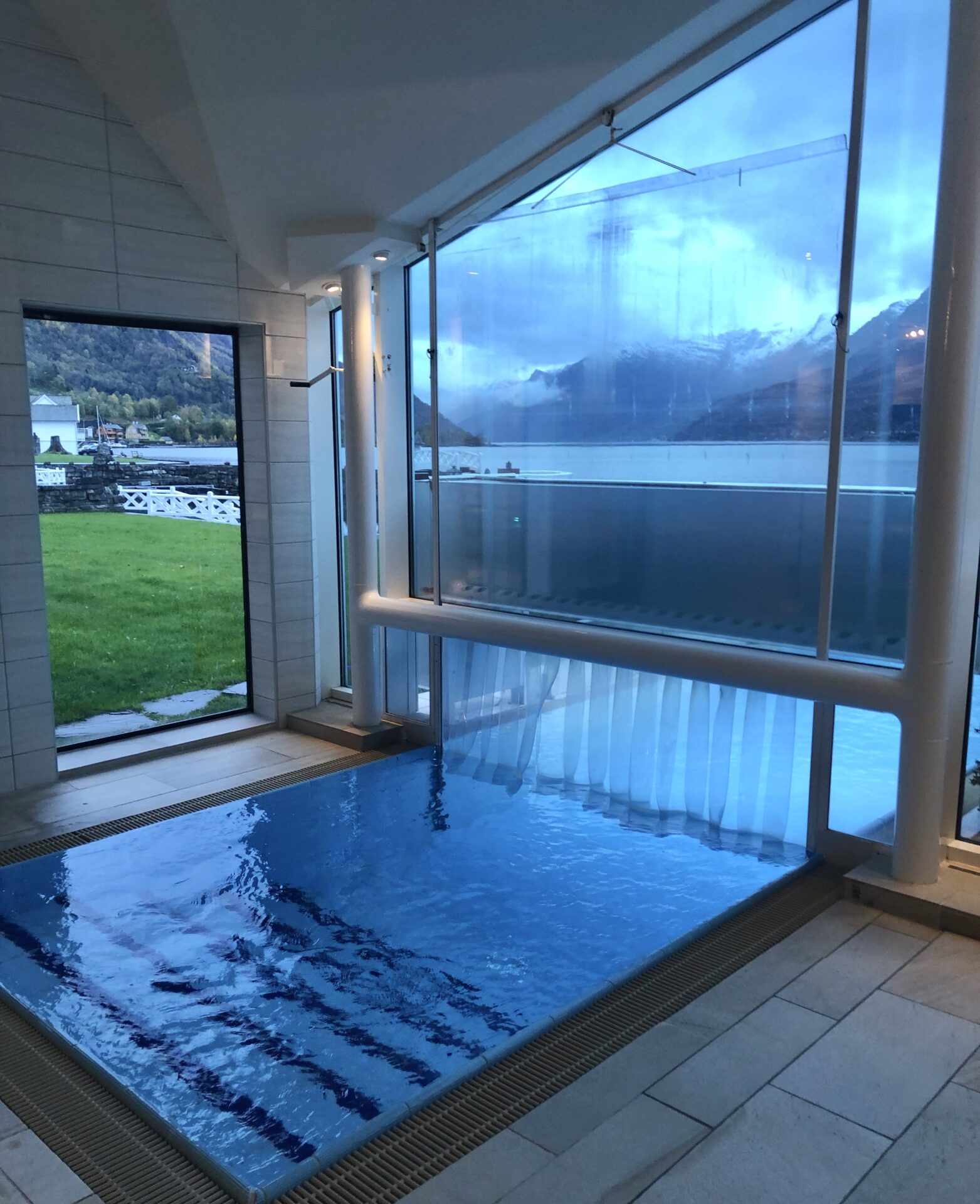
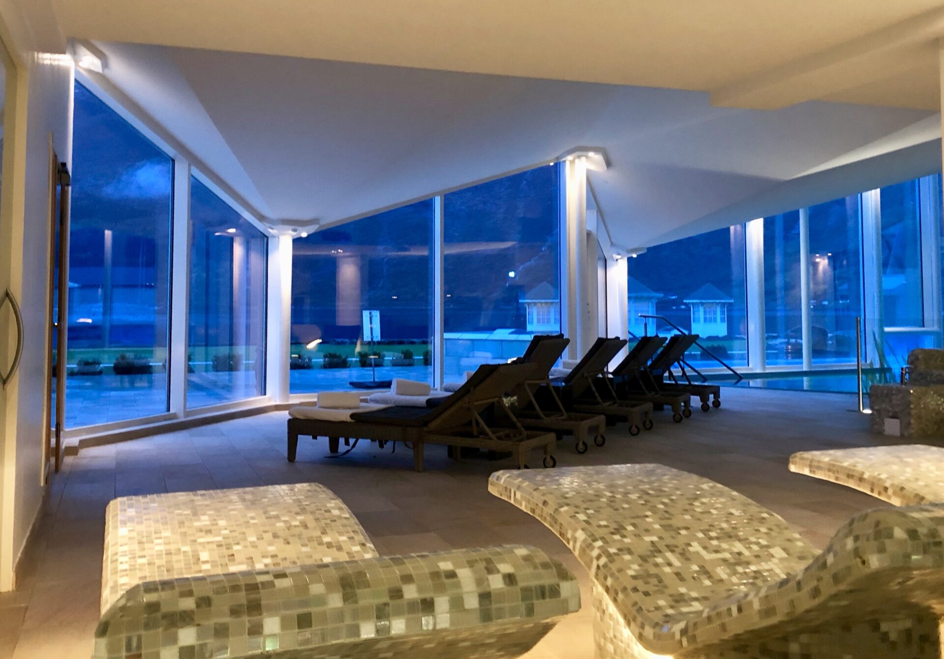
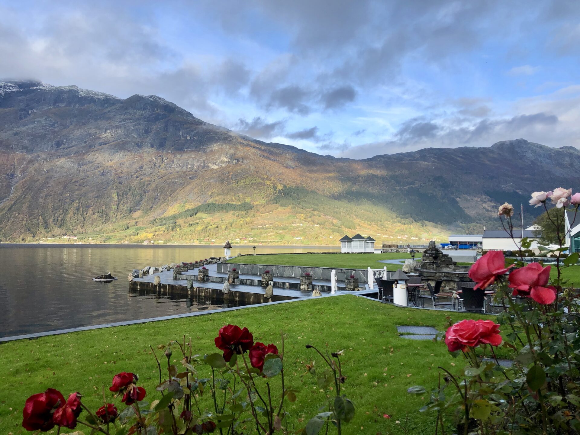
If you want an exceptional overnight stay in this area, I recommend the unique Hotel Ullensvang in Lofthus. It has a great location by the shore of Sørfjorden.
The hotel was founded in 1846, and it has been owned and run by the same family until recently. The hotel is beautifully decorated with a combination of modern comforts, local traditions and history. I have stayed there several times, and I am delighted with the service. The hotel also offers a wide range of fun activities for all ages. You can choose between bowling, swimming, squash and much more. I love their wellness area with an 88-meter long swimming channel stretching from the swimming pool indoors to an infinity pool outdoors. The recreation area also has a waterfall, loungers with a jacuzzi massage and the panorama sauna providing beautiful views of the fjord.
You will find Edvard Grieg’s composer’s cabin in the lovely hotel garden. He frequently used the house when staying in Lofthus.
Edvard Grieg (1843-1907) composed valuable pieces of his music here.
ACTIVITIES/HIKES IN THE LOFTHUS AREA
Lofthus is an ideal point of departure for magnificent hikes and experiences in nature. Trolltunga, described under Tyssedal, is just about 30 min. by car. On the contrary, the Dronningstien hike can start or end in Lofthus.
DRONNINGSTIEN
– The H.M. Queen Sonja’s Panorama Hiking Trail
The H.M. Queen Sonja’s Panorama Hiking Trail, known in Norway as “Dronningstien” (Queen’s Path) in Hardanger, has become one of Norway’s most popular hiking trails. It is also one of H.M. Queen Sonja’s favourite hiking trails, which leads through the high mountains between Kinsarvik and Lofthus. Spectacular view of the Sørfjorden, parts of the Folgefonna Glacier, and other scenic sites in Hardanger.
The hike is 16 km long and takes about 6 – 9 hours, and has a total difference in altitude of 1,100 meters. The hike consists of steep climbing, which can be challenging if you are not used to hiking in the mountains.
If you end the trail in Lofthus, the descending part of this trail is through the famous “Monk steps”; 616 steps of large stones that British monks built in the 13th century.
MUNKETRAPPENE – “The Monk Steps”/ Nosi viewpoint
The “Monk Steps” is a hike of its own. A steep walk from Ullensvang Hotel. The trail transitions from road to a gravel road that will zig-zag steeply. There is a short woodland area trail that meets another gravel road. The trail is well marked to the start point of the 616 monk steps (600 to 800 masl) that will take you to the Nosi viewpoint ( 950 masl).
The steps were made by monks of the Cistercian monastery – to simplify access to the Hardangervidda Plateau.
The view is spectacular: fjord, waterfalls, Folgefonna National Park and Hardangervidda National Park.
You can continue to the Nosi cabin. This return trip will take you approx. 5 hours.
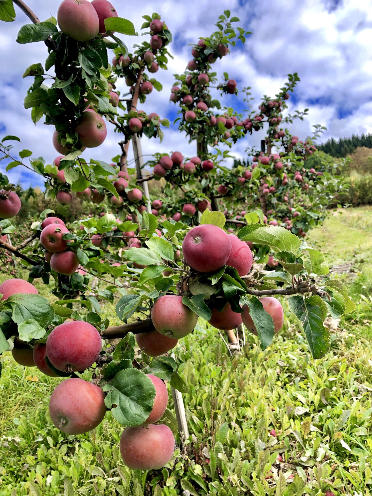
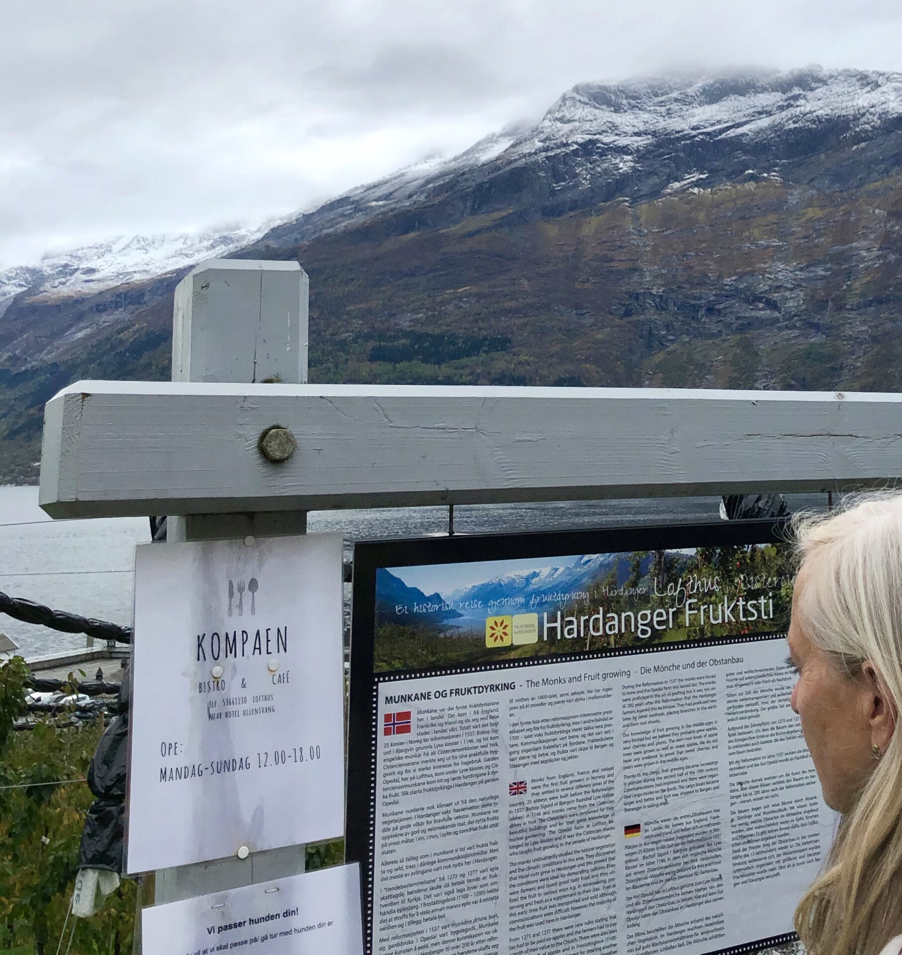
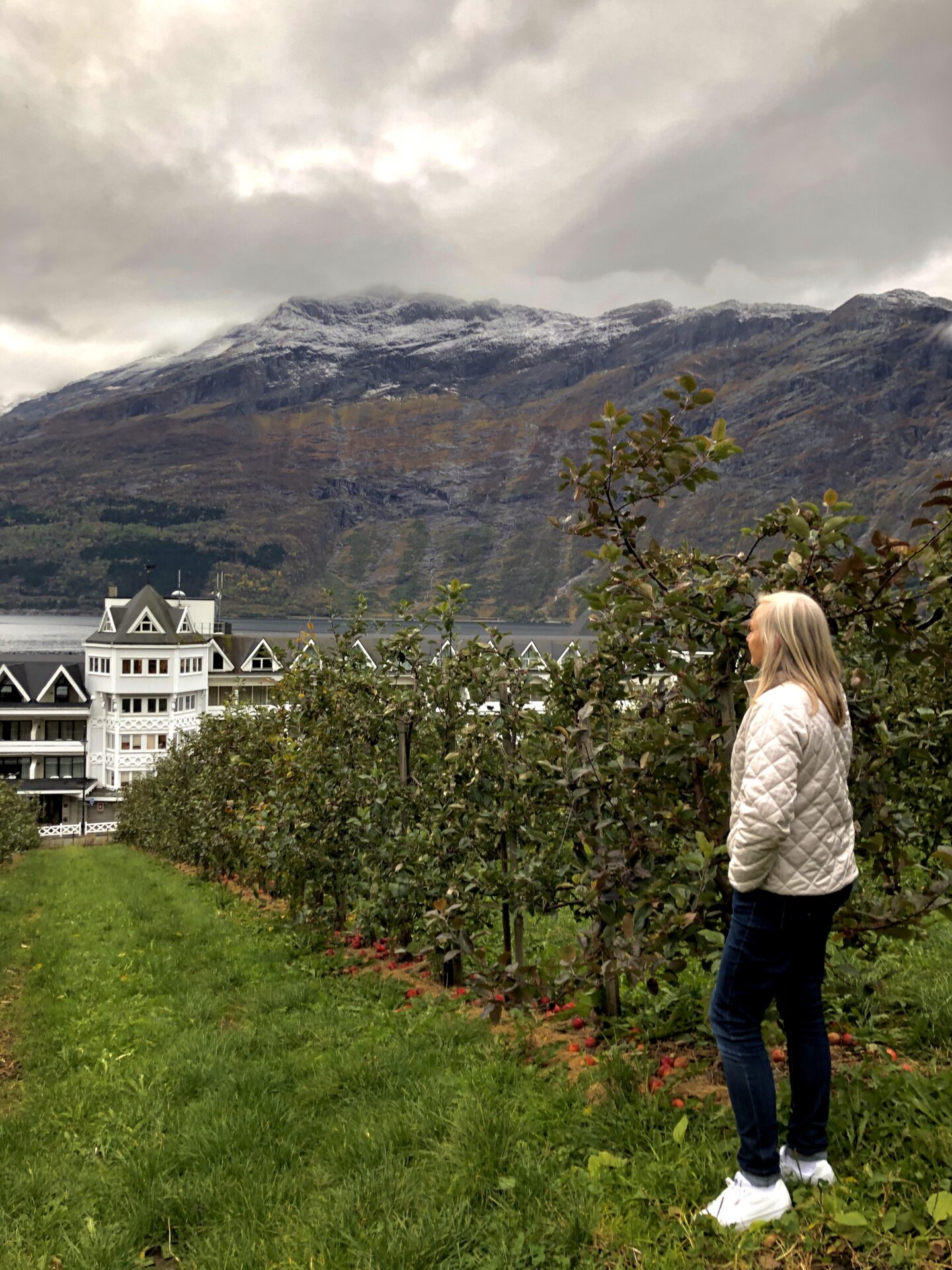
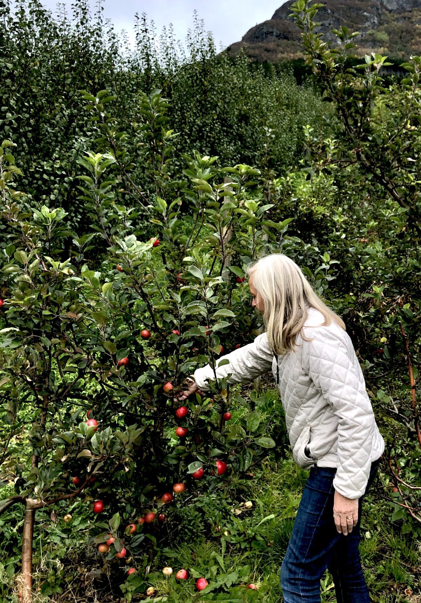
HARDANGER FRUIT TRAIL WALK
Ullensvang is Norway’s most extensive fruit garden, boasting over 500,000 fruit trees. It all began over 800 years ago when the monks from the Cistercian Order established a farm close to Ullensvang and taught the local farmers to grow fruit.
Hardanger Fruit Trail takes you on a journey through the heart of Norwegian fruit production. Follow the ten signposts along local roads and fruit gardens and learn more about fruit farming and local history while enjoying the beautiful scenery.
The Fruit Trail is accessible from many places: Lofthus Camping, Hotel Ullensvang, Ullensvang Gjesteheim, Hardanger Youth Hostel, and from the supermarket in Lofthus.
It is possible to make this a longer or shorter trip. The trip can take from 20 min to 2 hours (roundtrip), depending on your preferences.
We walked a part of this fruit trail in Oktober 2019:
KINSARVIK
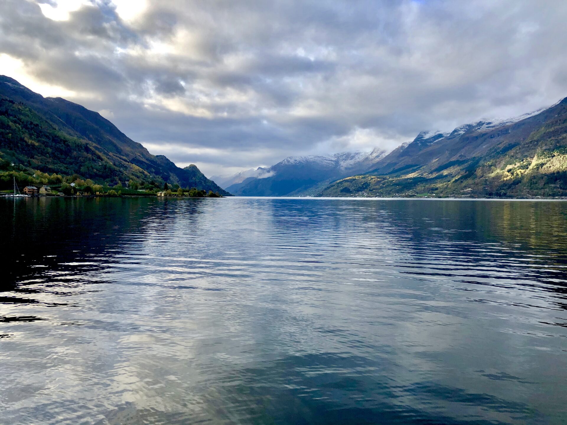
Kinsarvik – lies at the end of a small bay at the confluence of Sørfjorden and Eidfjorden, where they join to form the main branch of Hardangerfjorden.
The village has a ferry port with regular routes that connect it to Utne and Kvanndal across the fjord. Until the 1970s, it was the busiest ferry port in Norway and a crucial junction on the only all-year road connecting the main cities of Bergen and Oslo. After the Hardanger bridge was completed in 2013, Kinsarvik was no longer part of the dominant route and tourist stop for east-west and north-south traffic.
Due to its strategic location along the Hardangerfjorden, Kinsarvik has been important since the Viking Age.
The first church in Kinsarvik was a wooden post-church that was built around the year 1050. It was the first wooden church to be built in the Hardanger region. In 1160 a stone church replaced the wooden church on the same site. The new church has a Romanesque style. It is the oldest stone church in the Hardanger region, and at one time, it was one of the four main churches for all of the old Hordafylke county.
Kinsarvik functions as a base camp for tourists visiting the surrounding areas and has several camping grounds and a hotel. The shores of the fjords in this area are thick with fruit trees, primarily cherry and apple trees.
HUSEDALEN VALLEY / WATERFALL TRAIL
If you like waterfalls, you should visit Husedalen valley near Kinsarvik.
Four stunning waterfalls are close to each other along the hiking trail from Kinsarvik up to the Hardangervidda mountain plateau. From Kinsarvik, it is a 5 minutes drive over a very narrow road to a parking lot where the path into the Husedalen starts.
The hike takes 5-6 hours to the uppermost fall and back from the car park.
If you want to hike to the two first waterfalls, it will take around 3 hours.
The area is easily accessible and a good alternative for hikes of any length. The length is 5 km (one way), or less if turning back earlier.
Kinsarvik makes the end of the first section of the Hardanger Scenic Route-part1.
Follow me to the second section, Norwegian Scenic Route-Hardanger-part2:
