
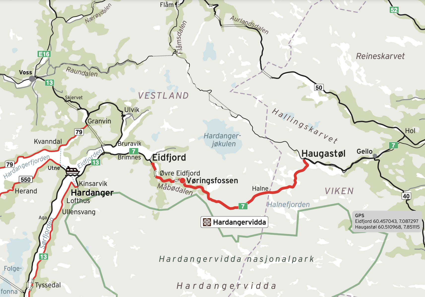
Norwegian Scenic Route-HARDANGERVIDDA – runs from Eidfjord by the fjord – to Haugastøl at the high mountain plateau Hardangervidda. It follows the national road Rv7 and has a total distance of 67 km.
Along this scenic route you will encounter the narrow, steep valley of Måbødalen, the great waterfall Vøringsfossen, high mountains and glaciers in the far distance, and Hardangervidda – Northern Europe’s largest mountain plateau and also Norway’s largest National park.
Main stops:
Eidfjord
Vøringsfossen
Hardangervidda
Dyranut
Halne
Fagerheim
Haugastøl
EIDFJORD
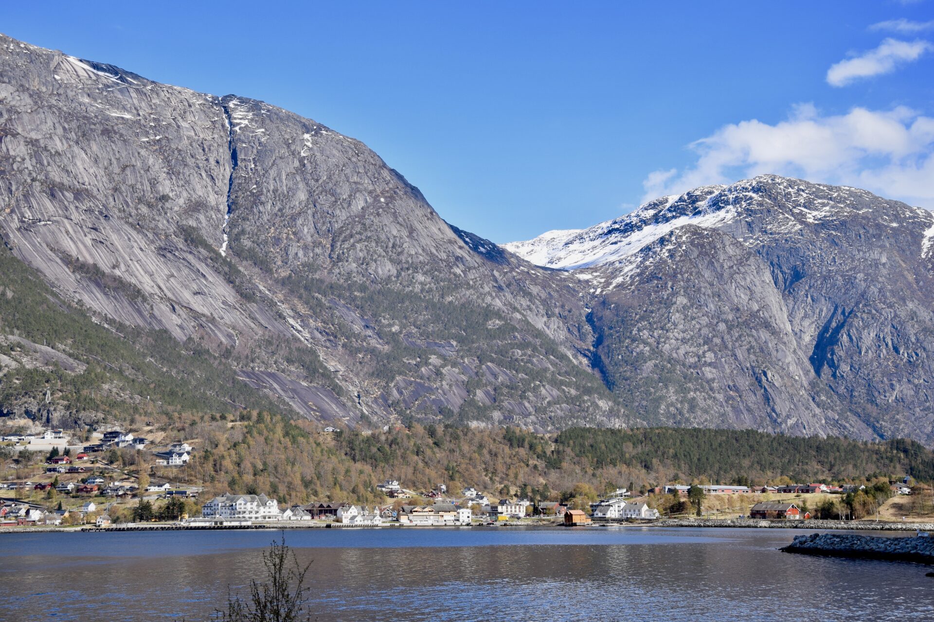
The village of Eidfjord, at the end of Eidfjorden, is the municipality’s administrative centre with the same name.
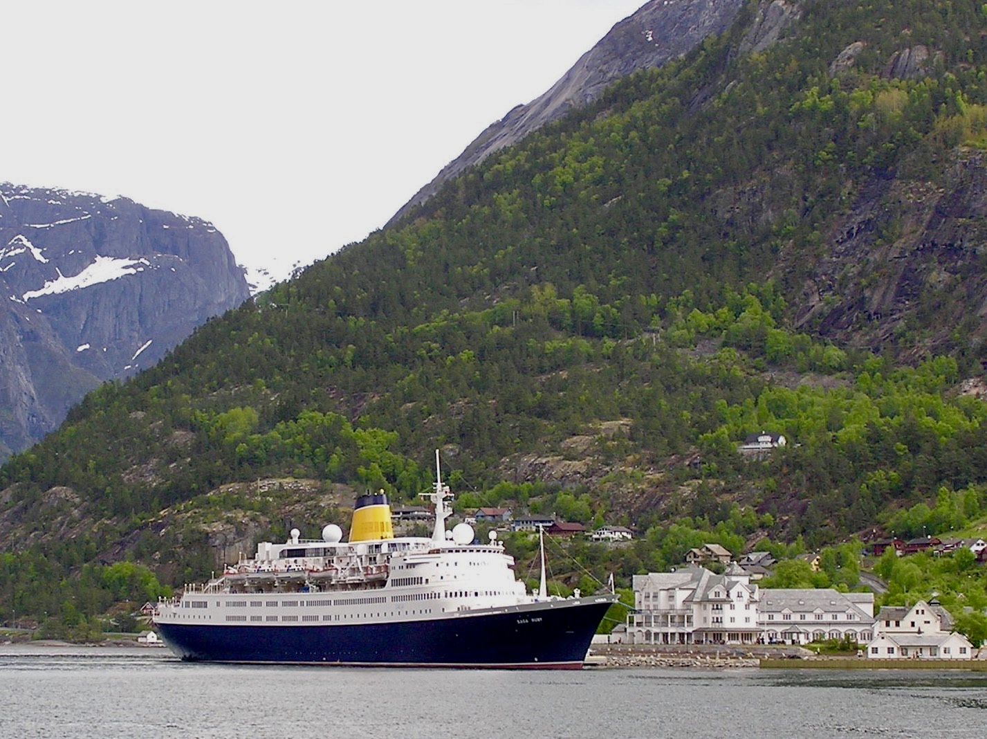
The village is a major cruise ship port of call, and most of the tourists come to visit the great attractions like Måbødalen valley, Vøringsfossen waterfall and Hardangervidda.
There are several accommodation possibilities in Eidfjord. Both hotels, huts, rooms and camping sites.
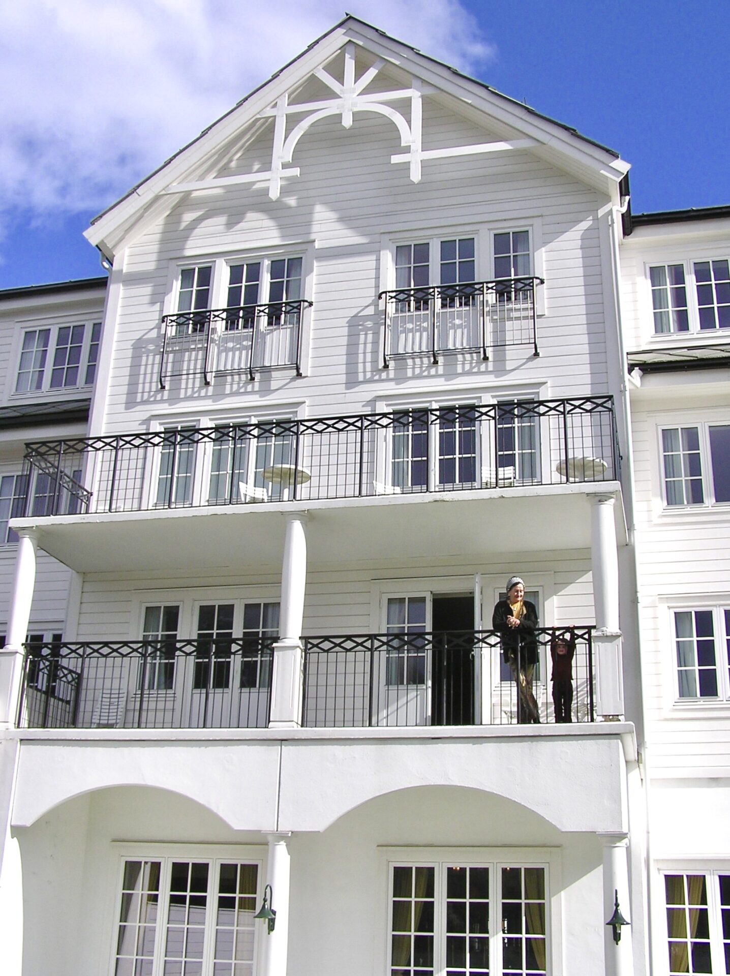
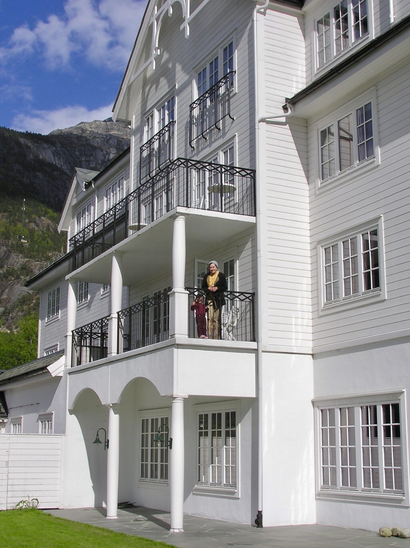
We stayed once at the Quality Hotel Vøringfoss, located just by the fjord and close to the cruise port. It is an extensive and modern hotel with a great view of breathtaking mountains up to 1600 meters. We enjoyed the hotel’s atmosphere and the spacious room with our balcony.

Eidfjord-Hotel Vøringsfoss 
Eidfjord-Hotel Vøringsfoss 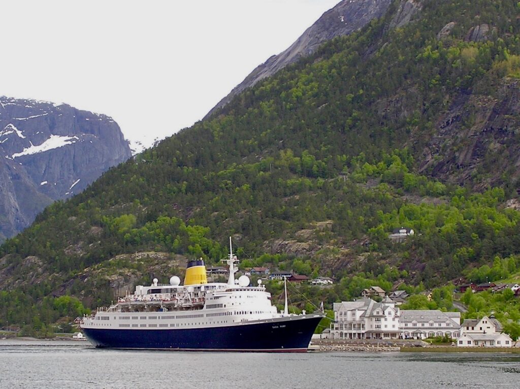
Eidfjord-cruise ship close to Hotel Vøringsfoss.
I started at Eidfjord and went east on Rv7. The road Rv7 is one of the main roads that connect Western Norway with Eastern Norway, and the scenic route is a part of this road.
I drove southwest along the river Eio and the lake Eidfjordsvatnet. At the southern end of the lake, I came to the village of Øvre Eidfjord. This place has a visitor centre for the nearby Hardangervidda National Park, the Hardangervidda Natursenter.
The road R13 then continues through the narrow valley Måbødalen which leads upland to the great waterfall Vøringfossen and the Hardangervidda plateau. There are several rest areas in the valley, also between the tunnels.
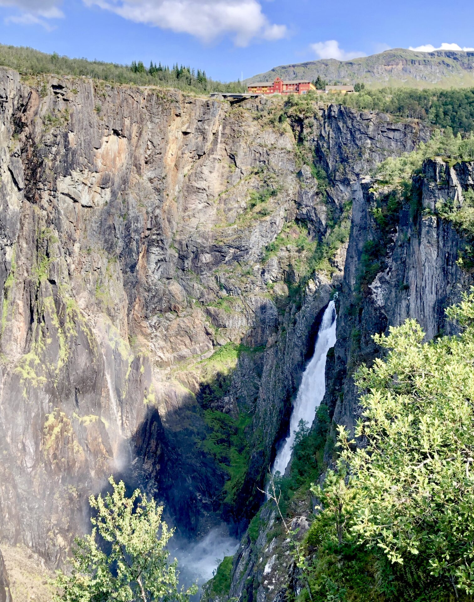
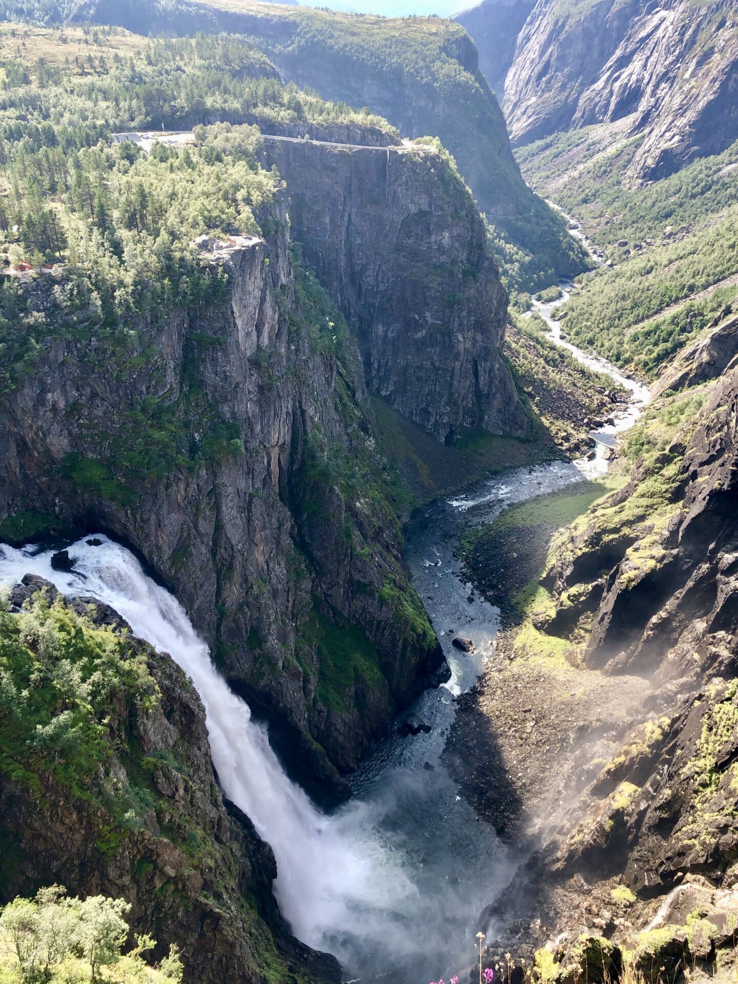
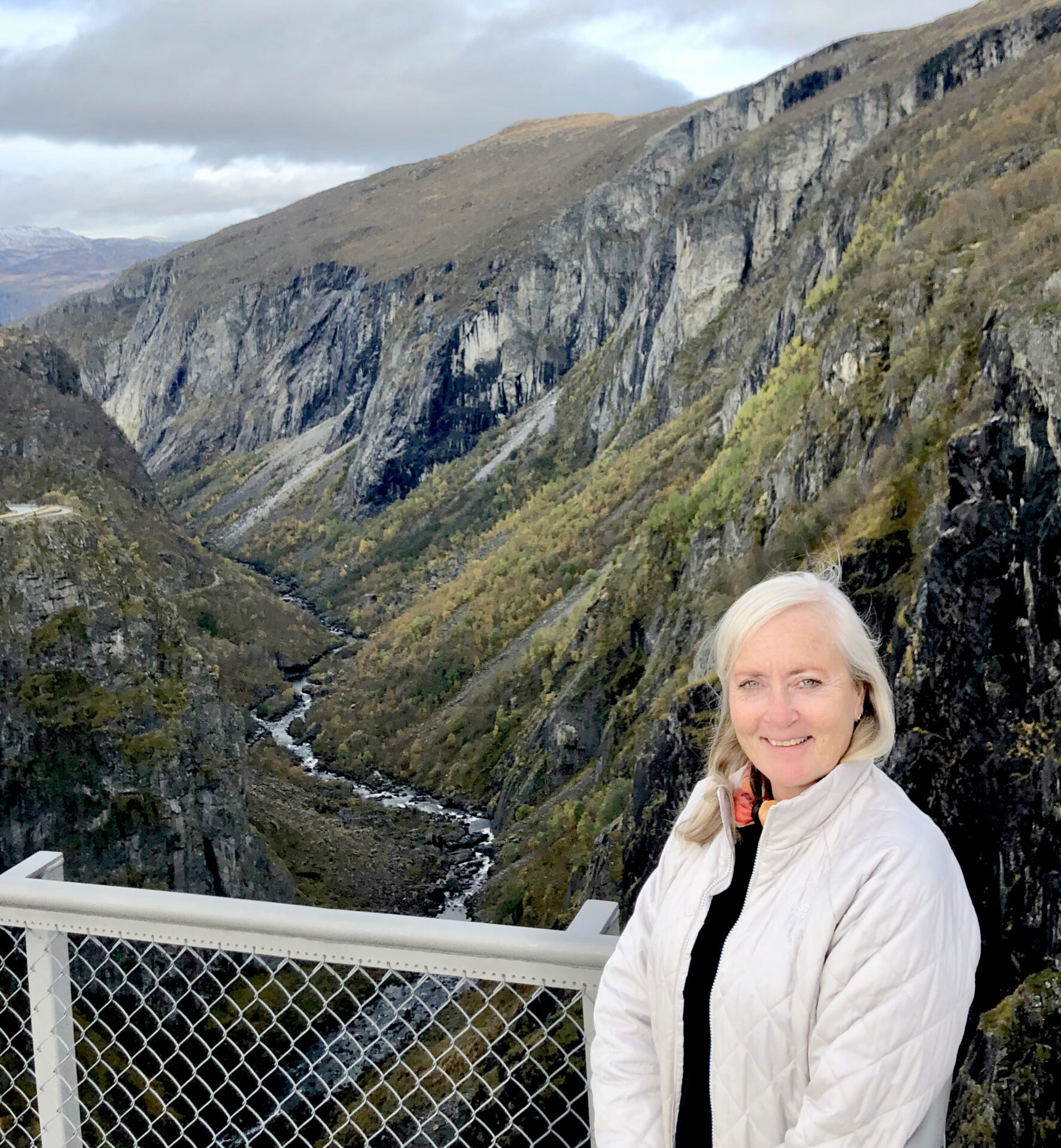
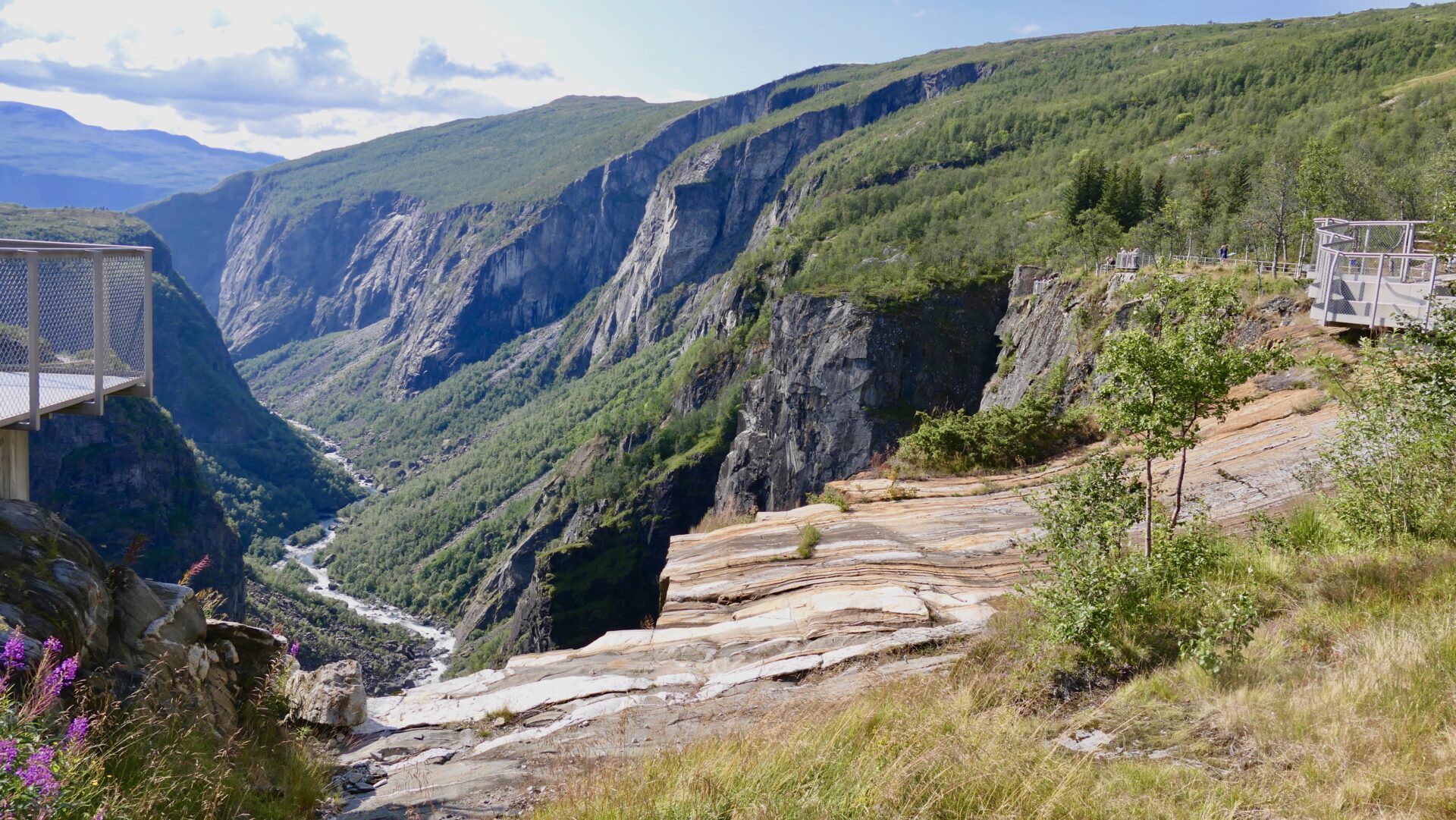
The last part of the road has several tunnels with sharp turns – but suddenly, you can see the waterfall at the end of the valley – Vøringsfossen! There is a viewpoint just before you reach the top of the valley; A great view of the waterfall and the Fossli Hotel on the top.
VØRINGSFOSSEN
Vøringsfossen is at the top of the Måbødalen and has a total drop of 182 metres (597 ft). It is perhaps the most famous in the country and a major tourist attraction on the way to/down from Hardangervidda.

Vøringsfossen and Måbødalen 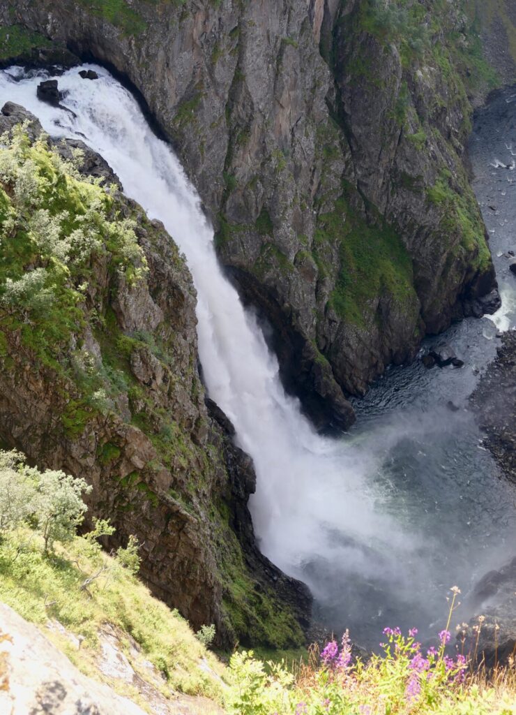
Vøringsfossen

FOSSLI HOTEL AND VIEWING PLATFOTMS
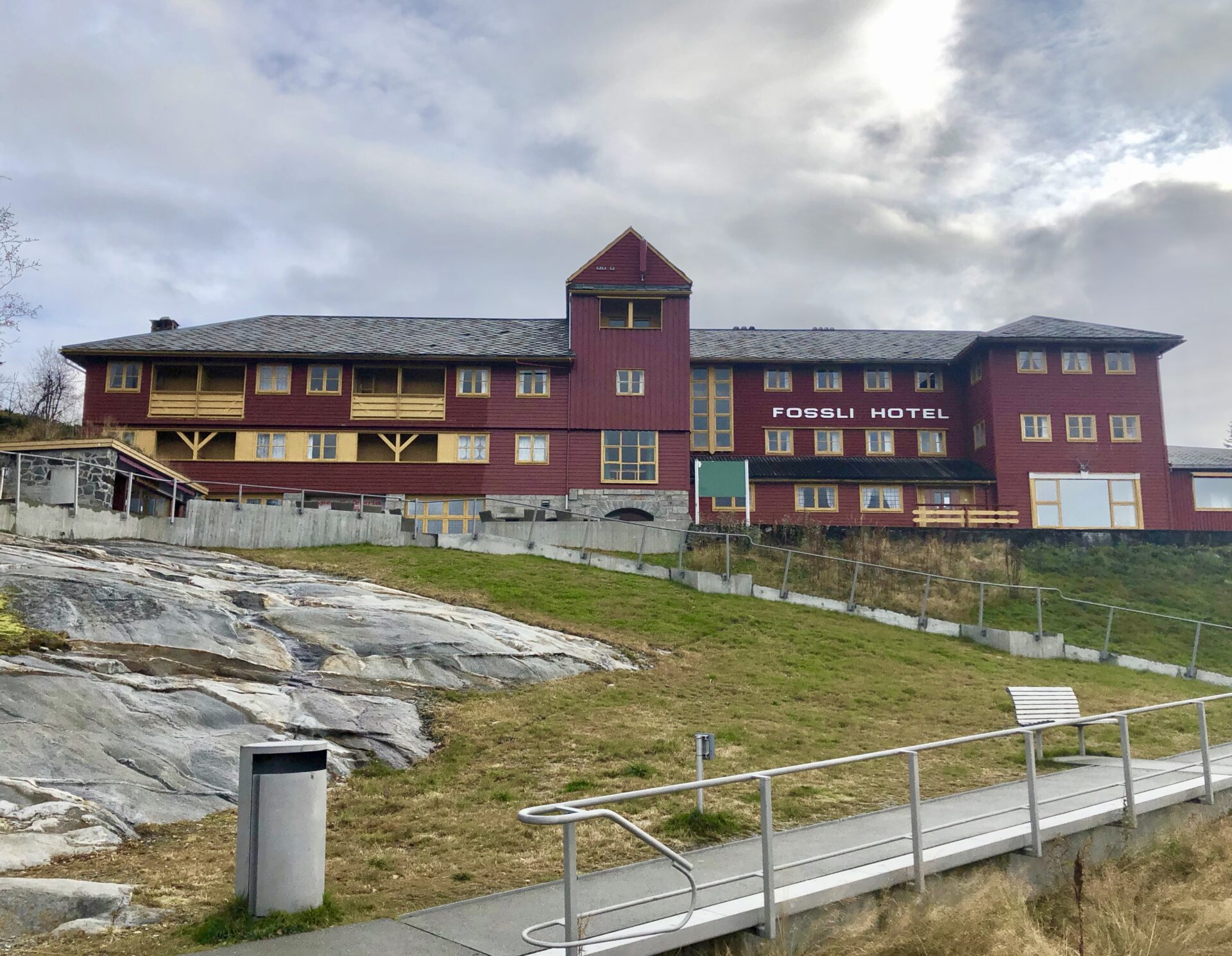
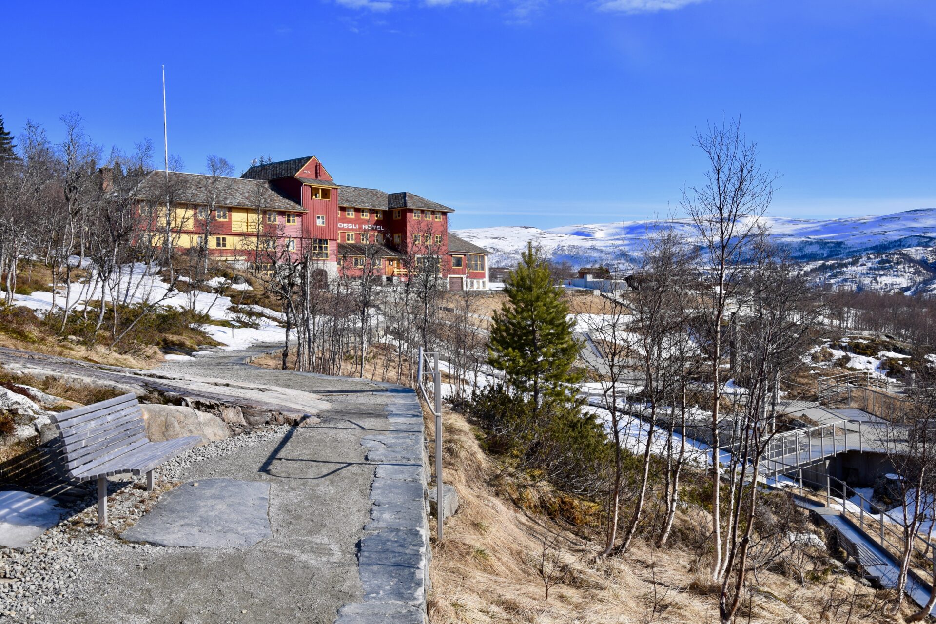
Fossli Hotel has a unique location – on top of the mountain, overlooking the Måbødalen valley and the Vøringfossen waterfall, just off Rv7. The hotel was established in 1891, 25 years before there was any road connection from Eidfjord. Fossli Hotel offers 21 rooms and has both a restaurant and a café.
The composer Edvard Grieg was a regular guest at the hotel.
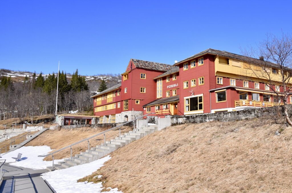
Fossli Hotel-Vøringsfossen 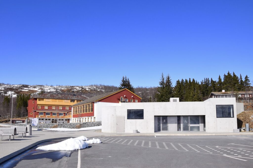
Facilities and parking near Fossli Hotel 
Fossli Hotel


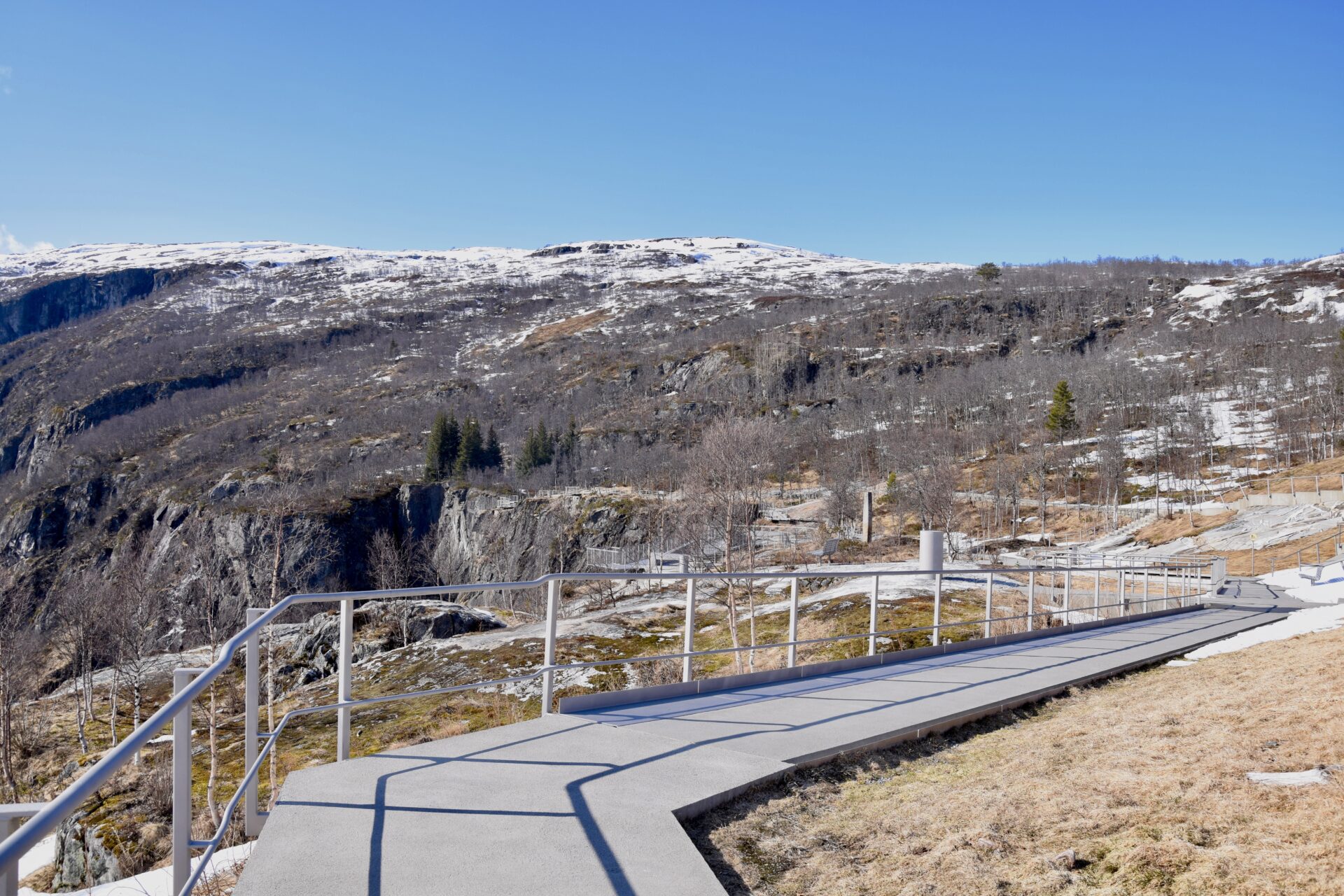
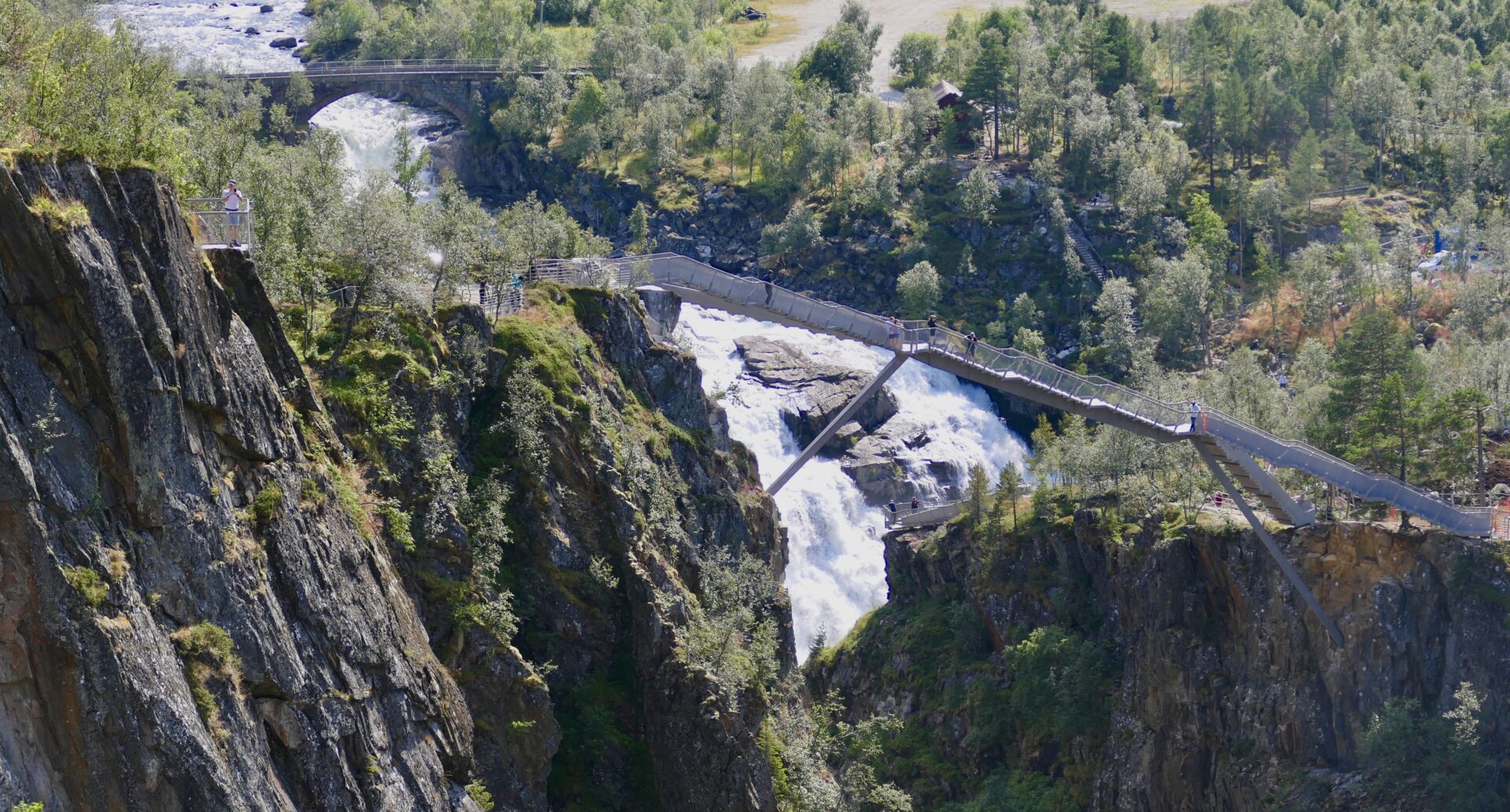
Near Fossli Hotel, there are parking and toilet facilities, walking paths, and spectacular viewing platforms. The Scenic Route Section in the Norwegian Public Roads Administration (NPRA) started these new building projects in 2015. The viewing platforms near Fossli Hotel are now completed, and the new walking bridge crossing the waterfall was finished last year. A spectacular bridge – with a span of 47 meters, 99 steps, 184 m high!
When I visited the walking bridge at the end of April this year, some people were making a movie about that bridge. They had been given the assignment from the Scenic Route Section; a drone was going to film when they played music on the bridge.
The Scenic Route Section will finalise some remaining projects in 2022.

Fossli Hotel with walking paths and viewing platforms 
Vøringsfossen-viewing platforms 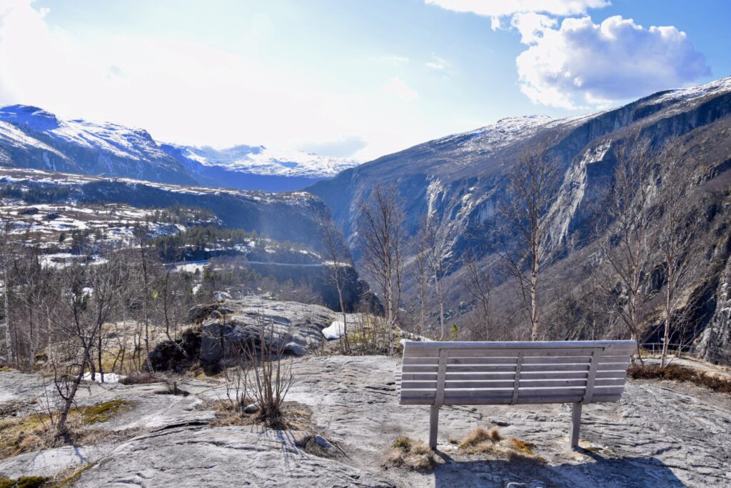
Vøringsfossen-view point 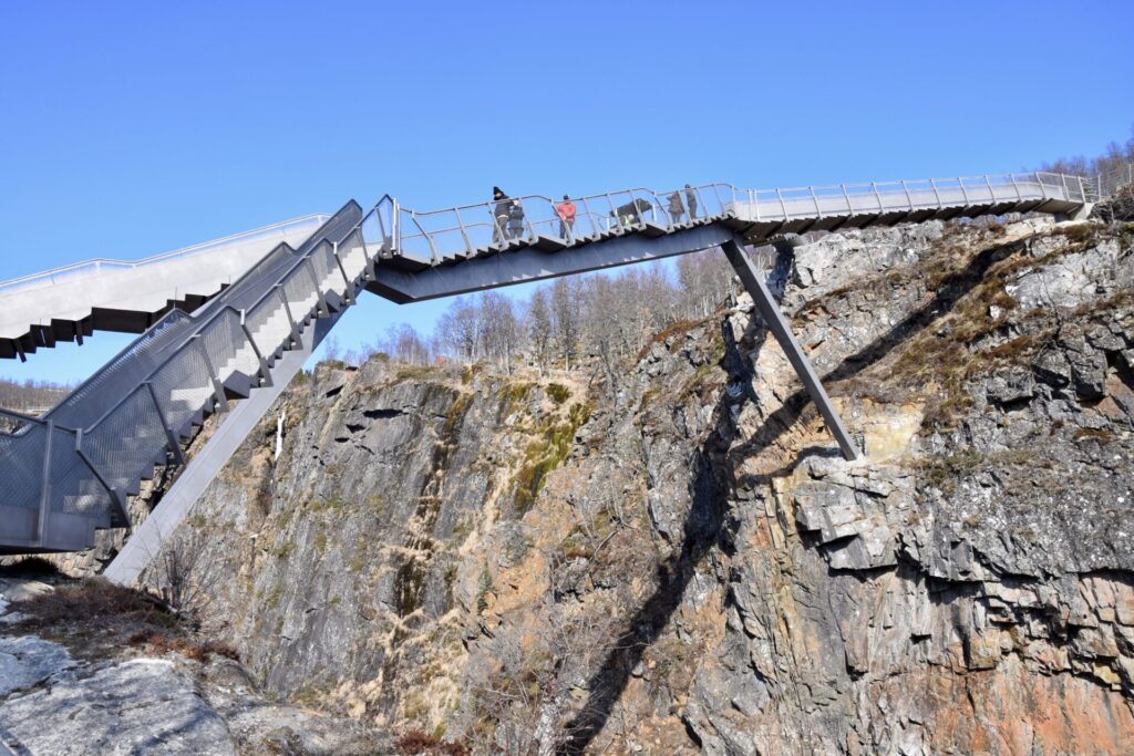
Vøringsfossen-new bridge. April 2021 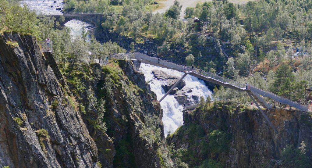
Vøringsfossen-new bridge 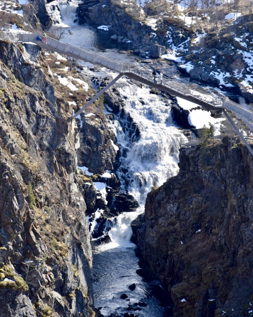
Vøringsfossen-new bridge. April 2021 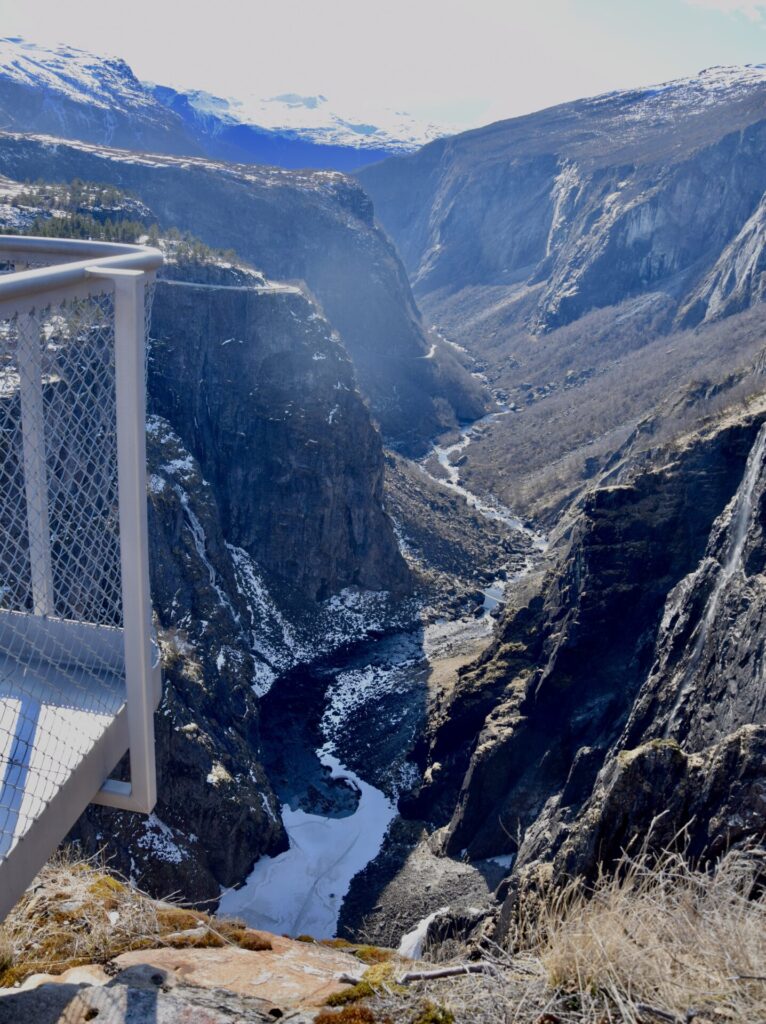
Vøringsfossen and Måbødalen-viewing point. April 2021 
Vøringsfossen-view point 
Vøringsfossen-viewpoints. Aug.2021


HARDANGERVIDDA
Hardangervidda is Northern Europe’s largest mountain plateau, and much of the plateau is protected as part of Hardangervidda National Park, Norway’s largest national park.
“Vidda”, the last part of the name Hardangervidda is the finite form of “vidde”, which means `wide plain, large mountain plateau’.
- Hardangervidda Mountain Plateau has an area of 6,500 square km covering parts of Vestland, Vestfold og Telemark, and Viken counties.
- In 1981 the Hardanger Plateau was designated a national park, occupying about 3,422 square km
- The National Park serves as a popular tourist destination for activities such as hiking, climbing, fishing, and cross-country skiing. The Norwegian Mountain Touring Association (DNT) maintains a comprehensive network of huts and paths across Hardangervidda. The Bergensbanen railway line and the main Rv7 cross the plateau.
- About 54% of the protected area is private land
- It has the southernmost stock of several arctic animals and plants. Its wild reindeer herds are among the largest in the world.
- Several hundred nomadic stone age settlements have been found in the area, most likely related to the migration of the reindeer.
- Ancient trails cross the plateau, linking western and eastern Norway; one example is the Nordmannsslepa linking Eidfjord and Veggli in the Numedal valley with Hol and Uvdal.
Driving along Rv7 on Hardangervidda
Going east from Vøringsfossen is Garen, 750 metres above sea level. Here you will find Garen Camping close to the river Bjoreio, with a beautiful view of the plateau and the mountains.
Maurset, at the beginning of the valley Sysendalen, has become a tourist centre. The place has many cabins, both privately owned and for rent, and ski lifts and alpine slopes.
Just east of Maurset is Sysendammen – one of Norway’s largest rockfill dams. It consists of 3,6 mill. m3 stone and moraine, and has a length of 1.160 m
The dam holds back the lake Sysenvatnet, the main reservoir for the Sy-Sima Hydroelectric Power Station. The dam regulates the water supply to Vøringsfossen, and there is a requirement for a minimum water supply during the summer season.
You can see the rockfill from the road – and view to Hardangerjøkulen :
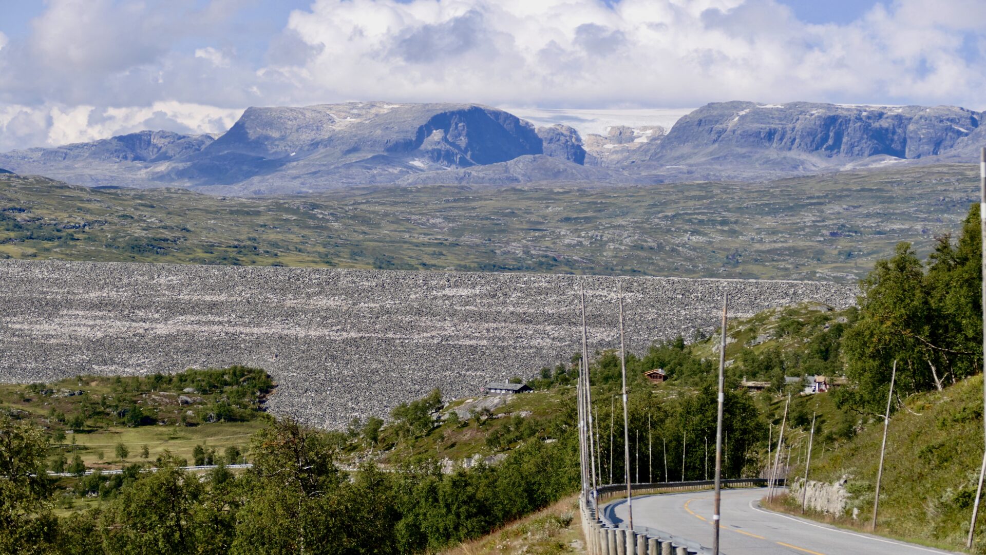
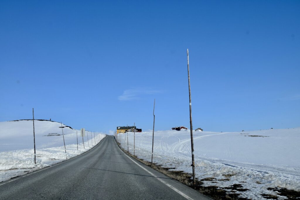
A beautiful scene just before Dyranut – high mountain plains – a parked RV and some motorcyclists along road Rv7:
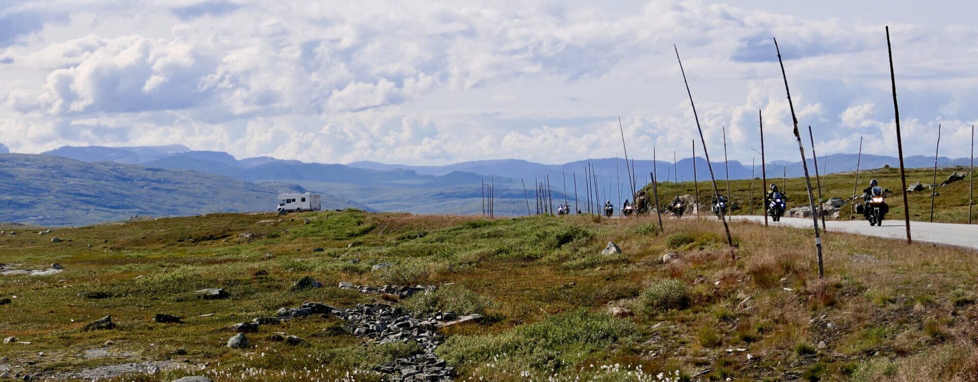
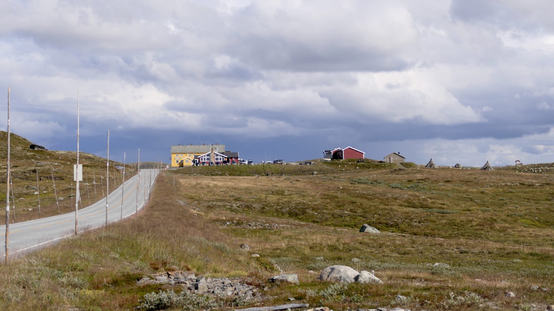
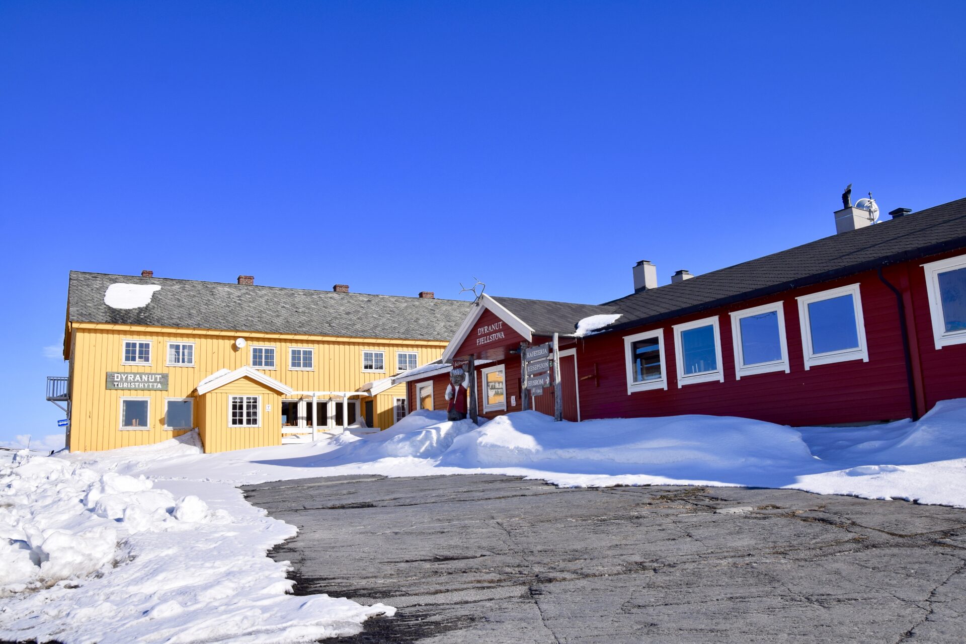
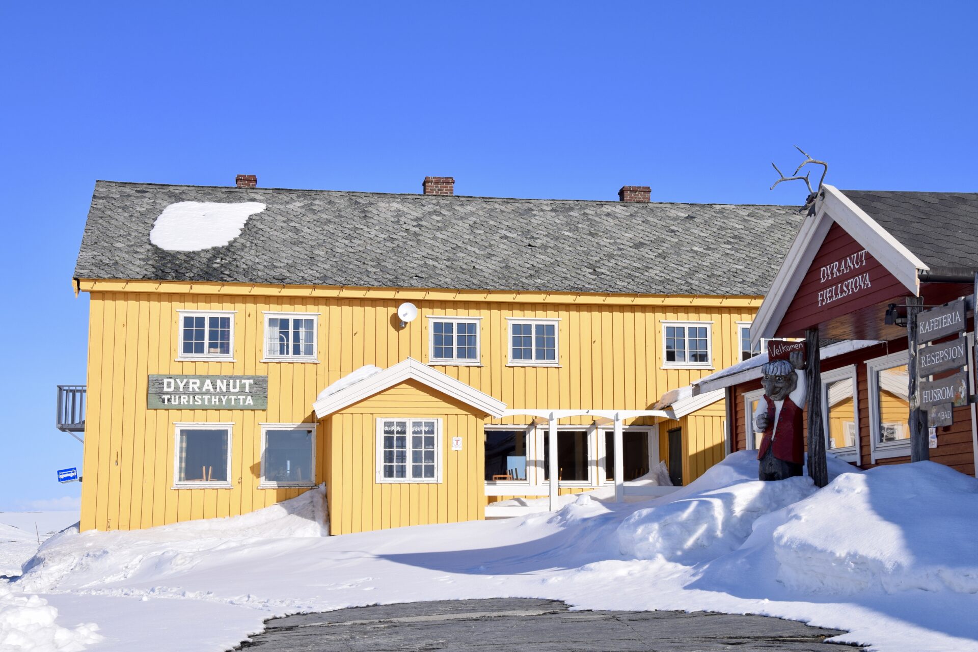
DYRANUT
Dyranut is located on top of the Hardangervidda (1245 masl) and is a good starting point for ski and hiking trips across the plains. Two privately operated tourist cabins, Dyranut Fjellstova and Dyranut Turisthytte (tourist lodge) lie side by side. Both have rooms to let and cafes serving breakfast and dinner.
The Norwegian Trekking Association (DNT) has several marked foot trails for hiking and in winter there are marked ski tracks to Sandhaug, Besso, Hadlaskard, Rauhelleren, Stigstuv, Finse and Krekja (via Halne or Kjeldebu).
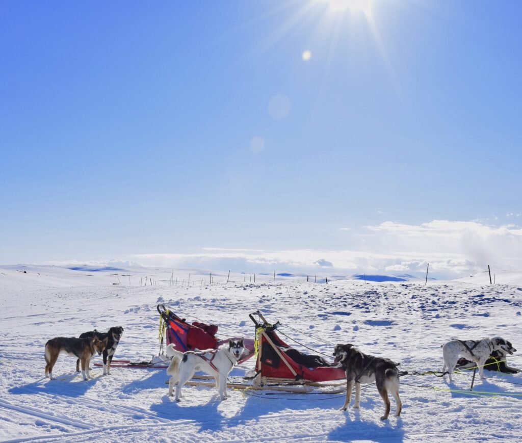
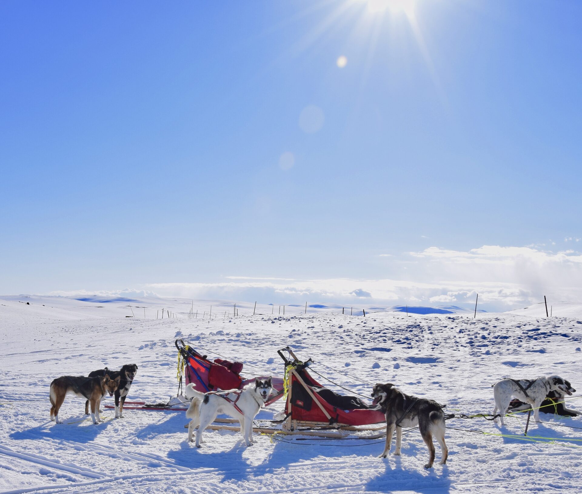
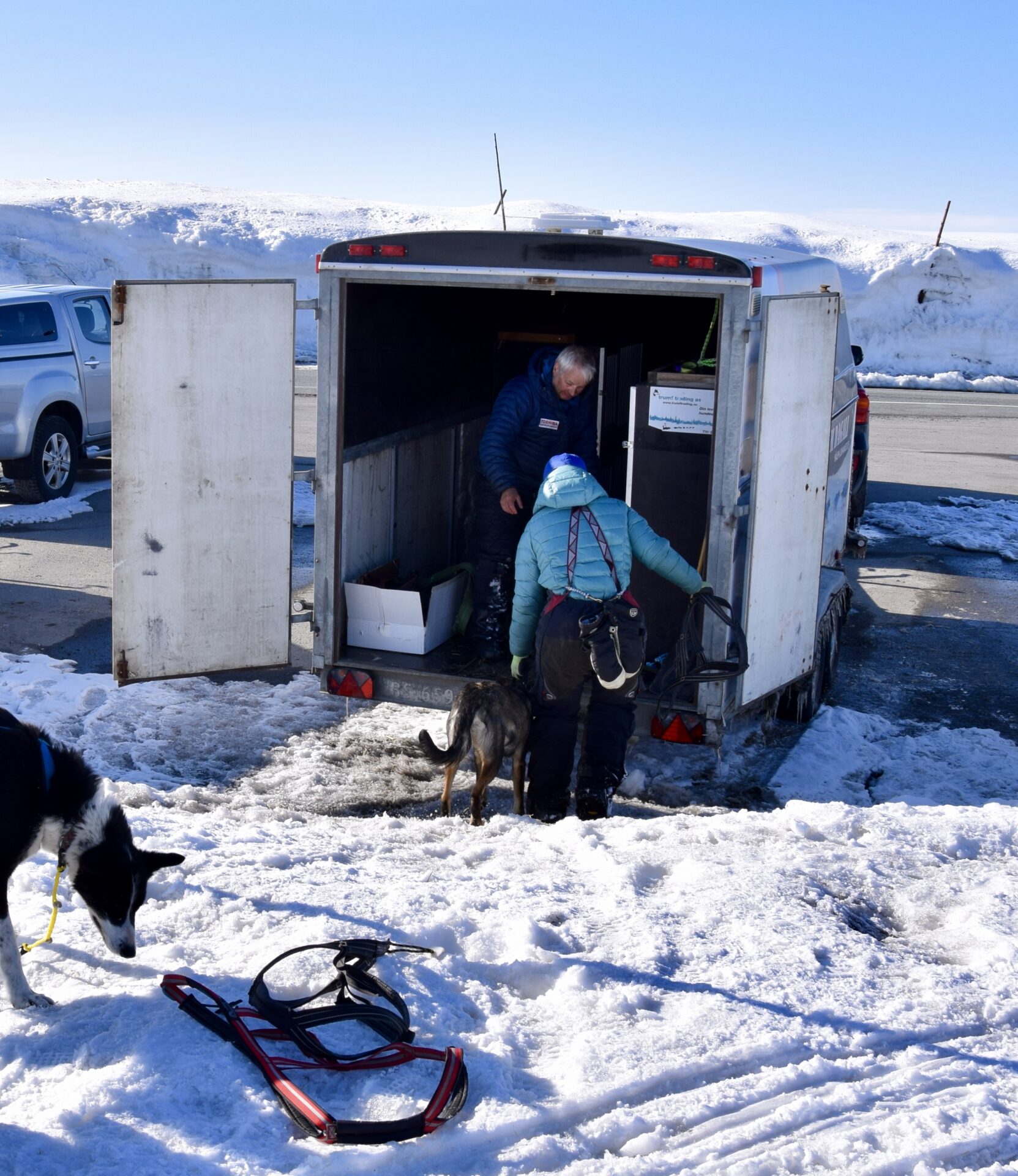
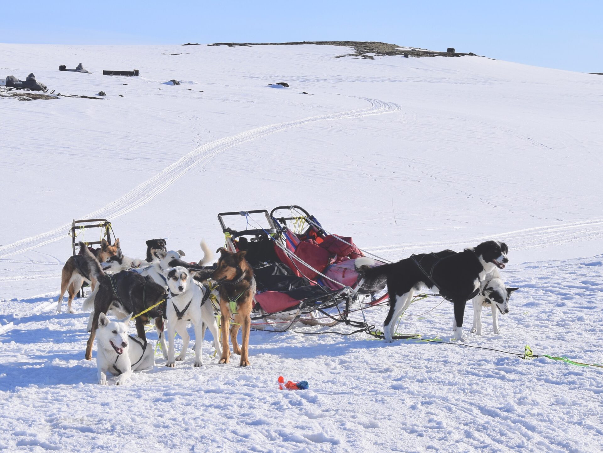
DOG SLEDDING
Even at the end of April, there was quite some snow in this area. At a stop by the road a bit further east of Dyranut, I had a fascinating meeting with a dog-sled team. They had been on an 80 km tour! The team leader turned out to be a well-known Norwegian musher Ralph Johannessen and his Alaska huskies. He has participated 12 times in the race called Finnmarksløpet. It is Europe’s longest dog-sled race, 1,200 kilometres with 14 dogs over 5-6 days across snowy Finnmark, in the primarily untouched and uninhabited wilderness.
Hardangervidda-dog sleds 
Hardangervidda-dog sleds 
Hardangervidda-dog sleds 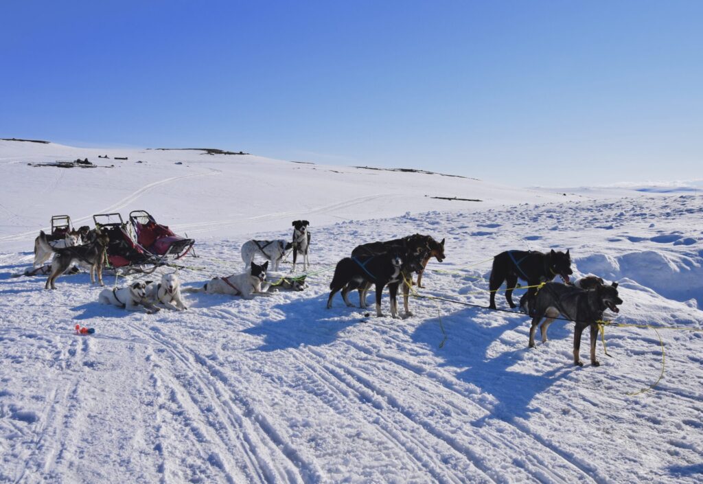
Hardangervidda-dog sleds 
Hardangervidda-dog sleds


Highest point – Rest areas
The road R7 highest point is 1250 m above sea level and is situated west of the lake Skiftesjøen. There used to be a picnic area, but it is now just a small parking place.
The picnic areas along the Hardangervidda Scenic Route have, in general, been simplified to reduce activity in the most vulnerable wild reindeer areas.
The Norwegian Scenic route section is known for creating architecturally impressive service buildings, but at Hardangervidda, they want people to focus on the open, vast plateau landscape – not architecture.
Just before you reach the lake Skiftesjøen, which you get on your left-hand side, you can again have a glimpse of the glacier in the distance. The view is better, though – after passing the lake, a couple of km further.
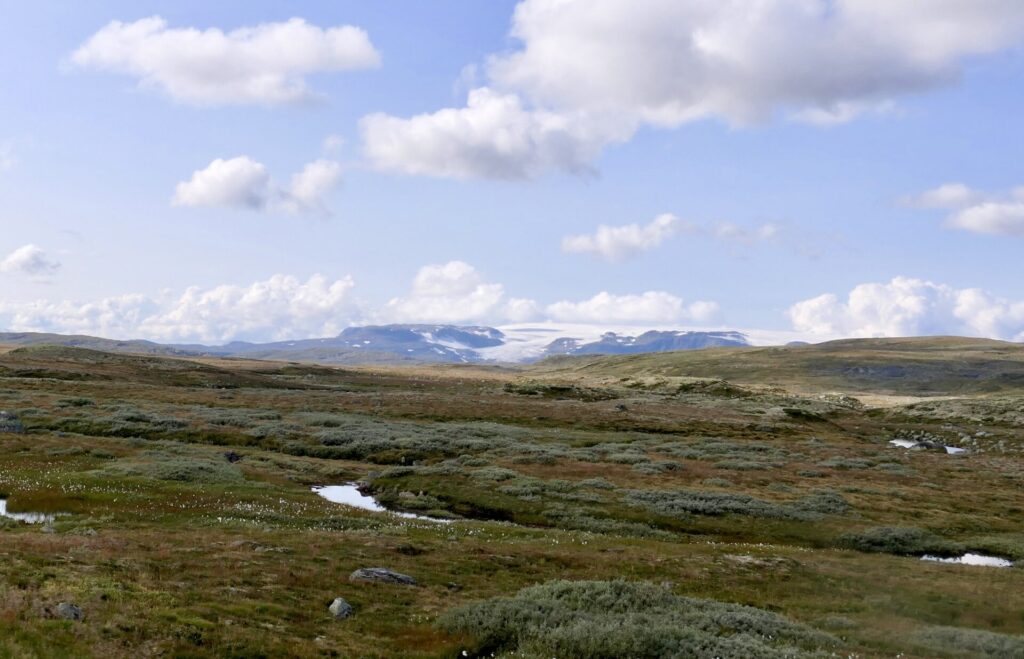
Hardangervidda-Hardangerjøkulen 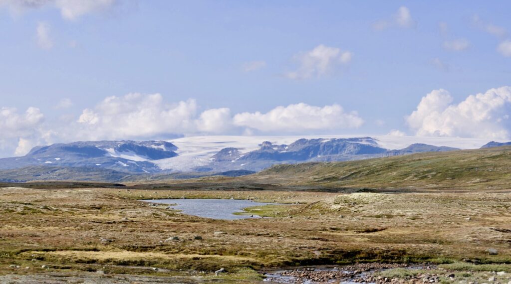
Hardangervidda-Hardangerjøkulen 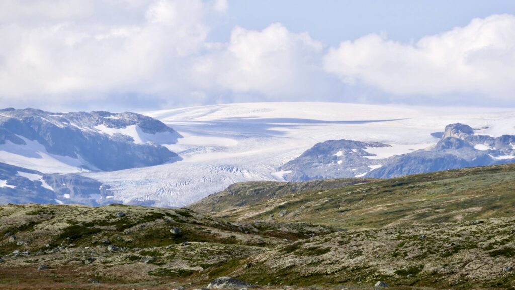
Hardangervidda-Hardangerjøkulen

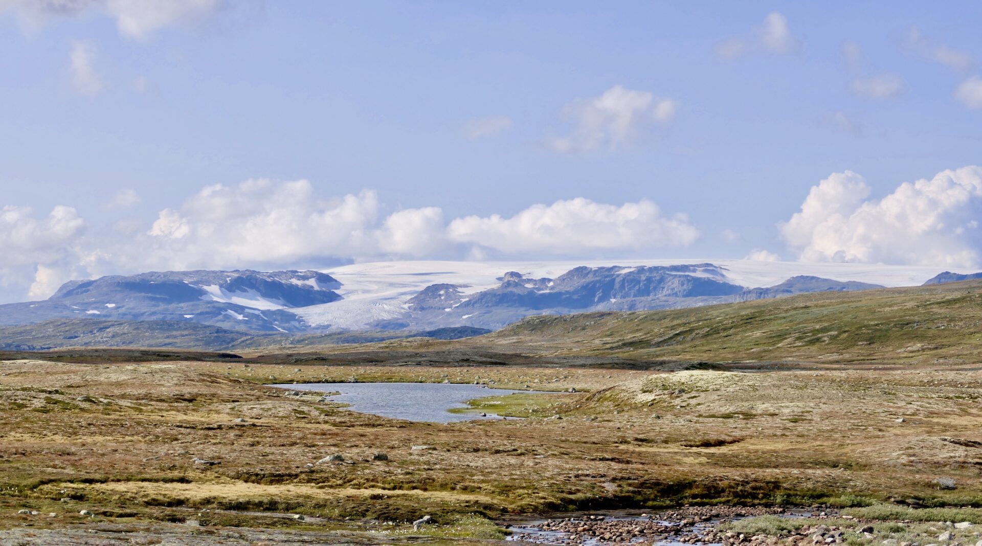
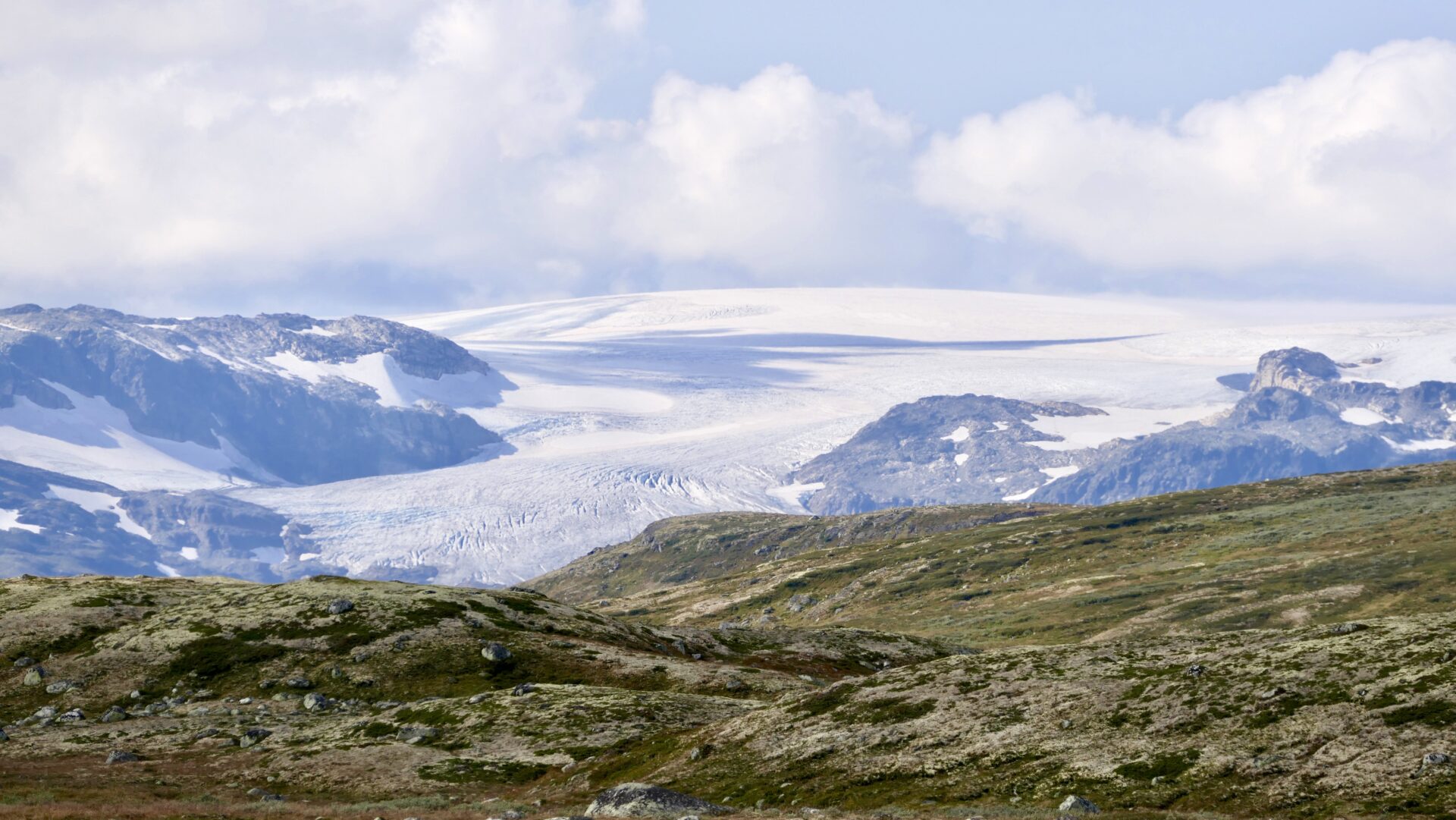
The Hardanger Glacier – Hardangerjøkulen –
- is the sixth largest glacier in mainland Norway.
- is located in the municipalities of Eidfjord and Ulvik in Vestland county; 16 km (9.9 mi) northeast of the village of Eidfjord, 5 km (3.1 mi) south of Finse, and 20 km (12 mi) west of Haugastøl.
- highest point is 1,863 m (6,112 ft) above sea level
- can be easily accessed by skis from the north in the winter, from the village of Finse, which is only accessible by stopping at Finse Station on the Bergen Line railway.
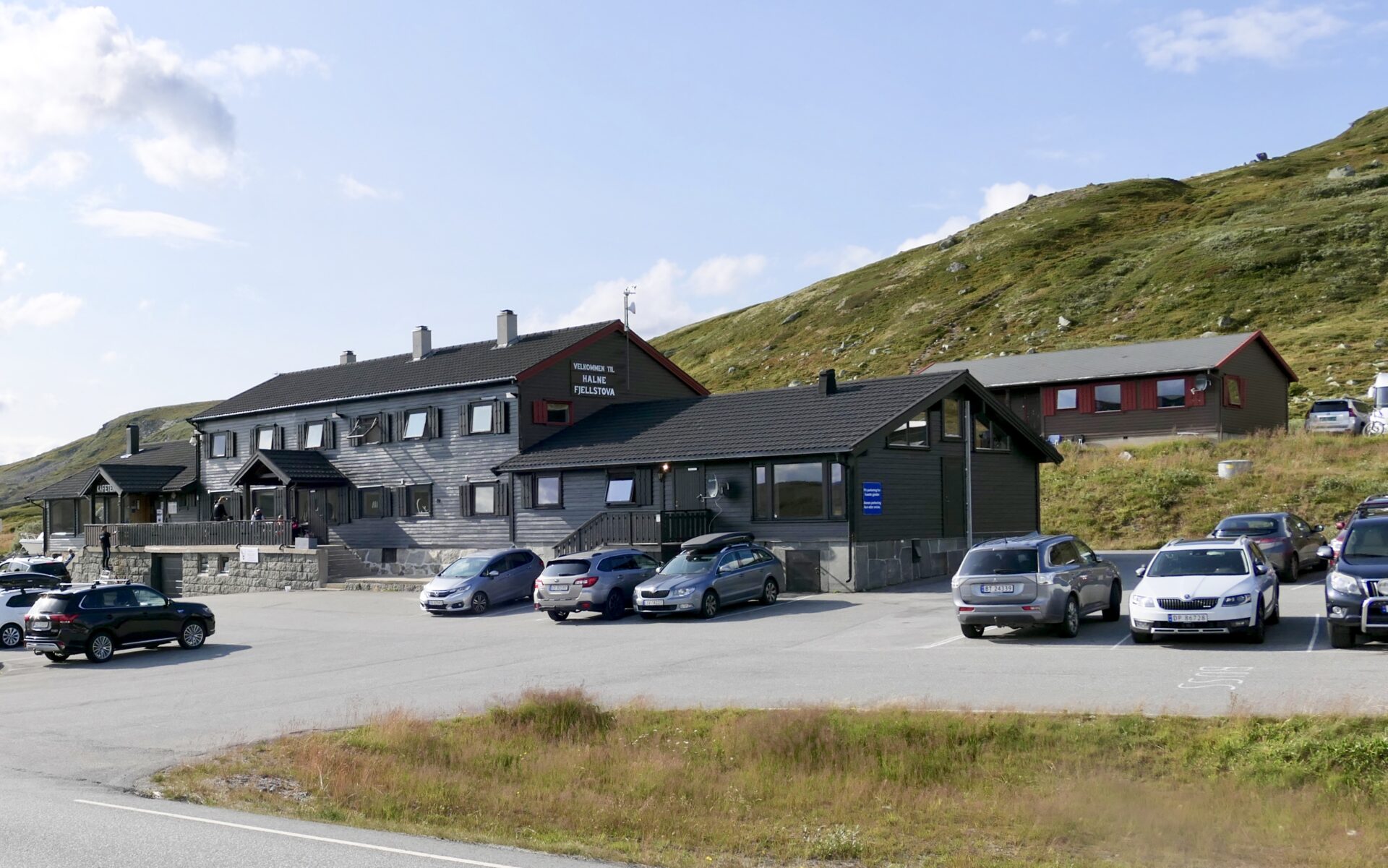
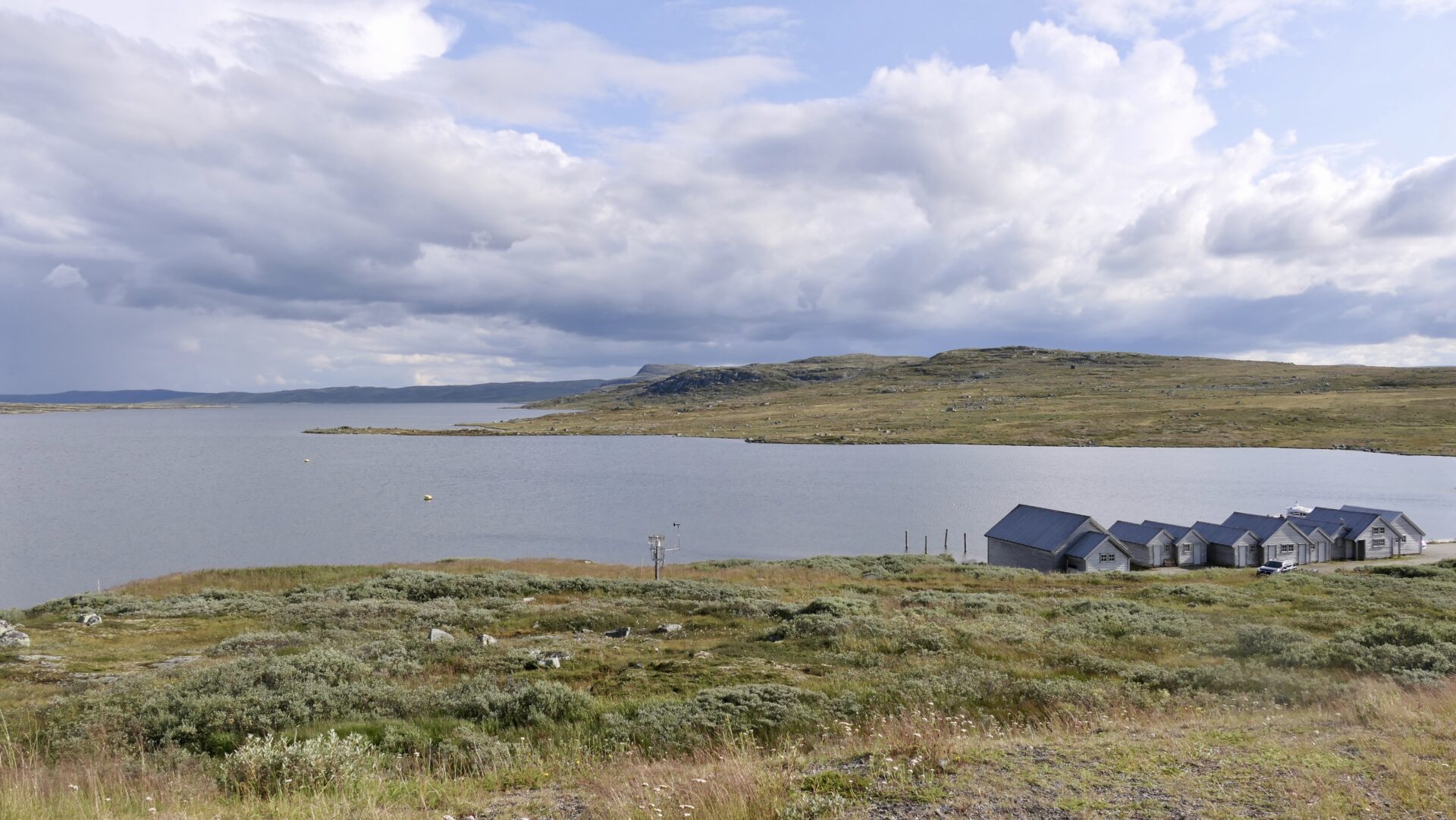
HALNE
When you reach Halne, you are in the middle of Hardangervidda and halfway between Norway’s eastern and western parts. Halne lies at an altitude of 1,140 masl and is the entrance to Hardangervidda National Park and an ideal starting point for trekking in the summer and skiing during the winter.
Halne Fjellstuge (Halne Mountain Lodge) offers accommodation, both rooms, cabins and apartments. The lodge faces the northern part of Halnefjorden, which is not a fjord but a large inland lake despite its name.
It is among the largest lakes located on the vast Hardangervidda plateau.
During the summer, there is a scheduled daily boat service on Lake Halnefjorden from Halne to Sleipa and Skaupa, about 13 km from Halne. The boat route has been operating since 1954. It is popular both for crossing the Halnefjord as a start of a hike or a round trip.
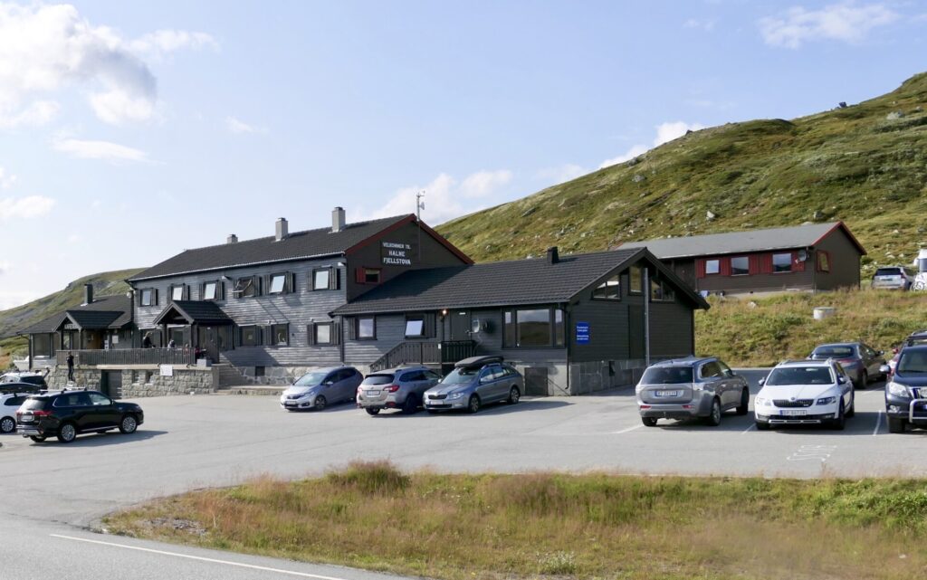
Halne Fjellstuge- Halne Mountain Lodge 
Halnefjorden-Halne
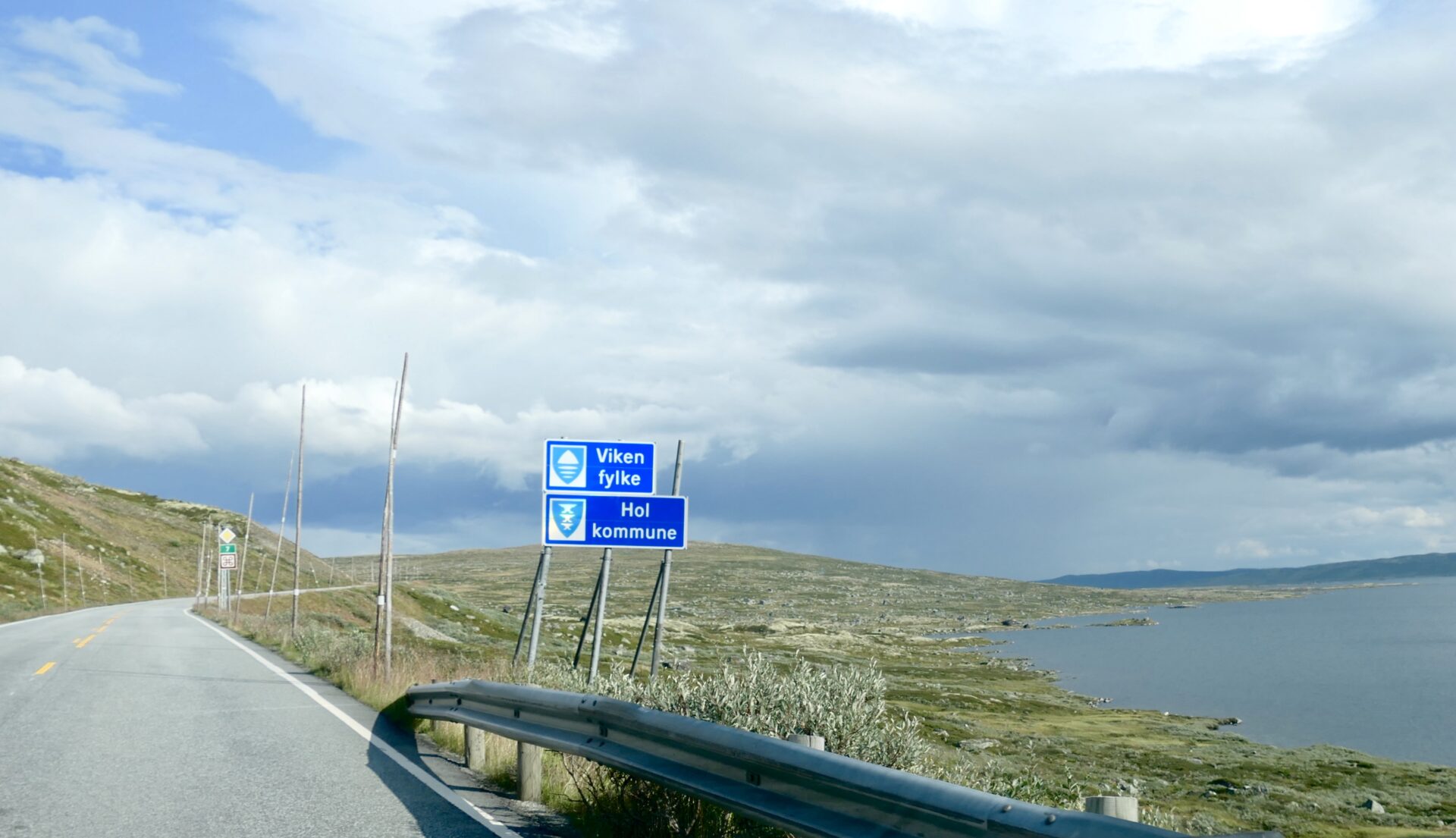
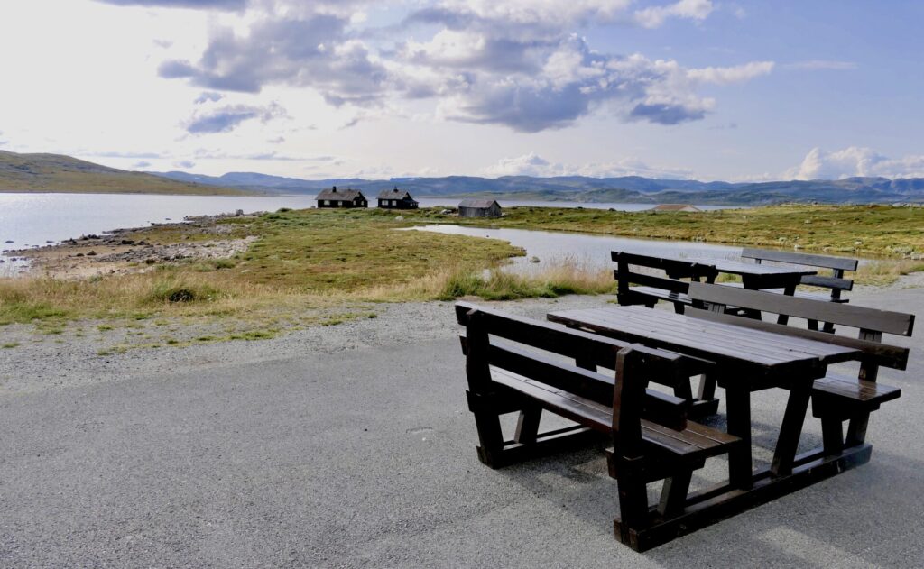
I passed the border to Viken county just after Halne. There is a rest area at the top of the hill from Halne – with a view to Halnefjornen.
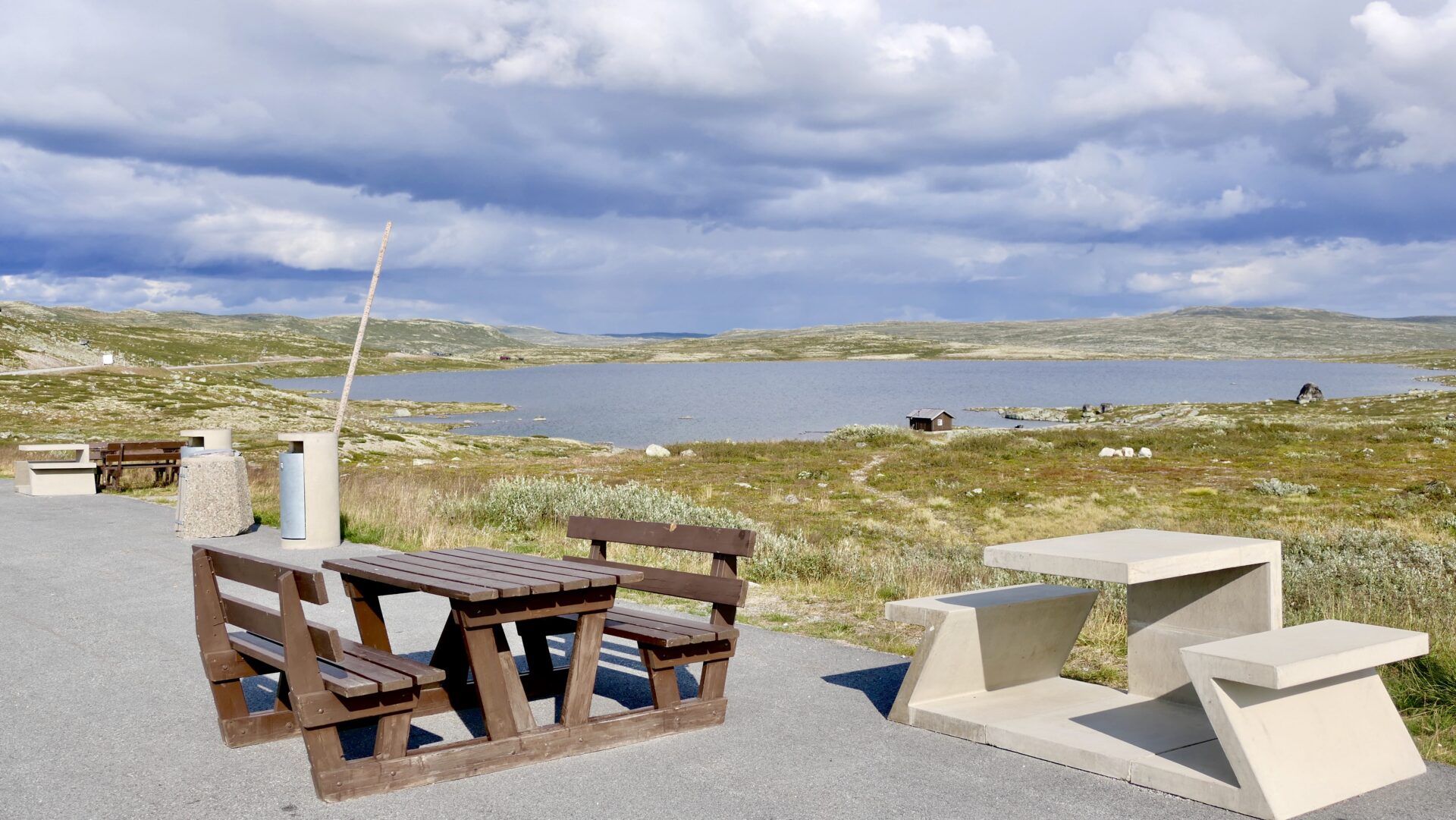
Further east, there is a rest area at the lake Båtstjørne:
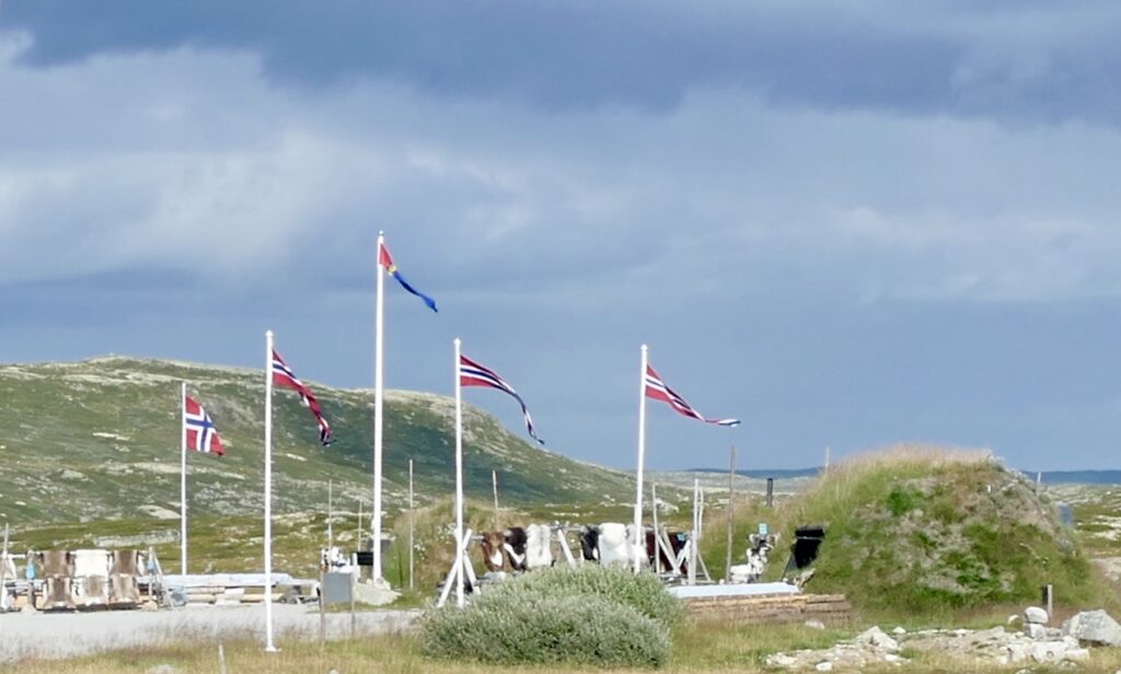
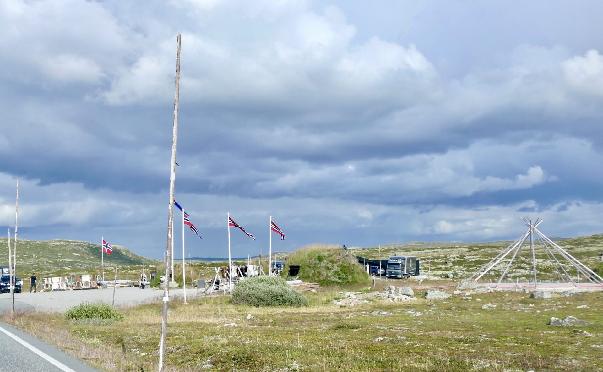
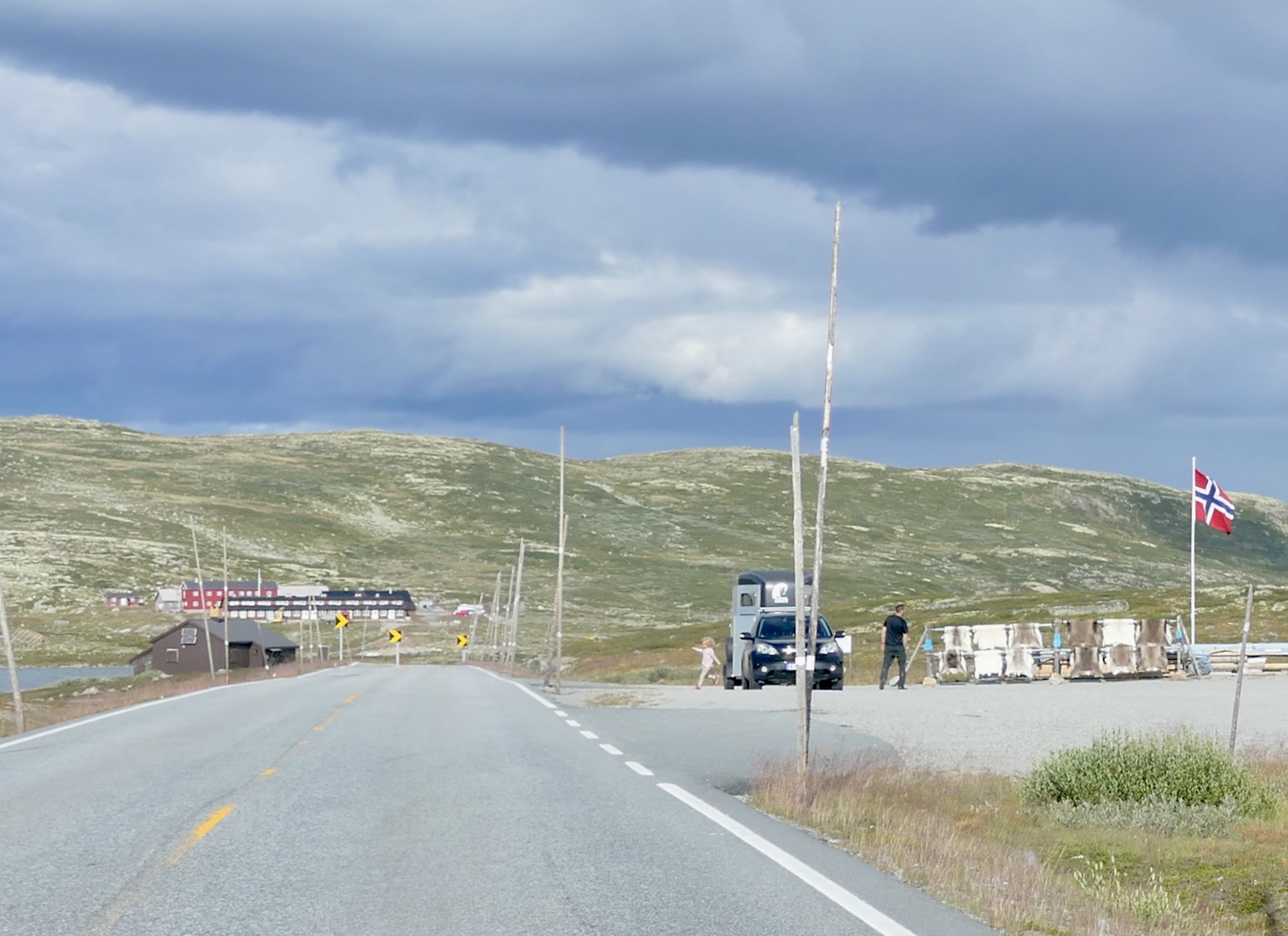
After passing the lake Båtstjørne, you will find an idyllic place with a “sami game” and lavvo. “Gamme” is an ancient, simple form of earth hut. Here you can buy Norwegian goods – not just souvenirs. They specialise in skins and fur products, and you can also purchase reindeer skins from Finnmark and Røros, sheepskins from Rogaland and self-produced fur hats and mittens.
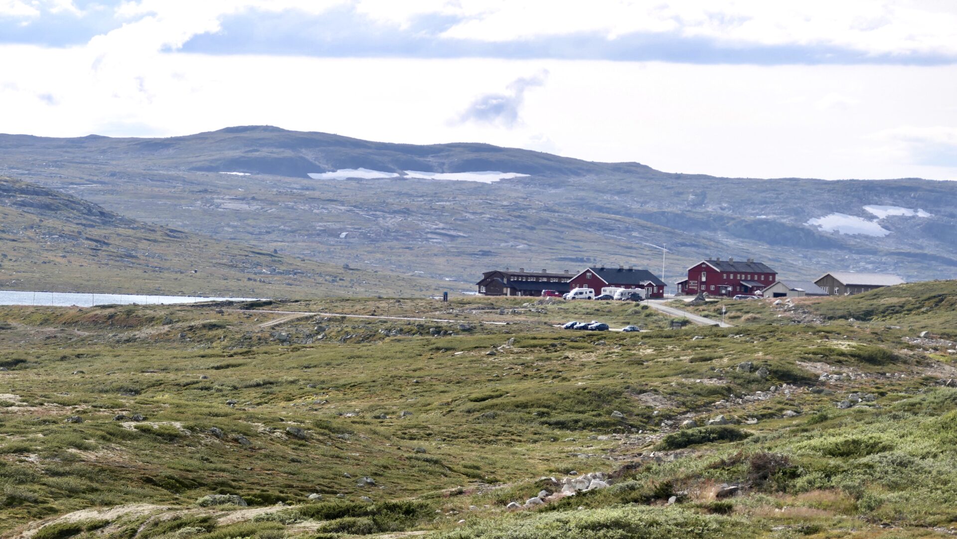
FAGERHEIM
Fagerheim Fjellstue
- is a privately operated tourist cabin situated at the southeast end of the lake Storekrækkja, 1177 masl.
- in the heart of the wild reindeer habitat with beautiful views of the Hardangervidda mountain landscape.
- is built in 1936, but newly renovated
- offer 19 rooms and the restaurant serves fresh local food for every meal.
Fagerheim is an excellent starting point for trips and hikes to Tuva, Heinseter, Krækkja, Finse, Kjeldebu, Trondsbu, Stigstuv and Bauhellern. If you prefer biking, Rallarvegen or Tinnhølvegen are great choices.
Rest area by the lake Ørteren. Ørteren is regulated for Ørteren Kraftverk, a hydroelectric power plant at Haugastøl. There is also another rest area by the lake, further east.
Rest area – Ørteren 
By the great lake Ørteren

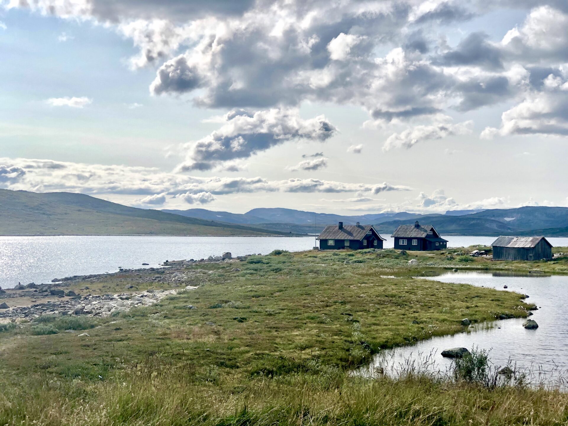
HAUGASTØL
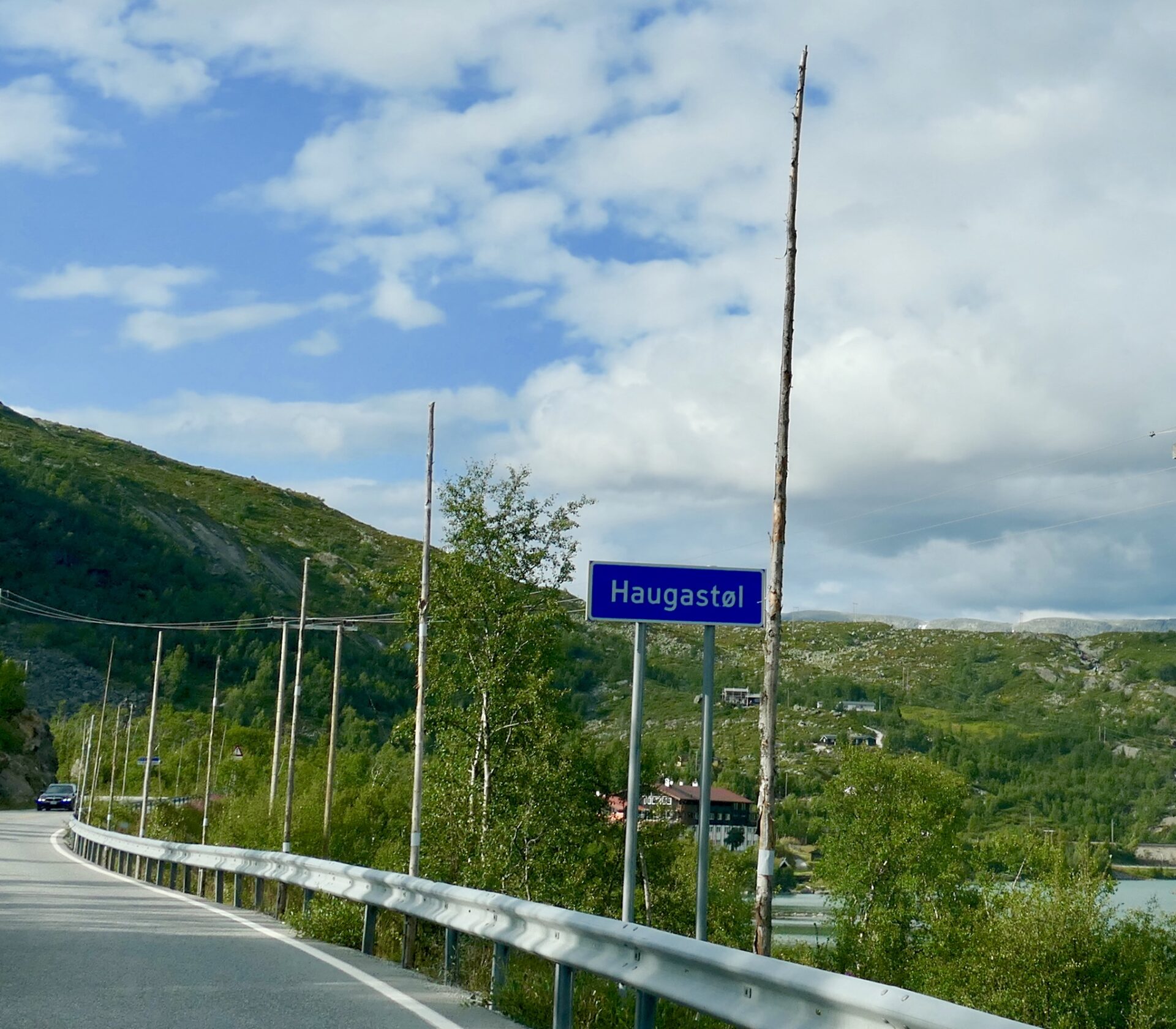
Haugastøl is the last stop at the Hardangervidda Scenic Route. At a location of 1000 m.a.sl. it has two national parks on its doorstep; Hallingskarvet National Park and Hardangervidda National Park.
Haugastøl makes a natural starting point for hiking, hunting and fishing. Biking is also very popular as it is the starting point for the cycling and hiking path Rallarvegen. This famous old navvies road follows the outskirts of the Hardangervidda Plateau, along the Bergen Railway Line from Haugastøl via Finse, Hallingskeid, Myrdal and ends up by the fjord side in Flåm. It is also possible to follow the road down to Voss. The road by itself is an attraction.
Many tourists arrive in Haugastøl by train, the second route to RV7. Haugastøl is a station on the Bergen Line, Bergen-Oslo, situated between Ustaoset to the east and Finse to the west. There is a distance of 1 km between Haugastøl Station and Haugastøl Turistcenter, which one has to walk when arriving by train.
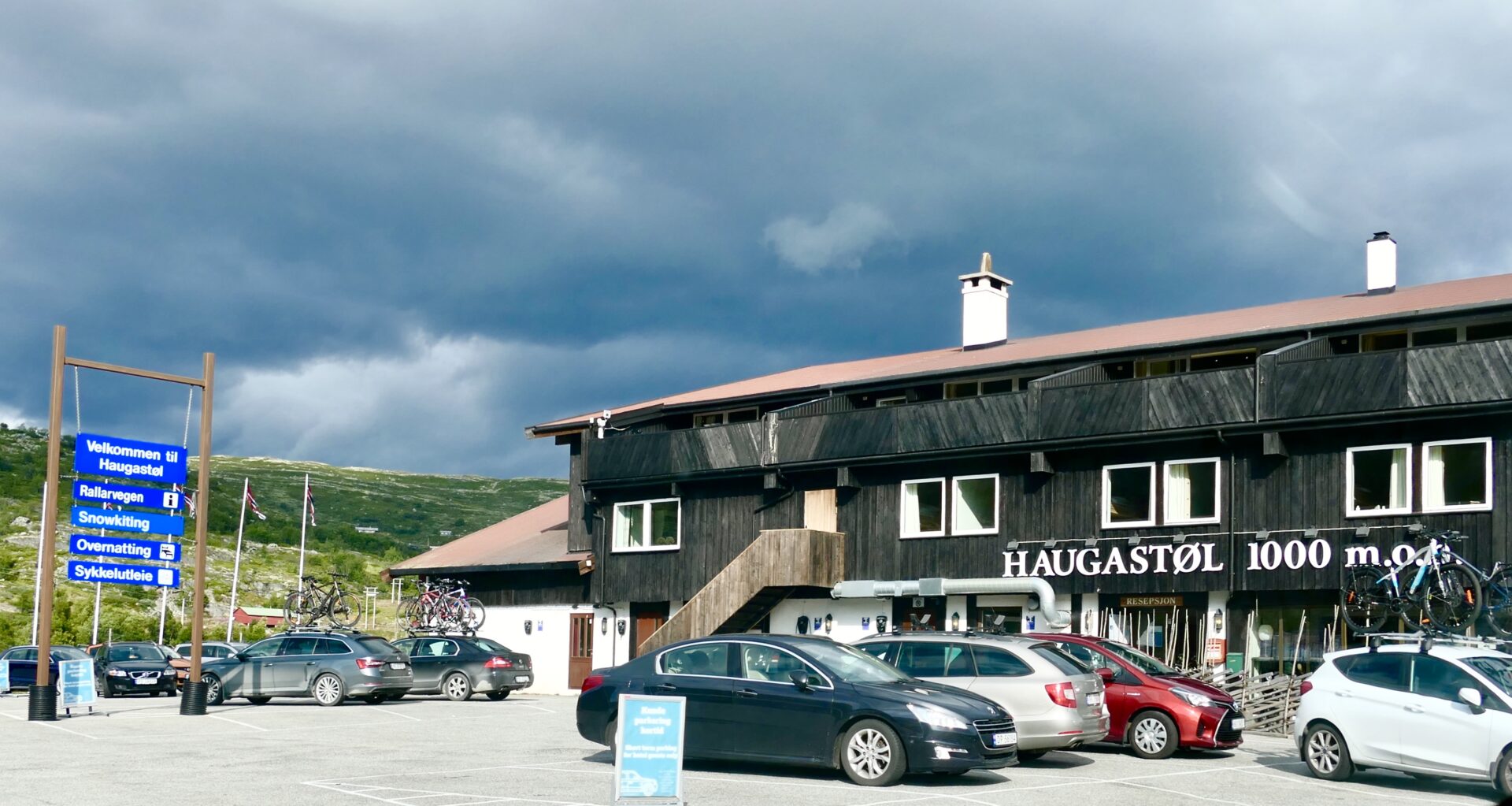
Haugastøl Turistsenter offers modern accommodation in different apartments, a coffee bar and a restaurant serving breakfast and dinner, and a bike shop.
In the winter, they offer kite courses and unique conditions for snowkiting.
In recent years, Haugastøl has also become a base for the world’s best snow kiters due to the great snow and wind conditions.
