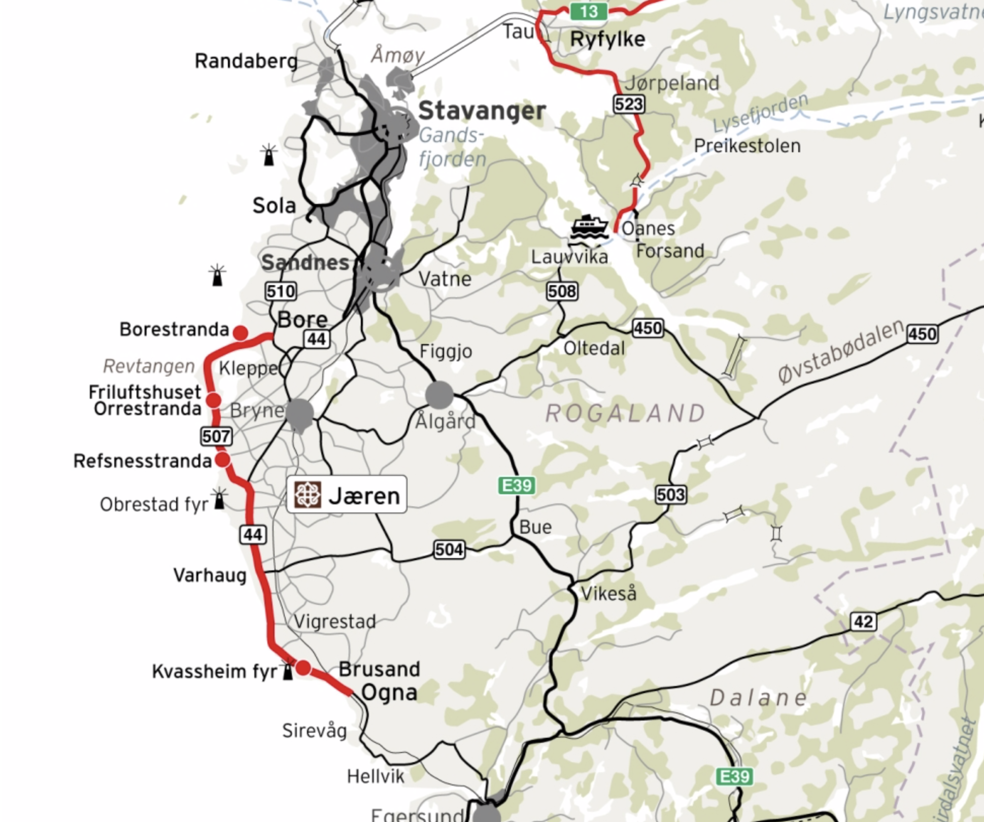
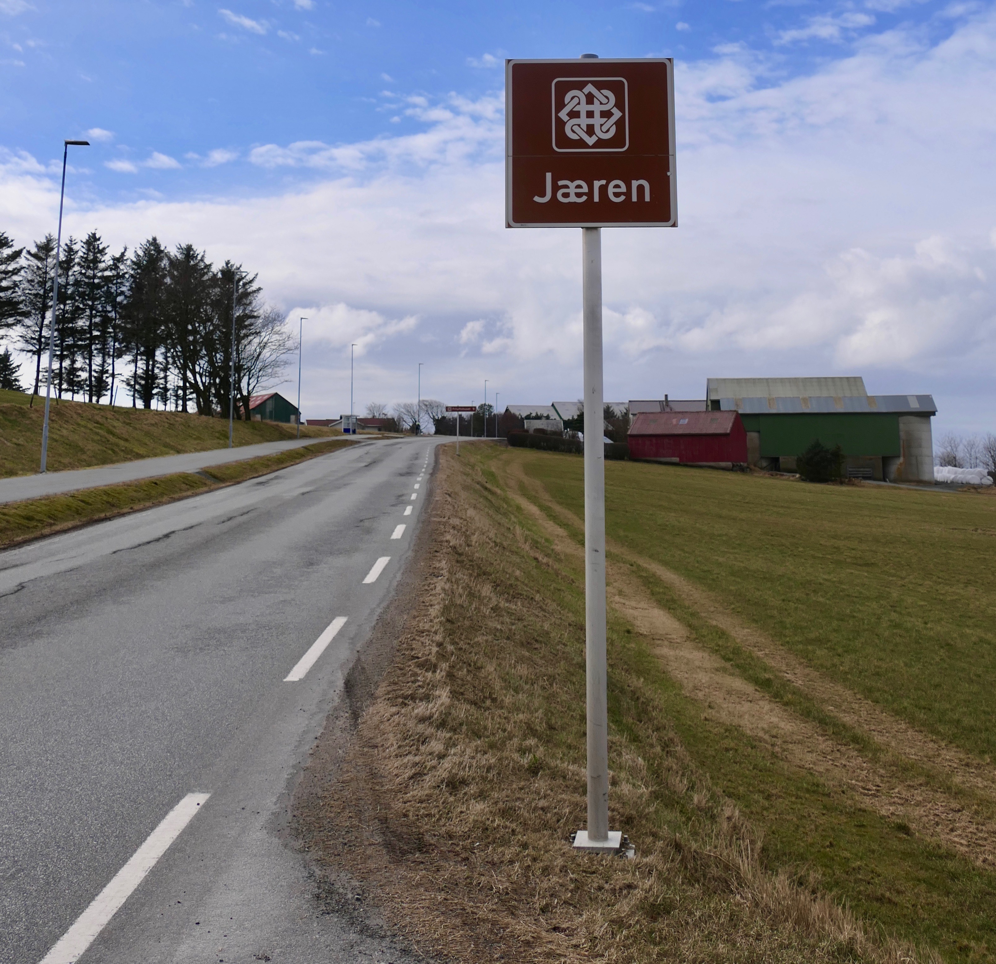
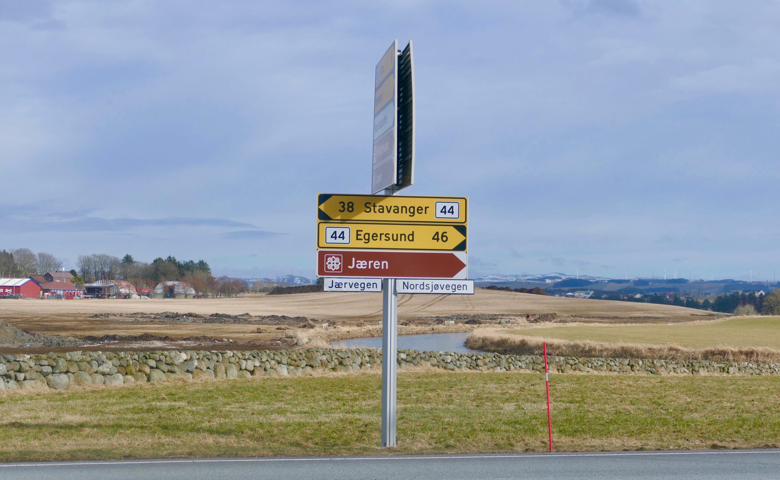
Norwegian Scenic Route – Jæren
– runs from Bore in the north to Ogna in the south (or vice versa) – a total distance of 41 km.
(Roads: Fv507/Rv44).
.
This route differs from many of the other scenic routes in Norway – as it is a regular road where you may have to drive behind a farmer on his tractor for a while.
It takes you along a flat terrain along the coast – where the ocean dominates. Long sandy beaches, many lighthouses and fascinating cultural landscape. Main attractions along the route:
MAIN ATTRACTIONS:
- Borestranden
- Orrestranden
- Refsnes
- Hå Gamle Prestegard – Hå Old Churchyard
- Obrestad Fyr – Obrestad Lighthouse
- Varhaug Gamle Kyrkjegard – Varhaug Old Churchyard
- Kvassheim Fyr – Kvassheim Lighthouse
- Brusand and Hitler´s Teeth
- Brusand strand – Brusand Beach
I started from Bore in the north, and the first part from
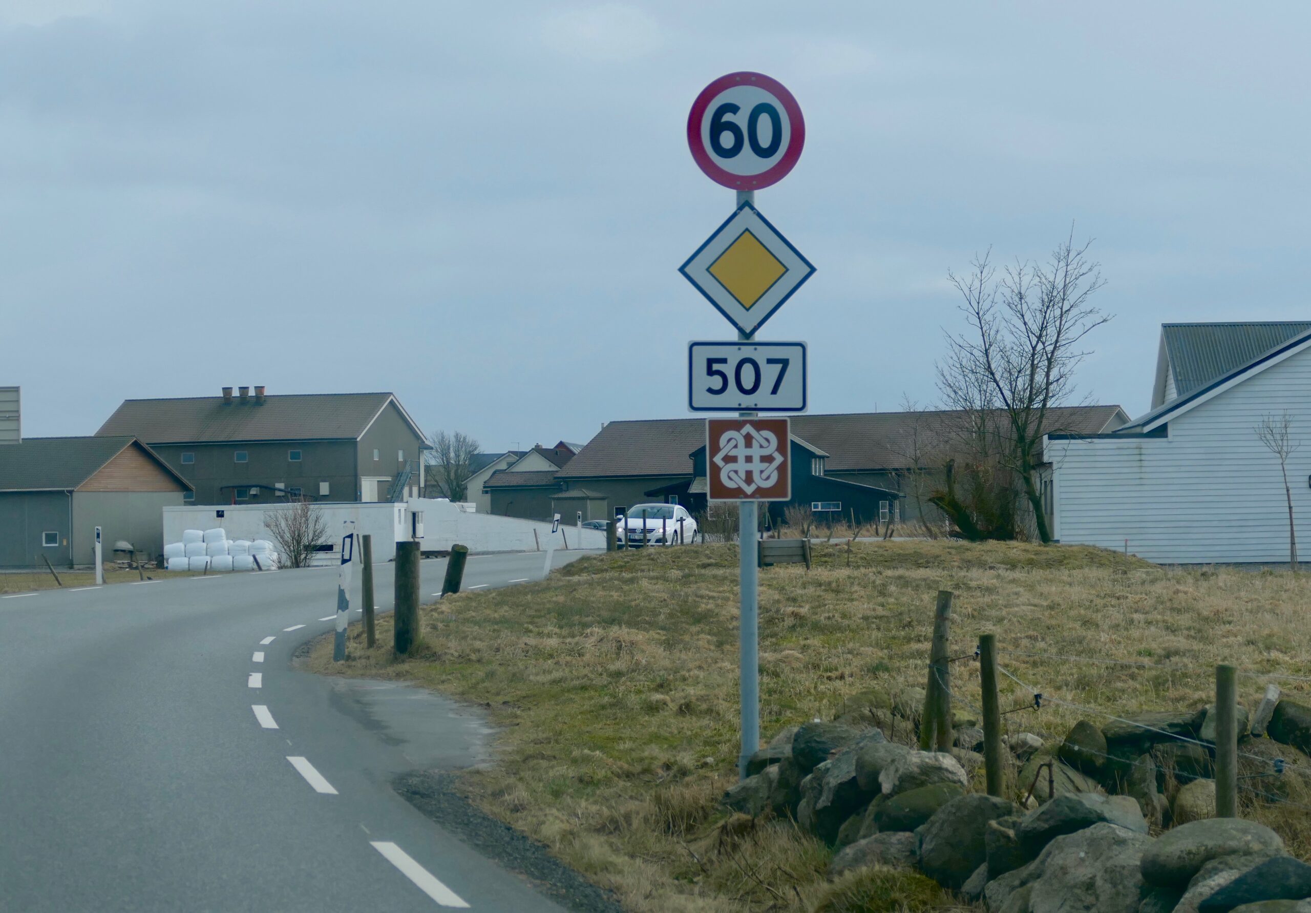
Bore- Refsnes runs along county road Fv507. The distance Obrestad – Ogna, is along the road Rv44, which is inland for a while, and then mostly along the sea in the south part.
I really enjoy this unique landscape; the cultural heritage, the ocean, the beaches, the fields and the magical “jærlyset” (light)!
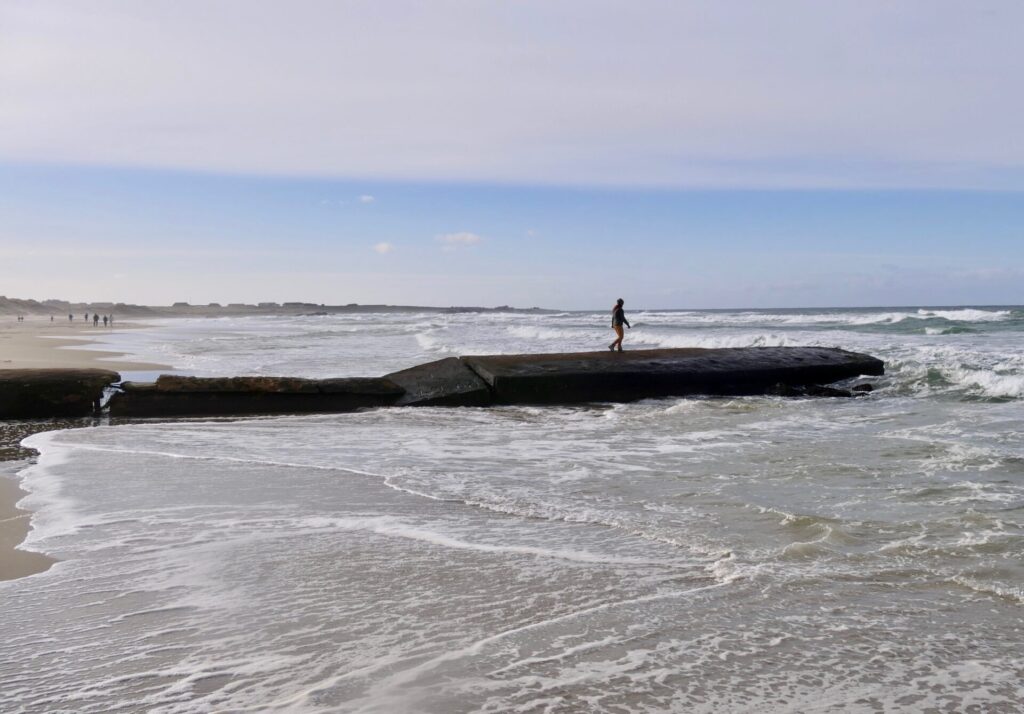
I will recommend taking a walk along one of the beautiful beaches – both the beaches of Orrestranda and Borestranda has nice hiking areas.
In fact – you can explore the entire coastline on foot. One of the special hikes is the historical “Kongevegen” (Kings Road) – from the Hå Old Vicarage to the churchyard at Varhaug Old Church. This hike takes you along sand dunes with the open sea on one side and lush farmland on the other.
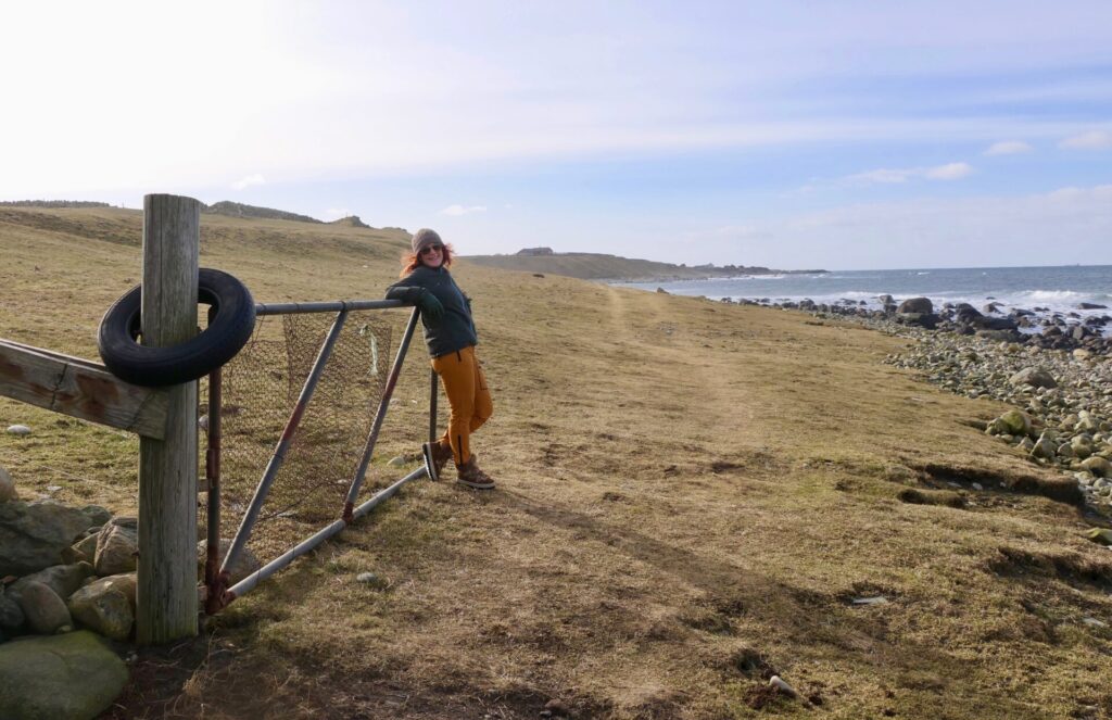
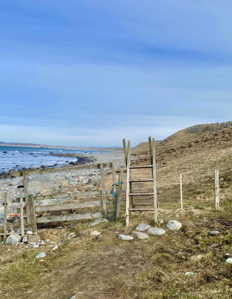
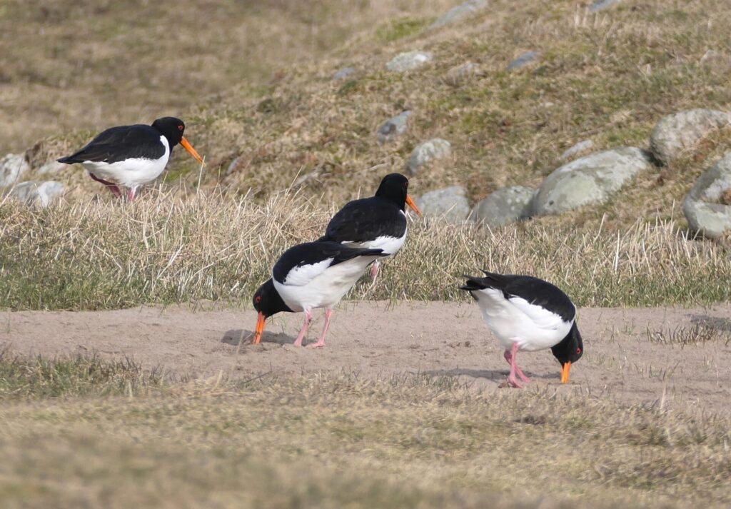
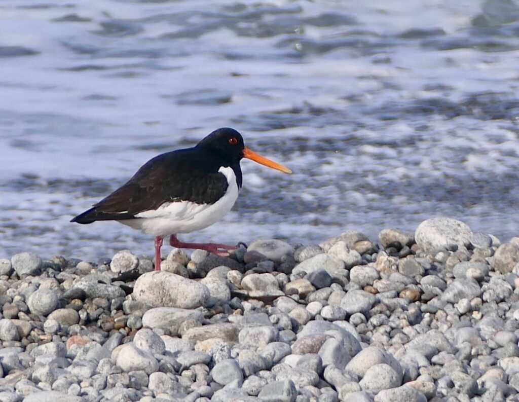
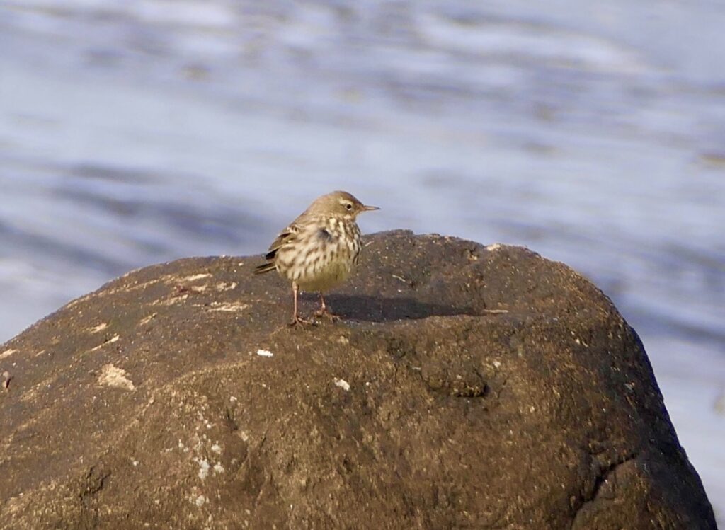
It is also exciting to explore some of the smaller side roads in this rural area. By the sea, you can explore small harbours and both sandy and pebble beaches – and some places are very good for birdwatching…
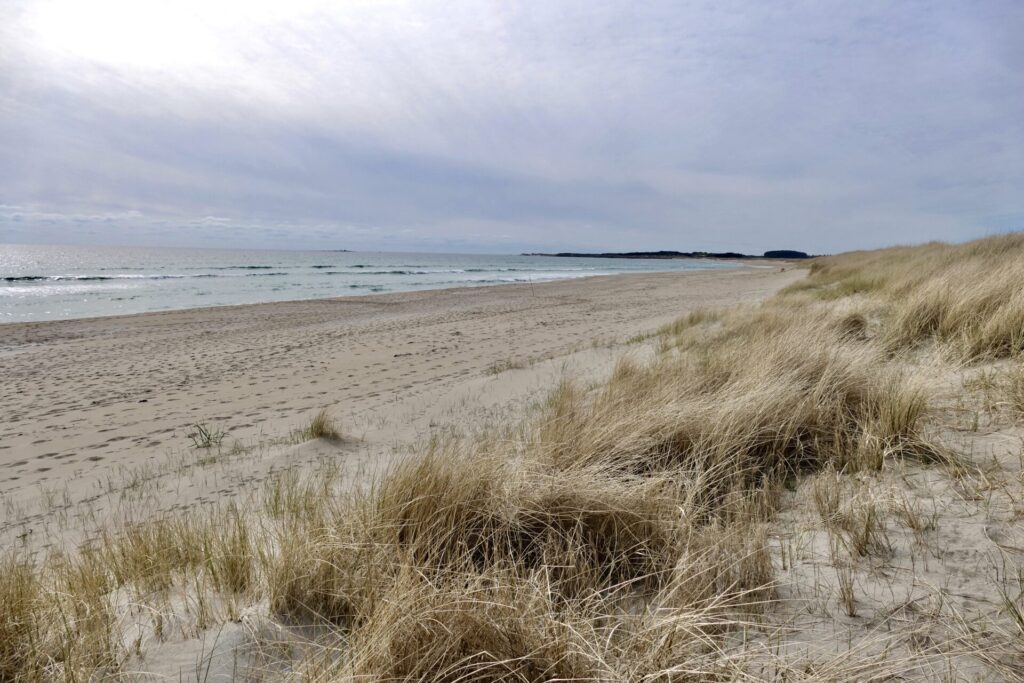
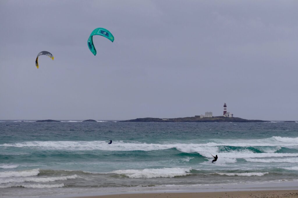
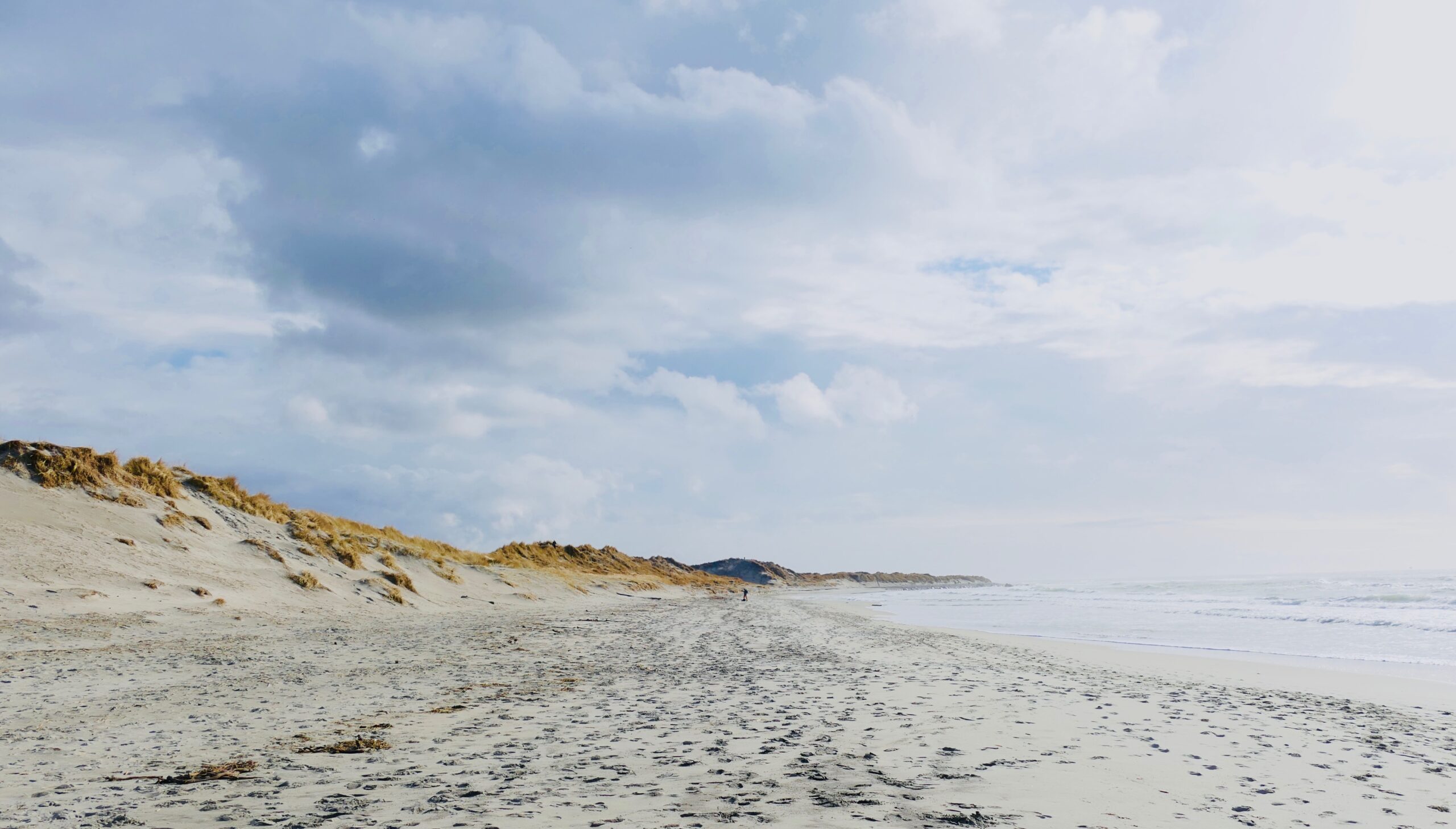
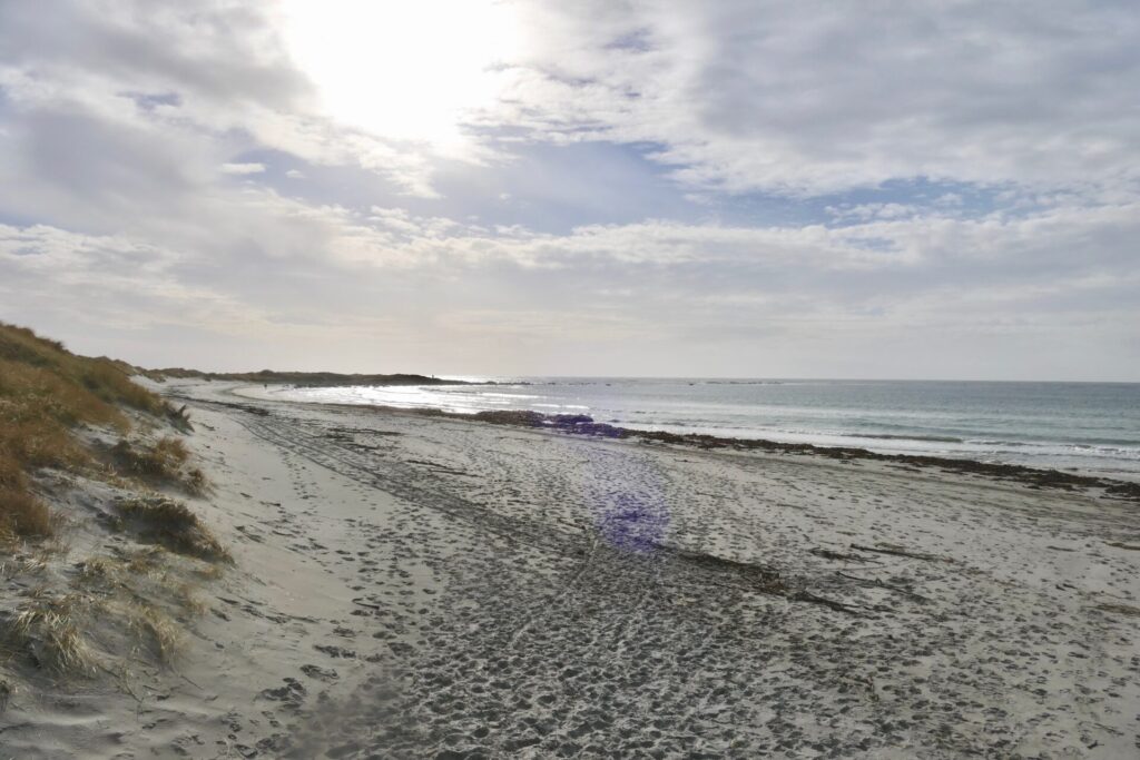
BORESTRANDEN
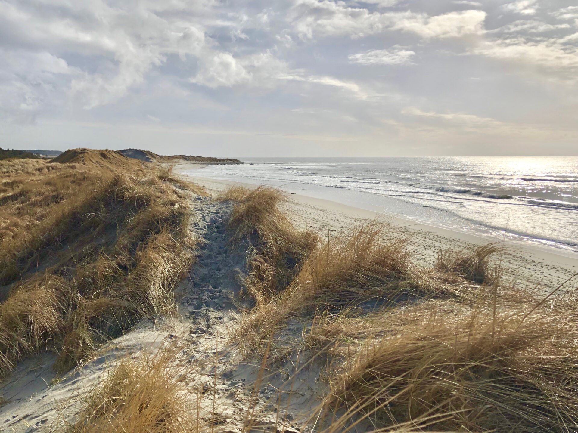
Borestranden is a long sandy beach – and many people think it is the most beautiful beach in Norway! It is a favourite destination all year round, popular among both hikers and surfers. It is also one of the beaches where kiting is allowed.
For the more experienced surfers, the conditions are more rewarding in autumn. Remember it is prohibited to surf/board sail/kite on beaches affected by bird protection. The main parking area is situated close to the middle of the beach. Borestranden has a campsite and also provides accommodation in flats and cabins at Boretunet.

WALKS FROM BORESTRANDEN
We had a great walk from BORESTRANDEN to REVE – which is a great way to explore the beaches of Jæren.
We started from the middle of the beach and walked southwards. First some fun:

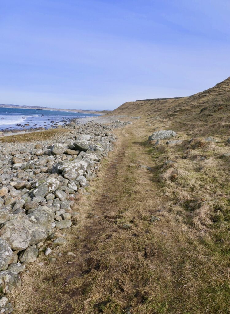
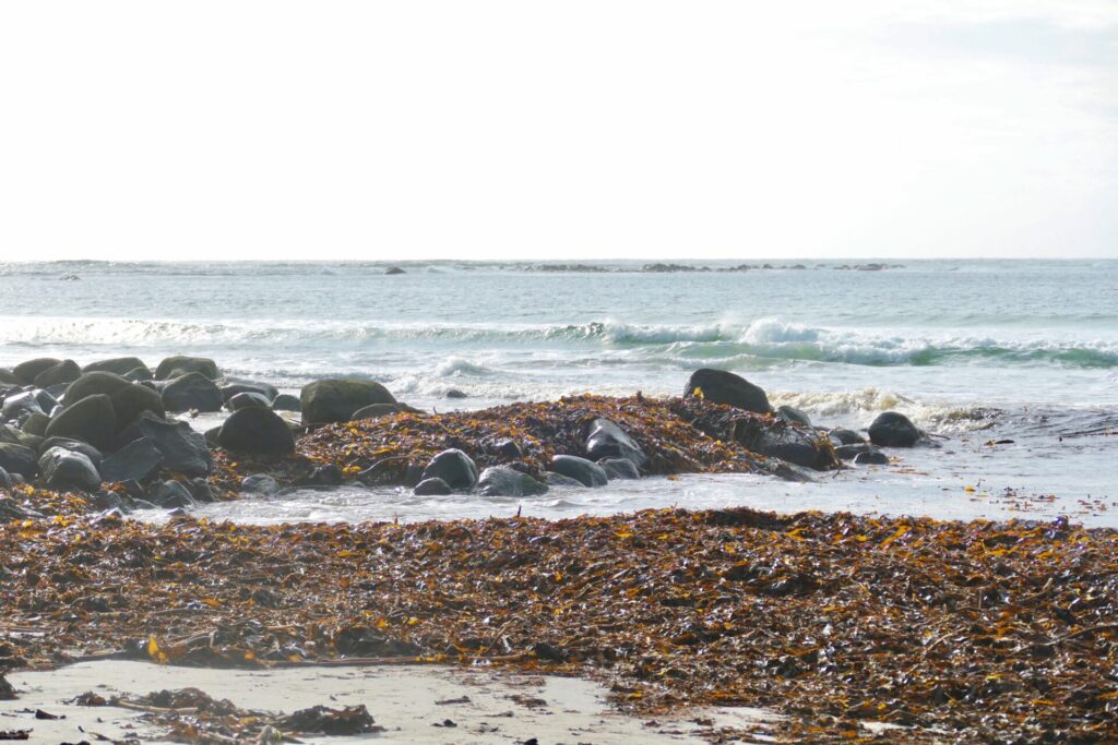
At the end of the sandy beach, you can see small islets close by, and the beach becomes rockier – like a pebble beach.

Pebble beach and grassy slopes as you get closer to Moldvika :
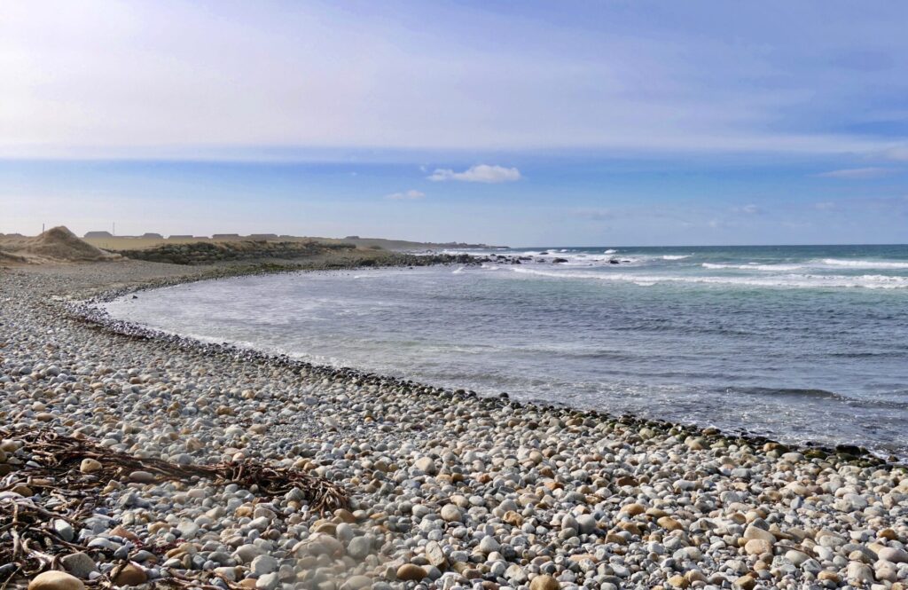
After a rest just before reaching Reve harbour, we started our return to Borestranden. This is the area between Reve and Moldevika – a special landscape:
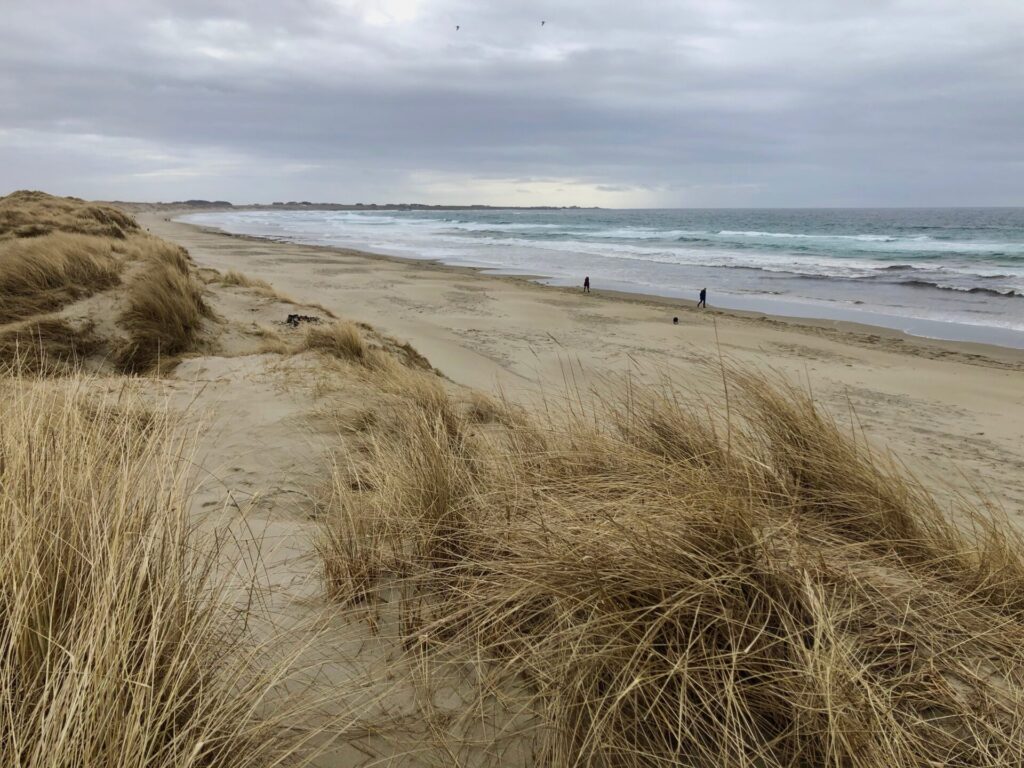
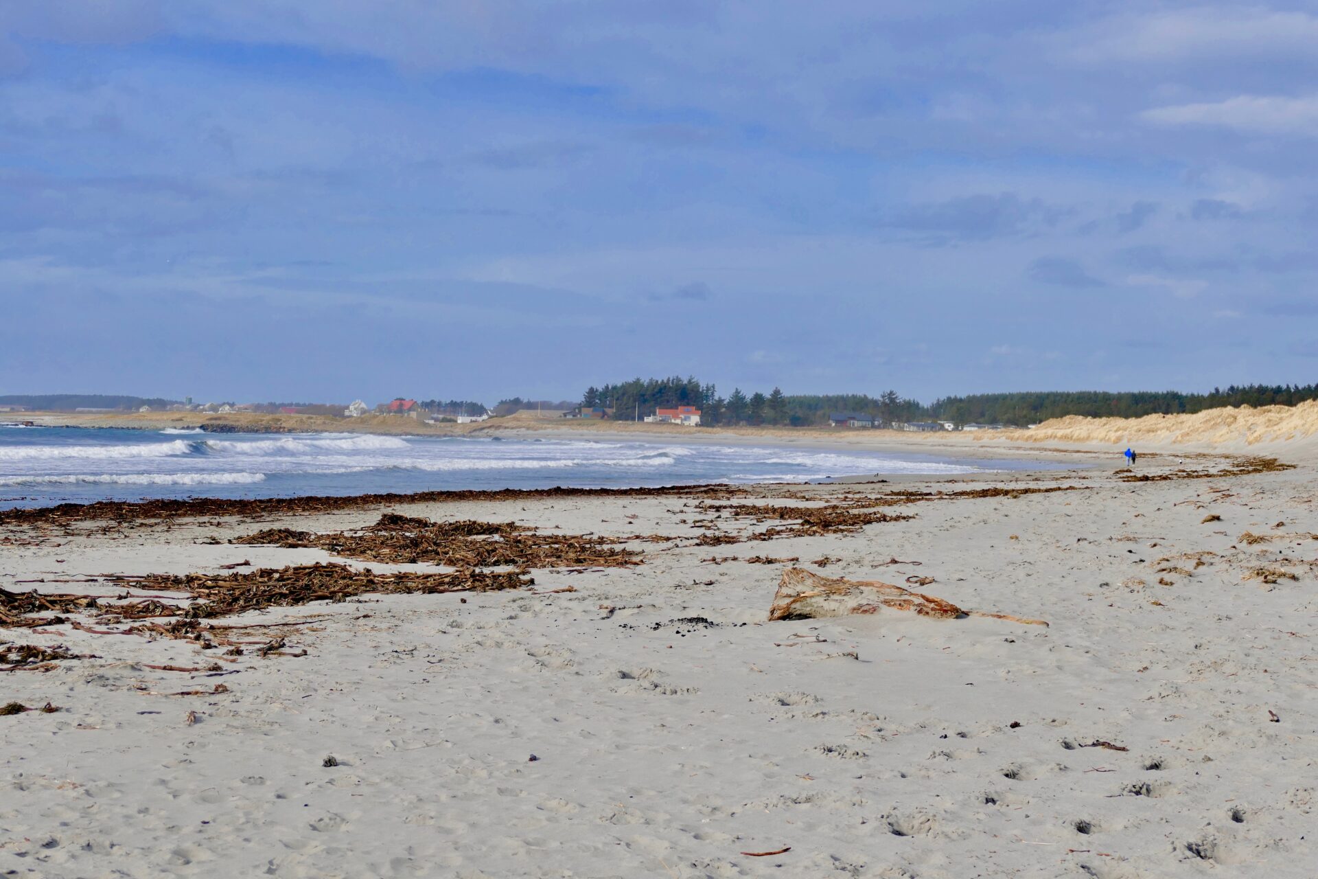
ORRESTRANDEN
The beautiful Orrestranden is one of the longest beaches in Norway. In June 2020 it once again obtained the blue flag – showing that Orrestranden is one of the world’s best beaches!
Orrestranden is located about 11 km south of Borestranden. You will pass
the Orrevatnet (large lake) on one side and the ocean on the other. If you like birding – Orrevatnet is a great place to watch different shorebirds. At Orreosen, the outlet at the south end of the lake, you can see a number of ducks and other waterbirds from a bird hide.
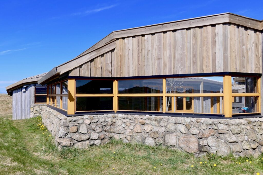
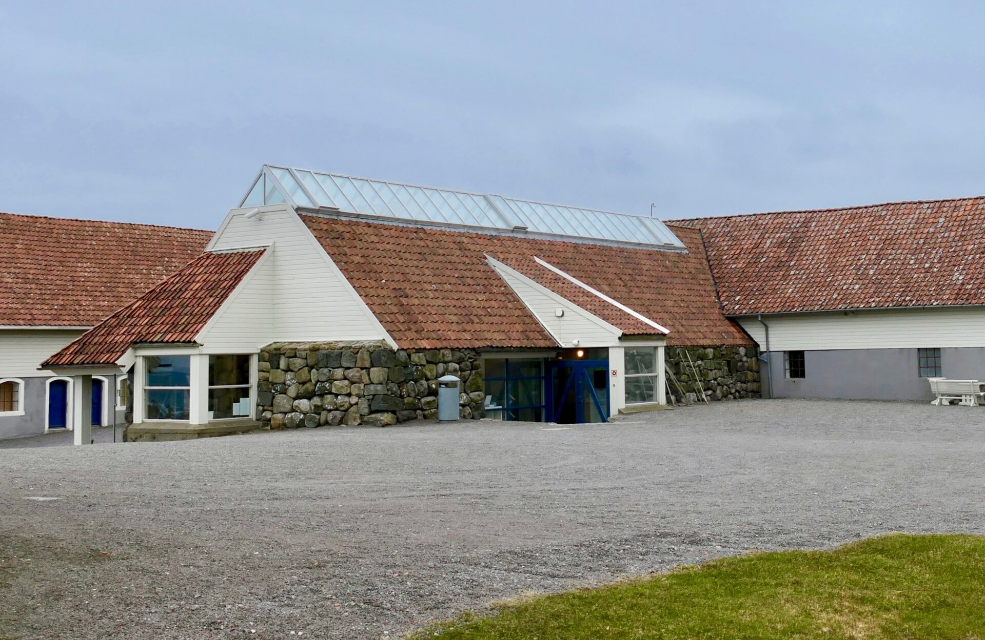
The beach is home to the Friluftshuset (Visitor Centre) which is located just by the parking lot. This Visitor Centre is one of three centres that is part of the Jæren Wetland Visitors´ Centre – a Norwegian nature centre offering exhibitions, public events and education that provide information about the region´s internationally protected wetlands.
Frilufthuset has a permanent exhibition that provides information about the Jærstrendene conservation area. There is also a small cafe (open in high season) where you can buy cakes and drinks – or eat your own brought lunch. There is also seating and a barbecue area outside.

![]()
The beautiful Orrestranden is one of the longest beaches in Norway.
Orrestranden obtained the blue flag status in June 2017, and once again in June 2020. The iconic Blue Flag is one of the world’s most recognised voluntary awards for beaches, marinas, and sustainable boating tourism operators. In order to qualify for the Blue Flag award, a series of stringent environmental criteria must be maintained. This is relating to water quality, information provision, environmental education, safety and environmental management.
Orrestranden became is a Blue Flag beach, largely on account of the pristine surrounds, which include part of the Jæren protected nature area. Both plants and birdlife are protected. It is not allowed to surf, kite, camp, cycle or picks flowers. Riding and motorised vehicles are prohibited.
It also means that the bathing water and beach facilities are top quality.
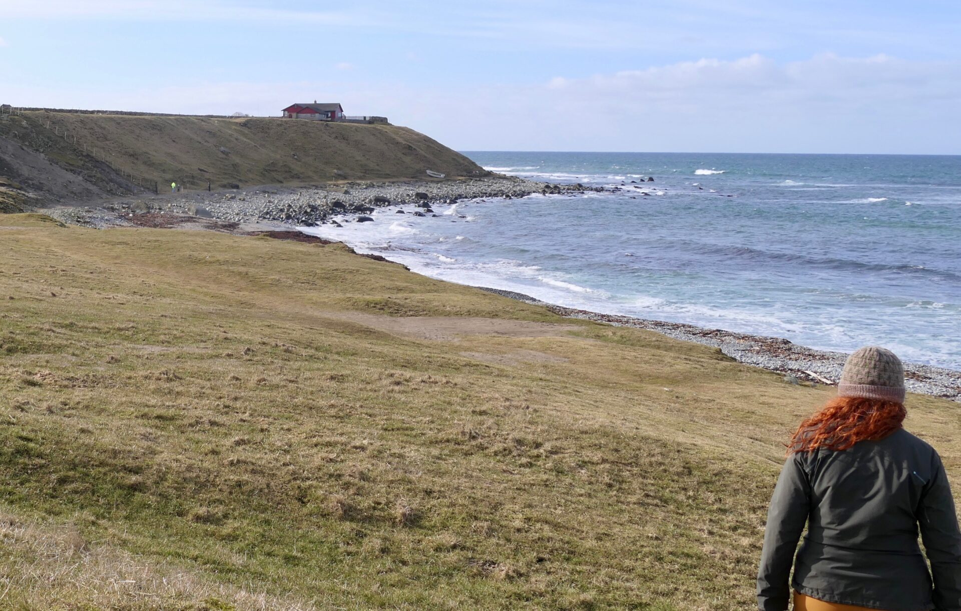
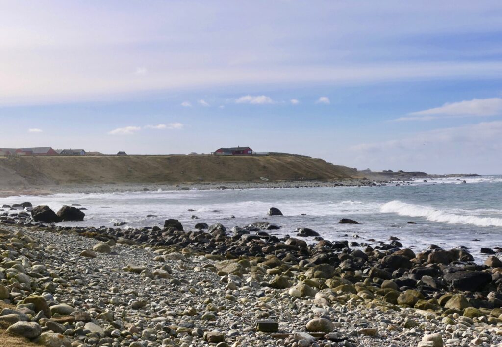
REFSNES
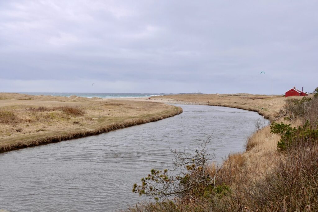
You will reach Refsnes beach driving 7,5 km south of Orrestranden. It is one of the smaller beaches at Jæren, but it is a peaceful place and it is a beautiful area to go for a walk, relax, or even for a swim!
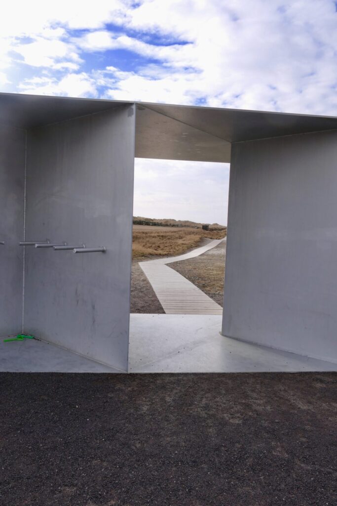
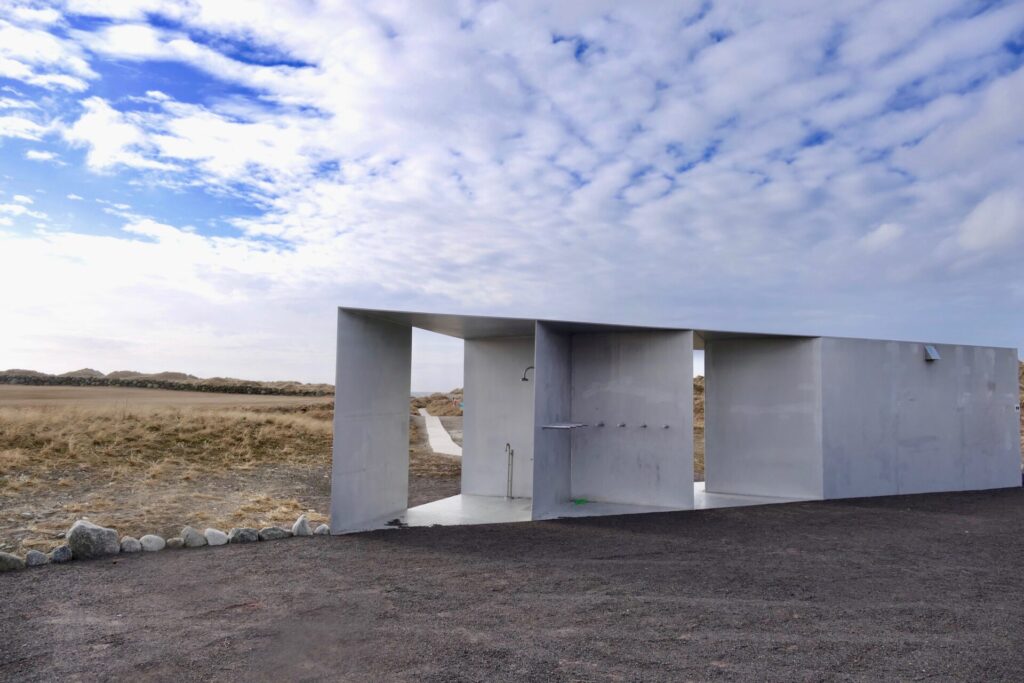
A modern building with an outdoor shower and toilet – is the first you will meet when leaving the parking lot at Refsnes. A wooden deck path runs down to the sand dunes. This path runs along a small river- Salteåna – that divides the beach into the northern and southern parts.
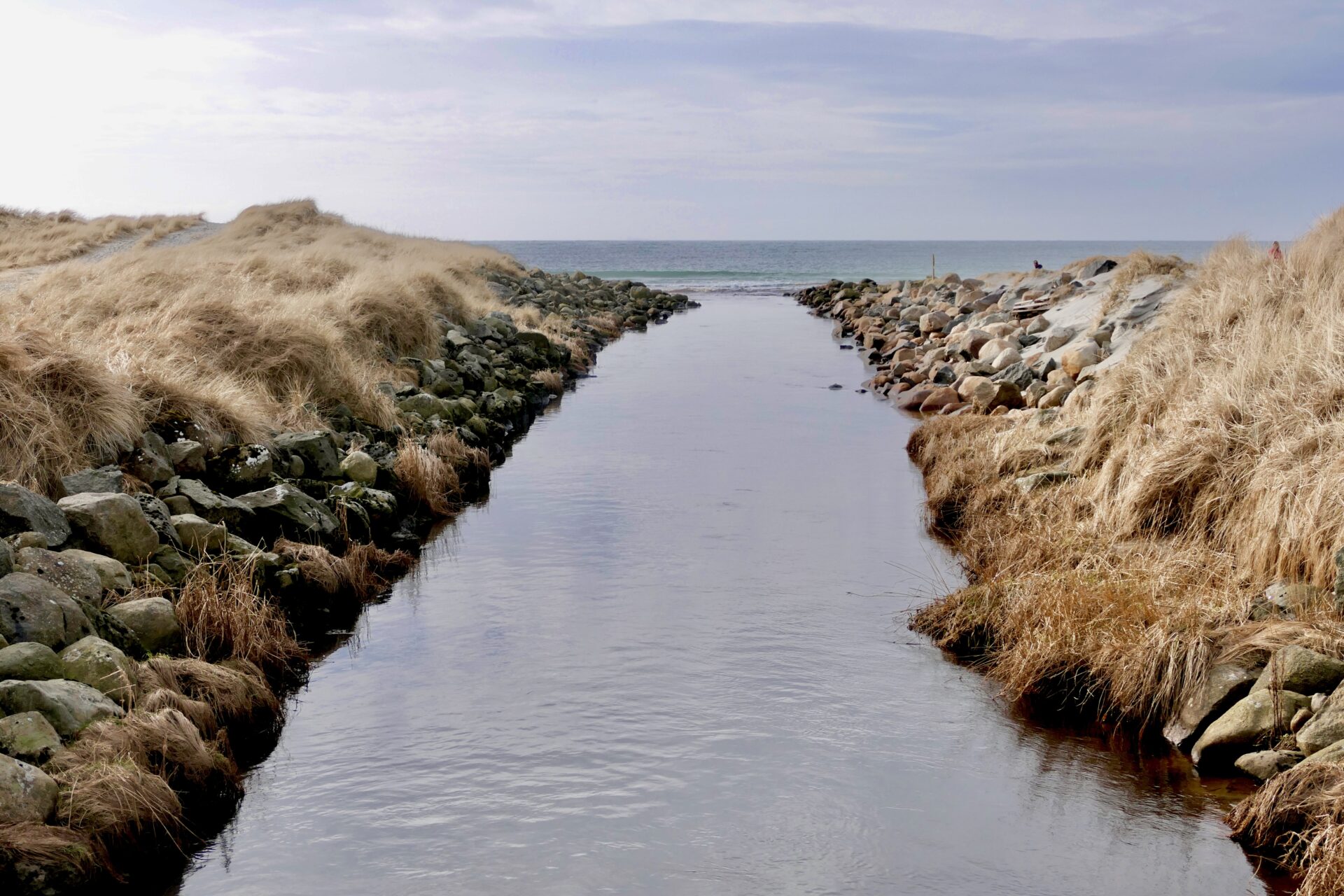
The southern parts of the beach mostly consist of sand dunes, while further north the beach has pebbles.
A lot of kelp at the northern side of the beach – and I watched different birds
in this part.
The southern part of Refsnes beach
The next stop was Hå Old Vicarage, an 8 km drive further south from Refsnes. After 2,5 km the road Fv507 ends and the route continues south on road Rv44.
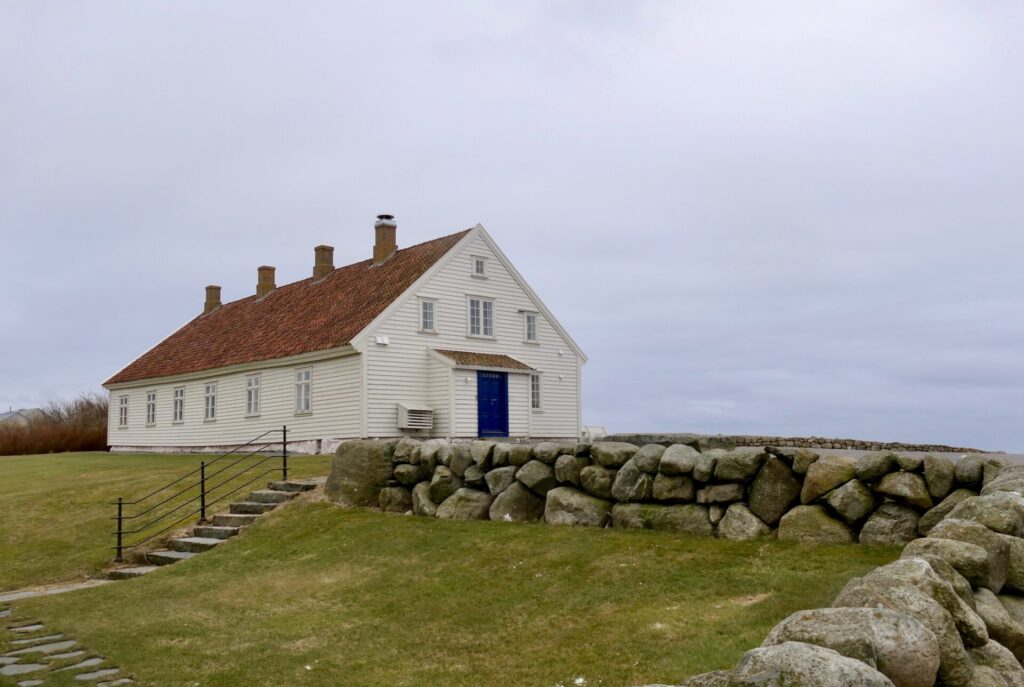
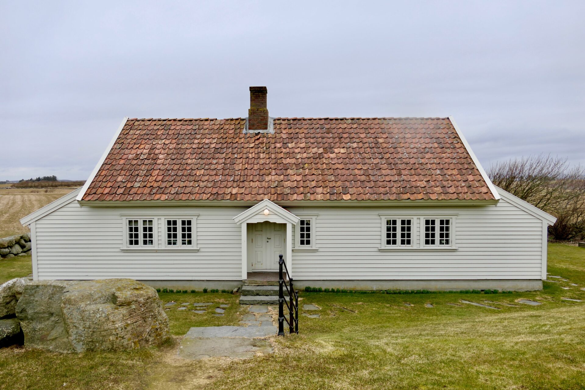
HÅ GAMLE PRESTEGARD – HÅ OLD VICARAGE
Where contemporary art meets ancient history
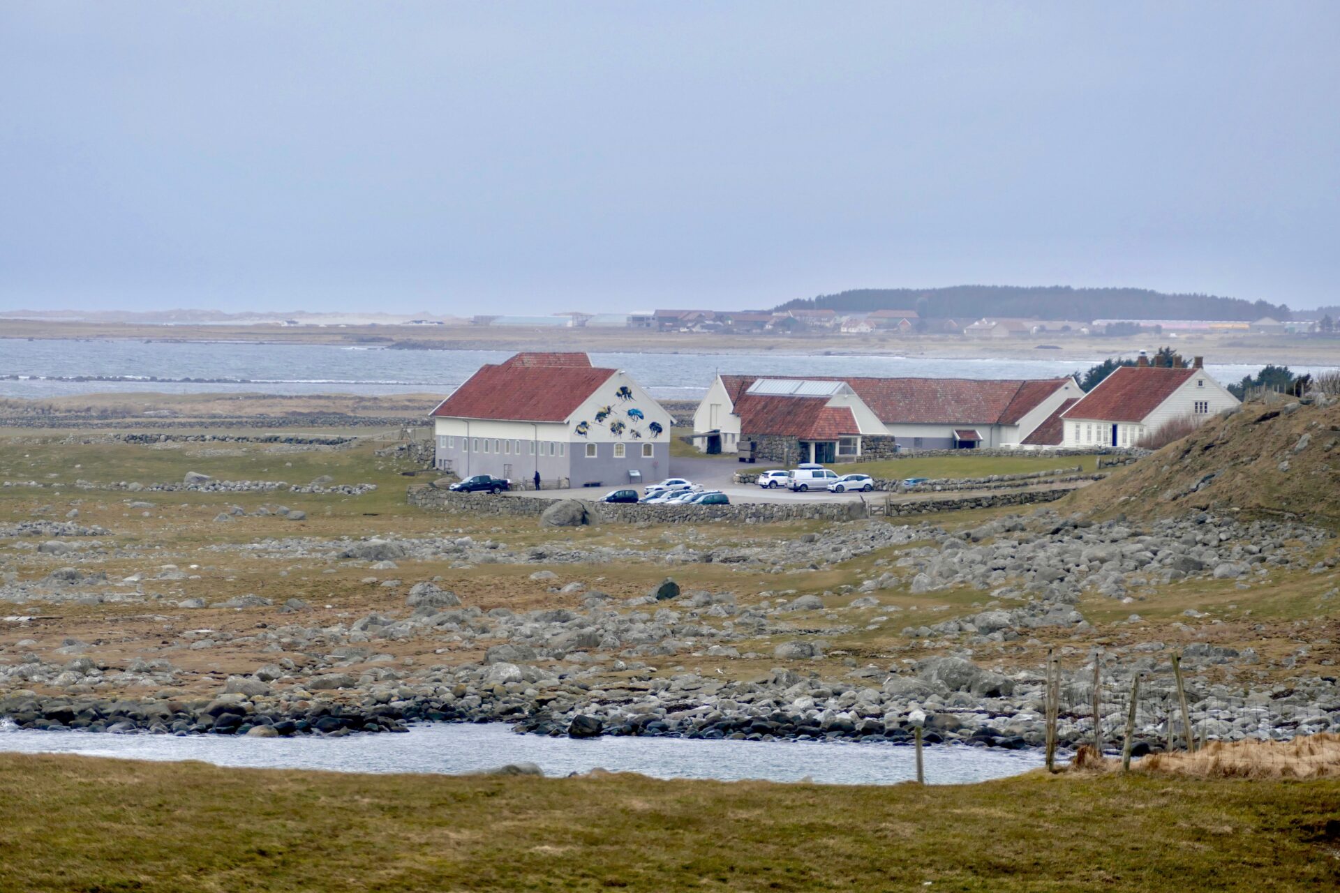
Hå Gamle Prestegard is an art and culture centre housed in traditional, listed buildings, which provides an exciting area for contemporary artists – visual arts, installations, sculpture – as well as handicrafts and cultural history exhibitions
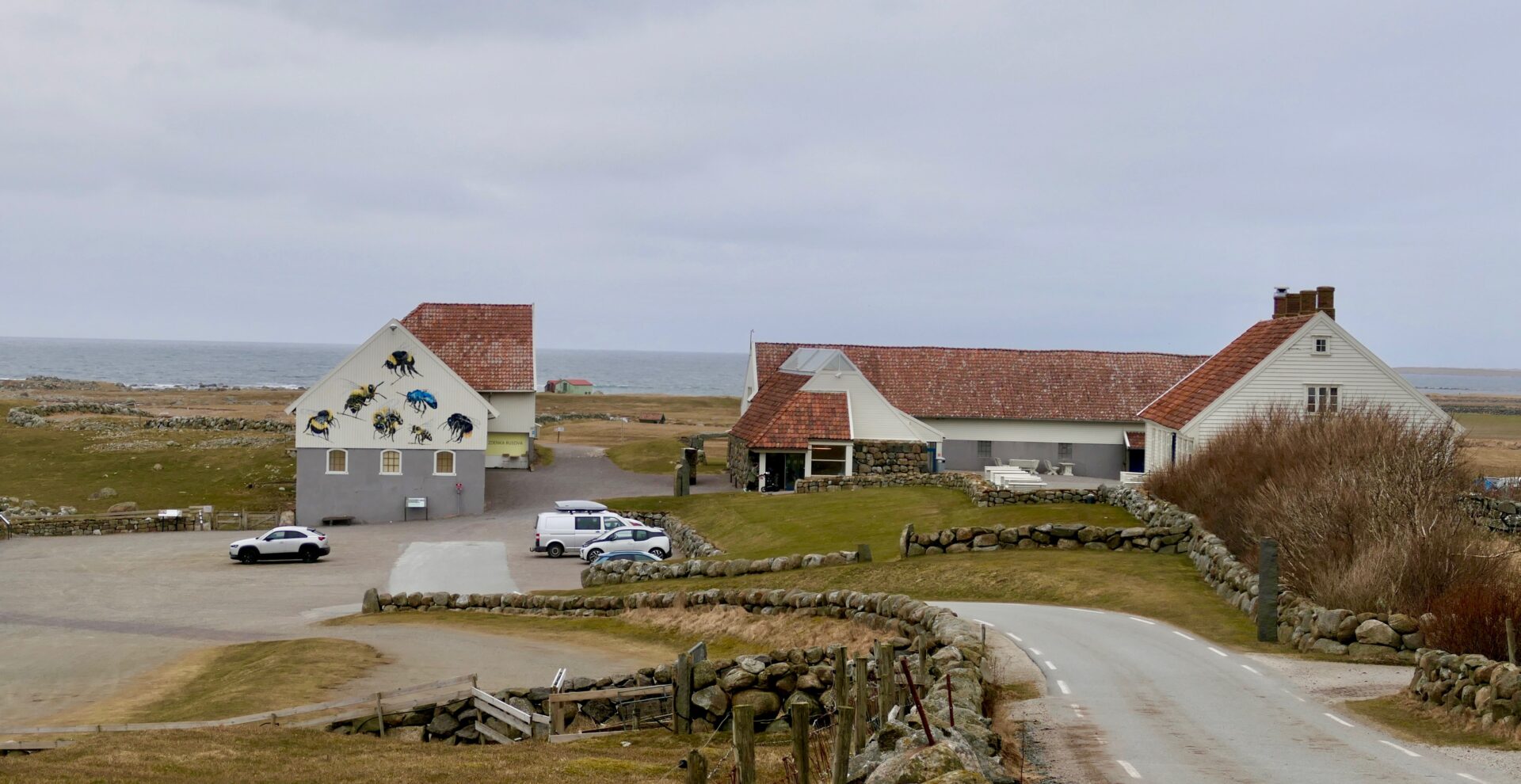
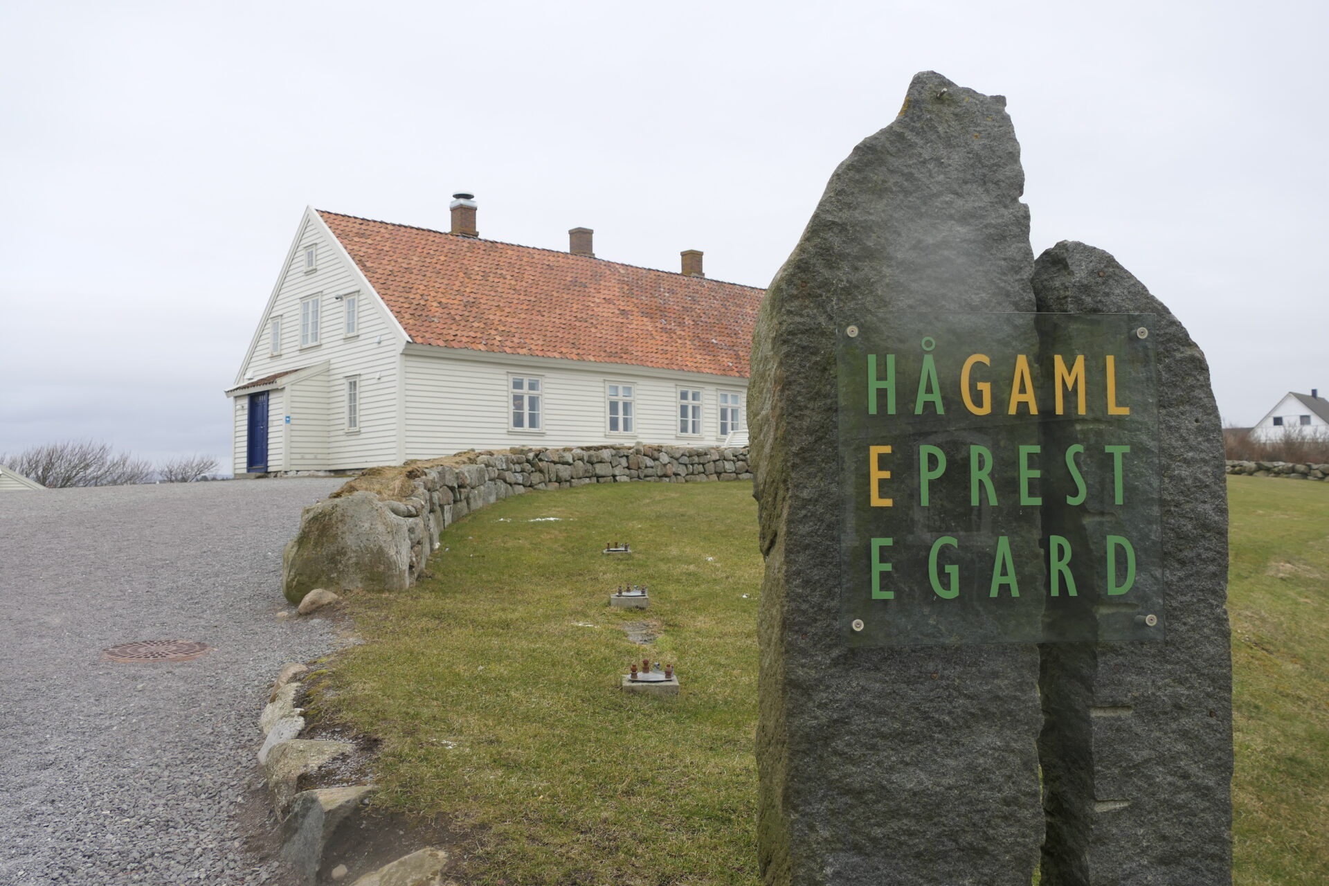
The vicarage is from around 1637 and was run as a vicarage farm up to 1919. The main building with a cafe is from 1789 and it is the farm´s oldest building.
The vicarage was centrally placed along the main route running between Stavanger and Sørlandet, and further on towards Denmark. The vicar was a public servant representing the national government and had a number of functions in the local community. In 1847, the first school in the parish was built here. Politically and socially, the vicarage was central in the village.
In 1919 the vicarage was moved to Nærbø, and Hå was run as a farm from 1930-1977.
The site includes the main building, a traditional house typical of the Jæren area -Jærhus, and two outbuildings.
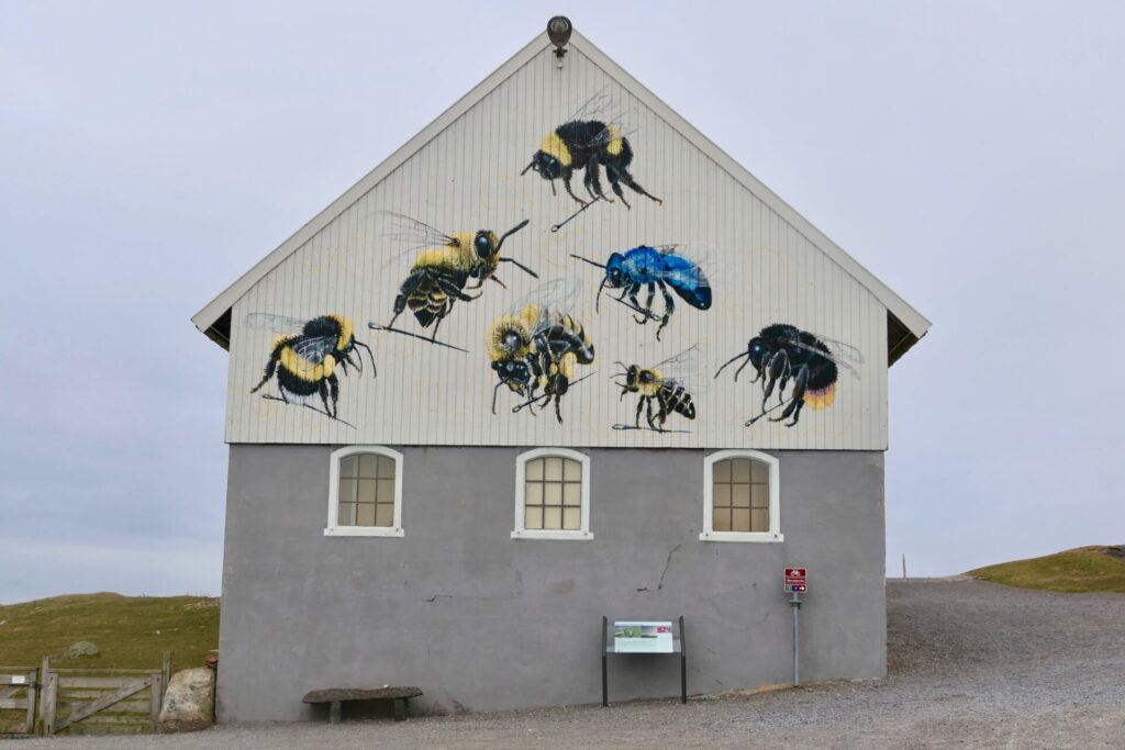
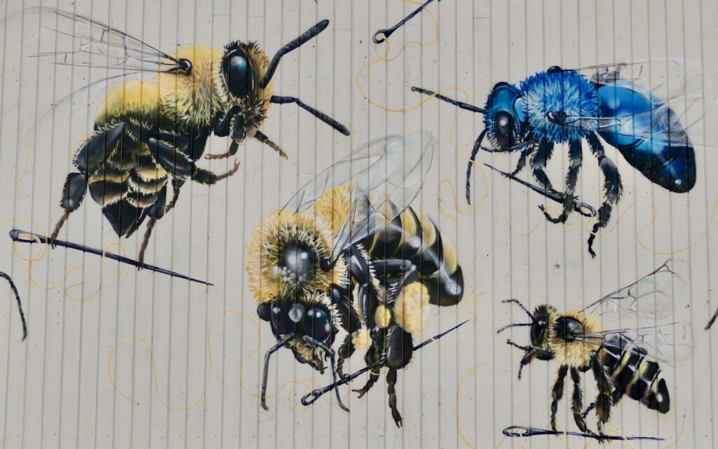
The street art with bees that you can see on one of the barn walls, was painted in connection with the exhibition “Power to the bees” that they had in 2017.
Hå Old Vicarage is today an art and cultural centre with permanent as well as temporary exhibitions. Concerts, literature readings and theme events.
At the old barn with the exhibition entrance (ticket office), there is an art shop and a nice café in the main building
The area is rich in culture heritage. A stone age settlement fro 7000 BC was discovered while the foundation was being dug for the Jæren house that was moved here in 1985. The finds are exhibited in the basement of the Jæren house. The beach burial mounds is found north of the barn closest to the sea. The graves are from around 1 AD to 1500 AD. Remnants of a place of trade seemingly from the Viking Age were found in the area in 2013.
OBSTRESTAD FYR – OBRESTAD LIGHTHOUSE
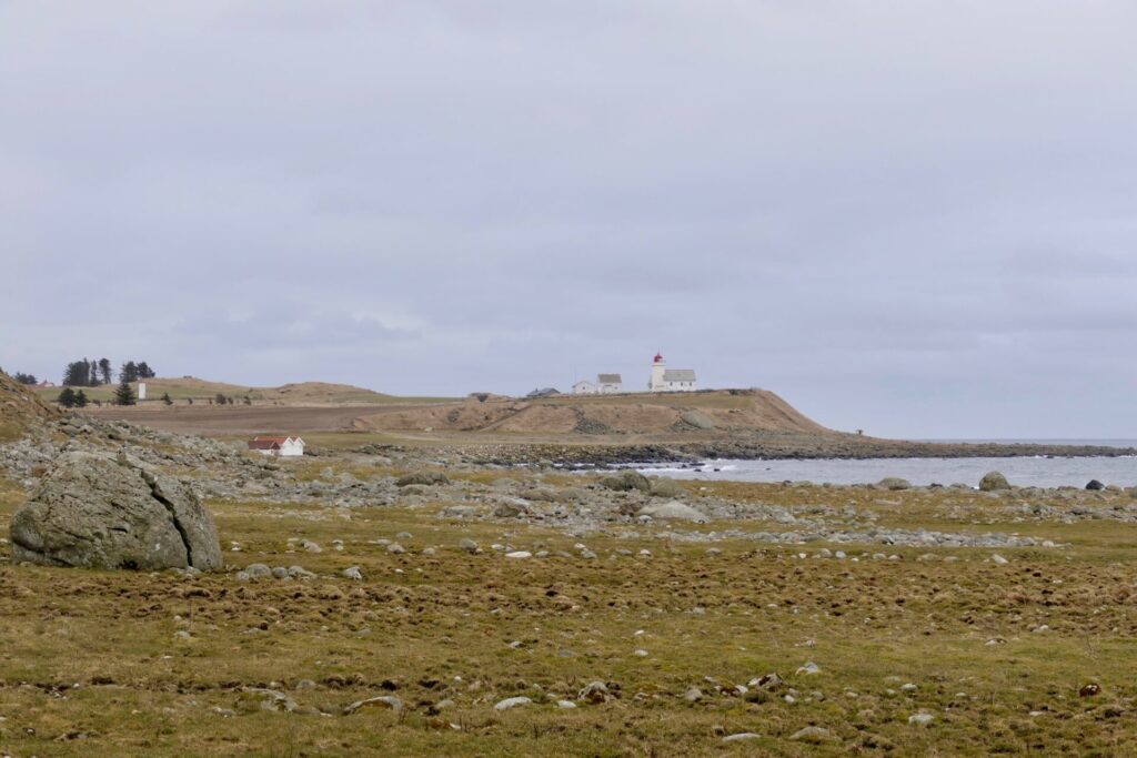
Obrestad lighthouse is located just 1 km south of Hå Old Vicarage.
The square tower is 16,5 m high and is attached to a 1-1/2 story granite lighthouse keeper’s home. The lighthouse was first lit in 1873.
In 1905, a new wooden lighthouse keeper’s house was built. Another house was built in 1950, at the same time that the tower was rebuilt in its present form.
The lighthouse was automated in 1991 and has been a protected historical building since 2000. The municipal government of Hå purchased the lighthouse station in 2006. There is a museum in the lighthouse and the keeper’s house is available for private functions or overnight accommodations.
The site is open to visitors daily from mid-June through mid-August and on Sundays from March through June and August through December.
VARHAUG GAMLE KYRKJEGARD – VARHAUG OLD CHURCHYARD
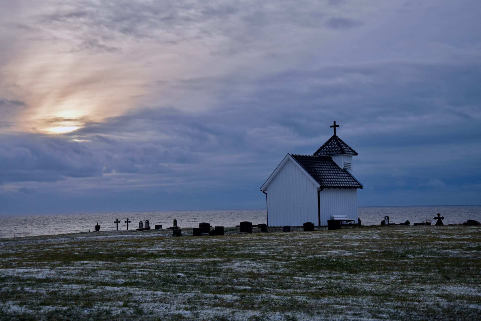
The churchyard dates back to the Middle Ages and is listed as a cultural monument.
It is beautifully situated facing the sea gap, and with the special light by the ocean, it was a kind of magical atmosphere when we came and visited the place an afternoon in January.
The first church was probably built here around 1200 and there are many indications that it was built on an old pagan place of worship. The old church was demolished in 1905 and replaced with a small grave chapel.
Today’s chapel was erected in 1951 with the old church bells from 1791 added.
The chapel is small, just around 15 m2 and is furnished with 14 traditional wicker chairs. It is often used for weddings. Bides the old church bells from 1791 there is a copy of the sculpture “Sapienta” (wisdom), dated 1650-1720. According to the Stavanger Museum, the original sculpture must have come from a church that stood on this church site earlier.
In 1842 a Russian three-mastered ship of the line, named “Ingermanland”, sank just off the coast of Varhaug. Of 892 people on board 389 died, including 21 women and 7 children. 9 were buried in Varhaug old churchyard and a memorial stone has been erected for the casualties of the disaster.
KVASSHEIM FYR – KVASSHEIM LIGHTHOUSE
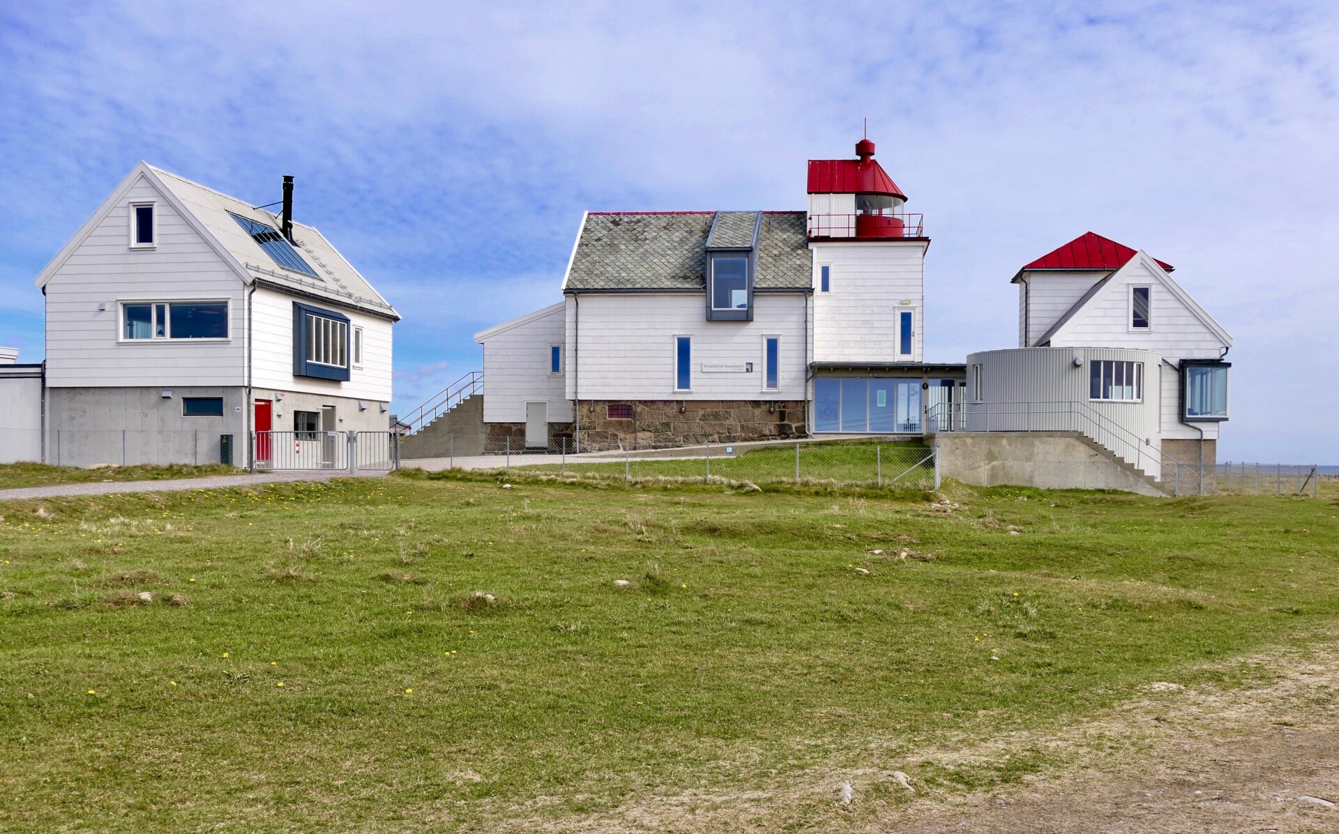
Kvassheim lighthouse is the southernmost lighthouse on Jæren and was in operation from 1912 to 1990. Now it serves as a Friluftshus; an information and recreation centre. Kvassheim lighthouse is one of Jæren Wetland Visitors´ centres.
The lighthouse is located about 17 km south of Obrestad Lighthouse and 2.5 km south of the village of Vigrestad.
The original building was established in 1912 and automated in 1984.
In 1990, the lighthouse was replaced with a smaller, automated lighthouse located about 70 metres westward, closer to the harbour.
In 2003, the management of the old station was transferred to the Jæren Friluftsråd (Recreation Council), which began restoration work the following winter. Today, the lighthouse’s five buildings have been restored to contain exhibitions and a small café. The lighthouse keeper’s residence contains exhibitions on all floors. On the first floor, you get to know the coast and about historic rescue operations along the coast of Jæren. The second floor features a major exhibition on the wetlands in the area.
In 2014 there were built a small museum in the garden – for the captain’s gig from the Russian three-masted fully-rigged ship “Ingermanland ” which sank off the coast of Varhaug in 1842. ( also mentioned in the article of Varhaug Old Churchyard)
The gig was taken in at Årsland Farm with 10 sailors on board. Three of which dies later on, and together with 6 other were buried at Varhaug Old Churchyard.
From the exhibition in this museum, you can learn more about the dramatic shipwreck of the large Russian liner Ingermanland.
Kvassheim harbor was built in the 1930s. The pier has served as an emergency port for small boats and as a base for smaller fishing boats.
The site and lighthouse are open daily from late June to mid-August and on Sundays and holidays during the rest of the year except January
WALKS FROM KVASSHEIM LIGHTHOUSE
One of the many relaxing and accessible coastal walks in Jæren is the route from Kvassheim Lighthouse to Ogna. This particular trail explores the southernmost part of the region, travelling along rocky shores and sandy beaches. As you near Ogna the landscape changes, with the flatlands giving way to more hilly terrain.
Kvassheim is also the southern end of the hike from Varhaug Old Churchyard (8.8 km).
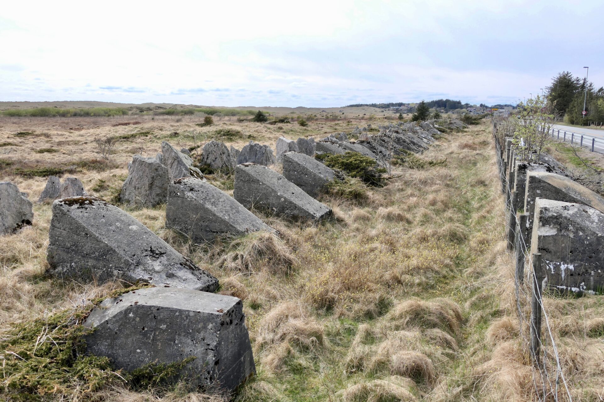
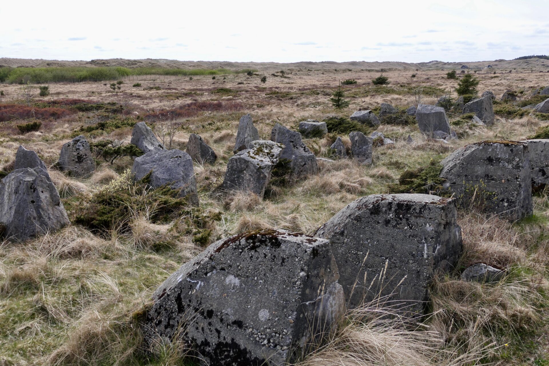
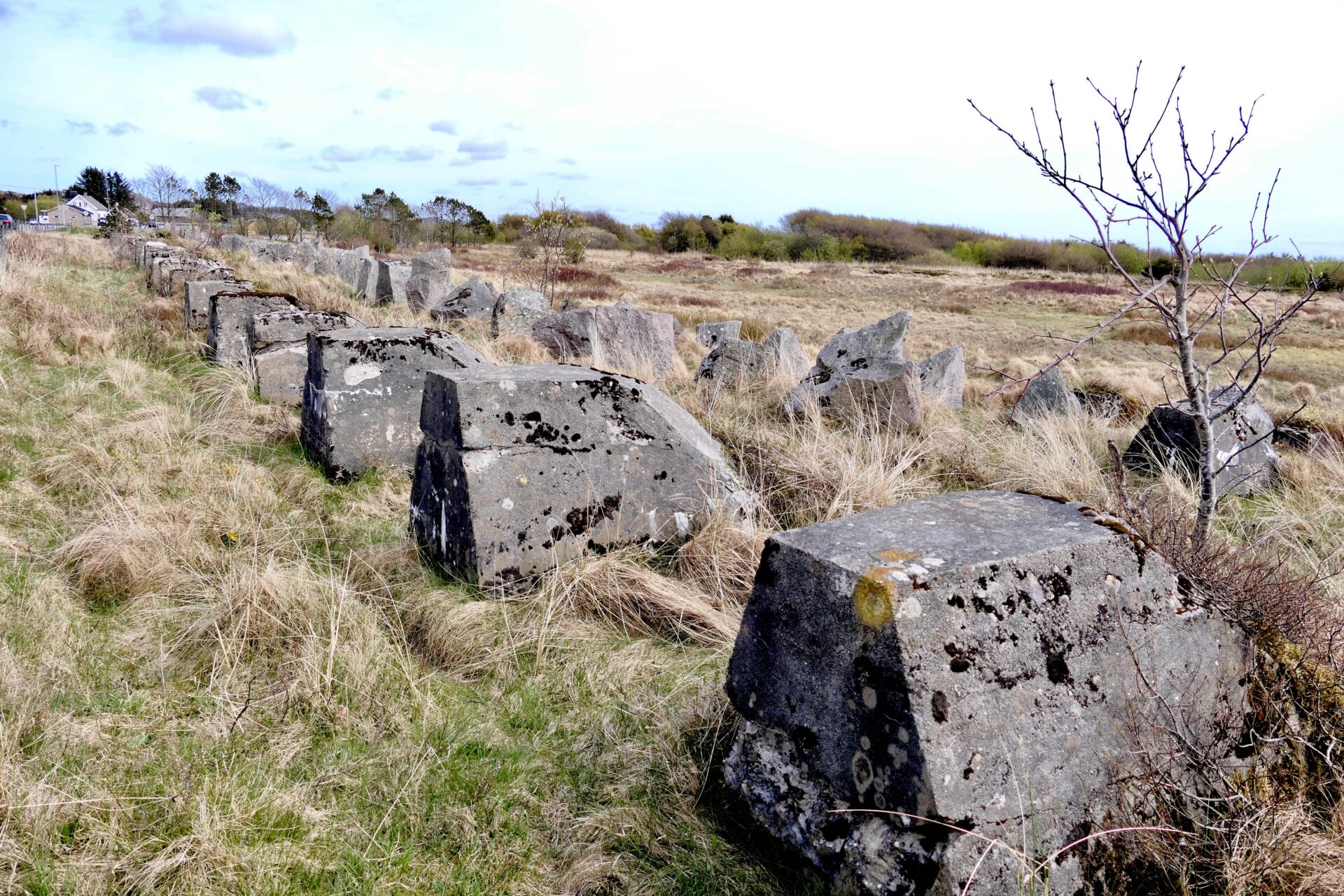
BRUSAND AND HITLER´ S TEETH
Just 4 km south of Kvassheim Lighthouse, along Rv44 at Brusand, there is a reminder of World War II.
One can still see the obstacles that were erected to prevent Allied forces from making landfall. They are made of stone and concrete and run for several kilometres with up to 4 rows of obstacles. These are called
(Norwegian: Hitlertennene or Hitler’s tenner), and they were erected by prisoners of war and other forced labourers. . The Norwegian prisoners sabotaged several “teeth” by mixing more sand into the concrete in order to make them weaker.
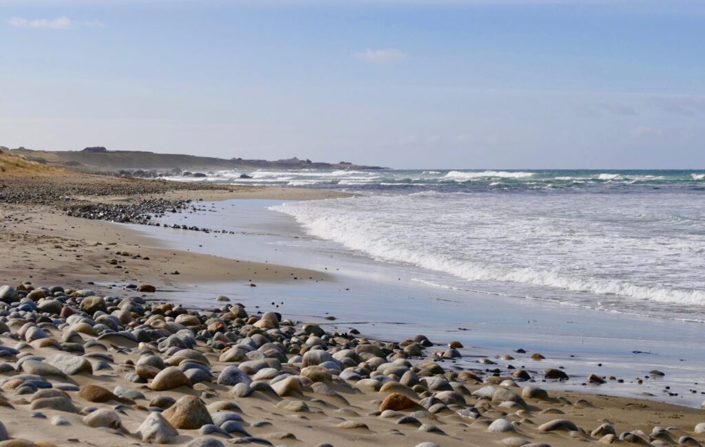
BRUSAND STRANDEN – BRUSAND BEACH
If you take the walk from Kvassheim to Ogna – a large part of the trail is along the prettify Brusanden Beach. You can also visit this long sandy beach if you drive to Ogna Campsite, which I did. It is just south of the village of Brusand. After just a short walk from the campsite, you can enjoy a walk from the south side of the beach.
The Northwestern part of the beach is also beautiful which you can reach from another campsite – Brusand Camping – just west of Brusand.
This was my last stop at the scenic route of Jæren. The route actually ends in Ogna, just a few kilometres south of Brusand. Ogna also has a sandy beach that has a more rocky shoreline, but this is beautiful as well.
Ogna has also an old church, originally built in the 13th century. It had a wooden tower when it was struck by lightning in 1991, and the fire caused major damage. An altarpiece and pulpit made by Gottfried Hendtzschel were totally damaged, – only the stone walls remained. The church was rebuilt with a new choir and an extension with, among other things, a church hall, kitchen and offices in 1995.